Updated March 4, 2025 02:08PM
The Ozark Trail: A Guide to Hiking Missouri's Mountains
This hidden gem of a thru-hike shows off all the Ozarks have to offer.
Taum Sauk (Photo: Keith Yahl via Flickr)
You might not recognize the name, but don’t let that dissuade you: The Ozark Trail (OT) deserves more attention than it tends to garner. The OT flaunts some of the most geographically unique hiking you can find anywhere. It brims with rocky streams, dolomite glades, plunge-pool-filled shut-ins, and hidden caves. Located in the Ozark Mountains, the OT’s 14 (mostly) continuous sections make up a large part of the mountain range’s 390 miles of trail. The 230-mile OT thru-hike is the main event in Missouri Ozarks, winding from Onondaga Cave State Park southeast of St. Louis to the western edge of the Mark Twain State Forest.
If you’re searching east of the Rockies for stunning scenery, technical terrain, and a long hike option sans the AT crowds, the Ozark Trail checks all the boxes. You’ll cross paths with fewer people than you can count on two hands—just keep an eye out for mountain bikers and horseback riders who frequent the multi-use sections of the trail.
Hiking the Ozark Trail
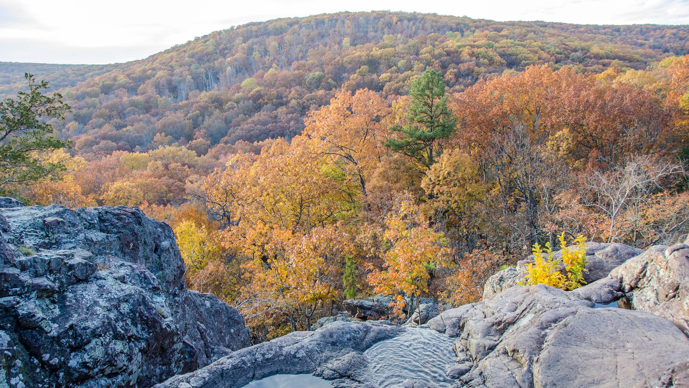
Courtois Creek Section
The 230-mile backbone of the Ozark Trail links eight continuous trail sections: the Courtois Creek, Trace Creek, Middle Fork, Karkaghne, Blair Creek, Current River, Between the Rivers, and Eleven Point. Most thru-hikers travel north to south, but the route works in either direction. From Onondaga Trailhead, hikers embark on the first 48-mile section full of white oak, pawpaw trees, and seasonal wildflowers. Duck into caves carved into the bluffs along Courtois Creek and spot wildlife within Huzzah Conservation Area, known for cerulean warbler, wild turkey, and North American river otter sightings. Popular campsites on this section include Berryman Campground around mile 22 or dispersed creek-side spots under red bluff walls on Huzzah Creek past mile 32.
Trace Creek and Middle Fork Sections
The next section along Trace Creek is an enjoyable, quiet walk in the woods. Camp at the Hazel Creek Campground at the start of this section or continue on for 12 miles through dense oak, hickory, and pine forests to Middle Fork/John Roth Memorial section. Some hikers may choose to continue on Trace Creek to the Taum Sauk section, but OT thru-hikers should head west onto Middle Fork/John Roth Memorial section to complete the full route. This hilly 26-mile segment gains over 2,600 feet of elevation. It meanders over a contoured landscape crossing brooks, streams, and wetlands, as well as small savannahs of oak and hickory hardwoods. Camp at Highway DD trailhead near the section’s start or Harper Spring around the 15-mile mark.
ADVERTISEMENT
Karkaghne Section
After Middle Fork, head into the 29-mile Karkaghne section. This part of the trail mixes sweeping wetland prairies and ridge-lined valley views through the Sutton Bluff Recreation Area. Camp riverside on a natural gravel beach along the West Fork of the slow-moving Black River. Or, set up a dispersed camp anywhere in the Mark Twain National Forest that’s at least 100 feet from the trail. Keep an eye out for a short spur trail between Sutton Bluff campground and Highway TT. This will lead to Grasshopper Hollow, the largest fen (peat-forming wetland) in non-glaciated North America.
Blair Creek and Current River Sections
Wetlands give way to ridgelines at the start of the Blair Creek section. This 26-mile segment follows Blair Creek south as it carves down a valley through oak-hickory-pine forest before merging with the emerald waters of the Current River. This marks the start of the 30-mile Current River section. This section follows the river for two miles before veering south toward Stegall Mountain. You’ll find this area along the Indian Creek and Rocky Creek flush with shut-ins and water-eroded rock formations unique to the Ozarks that feature complex systems of plunge pools, rivulets, and shallow waterfalls. Enjoy views of the Ozark landscape as you gain 500 feet of elevation over 2.5 miles to the top of Stegall Mountain. Camp out at the top overnight and catch a glimpse of a full sky of stars if it’s clear.
Between the Rivers Section
The next 30 miles is the Between the Rivers section. It does just as it says: bridges the gap between the Current River and the Eleven Point River. The route passes several tributaries, including Wildhorse Hollow, Devil’s Run, and Chilton and Big Barren creeks. Though there is an abundance of water nearby, this section doesn’t have the larger swimming holes found up until this point on the OT. A gradual climb along a ridgeline takes you through forests filled with white and scarlet oak.
ADVERTISEMENT
Eleven Point River Section
Lock-in your thru-hike with the completion of the 29-mile Eleven Point River section. The finish challenges hikers with over 3,200 feet of elevation gain. It travels up slopes and through hollows following the contours of the Eleven Point National Scenic River. This segment provides plenty of options to dip your feet in clear pools and rock-stirred rapids along the way. Enjoy sweeping views from dolomite bluffs and a hallmark lookout over Greer Spring at mile 12. The hike finishes at Eleven Point western trailhead (also known as 4155 Trailhead).
The Map: The Ozark Trail
Gear for the Ozark Trail
With access to the Ozark Trail available year-round, hikers will need to prepare differently for each season:
-
- Springtime there sees a lot of rain and varied temperatures.
- Summers tend to be hot, muggy, and wet.
- Winters can drop below freezing.
- Wet weather is common to the Ozark climate, especially in late spring through summer. It fosters a breeding ground for bugs, mosquitos, and ticks.
Consider bringing waterproof shoes and treating your clothes ahead of time with permethrin to repel insects. In the colder seasons insulating layers are a must. A good rain shell for you and rain fly for your tent are necessary year-round.

ADVERTISEMENT
Permits
A perk of hiking lesser-traveled trails are fewer (or non-existent) permits and parking fees. The Ozark Trail does not have permit, parking, or registration requirements for its trail sections.