Published July 10, 2019 07:56PM
Hike the New, Improved Timberline Trail
After a decade of detours, the loop around Mt. Hood is complete and better than ever.
'Larry Geddis / Alamy Stock Photo'
The sunlight reflecting off the White River is so bright I can barely see the rapids that are thundering in my ears. This is the most difficult ford on the 40-mile Timberline Trail. I squint across the swath of glacial whitewater and see no sign of the trail on the other side. It’s camouflaged by the beige cliff rising out of the river valley, I assure myself. A mere 2 miles from closing the famed circuit, I’m completely stuck.
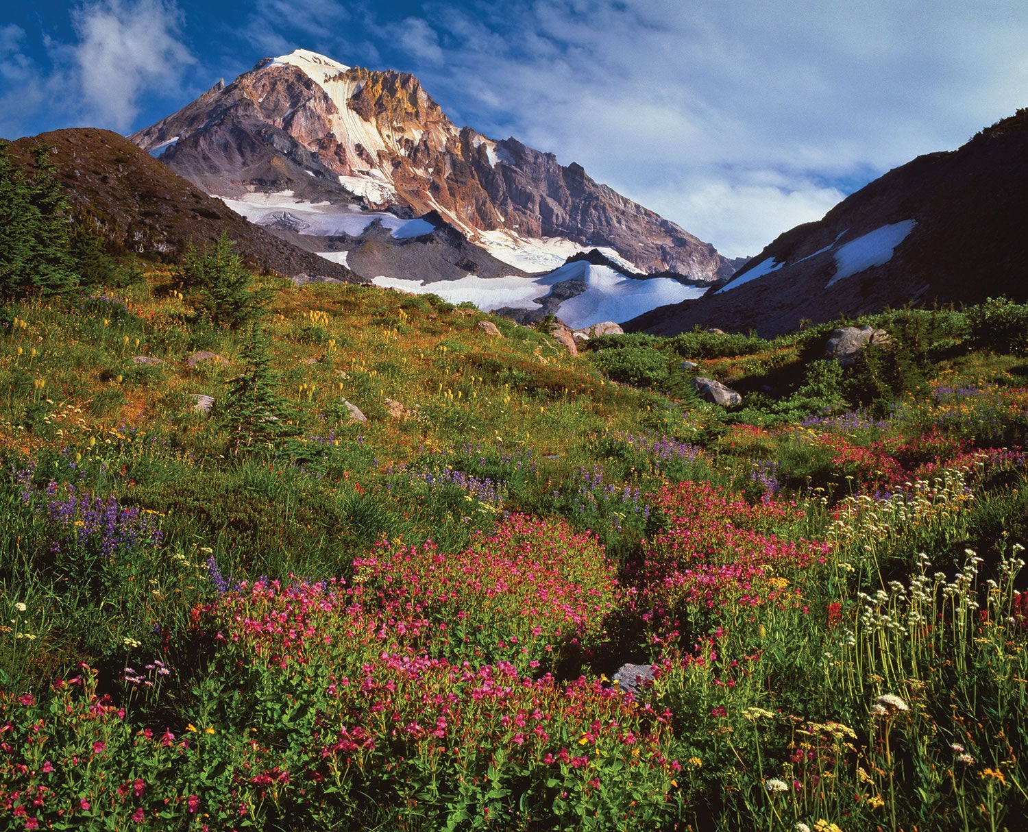
The Timberline Trail is the most storied multiday backpacking trip in Oregon. It circles the 11,000-foot cone of Mt. Hood, dipping between alpine meadows, moss-shrouded waterfalls, and steep, rocky outcrops with panoramic views across the state and into Washington. In 1885, trail pioneers sketched out the first few segments, but it wasn’t until the 1930s, when Franklin Roosevelt created the Civilian Conservation Corps, that the route became a ring. But due to the hairy river crossings, few people have thru-hiked it. I myself have ticked off its best in bits and pieces, but was turned around on my last thru-hike attempt when the Eliot Branch, one of the trail’s five critical crossings, was impassable.
While the majority of the trail is well-signed, the safest fords drift year to year as glacial melt rearranges the shoreline. That means no GPS tracks or cairns point to safe passage. Moreover, the current often crests on summer afternoons. In 2006, a particularly powerful flood pulverized the bridge across the Eliot Branch, on the northeast side of the mountain, making circumnavigation impossible. At the end of 2016, the Forest Service rerouted the trail to a wider section of the Eliot Branch, shallow enough to boulder-hop in low water. That’s what gave me the confidence to try for the four-day, full circuit once again.
ADVERTISEMENT
The Timberline Trail is a Cascadian roller coaster, with bountiful water sources and well-established campsites the whole way. Moving clockwise from the path’s de-facto starting point at the luxe Timberline Lodge, I started my route up the west side. I crossed Paradise Park’s display of fuchsia Indian paintbrushes and violet lupines and the silky veil of 120-foot Ramona Falls. Farther along, I reached McNeil Point’s historic, glacier lily-shrouded stone shelter at 5,900 feet, below Hood’s craggy western face. Around the east side, I climbed above 7,000 feet on Gnarl Ridge, the trail’s gusty high point, and strolled through Sound of Music wildflowers at Elk Meadows and ski resorts silenced by summer.
Nearly two-thirds of the way into the hike, I reached the Eliot Branch’s new crossing. It was no longer the heart-pounding gamble I remembered from failed earlier attempts. The freshly blazed trail led me to a relatively tame passage (in the morning, at least), and I grinned smugly at succeeding where I and so many other hikers had failed in years past.
When I hit the White River and its crescendo of crashing rapids, 10 miles and several crossings later, I can nearly taste the lodge’s Ice Axe IPA. I pace the banks, scanning across to the tan cliffs, then, finally: the dusty outline of a trail! I shuffle, thigh-deep, facing the icy current. Soon the lodge’s iconic snow goose weather vane pops into view over the ridge. I breathe. I laugh. I’m giddy. It took a decade, but I’ve finally closed the loop.
DO IT There plenty of access points, but most hikers start at Timberline Lodge and go clockwise. From Portland: Drive east on US 26 to Timberline Hwy. Season Mid-July to September (expect snowfields year-round) Permit Required (free); self-issue at the trailhead.