Updated April 9, 2025 11:36AM
Kettle Moraine State Forest: Hike Ice Age History Near Milwaukee
If you're a fan of eskers, moraines, kettles, and kames, Wisconsin's Kettle Moraine State Forest is the right place for you.
(Photo: Kevin Horan via Getty Images)
I wanted to do some springtime hiking in Wisconsin’s Kettle Moraine State Forest when the trees were budding, the birds were nesting, and the bugs weren’t yet buzzing. But other commitments kept getting in the way. Then summer came, along with the poison ivy and ravenous mosquitoes, so it was early fall and peak color before I finally made the journey.
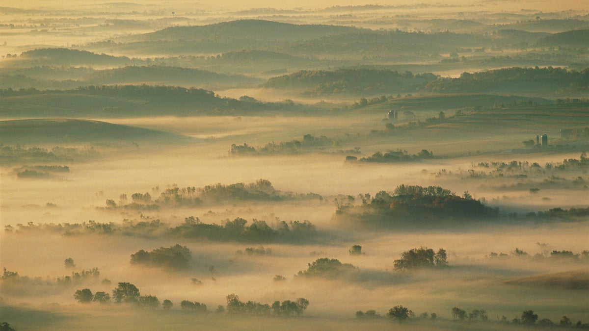
It turned out to be pretty good timing. It was a sunny weekend, and southeast Wisconsin decided to tout its early fall finery. There wasn’t a better day for hiking or mountain biking—bikes are allowed on 23 of the area’s 145 miles of trails. The path was a corridor of colors. Clusters of multicolored trees surrounded ponds and streams running across the countryside. Hilltop vistas revealed quintessential dairyland scenes: rolling hills overlaid with a patchwork of farms and dairies that stretched to the horizon.
A Short History of Kettle Moraine State Forest
About 10,000 years ago, this area was buried under a glacier that covered two-thirds of Wisconsin and most of northern North America. The giant sheet of ice advanced and retreated several times over the course of about 15,000 years. In the process, it tore, picked up, and deposited pieces of terra firma along its path. As the glacier melted, a most unusual landscape was unveiled. Giant boulders and anomalous piles of cobbles were left among the rolling hills and ridges. Large conical hills along with dells and dales dotted the undulating countryside. Ponds and lakes filled depressions left behind.
Kames, Eskers, and Moraines
The conical hills, called kames (some are 350 feet high), were formed by surface rivers flowing down to the ground through cracks in the ice, depositing heaps of cone-shaped debris along the way. Serpentine ridges, called eskers, were formed by streams traveling through tunnels at the base of the ice sheet. Ridges formed by sand, boulders, and cobbles when the glacier melted are called moraines.
ADVERTISEMENT
Errant rock piles and boulders became a part of the traveling deep freeze, moving with the ice until the glacier melted and randomly deposited its cargo. In many places, a block of ice became buried under the debris. When that ice eventually melted, it left a depression called a kettle. Many of Wisconsin’s lakes now fill these kettles.
What to Expect in Kettle Moraine
Hiking
The 1,000-mile Ice Age Trail traces the edge of the glacier’s path and links the two Kettle Moraine State Forest units. Hikers can explore everything from rugged half-day treks to multi-day adventures. Along the way, you’ll find three-sided shelters scattered along the Ice Age Trail, including several nestled in the Kettle Moraine forests.
In winter, crews groom some of the trails for cross-country skiing. One person told me that the silence of a snow-covered trail under the light of a full moon rivals the vibrant fall foliage and the blossoms of spring and summer. I can’t wait to experience it for myself.
Flora and Fauna
You might see whitetail deer, hawks, turkey vultures, raccoons, squirrels, opossums, and turtles frolicking through Kettle Moraine, but no bears in this area. Mosquitoes abound in summer.
ADVERTISEMENT
The plant life along the area’s trails is as unique and varied as the geologic history. Because the Kettle Moraine landscape is so rugged and forbidding to human settlers, many rare plants thrive in the diverse sanctuary of the forests. Fields that dance with wildflowers one week can become a blanket of shimmering straw grasses just a few weeks later. Groves of fiery sumac, maple, and oak resemble tapestries of green, wine, and pink-orange in fall. Stands of silver-trunked birch carpet the ground with yellow leaves.
What to Watch Out For
- In summer, you’ll have to deal with poison ivy.
- Never wade downstream in rivers because sand bars drop off abruptly on the downstream side. Waters of Lake Superior and Lake Michigan can be dangerously cold. Officials do not recommend swimming in Lake Superior. The Great Lakes generate strong currents—similar to those in the ocean—due to their large size, especially along the shore. Swimmers should be extremely cautious of areas where the current appears to flow away from the shore.
- Not all trails are surfaced.
- You may encounter steep climbs, descents, and stairways.
Permits & Other Logistics
Permits
Vehicle admission is $8 per day for Wisconsin residents, $11 for non-residents. Annual parking stickers (good at all Wisconsin state parks and forests for one calendar year) are $28 for Wisconsin residents, $38 for non-residents. Parks also require a state trail pass for anyone 16 and over who are biking or horseback riding. They’re not available online. Purchase annual or daily trail passes and vehicle stickers at any self-registration pay station. If you want to fish or hunt, you need to have a permit.
Getting There
Kettle Moraine is located in southeast Wisconsin, about 45 minutes from Milwaukee. State Hwys. 12, 59, and 67 all lead to the park’s Southern Unit. Take Hwy. 45 from Milwaukee (Hwy. 23 from Fond du Lac) to the Northern Unit.
Parking
If you’re biking the Greenbush and New Fane trails, there is parking available near the Greenbush Shelter and the Greenbush Picnic Area. For those backpacking, there are sites available near the shelters. Many other parking areas are available throughout the forest. For all cars and motor vehicles stopping in state parks, forests, and recreation areas, you must have a Wisconsin State Park System vehicle admission sticker.
ADVERTISEMENT
Season
In summer, temperatures are between 75 and 95 degrees Fahrenheit. In winter, temperatures are perfect for skiing at 0 to 32 degrees Fahrenheit. Bike trails are open from mid-April through November, depending on trail conditions.
Camping and Reservations
- There are two family campgrounds in the Northern Unit—Long Lake and Mauthe Lake—with over 275 sites between them. They are 75 percent reservation, 25 percent first-come, first-served. Hook-ups, flush toilets, showers, and water are available.
- There are three family campgrounds—Ottawa Lake, Pinewoods, and Whitewater Lake—in the Southern Unit. All campgrounds accept reservations. Pinewoods and Ottawa Lake has showers, flush toilets, and water available. The other sites only provide pit toilets and water.
- Visitors can also camp at primitive backpack shelters. You may backpack camp along the Ice Age Trail only at the three designated shelter sites. Each site includes a roofed shelter, fire ring, and pit toilet. To stay overnight, you must reserve a site by calling the park office.
- The park office accepts reservations up to 11 months in advance. You can reserve each site for one night only, and the park strongly recommends making a reservation ahead of time.
Other Trips Near Kettle Moraine
The shores of Lake Michigan are 20 miles east. Also, throughout this part of Wisconsin, Old World Wisconsin provides a trip into the 1700s and 1800s with historic buildings and sites.
Leave No Trace
Some of the land within the forest boundary is under private ownership. Respect private property. Stay in designated areas. Stay on trails and in picnic areas and other developed areas. All LNT guidelines apply.