Published December 1, 2004 12:00AM
High Points: Borah Peak, Idaho
Don't forget your sound judgment when summitting this high point.
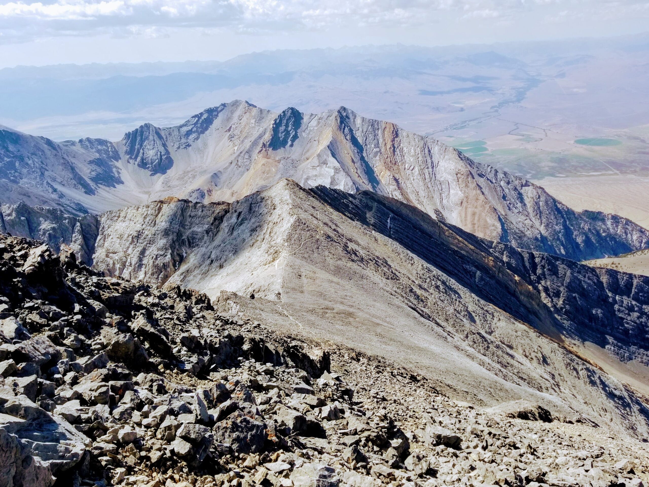
Looking back on the approach ridge of Borah Peak, just below the summit. (Photo: James Dziezynski)
It’s only a 6.8-mile round-trip hike up and down the jagged profile of Borah Peak, the granddaddy of the Lost River Range. But the route is relentlessly steep, and the mountain’s upper section features one of the all-time-great topographical nicknames–Chicken Out Ridge. Many who peer over this airy line above 11,300 feet quit on the spot. Next up is a 400-foot section of ridge that requires careful hand and foot placement, but not a rope. Around 12,000 feet, there’s a steep snow bridge with steps kicked in near the sharply angled top. Start early, bring an ice axe and crampons, exercise sound judgment, and 6 hours later you’ll be rewarded with views across two dozen of Idaho’s highest mountains.
Elevation: 12,662 feet
Rank: 11
Contact: Lost River Ranger District, Salmon-Challis National Forest, (208) 588-2224
USGS Topo: Borah Peak
Eat: Bear Bottom Inn, MacKay, (208) 588-2483
Sleep: There are three established tent sites within 100 yards of the trailhead, Lost River Ranger District, (208) 588-2224
Gear: The Bent Rod, MacKay, (208) 588-3310