Yosemite National Park: Pohono Trail
Wander along Yosemite's towering South Rim for unbeatable Valley panoramas from a series of high-country, cliff-edge vantage points.
Heading out the door? Read this article on the new Outside+ app available now on iOS devices for members! Download the app.
Crammed with world-famous features like Half Dome, El Capitan, Yosemite Fall and Sentinel Dome, the glacier-carved Yosemite Valley holds a veritable treasure chest of must-see park icons. On this 13.8-miler ideal for a long day hike or leisurely overnight, climb from the panorama-blessed Tunnel View to the soaring Glacier Point before catching a shuttle for the scenic return trip down Glacier Point Road. For travelers hoping to experience Yosemite sans car, this excursion is an ideal way to nab views from can’t-miss vantage points like Taft Point, Sentinel Dome and Glacier Point.
From the east mouth of Wawona Tunnel, snag your first series of Valley views – featuring El Capitan, Clouds Rest, Half Dome, Cathedral Rocks and Sentinel Dome – before climbing to the top of the South Rim on the Pohono Trail. Notch your first aerial vistas of the valley from Stanford Point (2.8 miles) before continuing on for fresh perspectives from Crocker Point and Dewey Point.
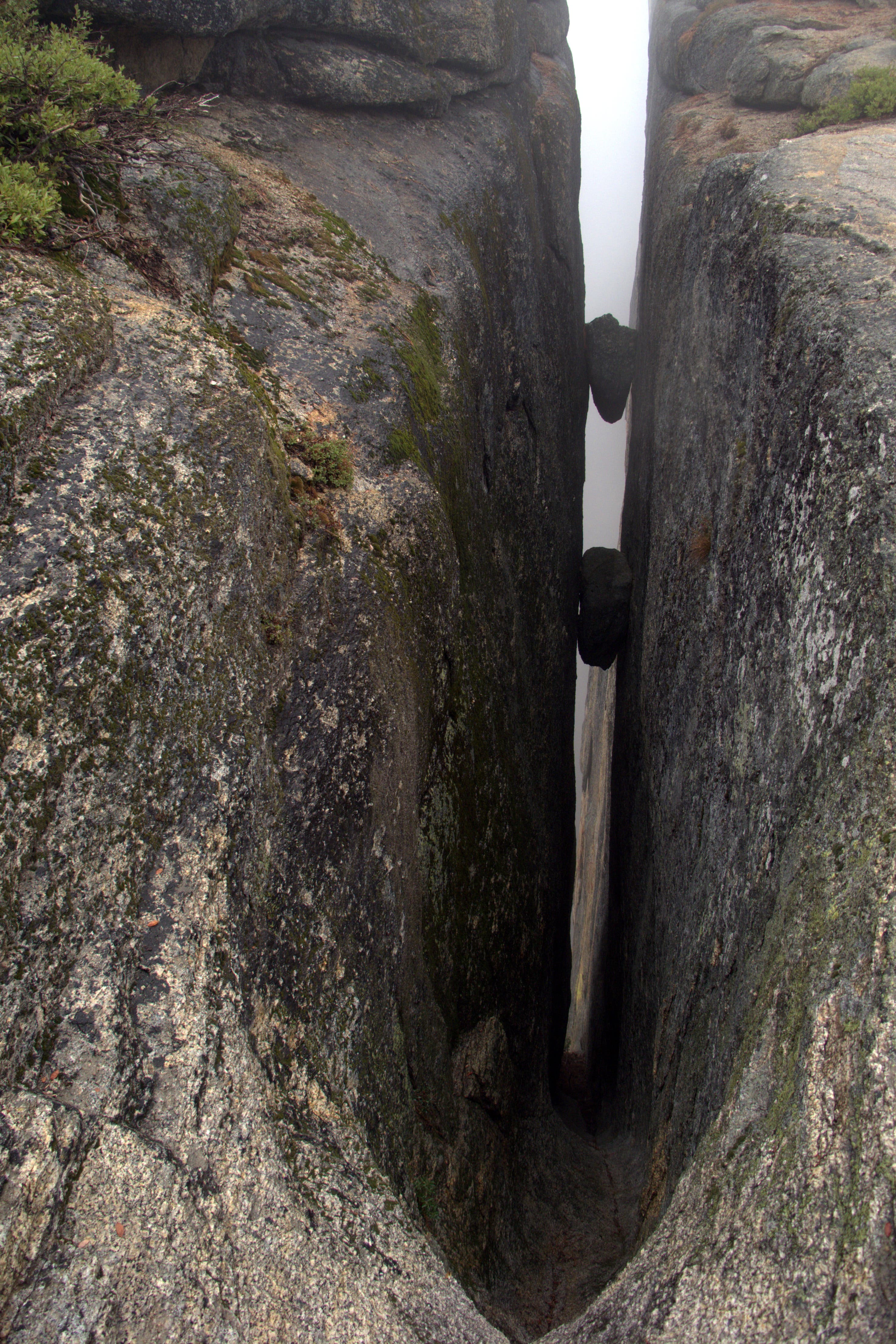
Weave through a 4.3-mile stretch of forest before passing the Fissures – a series of deep, tight gashes into the granite of Profile Cliff – en route to Taft Point. The panoramas from Taft Point, which protrudes precariously into the void above the Valley, rival those from Glacier Point, although Taft, inaccessible by motor vehicles, draws considerably less visitors. Continue to Sentinel Dome (three miles east) for all-encompassing vistas from the Valley’s second highest vantage point (Half Dome is the highest). Then, descend from Sentinel’s exposed, granite summit to complete the final one-mile jaunt to the legendary Glacier Point for spectacular cross-valley panoramas of Half Dome.
Return to Tunnel View via the Glacier Point Shuttle. The $25, one-way shuttle departs from Glacier Point at 10:30 a.m., 12:00 p.m. and 3:30 p.m. The shuttle does not accept reservations for rides from Glacier Point to the Valley, though usually has openings because most passengers ride the bus up and walk back to the Valley via the Four Mile Trail.
PLAN IT
GUIDEBOOK AND MAP The Complete Guidebook to Yosemite National Park, 6th Edition ($12.95, yosemitegifts.com). Consult the time-tested authority on Yosemite, or plan other trips in the park using BACKPACKER’s Destination’s page (backpacker.com/destinations/category/206). Get around the park using Yosemite’s free shuttle service (nps.gov/yose/planyourvisit/upload/valleyshuttle.pdf).
FEES/PERMITS To enter park: $20 per car, $10 per pedestrian/ bicyclist. Pass is valid for seven days. Backcountry permits are required for all overnight stays from May through October. Reservations for a permit can be obtained no earlier than 24 weeks before the first night of your stay. Permits cost $5 per reservation and $5 per person in the party. Depending on availability, permits can also be obtained at the wilderness center on the day of your trip.
CONTACT Call the Wilderness Permit Office at (209) 372-0740; nps.gov/yose/planyourvisit/wildpermits.htm
CONDITIONS Tioga Pass Road (Highway 120) is closed between October and May. Water is available along the trail at mile 2.8, mile 3.8, mile 5.4 (seasonal), mile 7.9, mile 11.7, mile 13, and mile 14.4.
GPS DATA Download tracks and waypoints, print or order custom topos, from the menu on the left.
LOCAL LINKS
GAS
LEE VINING: CHEVRON
51557 Highway 395
Lee Vining, CA 93541
(760) 647-6330
GROVELAND: CLAIM JUMPER OUTPOST
17586 Highway 120
Groveland-Big Oak Flat, CA 95305
(209) 962-7153
GEAR
MAMMOTH MOUNTAINEERING SUPPLY
3189 Main St.
Mammoth Lakes, CA 93546
(888) 395-3951
GROCERIES
EL PORTAL: EL PORTAL MARKET
10913 Highway 140
El Portal, CA 95318
(209) 379-2700
MAMMOTH LAKES: VONS
481 Old Mammoth Rd.
Mammoth Lakes, CA
(760) 934-4536
RESTAURANTS
MAMMOTH LAKES: ANGEL’S RESTAURANT
20 Sierra Blvd.
Mammoth Lakes, CA 93546
(760) 934-7427
CURRY VILLAGE: DEGNAN’S DELI
9015 Village Dr.
Curry Village, Yosemite National Park, CA 95389
(290) 372-8454
-Text: Brian Beer. Map and photographs: Jeff Chow


Trail Facts
- Distance: 22.3
Waypoints
PHT001
Location: 37.715061, -119.67649
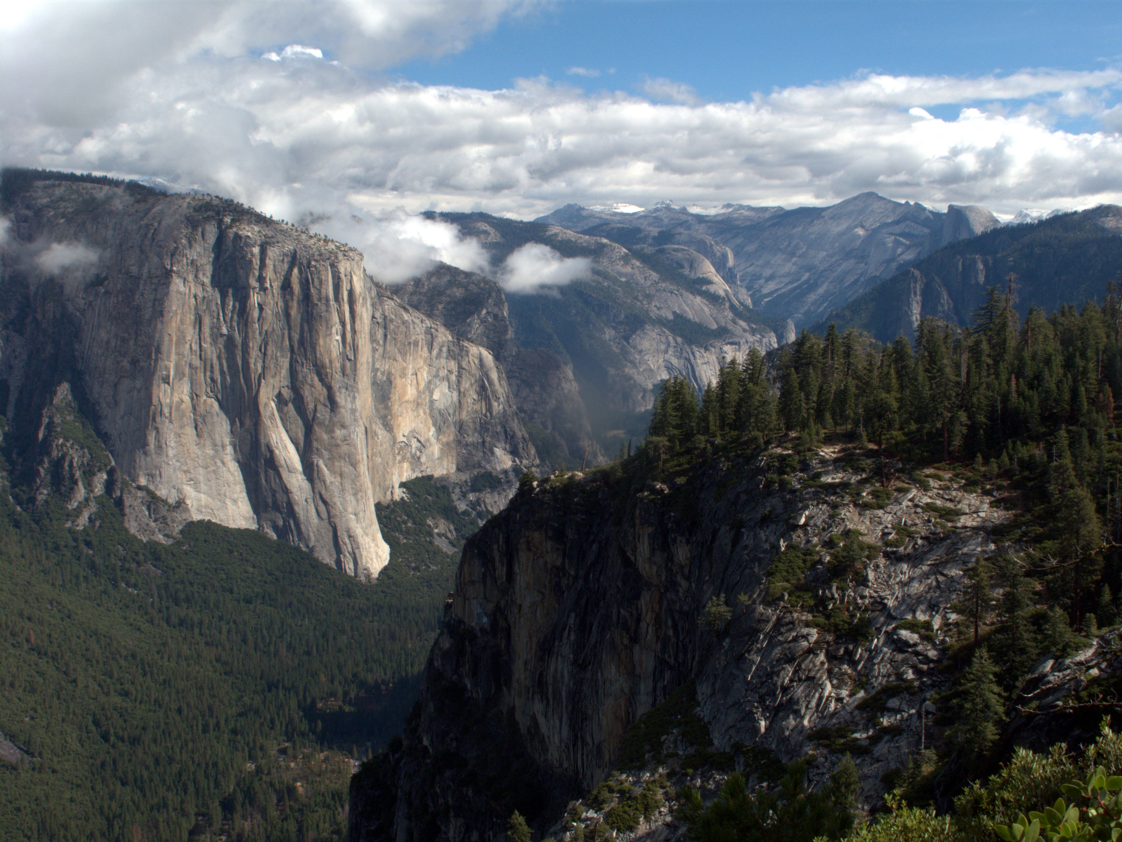
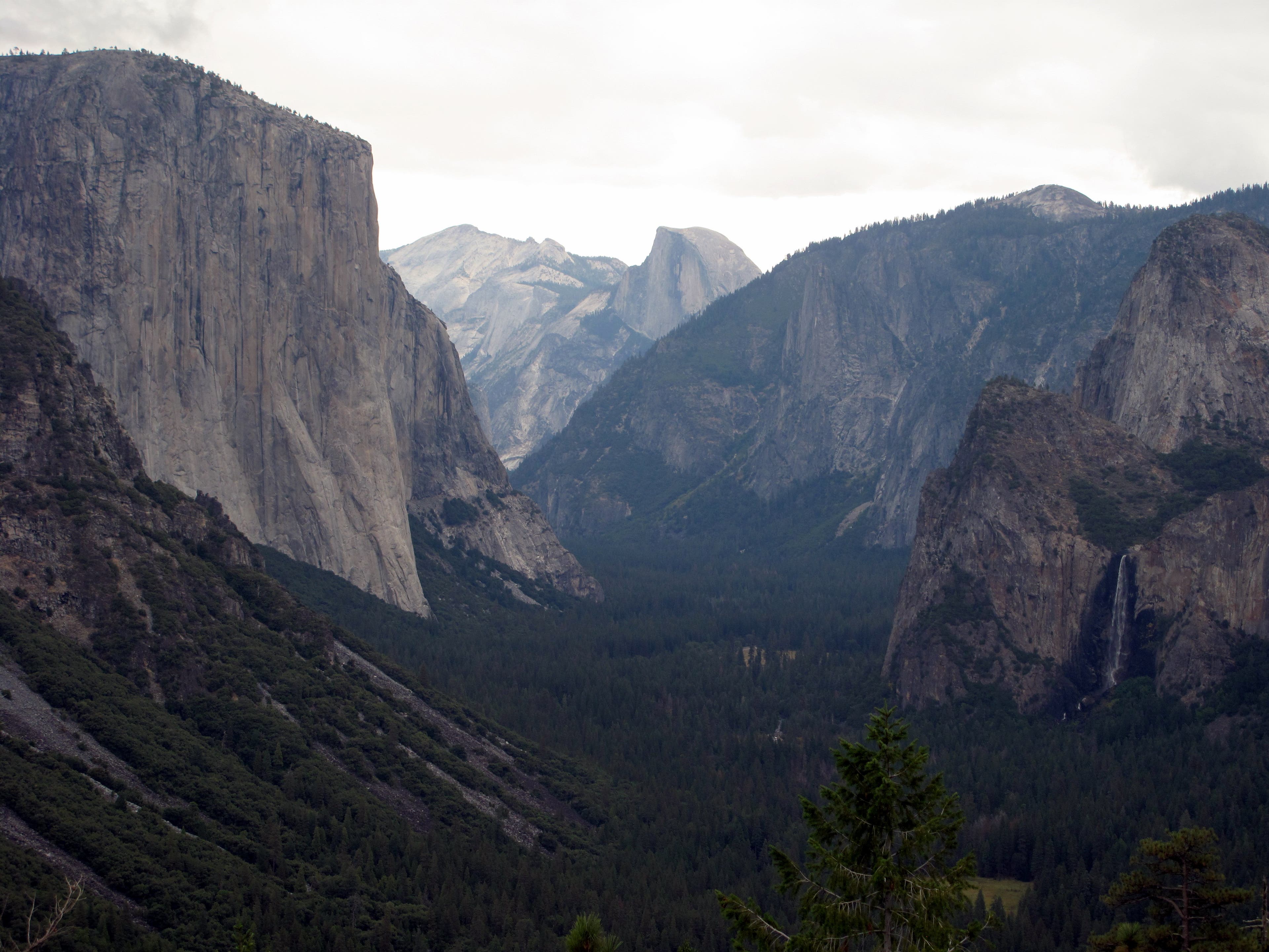
Start at the Tunnel View Trailhead. Bear boxes and overnight parking are available on the south side of Wawona road. Before setting out, look down-valley for a greatest hits collection of Yosemite Valley scenery. El Capitan punctuates the North Rim, while Clouds Rest, Half Dome, Sentinel Rock, Sentiel Dome, Bridalveil Fall, Cathedral Rocks and Half Dome span the South Rim. After snapping a few photos, leave the crowds at the viewpoint and head south to begin climbing the mildly-graded Pohono Trail.
PHT002
Location: 37.7146, -119.68255
At the Y-junction, fork right to stay on the Pohono Trail. The left trail leads to Artist Point (0.5 mile) before continuing another 1.5 miles to the Bridalveil Falls Trailhead.
PHT003
Location: 37.713283, -119.687217
Reach a clearing where the parking area for Inspiration Point once stood. Cross through the partially-paved area and turn right to descend to Inspiration Point, which features an excellent panorama of Yosemite Valley. Dense forests mask the roads weaving across the valley floor, providing a pristine base to the soaring peaks overhead. The Valley regulars are available visible here, with El Capitan and Half Dome presiding over the rest of the gang. After savoring the view, turn around to continue climbing the Pohono Trail. You’ll gain an additional 1600 feet of vertical before earning your descent.
PHT004
Location: 37.702433, -119.67785
Cross Artist Creek. Water is available here.
PHT005
Location: 37.703017, -119.672817
Reach the top of the South Rim as the Clarke Range and Cathedral Range slowly creep into view. Sentinel Dome rises clearly near Half Dome to the south.
PHT006
Location: 37.700633, -119.66725
Cross Meadow Brook. Water is available here, and campsites are situated along the upcoming stretch of trail leading to Stanford Point.
PHT007
Location: 37.706333, -119.666917
Reach Stanford Point and notch additional panoramas of the Valley. The southwest face of El Capitan dominates the horizon, while Cathedral Rocks peek over the nearby rise of the South Rim. Bridalveil Fall is also visible to the south.
PHT008
Location: 37.704233, -119.659033
From the overhanging eastern edge of Crocker Point, gain dizzying views of the Valley below. Some established campsites are perched on cliff edges, but the Park Service prohibits camping within 0.5 mile of the Rim. If you are planning on spending the night, however, keep your eyes open for a site: camping is not permitted east of Bridalveil Creek (2.9 miles away).
Once done gawking at the height from which you stand, continue along the Pohono Trail where in 300 yards you will come across 3 boulders with a view back to Crocker Point and its overhanging viewpoint.
PHT009
Location: 37.704417, -119.650167
Snag prime panoramas from Dewey Point before descending into the marshy Bridalveil Fall drainage.
PHT010
Location: 37.6944, -119.6413
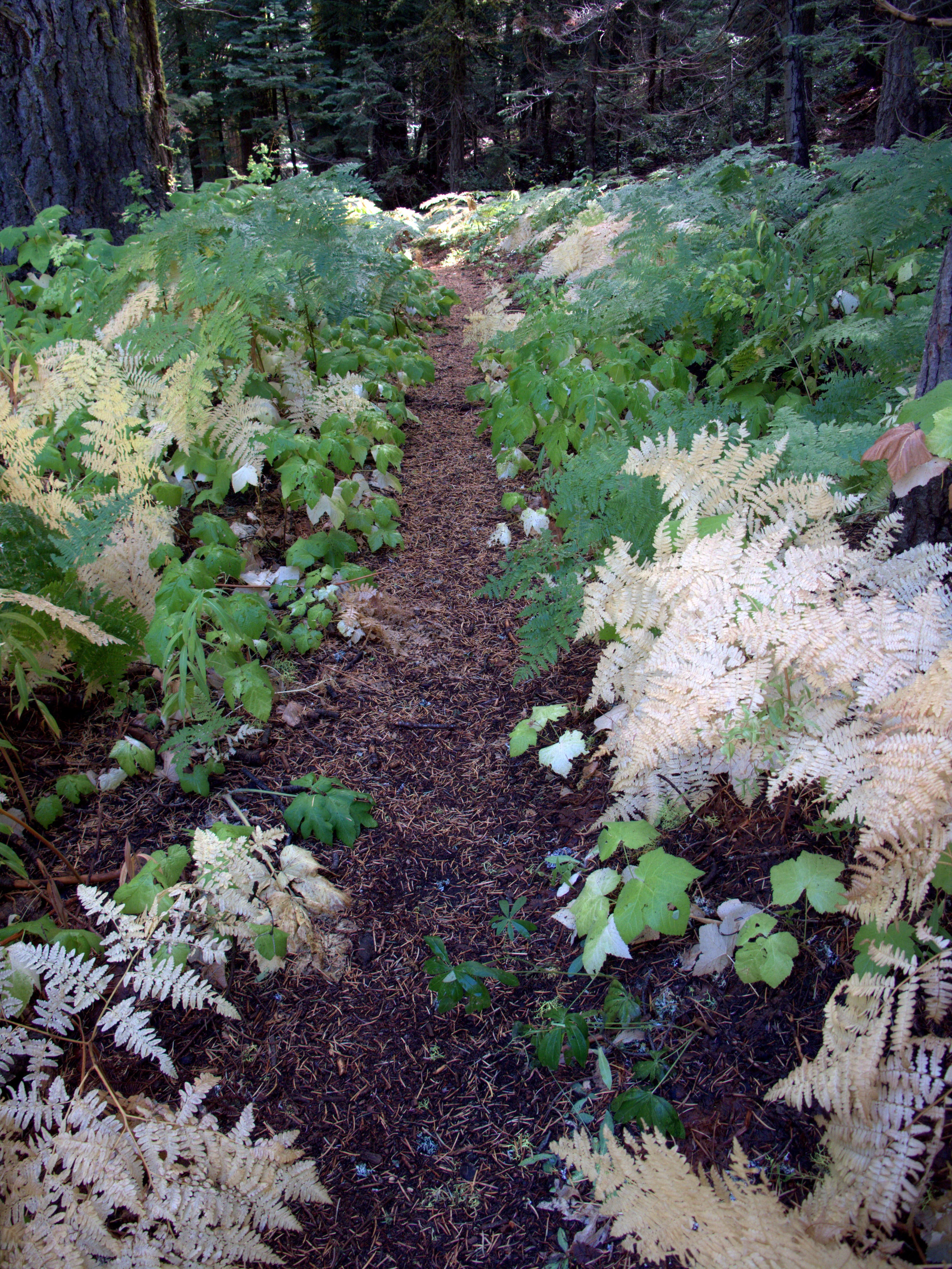
Cross through fern-blanketed marshes flanking the Pohono Trail above Bridalveil Creek. Whitedail deer frequent the area.
PHT011
Location: 37.693233, -119.6259
After crossing through a clearing, reach a Y-junction with the McGurk Meadow Trail. Bear left to follow the Pohono Trail to a footbridge spanning Bridalveil Creek. Camping is not available east of Bridalveil Creek. Find a spot here or complete the trek to the Valley floor before nightfall.
In a quarter mile you will come across a large footbridge over Bridalveil Creek. This crossing also marks the western edge of the no dispersed camping area. If you’re camping, flat spots can be found here, near the trail junction.
PHT012
Location: 37.70585, -119.611333
Hug the edge of a cliff while enjoying prime vistas of El Capitan’s eastern face.
PHT013
Location: 37.71315, -119.6046
Reach Taft Point. The Valley panoramas from here rivals those from Glacier Point, but Taft, only accessible via foot, attracts fewer visitors.
PHT014
Location: 37.711967, -119.595967
Stay left to continue on the Pohono Trail. The right fork leads to Glacier Point Road.
PHT015
Location: 37.71445, -119.5931
Sentinel Dome comes into view as the trail bends to the north and crosses through a clearing.
PHT016
Location: 37.719883, -119.595033
As the trail skirts a high cliff, snag views of Yosemite Falls and El Capitan’s eastern face.
PHT017
Location: 37.7221, -119.5928
Cross Sentinel Creek. Water is available here.
PHT018
Location: 37.72655, -119.58245
At the Y-junction, bear right to take a spur trail to Sentinel Dome.
PHT019
Location: 37.725213, -119.581208
Cross right and cross a dirt road to continue climbing toward Sentinel Dome.
PHT020
Location: 37.7231, -119.584333
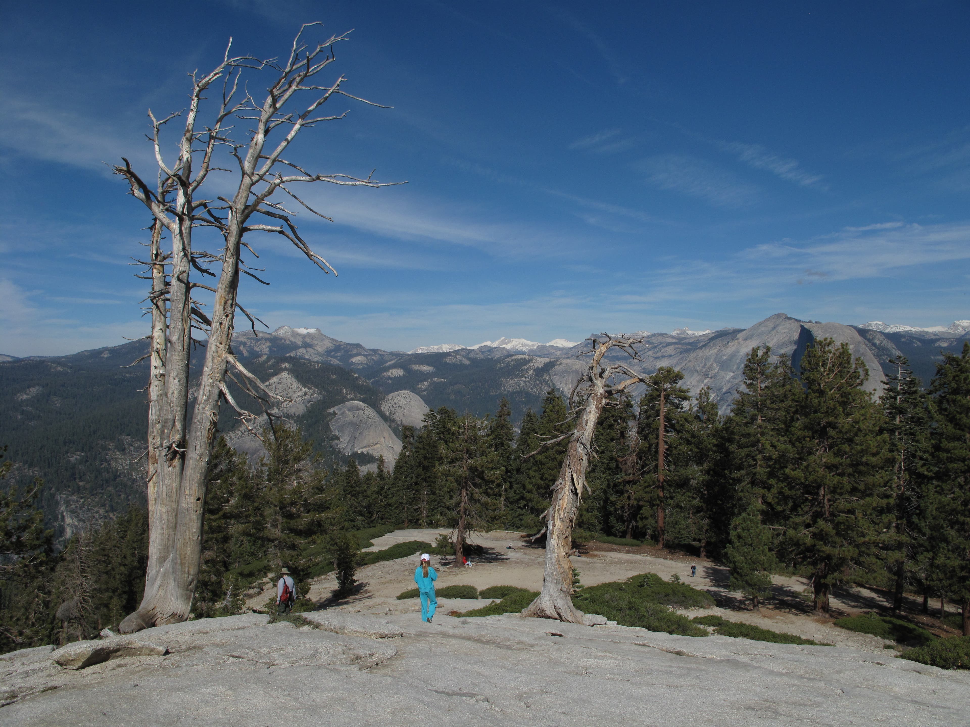
Grab some of the park’s best views from the exposed summit of Sentinel Dome. The second highest point in the Valley (behind Half Dome), Sentinel clocks in at 8,117 feet and is home to the gnarled Jeffrey Pine immortalized in Ansel Adams’ in several Ansel Adams photographs. Along with views of the Valley’s usual suspects — El Capitan, Yosemite Falls, Cathedral Rocks and Clouds Rest — Sentinel offers vistas of the far-off Cathedral and Clark ranges,as well as glimpses of Vernal and Nevada Falls. After feasting on the scenery, retrace your steps to the Sentinel Dome spur junction and turn right.
PHT021
Location: 37.723886, -119.575496
Follow signs to Glacier Point.
PHT022
Location: 37.7258, -119.5747
Cross Glacier Point Road and continue straight to Glacier Point.
PHT023
Location: 37.728, -119.573283
Reach Glacier Point. Wander through the interpretive area and toward the edge for spectacular panoramas of the Valley below.
PHT024
Location: 37.72969, -119.573178
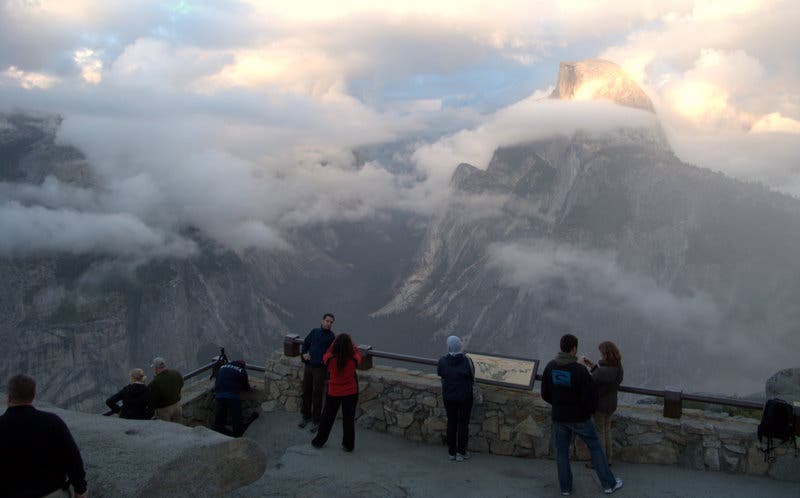
Though packed with tourists, Glacier Point’s superb high-country panoramas render it a must-see. Grab jaw-dropping views, comparable to those from Sentinel Dome, while wandering through an interpretive area toward Glacier Point’s cliff-edged northern terminus.
PHT025
Location: 37.730717, -119.573583
Savor world-class vistas from the edge of Glacier Point, perched precipitously atop Yosemite Valley’s sky-scraping South Wall. Half Dome looms majestically to the northeast, while Nevada and Vernal Falls can be seen above the confluence of the Illilouette Gorge and Merced River to the east. Curry Village is carved into the valley floor directly north, Yosemite Falls plunge from the valley’s North Wall, and the Clarke Range spans the southeast horizon. After soaking in the views, turn around and retrace your route to the Sentinel Dome/ Taft Point Trailhead.
Tunnel View
Location: 37.715067, -119.676483
From Tunnel Point, look south for a greatest hits collection of Yosemite Valley scenery. From left to right: El Capitan, Clouds Rest, Half Dome, Sentinel Rocks, Sentinel Dome, Cathedral Rocks and Bridal Veil Fall.
Inspiration Point
Location: 37.714183, -119.687933
Savor ultimate Yosemite Valley views from Inspiration Point. El Capitan and Half Dome rise prominently. The Valley’s other mainstays (Clouds Rest, Cathedral Rocks, Bridalveil Fall, Sentinel Dome and Sentinel Rocks) are also visible.
South Rim Viewpoint
Location: 37.70315, -119.672733
After gaining the South Rim, grab spectacular down-valley views.
Nearing Meadow Brook
Location: 37.701167, -119.668617
Broad leaves line the trail leading to Meadow Brook.
Stanford Point
Location: 37.706117, -119.666483
Spectacular, cliff-edge campsites await from Stanford Point.
Stanford Point
Location: 37.70635, -119.666967
Clouds add an ethereal aura to the breathtaking panorama of Yosemite Valley from Stanford Point.
Crocker Point
Location: 37.704333, -119.65895
Crocker Point
Location: 37.70415, -119.65905
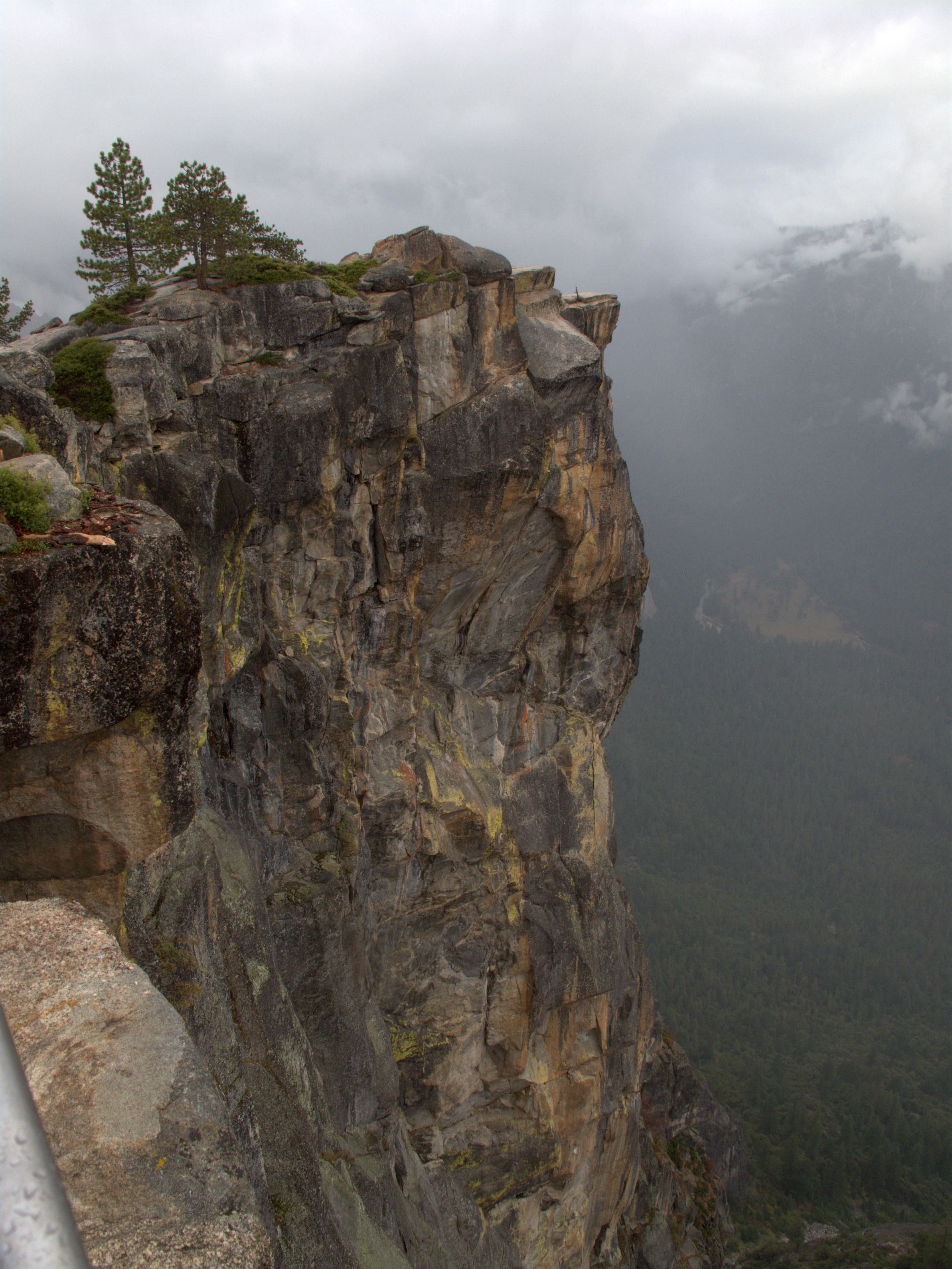
Crocker Point hangs precariously over the Valley below.
Bridalveil Creek
Location: 37.69425, -119.62185
Bridalveil Creek flows north toward a waterfall below.
Approaching Taft Point
Location: 37.707017, -119.609817
Gain Valley views as the trail hugs a cliff while approaching Taft Point.
The Fissures
Location: 37.712767, -119.604117
Before hitting Taft Point, pass by a series of tight, vertical slots known as “The Fissures.”
Taft Point
Location: 37.712933, -119.604417
Taft Point, as seen from the trail to the southeast.
Trekking East
Location: 37.711267, -119.6013
From Taft Point, follow a smooth trail through boulder-dotted pine forest.
Sentinel Dome
Location: 37.7146, -119.59315
Sentinel Dome comes into view 0.8 mile east of Taft Point.
Approaching Sentinel Dome
Location: 37.718417, -119.5947
Meander over a soft trail of dirt and pine needle as you approach Sentinel Dome.
Yosemite Fall
Location: 37.722017, -119.59315
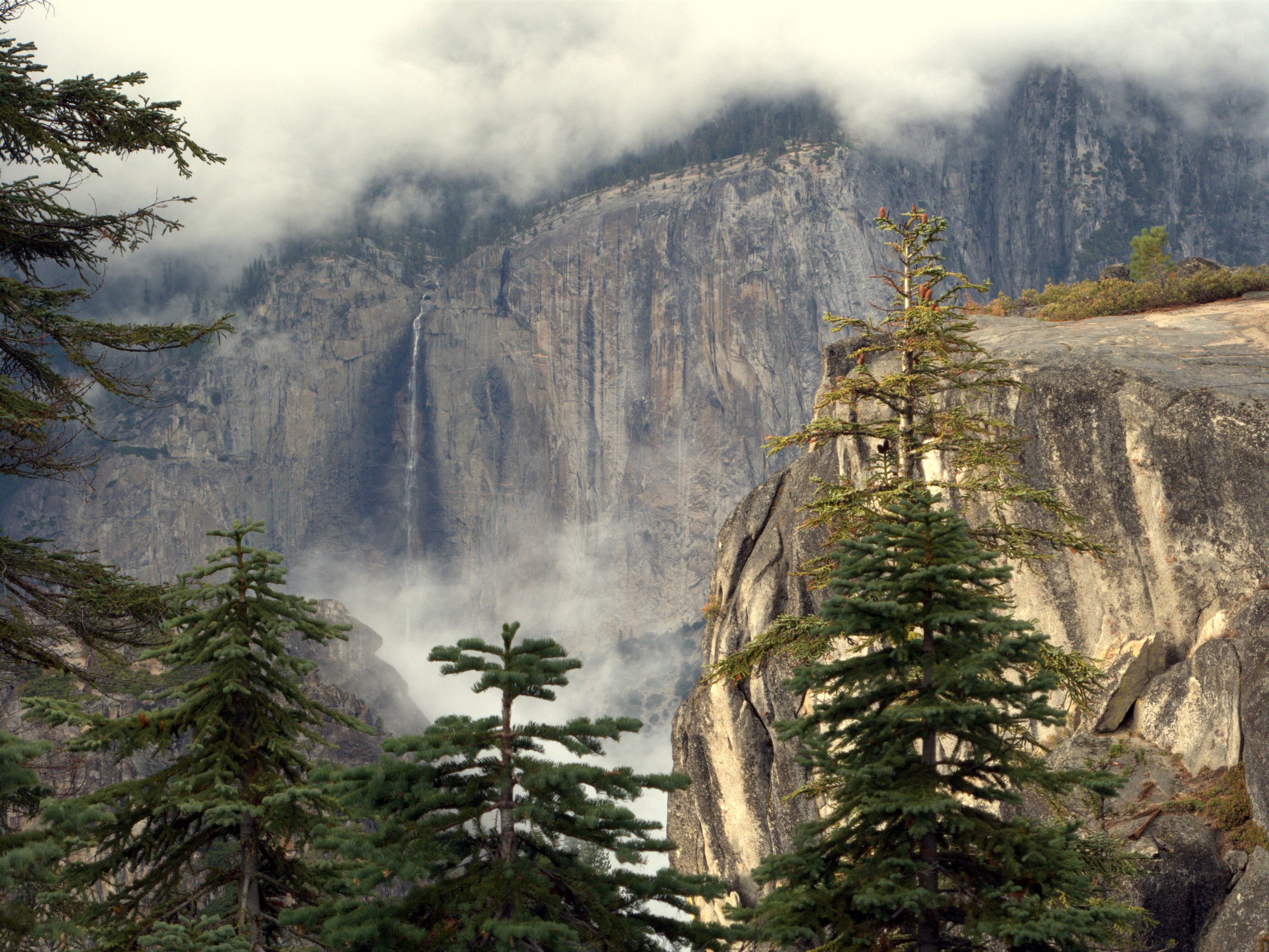
Gain dramatic cross-valley views of Yosemite Fall from a vantage point below Sentinel Dome.
Weather Rolls In
Location: 37.722017, -119.59315
Clouds add layers of texture to the Valley’s already dramatic alpine scenery.
Sign
Location: 37.72405, -119.5758
Rusty as it may be, this sign indicates the correct route to Glacier Point.
Glacier Point Road
Location: 37.725883, -119.574667
Cross Glacier Point Road en route to Glacier Point.
Nearing Sentinel Dome
Location: 37.721083, -119.583317
Hardy lodgepole pines, Jeffrey pines and western white pines cling for life in the thin soil under Sentinel Dome.
Cathedral Range
Location: 37.723817, -119.583883
As you near Sentinel’s peak, the snowy Cathedral Range spans the northeastern horizon.
Fallen Soldier
Location: 37.723083, -119.584317
Once the subject of many photos by Ansel Adams, this Jeffrey Pine remained standing until the summer of 2003.
Down Valley
Location: 37.728017, -119.581233
Half Dome punctuates a northeastern panorama of Yosemite Valley.
Glacier Point
Location: 37.730617, -119.573683
End the hike with world-class views of Half Dome and the Yosemite Valley from cliff-edged Glacier Point.