Yosemite National Park: High Sierra Camps Loop

Day 1: Hike north on the John Muir Trail/Pacific Crest Trail from the trailhead near Tuolumne Meadows’ Wilderness Permit Center and the Tuolumne Lodge. Cross the highway and skirt the western base of Lembert Dome on Old Tuolumne Road, which travels across the northern fringe of Tuolumne Meadows. As you hike through sprawling meadows and past the winding Tuolumne River, you’ll catch views of Cockscomb, Unicorn, and Cathedral Peaks to the south, and Pothole Dome to the west. At the Parsons Memorial Lodge, just beyond Soda Springs, the JMT turns south while the PCT turns northwest. Continue along the PCT, following signs for Glen Aulin High Sierra Camp. The next five miles follow the Tuolumne River, passing side trails to the stable areas and Young Lakes, making a gradual descent into the Grand Canyon of the Tuolumne. Pass Tuolumne and White Falls to a 3-way junction and turn right (north), crossing the river, to Glen Aulin High Sierra Camp.
Day 2: Return to the river crossing, turning southwest off of the PCT, following signs toward May Lake. A mile from the junction, pass swampy McGee Lake and enter shadowy forest for the next several miles. Four miles along, fork right (west) at a junction, then left (south) at another junction a half-mile farther. Hike south over a shallow saddle and pass tiny Raisin Lake below the flanks of Tuolumne Peak. The trail winds north, making a short ascent, before turning south again to May Lake High Sierra Camp, directly below 10,850-foot Mt. Hoffmann.
Day 3: Continue south 1.2 miles to a junction for Snow Flat. Turn right (southeast) for a steady descent to a highway crossing; pick up the trail on the other side, and turn eastward to Tenaya Lake. Several picnic tables dot the lakeshore, making an ideal lunch stop with views of Polly and Pywiack Domes and towering Tenaya Peak. The trail continues southward for the next 2.5 miles, climbing gradually at first, then transitioning to steep switchbacks. Fork left (east) at the next junction, making a short northeastern descent to the Sunrise Lakes before turning southward and climbing again. Make a short, quick descent and turn left (north) on the JMT to Sunrise High Sierra Camp on the western edge of wide Sunrise Meadow.
Optional side trip to Cathedral Lakes: From Sunrise High Sierra Camp, stroll north through Sunrise and Long Meadows, often brimming with summer wildflowers. The trail curves eastward around the Columbia Finger, making a gradual ascent toward Cathedral Pass. Along the way, several outcrops offer stunning views of the Matthes Crest and Echo Peaks. Cross Cathedral Pass below Tressider Peak and make a short descent to Upper Cathedral Lake, surrounded by grassy meadows. Continue another 0.5 mile to a junction for Lower Cathedral Lake and a 0.5 mile side trail to the lower lake in a wide basin with outstanding views of Cathedral Peak. Return to Sunrise High Sierra Camp by the same route.
Day 4: Begin the day with a leisurely stroll northward through Sunrise and Long Meadows, with views toward Tressider Peak and the Columbia Finger. After a mile, turn right (east) off of the JMT, following signs for Merced Lake. The next six miles winds southward, descending gradually to a junction northeast of Bunnell Point. Fork left (southeast) for 0.7 mile to another junction, now entering Echo Valley. Turn left (east) following the Merced River 1.25 miles to the outlet of Merced Lake. Skirt the northern lakeshore another mile to Merced Lake High Sierra Camp.
Day 5: Proceed eastward to the next junction and the Merced Ranger Station; fork left (northeast), and begin a steady climb for the next mile, following signs for Vogelsang. At the next junction, fork left (northeast) again, crossing Lewis Creek and beginning another steady climb. 2.5 miles from the ranger station a side trail leads 0.3 mile to Babcock Lake, a nice lunch stop. Continuing upward, the trail turns northeastward, following Fletcher Creek through a meadowy valley. At a 4-way junction, the trail left leads 0.5 mile to Emeric Lake and straight ahead 3 miles to Booth Lake. Veer right 2.2 miles to Vogelsang High Sierra Camp at the base of Vogelsang and Fletcher Peaks. Ascend an easy, half-mile-long trail to visit Vogelsang Lake.
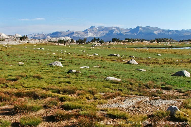
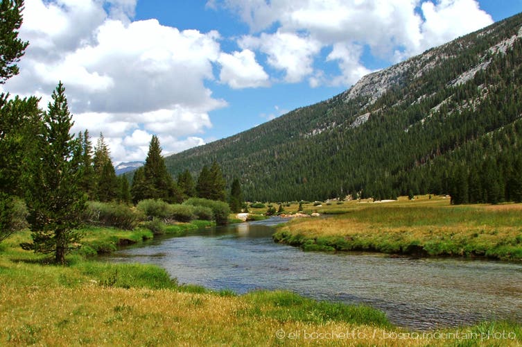
Day 6: From Vogelsang, continue eastward past Fletcher Lake into a wide, meadowy basin with Evelyn Lake glistening beneath the north flank of Fletcher Peak. Mount a shallow saddle and start descending to a junction with the trail to Ireland Lake, nestled beneath Amelia Earhart Peak—a worthy 3-mile side trip. Continuing on, come to an exposed plateau with incredible views into Lyell Canyon and southward to Donohue Pass, before making a steady 2.5-mile descent along the flank of Potter Point into Lyell Canyon. Turn left, once again on the JMT/PCT, and follow the clear, sparkling waters of the Lyell Fork on near-level trail for 5 miles. Pass the Fletcher Creek trail, then turn right and cross the Lyell Fork on several bridges, following signs to the Tuolumne Meadows Lodge and the completion of the loop.
-Mapped by Eli Boschetto, Bosco Mountain Photo
Trail Facts
- Distance: 91.9
Waypoints
HSC001
Location: 37.876681, -119.345451
Pick up the northbound John Muir Trail (JMT) near the Tuolumne Meadows’ Wilderness Permit Center and the Tuolumne Lodge.
HSC002
Location: 37.87697, -119.353213
Cross the highway, veering left on gravel road, following signs to stables.
HSC003
Location: 37.878803, -119.358411
Fork left through a gate onto Old Tioga Road, skirting the north side of Tuolumne Meadows.
HSC004
Location: 37.878513, -119.365666
Fork right, rounding the bubbling Soda Springs to the Parsons Memorial Lodge.
HSC005
Location: 37.879032, -119.367183
Turn right onto the northbound Pacific Crest Trail (PCT); follow signs for Glen Aulin.
HSC006
Location: 37.884289, -119.377311
Continue straight (north) through junction; trail on right returns to stables.
HSC007
Location: 37.88881, -119.381004
Fork left, continuing on the PCT.
HSC008
Location: 37.895616, -119.395063
Cross several branches of Dingley Creek.
HSC009
Location: 37.900914, -119.413191
Cross Tuolumne River above unnamed falls.
HSC010
Location: 37.905843, -119.41847
View of Tuolumne Falls
HSC011
Location: 37.908009, -119.421361
Optional: Turn right for Glen Aulin High Sierra Camp and White Falls view. To continue on the loop, turn left (southwest) off the PCT and hike toward May Lake.
HSC012
Location: 37.909248, -119.420253
Cross bridges over the Tuolumne River and Conness Creek to Glen Aulin High Sierra Camp. Stop for views of White Cascade.
HSC013
Location: 37.90991, -119.417864
Glen Aulin High Sierra Camp: The High Sierra Camps offer two different camping options. Hikers can reserve a spot in the tent cabins and sleep inside or set up tents in the neighboring backpackers camp (pit toilet and bear boxes). Backtrack to HSC011, and continue straight (southwest).
HSC014
Location: 37.893546, -119.442287
Cross Cathedral Creek.
HSC015
Location: 37.882781, -119.452539
Sweet, hidden campsite on bluff with Tuolumne Valley view.
HSC016
Location: 37.869588, -119.462945
Fork right (west).
HSC017
Location: 37.866773, -119.468706
Bear left (south).
HSC018
Location: 37.844801, -119.491506
May Lake High Sierra Camp: This camp is backdropped by its namesake lake and 10,850-foot Mt. Hoffmann to the west.
HSC019
Location: 37.832392, -119.491122
Turn left (east).
HSC020
Location: 37.820736, -119.478121
Cross CA 120, and turn left (north) toward Tenaya Lake.
HSC021
Location: 37.825921, -119.46825
Eat lunch at the picnic tables overlooking Tenaya Lake, which is ringed by its eponymous peak and the glacier-polished Polly and Pywiack Domes.
HSC022
Location: 37.800869, -119.458639
Turn left (east) and hike past three small lakes in the Sunrise Lakes basin.
HSC023
Location: 37.793375, -119.433318
Turn left (north) on the JMT to reach Sunrise High Sierra Camp.
HSC024
Location: 37.794596, -119.432676
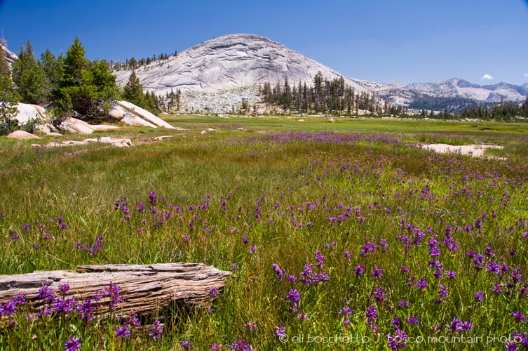
Sunrise High Sierra Camp: This camp is perched on a small ridge overlooking meadows (filled with purple penstemon in July and August) and Sunrise Dome.
HSC025
Location: 37.80307, -119.430308
Turn right (east) to continue on the loop to Merced Lake. Optional side trip: To visit Cathedral Lakes, continue straight at this 3-way junction.
HSC026
Location: 37.764578, -119.420534
Cross Echo Creek.
HSC027
Location: 37.752396, -119.441428
Fork left (south) and descend into Echo Valley.
HSC028
Location: 37.745406, -119.435638
Continue straight (southeast), crossing Echo Creek en route to Merced Lake.
HSC029
Location: 37.738582, -119.406796
Merced Lake High Sierra Camp: This camp, just east of Merced Lake, is bounded by peaks.
HSC030
Location: 37.738519, -119.395334
Turn left (north) for a one mile climb, gaining 900 feet of elevation.
HSC031
Location: 37.743944, -119.387569
Continue straight (north), following signs for Babcock Lake and Vogelsang.
HSC032
Location: 37.76028, -119.389589
Optional: Turn right for a 0.3-mile side trail to Babcock Lake; a nice place to break for lunch.
HSC033
Location: 37.77935, -119.376136
Pass the 0.4-mile side trail to Emeric Lake.
HSC034
Location: 37.780174, -119.375038
Fork right (east) to Vogelsang High Sierra Camp; the trail on the left leads 3 miles to Booth Lake and Tuolumne Pass.
HSC035
Location: 37.795512, -119.345765
Vogelsang High Sierra Camp: This is the highest of the High Sierra Camps and sits in a meadow below Fletcher Peak. Get there before sunset to watch the alpenglow paint surrounding granite peaks in rosy hues. Next day: Continue the loop by heading east toward Ireland Lake and Lyell Canyon (the trail on the right leads 0.5 mile south to Vogelsang Lake).
HSC036
Location: 37.812348, -119.299523
Pass a 1.5-mile side trail to Ireland Lake on the right. From here, the trail drops into Lyell Canyon to a junction with the JMT/PCT.
HSC037
Location: 37.826294, -119.279294
Turn left (north) on the JMT/PCT.
HSC038
Location: 37.84192, -119.285817
Camping is not permitted in Lyell Canyon north of this point.
HSC039
Location: 37.866607, -119.323261
Continue straight (west) through the 3-way junction; the trail on the left leads 5 miles to Tuolumne Pass.
HSC040
Location: 37.868468, -119.334054
Turn right (north), continuing on JMT/PCT. Cross several bridges over Lyell Fork.
HSC041
Location: 37.875534, -119.334353
Fork left (west), continuing on the JMT/PCT toward Tuolumne Meadows.
HSC042
Location: 37.876259, -119.33547
Fork left (west), continuing on the JMT/PCT to the end of the loop.
CATH001
Location: 37.803342, -119.430335
Follow the John Muir Trail to the north through Long Meadow.
CATH002
Location: 37.8127, -119.428811
The trail leaves Long Meadow and curves northeast around Columbia Finger.
CATH003
Location: 37.823209, -119.417825
Crest a saddle south of Cathedral Pass; continue north.
CATH004
Location: 37.835446, -119.415164
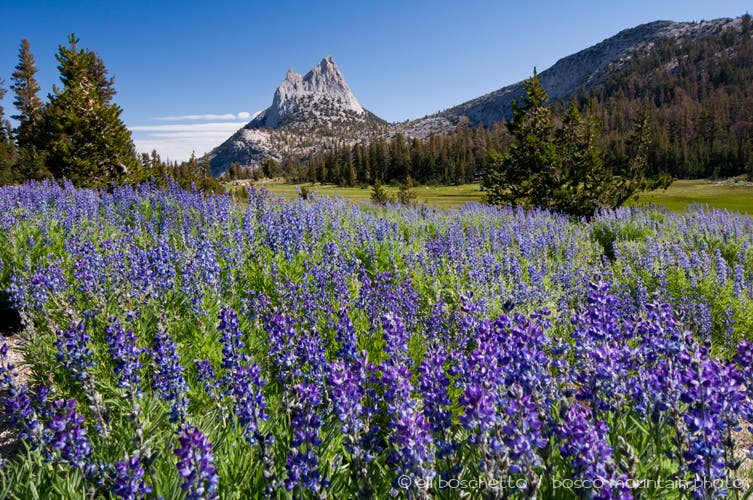
Cathedral Pass: In summer, you’ll hike through huge fields of subalpine lupine.
CATH005
Location: 37.837042, -119.41413
A side trail on the left leads to campsites at Upper Cathedral Lake.
CATH006
Location: 37.848697, -119.415464
Turn left for the last half-mile stretch to Lower Cathedral Lake.
CATH007
Location: 37.843919, -119.42203
Lower Cathedral Lake; backtrack to HSC025.
IRE001
Location: 37.81192, -119.299893
Follow the trail southwest.
IRE002
Location: 37.791642, -119.306073
The trail ends at the northern tip of Ireland Lake, nestled beneath Amelia Earhart and Parsons Peaks. Return to tk.
Lupine at Cathedral Pass
Location: 37.835446, -119.414735
Sunrise Dome and Meadows
Location: 37.795238, -119.430824
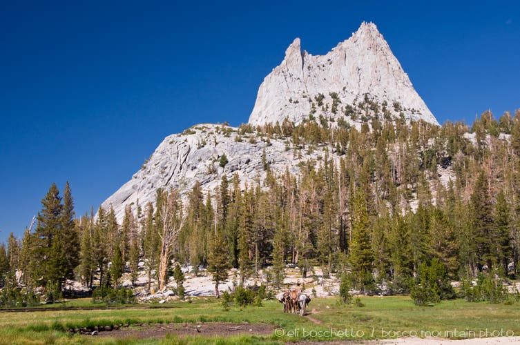
Cathedral Peak
Location: 37.845914, -119.417396
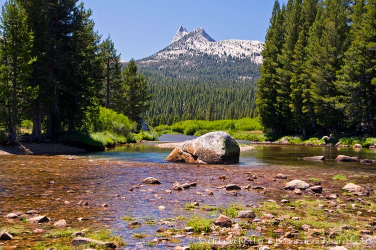
Tuolumne River and Cathedral Peak
Location: 37.878851, -119.363108
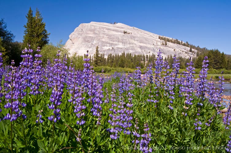
Lupine and Lembert Dome
Location: 37.877494, -119.354015
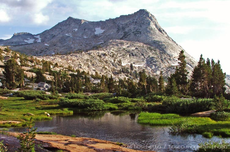
Vogelsang Peak
Location: 37.795678, -119.345126
Meadow and Dome
Location: 37.789845, -119.35667
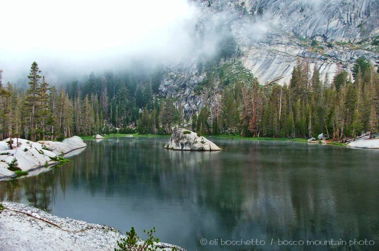
Emeric Lake
Location: 37.777092, -119.382591
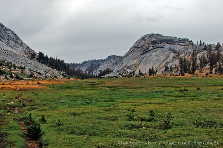
Evelyn Meadows
Location: 37.809241, -119.32354
Lyell Fork
Location: 37.847613, -119.289036