Published September 20, 2013 05:47AM
Yellowstone National Park: Agate Creek via Specimen Ridge Trail
This 13.3-mile backcountry trek in Yellowstone National Park travels to a rocky beach (and campsites) in the Grand Canyon of the Yellowstone.
A good introduction to Yellowstone’s backcountry, this 13.3-mile trip tours expansive grasslands and forests en route to a rocky beach in the Grand Canyon of the Yellowstone. Start at the Specimen Ridge Trail and hike southeast across sagebrush-filled grasslands–a popular hang out for grazing bison. The path climbs steadily for 1.2 miles to a T-junction. Turn left and begin a steep switchback climb—occasionally following wolf and elk tracks—to Specimen Ridge.
At the top of the ridge, enjoy the expansive views while keeping an eye out for wolves, bison, and herds of elk. Continue hiking southeast over rolling terrain to another junction at Quartz Creek, a distinct v-shaped creek bed. Take the trail to the right, heading southwest toward the canyon—occasional antler cairns mark the way.
ADVERTISEMENT
The descent into the canyon begins at mile 4.8, dropping more than 1,200 feet in 1.8 miles on long switchbacks (coyote and bear tracks are sometimes etched into the trail). Set up camp above the Yellowstone River near a small, open clearing marked with a campsite sign, then make the final 850-foot stretch to a rocky beach along the river.
PERMIT Overnight camping in Yellowstone National Park requires a backcountry permit. Check out the latest fees and more details at nps.gov/yell/planyourvisit/backcountryhiking.htm
MORE PARK INFO Yellowstone National Park, (307) 344-7381; nps.gov/yell/
-Mapped by Jeff Chow


ADVERTISEMENT
Trail Facts
- Distance: 21.5
Waypoints
AGT001
Location: 44.912393, -110.386989
Cross NE Entrance Road and hike south on the Specimen Ridge Trail.
AGT002
Location: 44.899877, -110.37871
Turn left @ T-junction, heading uphill on Specimen Ridge Trail. The trail to the right leads to Yellowstone River Picnic Area. This vantage point offers views of the Yellowstone River. Ahead, you’ll climb and switchback through open plains to a rolling plateau with views of the forested canyon and Prospect Peak behind it.
AGT003
Location: 44.892443, -110.361246
Bear right @ Y-junction onto Agate Creek Trail.
AGT004
Location: 44.890008, -110.358002
The trail passes glacial erratics (boulders left by retreating glaciers).
AGT005
Location: 44.875015, -110.344841
ADVERTISEMENT
Cross Quartz Creek and turn right. Note: Do not follow the well-traveled game trail that continues straight. Ahead, the trail leaves the creek bed and winds through expansive grassland. Antler cairns (and antlers hung from trees) mark the trail.
AGT006
Location: 44.8654509, -110.3484392
The canyon wall drops down on the right-hand side of the trail.
AGT007
Location: 44.863421, -110.345338
Skirt young lodgepole pines. Ahead, the trail will start its switchback descent into the canyon through forest and burnt lodgepole.
AGT008
Location: 44.854077, -110.355089
Hike across a small shelf above the Yellowstone River.
AGT009
Location: 44.852142, -110.3583527
Continue straight @ the 4-way junction to reach the Yellowstone River. The junction is marked with a ‘2Y1 Campsite’ sign. Backpackers: Turn left to access the well-built cooking area with fire ring and food pole. Don’t leave any food unattended; bears are common in this area. Camp at the edge of the field near the trees that border the canyon. Rangers advise people to not camp near the river as hikers often cook there, which can attract bears. Filter water in the Yellowstone River or Agate Creek.
AGT010
Location: 44.8518149, -110.3587925
ADVERTISEMENT
This broad ridge is a good spot to set up camp.
AGT011
Location: 44.8508946, -110.3605869
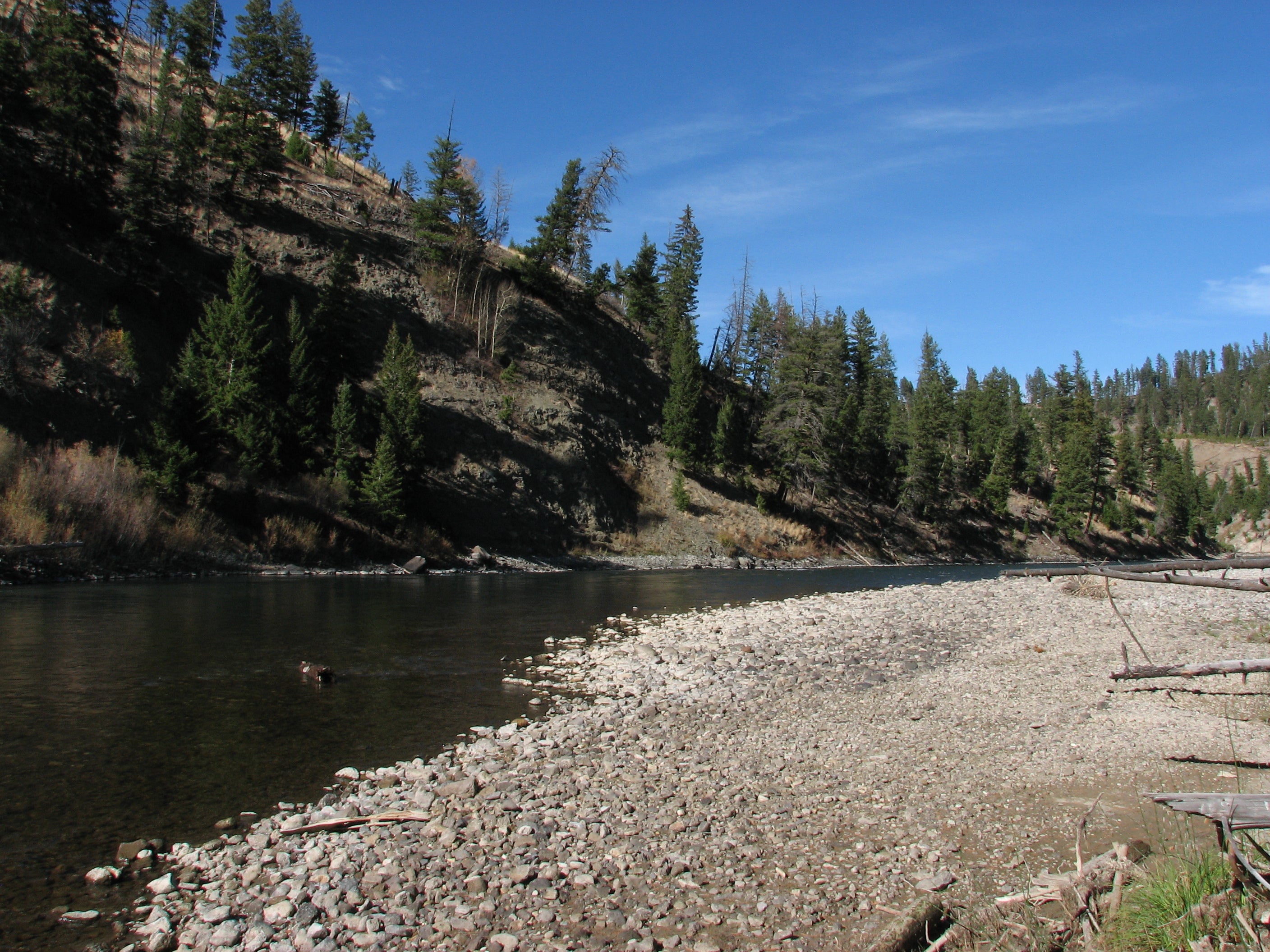
After a steep descent to the Yellowstone River, relax on the rocky beach next to the water (a good spot to filter water). Crane your neck to see the vast canyon walls flanking the river. Follow the same route back to the trailhead.
Rocky Beach
Location: 44.8508775, -110.3605628
Speciman Ridge Trailhead
Location: 44.911058, -110.386839
Grassy Trail
Location: 44.90974, -110.386258
Buffalo
Location: 44.903788, -110.380226
Buffalo
Location: 44.90357, -110.37972
Grazing Buffalo
Location: 44.903674, -110.378461
Trail Sign
Location: 44.900458, -110.379774
Yellowstone River
Location: 44.8998764, -110.378665
Yellowstone River
Location: 44.8998783, -110.3786114
Footprint
Location: 44.899896, -110.378373
Sunset
Location: 44.899827, -110.378333
Golden Meadows
Location: 44.901059, -110.374483
Incoming Storm
Location: 44.900215, -110.372897
Speciman Ridge Trail
Location: 44.899182, -110.371125
Black Skies
Location: 44.892867, -110.362211
Expansive Meadows
Location: 44.890485, -110.35871
Elk
Location: 44.883324, -110.354058
Grassy Hillsides
Location: 44.88257, -110.353365
Herd of Elk
Location: 44.881881, -110.352464
Antlers
Location: 44.879327, -110.351036
Buffalo
Location: 44.878863, -110.350881
Buffalo
ADVERTISEMENT
Location: 44.878699, -110.35065
Expansive Views
Location: 44.878053, -110.349924
Antler Cairn
Location: 44.877156, -110.348833
Buffalo
Location: 44.876473, -110.347947
Distant Elk
Location: 44.876133, -110.347499
Views of the Yellowstone River
Location: 44.867317, -110.348859
Ascent above Quartz Creek
Location: 44.866908, -110.348716
Views across the Yellowstone River
Location: 44.864999, -110.348153
Sunset
Location: 44.863283, -110.345304
Meadow
Location: 44.860664, -110.346063
Views of the Yellowstone River
Location: 44.852034, -110.358438
Campsite
Location: 44.851847, -110.358707
Meadow along the Yellowstone River
Location: 44.8507938, -110.3604528