Updated March 19, 2024 12:17PM
This Dayhike In the North Cascades Is a Feast of Colors And Dramatic Landscapes
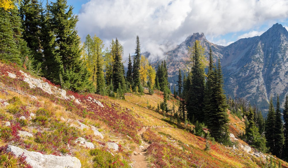
The Maple Pass Loop starts at Rainy Pass and crests the 7,000-foot ridge above the lake for eagle-eye views of the glacier-topped Cascades.
(Photo: Lidija Kamansky via Getty Images)
In the 9.3 miles of the Maple Pass Loop Trail, a moderate dayhike in the North Cascades, you’ll hike past views of steep granite peaks that jut into the sky, golden larch (in fall), red and purple huckleberry brush backdropped by white and dark granite, and scenic alpine lakes.
How to Hike Maple Pass Loop
This trail offers a challenging loop beginning in a heavily timbered area. Start at the Rainy Pass parking lot, and go counterclockwise (stay right) on Trail #740 to Lake Ann. The first mile is an easy hike and soon passes through a large avalanche meadow and more timber to a trail junction near Lake Ann; stay right here, or bear left to visit Lake Ann. Just past this junction, the route travels above treeline for five-star views of Lake Ann and the peaks and ridges that encircle it. Larch lines the opposite walls of the bowl, and there is an abundance of huckleberry brush clinging to the slopes, creating a blast of color during fall. In the distance, you can see the top of Corteo Peak poking above the ridgeline.
ADVERTISEMENT
Continue the steady climb to another trail junction that leads to Heather Pass and the surrounding peaks and mountains that rise around the trail. At Heather Pass there is a faint trail leading off towards Lewis lake and a possible side trip for experienced hiker and route finder. Wildflowers are beautiful in July and August and the fall colors created by golden alpine larch and red huckleberries bushes are spectacular. Snowmelt sometimes lingers into mid July, making it difficult to follow trail. The hike beyond to Heather Pass and Maple Pass is steep, the trail is above tree line in high alpine zone. Stay straight on the trail and continue to a viewpoint. Looking back the direction you came, you’ll see Whistler Mountain, Cutthroat Peak, Lewis Lake at the base of Black Peak, and meadows.
From here, the trail traverses more high-country meadows that dot the top of the cirque to an unnamed saddle, which overlooks the eastern face of Corteo Peak and distant glacier covered peaks. Continue following the main ridgeline trail (several trails diverge along this stretch).
Crest a 6,967-foot pass before following the zigzagging trail downhill. (Look to your right for Lyall Glacier, which sits at the foot of Frisco Mountain.)
The trail then descends along a ridge line between Lake Ann and Rainy Lake dropping quickly and steeply into timber (this trail beyond the summit is steep and challenging). The spine of the ridge narrows considerably, giving you a sense of vertigo. The trail then levels out when it junctions with the Rainy Lake trail. Continue for about 0.25 mile on the paved Rainy Lake trail to return to the trailhead.
ADVERTISEMENT
Essential Information
Camping is permitted within 0.25 miles of Lake Ann or Rainy Lake or along the Heather/Maple Pass Loop Trail. Also, Okanogan-Wenatchee National Forest requires a Recreation Pass, which you can purchase at a self-pay station at the trailhead ($5/vehicle/day).