Published May 19, 2016 07:57PM
When the Trail is Closed
What are thru-hikers to do when fire scars block their path?
'(Photo by Amanda Jameson)'
One of the interesting things about the Pacific Crest Trail is that it’s different from year to year—mostly due to closures, which are mostly due to fires. While we’re not quite into wildfire season yet here in Southern California, there are two closures so far that most PCT hikers have had to deal with in one way or another: the Mountain Fire Closure, just south of Idyllwild, California (162.5-178), and the Lake Fire Closure, between I-10 and Big Bear Lake/City (236.5-252).
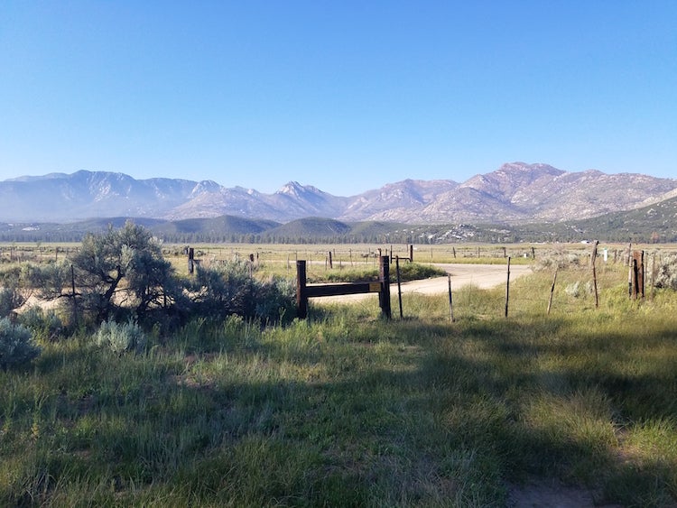
We started talking about the Mountain Fire Closure in earnest about four days ago, as we approached Highway 74 and the delicious, delicious burgers at Paradise Valley Cafe. Both the Pacific Crest Trail Association and Halfmile, the creator of beloved PCT maps, had recommendations for a detour basically following the same route— but while it kept us on PCT for as long as possible, there was a lot of roadwalking, of both the dirt and paved variety. Roads, even dirt roads, are hard on your knees, so a number of people chose to simply hitch the 17 miles from the Cafe to Idyllwild. But for those of us who took the detour, there were some pretty great views, both on the PCT and on the roadwalk.
All the buzz here in Idyllwild is the Lake Fire Closure, about 60 miles up the trail from where we are now. A lot of hikers have hitched or gotten shuttled from I-10 or Ziggy and the Bear’s place, since there’s no fun way to walk around it— both the PCTA and Halfmile suggest simply getting a ride around it – but that means missing 50 miles of the trail, turning 2,650 miles into a near-even 2600. Some of the talk here is leaning towards at least going to mile 218.6 and the Whitewater Preserve, and then getting a ride up to Onyx Summit at the end of the closure at mile 252.1 to hike into Big Bear, which only skips 33.5 miles of trail. Others are talking about walking the number of mapped-but-maybe-not-checked detours available on the internet, or even biking the roads to get around the closure.
ADVERTISEMENT
Me, I’m thinking about going from Whitewater to Onyx Summit, then cleaning up those missed miles at another time, but I’m waffling back and forth at this point. I’ve got about three days to decide, between a zero day in Idyllwild and about hiking days to I-10. Meanwhile, what’s foremost on my mind is the hike out of town and up Mount San Jacinto, which I’m told is well worth the extra mile as compared to the PCT. It’ll be the first time we’re above 10,000 feet on our travels, but certainly not the last.