Wenatchee, WA: Whistling Pig Meadow to Blue Creek Meadow Loop

Save this 14.4-miler for late summer when the snowmelt has subsided, then hike into the far northern reaches of the river valley to two high mountain meadows. From the parking area at Maverick Saddle, the trail traces the Mad River, passing through a mix of conifers and wildflowers. Continue straight at the handful of trail junctions on the way to the first fording of the Mad River at mile 3.8. (Although the trail might be snow free by mid to late June, waist-deep water levels are common in years with high snow levels.)
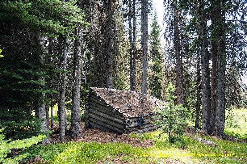
After 4.5 miles, ford the river again, then turn right onto Trail No. 1415 and head toward Whistling Pig and Cougar meadows. A mile later, follow the narrow trail through Whistling Pig Meadow where vast views stretch to the east and west—look for deer and elk and a whistle pig or two. Pass the famous hunter’s cabin nestled in the trees in the middle of the meadow and continue northeast.
The route rounds to the west at mile 6.3 and climbs to elevations over 6,000 feet, then turns south 2 miles later toward Blue Creek Meadow. Drop your pack at Blue Creek Meadow and visit the historic Blue Creek Guard Station before closing the loop back at Waypoint 6 and returning to the trailhead.
-Mapped by Alan Bauer, Alan Bauer Photography

Trail Facts
- Distance: 23.2
Waypoints
WHS001
Location: 47.844177, -120.6025779
Hike north from the parking area at Maverick Saddle, heading through a mix of pine, fir, and cedar (the Mad River flows down on the right). This stretch of trail passes wild ginger, trillium, yellow violets, and queen’s cup.
WHS002
Location: 47.859454, -120.604912
Continue straight @ 3-way junction with Trail No. 1403 on your left, which heads up to Lost Lake. In about 100 yards, cross the Mad River on a large bridge.
WHS003
Location: 47.861274, -120.606047
Continue straight on the Mad River Trail @ the unsigned 3-way junction with Jimmy Creek Trail (a great hike that climbs to the summit of Cougar Mountain). For the next two miles, hike to the almost constant sounds and sights of the Mad River, meadows of wildflowers, and the occasional whistles of marmots.
WHS004
Location: 47.884955, -120.614537
Pass a string of meadows and a scenic campsite. Continue straight @ the junction with Trail No. 1421 and continue hiking toward the far northern reaches of the river valley and the highland plateaus.
WHS005
Location: 47.894621, -120.615175
Cross the upper Mad River. Note: Depending on the season, hikers may have to turn around at this first river crossing. Although the trail might be snow free by mid to late June, you could find waist-deep water levels here in years with high snow levels. If you wait until late July to hike this trail, the ford will likely be shin deep.
WHS006
Location: 47.902086, -120.608659
Ford the river again, then turn right onto Trail No. 1415 and head toward Whistling Pig and Cougar meadows.
WHS007
Location: 47.901109, -120.596772
Turn left onto Trail No. 1417 @ 3-way junction and hike past a lovely meadow filled with paintbrush and elephant head.
WHS008
Location: 47.905249, -120.595285
Whistling Pig Meadow stretches out before you. Hike the narrow trail leading out into the middle with vast views to the east and west. Look for deer and elk and maybe a whistling pig marmot.
WHS009
Location: 47.907725, -120.593339
Pass the famous hunter’s cabin nestled in the trees in the middle of the meadow. Enjoy views in all directions before leaving Whistling Pig Meadow and continuing northeast.
WHS010
Location: 47.914192, -120.58797
Turn left onto Trail No. 1424 @ T-junction and climb to elevations over 6,000 feet. Take a few side steps off the trail to find great views of the Entiat Mountains and the river valley. Ahead, look for warblers in the open meadows and woodpeckers in the deadwood stands of trees.
WHS011
Location: 47.919741, -120.618616
Turn left and start hiking south toward Blue Creek Meadow, passing mini meadows and lodgepole pines and firs. You may spot elk, deer, and coyote.
WHS012
Location: 47.91397, -120.622115
Blue Creek Meadow: Drop your pack at the trail junction with the Mad River Trail. To visit the historic Blue Creek Guard Station building, walk back a few feet to the side trail that leads across Blue Creek. When you’re ready, continue southeast along the trail. You’ll cross Blue Creek and hug the eastern edge of Blue Creek Meadow before closing the loop back at Waypoint 6. Turn right @ Waypoint 6 to return to the trailhead.
The Hunter’s Cabin
Location: 47.9077126, -120.5925465
©Alan Bauer