Published September 20, 2013 05:57AM
Wenatchee, WA: Clara and Marion Lakes
An ideal family trip, this 2.6-mile hike is short on miles, but big on scenery. You'll encounter spectacular rock formations, spring wildflowers, and two peaceful lakes.
What this trail lacks in length, it makes up for in scenery. Bring the kids (and your camera) and start from the parking pullout along FR 9712. It’s a steep uphill climb past the sign post, but the trail quickly levels out as you enter grassy meadows filled with lupines and giant, old-growth western larch that turn golden shades of yellow in mid-October. Look for the spectacular mountainside of rocks that rises on the right-hand side of the trail, displaying the area’s geologic history.
After 0.2 mile, the trail travels through burned larch and pine forest (home to masses of busy woodpeckers) and lush meadows brimming with wildflowers. Less than a mile later, cross a bridge over an outlet creek, then bear right at the Y-junction to reach Clara Lake, a skinny and shallow mountain lake. At mile 1.1, the trail drops down to the spectacular Marion Lake where you may spot nesting grebes and mergansers ushering their young around the green waters. Drop your packs and stay for awhile, or turn around and return to the trailhead.
-Mapped by Alan Bauer, Alan Bauer Photography

Trail Facts
- Distance: 4.1
Waypoints
CLA001
ADVERTISEMENT
Location: 47.305445, -120.424341
From the parking pullout along FR 9712, it’s a steep uphill past the sign post. The trail quickly levels out as you enter grassy meadows filled with lupines.
CLA002
Location: 47.304152, -120.424326
Don’t be fooled into thinking that these giant conifers are ponderosa pines. Look up: They’re actually massive, old-growth western larch, which turn golden shades of yellow in mid-October before their needles fall off.
CLA003
Location: 47.303471, -120.423384
Pass a spectacular mountainside of rocks on the right, an incredible display of the area’s geologic history. Ahead, pass through a scarred forest, which was burned in a relatively recent fire. The burned larch and pine trees are now home to masses of busy woodpeckers; song birds dash around the bare branches as well. Lush, grassy meadows and a wildflower bonanza of currents, paintbrush, and lupines complete the scene.
CLA004
Location: 47.299212, -120.418846
ADVERTISEMENT
Exit a short stretch of dense forest and hike past a rocky perch dotted with wildflowers. Keep an eye to the sky for raptors. This is also a popular hang-out for mule deer and elk.
CLA005
Location: 47.2958073, -120.4151773
Cross a bridge over Clara Lake’s outlet creek. You can’t see the lake from this broad, flat wetland marsh of grasses and reeds; however, dragonflies are a common sight.
CLA006
Location: 47.2952907, -120.4149735
Stay right @ Y-junction. The well-traveled trail on the left starts from the Mission Ridge Ski Area parking lot.
CLA007
Location: 47.2952398, -120.4164165
Hike past grassy reeds and dragonflies until you’re looking over Clara Lake, a long, skinny, and shallow lake. Keep hiking: You’re almost to the second lake.
CLA008
Location: 47.294403, -120.4195976
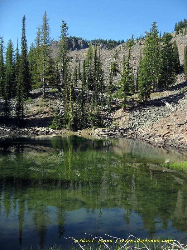
The trail drops down to the spectacular Marion Lake. Nesting grebes and mergansers frequently usher their young around the green waters. Incredible rock formations punctuate the hillsides. In the fall, golden larch tree are reflected in Marion’s waters. Turn around and return to the trailhead.
Marion Lake
Location: 47.2943957, -120.4194796
©Alan Bauer