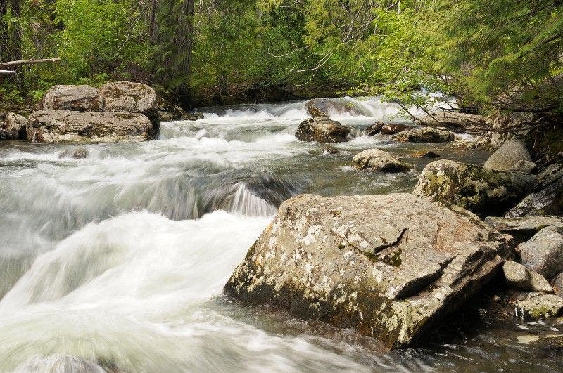
Wenatchee, WA: Chiwaukum Creek

When snow still covers the high-country in early spring and late fall, this 11.4-mile out-and-back offers a scenic, lower-elevation option for hikers. Or go in late spring to see the brilliant displays of wildflowers that cover the hillsides. You’ll spot the rare Tweedy’s lewisia (a flowering plant with yellowish-pink flowers), paintbrush, and lupines.
From the parking area, follow a gated road for the first 1.2 miles—you’ll connect with the Chiwaukum Creek Trail at the end of the road. Hike past slide alder and vine maples into mature forest. The trail follows the creek past a grove of massive, old-growth ponderosa pines and a creek-side camping spot. After 3.3 miles, the path wanders through lupine-lined meadows, dotted with towering pines, and views of the surrounding ridges and cliffs.
Tackle a steep, but short, section of trail at mile 5, which leads to the trip’s highpoint on the upper cliffs above Chiwaukum Creek. From here, descend back down to the water—drop your pack and relax next to the narrow, fast-moving Chiwaukum Creek. When you’re ready, turn around and follow the same route back to the trailhead.
-Mapped by Alan Bauer, Alan Bauer Photography

Trail Facts
- Distance: 18.5
Waypoints
CHI001
Location: 47.689076, -120.740639
Hike west past a signpost onto the gated road (a private access for a few private landowners). Caution: Keep an eye out for rattlesnakes along hot, sunny stretches of road.
CHI002
Location: 47.686787, -120.748352
Pass several vacation homes and cabins nestled in the trees. Stay on the road and prepare for the vibrant flower show ahead.
CHI003
Location: 47.684986, -120.754257
In late spring, brilliant displays of wildflowers cover the hillsides above the road. You’ll spot rare Tweedy’s lewisia (a flowering plant with yellowish-pink flowers). Paintbrush, lupines, and sedums flourish near old ponderosa pines and firs. Continue following the road; the roar of the creek can be heard as you hike.
CHI004
Location: 47.689175, -120.759216
Pass a bridge over Chiwaukum Creek on the left (access to a private inholding). The road ends here, and a trail signpost marks the Chiwaukum Creek Trail. Within minutes, you’ll hike past slide alder and vine maples into mature forest. Varieties of wildflowers cover the ground; look for vanilla leaf, red columbine, and queen’s cup. Ahead, the trail gains elevation, traveling above the creek.
CHI005
Location: 47.690422, -120.762444
Pass into the Alpine Lakes Wilderness. The trail levels out and moves closer to the creek.
CHI006
Location: 47.69397, -120.770851
This scenic stretch travels right to the edge Chiwaukum Creek (depending on water levels, the creek may flow across the trail here). Grab a snack next to the roaring creek.
CHI007
Location: 47.703823, -120.779434
A grove of massive, old-growth ponderosa pines flanks the trail.
CHI008
Location: 47.704296, -120.782242
Pass a creek-side camping spot (another good spot to take a break).
CHI009
Location: 47.708305, -120.787888
The path wanders through lupine-lined meadows, dotted with towering pines, and views of the surrounding ridges and cliffs. Signs of deer and bears can be seen throughout these areas.
CHI010
Location: 47.709564, -120.822067
After finishing the only steep, but short, section of trail, you’ll reach the upper cliffs above Chiwaukum Creek (the trip’s highpoint). The creek passes through a gorge below and can’t be seen. Old-growth ponderosa pines fill the open forest between meadows of lupines and balsamroot. Ahead, the trail descends to the creek.
CHI011
Location: 47.710304, -120.829842
Drop your pack and relax next to the narrow, fast-moving Chiwaukum Creek. When you’re ready, turn around and follow the same route back to the trailhead. Optional: To extend your trip by 7 miles roundtrip, ford the creek and follow the trail to Chiwaukum Lake.
Chiwaukum Creek
Location: 47.71035, -120.829796