Updated July 7, 2025 09:53PM
Go Off Trail in the Upper Buffalo Wilderness, Arkansas
Get off the beaten path in the Ozarks.
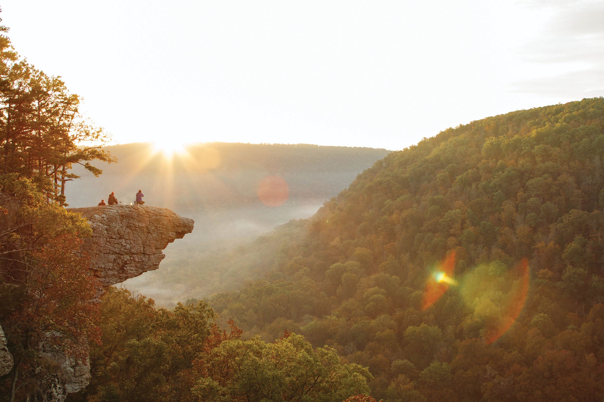
'Photo by Ben Matthews'
Supply and demand in the Ozarks is a touchy subject. Hikers here tend to funnel into a few main drags (which, to their credit, are replete with hollows, waterfalls, and hardwoods), making it hard to score a slice to yourself. Venture into the trailless Upper Buffalo Wilderness, however, and that changes. Off-trail navigation is allowed there, so if you’re handy with a map and compass, solitude beckons. Yesterday, I linked river drainages to camp in a sycamore-ringed clearing near Whitaker Creek. Though it was less than a mile as the crow flies from popular Hawksbill Crag, I spent the night completely by myself. Today’s agenda calls for more of the same: trailless creeks and woods, where solitude and beauty are never in short supply.
Turn-by-turn from the Magnolia Falls trailhead
1) Take the Magnolia Falls Trail 1.3 miles to its terminus at a small stream.
2) Parallel the creek downstream to Boen Gulf Branch at mile 1.6.
3) Turn west (hiker’s left) and trace Boen Gulf Branch 1.5 miles to the Buffalo River.
4) Veer north (hiker’s right) and follow the Buffalo River downstream to Whitaker Creek near mile 4.3.
5) Continue hiking upstream beside Whitaker Creek for just over a mile, dodging boulders and circumventing waterfalls, to a confluence.
6) Go .4 mile upstream along Lower Fork Creek to locate a convenient break in the cliff band on the west side (hiker’s left). The writer found a direct route near 35.8925, -93.4474.
7) Climb out of the drainage, setting a bearing for an old road near 35.8882, -93.4576, less than a mile southwest.
8) Follow the lane about .3 mile north to County Road 5.
9) Take the road .5 mile northeast to the Whitaker Point trailhead at mile 7.4.
ADVERTISEMENT
Campsite: Whitaker Creek (mile 4.3)
Look for an old chimney from a long-gone homestead on the north side of Whitaker Creek, just beyond where it meets the Buffalo River. (Scouting a safe crossing should be easy in September.) In the morning, wander down to the shore to spy elk, coyotes, and white-tailed deer getting a drink.
Bushwhacking 101
Budget extra time: In the Ozarks, the thick understory means that the going can be extremely slow despite the relatively basic navigation and terrain. Plan to walk less than half your usual speed.
ADVERTISEMENT
DO IT Shuttle car 35.9011, -93.4579; 14 miles north of Arbaugh on Co. Rd. 5 Trailhead 35.8625, -93.3858; a 31-minute drive east from shuttle car Season Year-round Permit None Custom map ($15) Contact
Distance 7.4 miles (point to point)
Time 2 days