Updated July 7, 2025 09:53PM
Leaf Peep in Private at Mt. Grace State Forest, Massachusetts
Catch some September green along the New England Trail before the crowds arrive.
'Photo by Flickr/Doug Kerr'
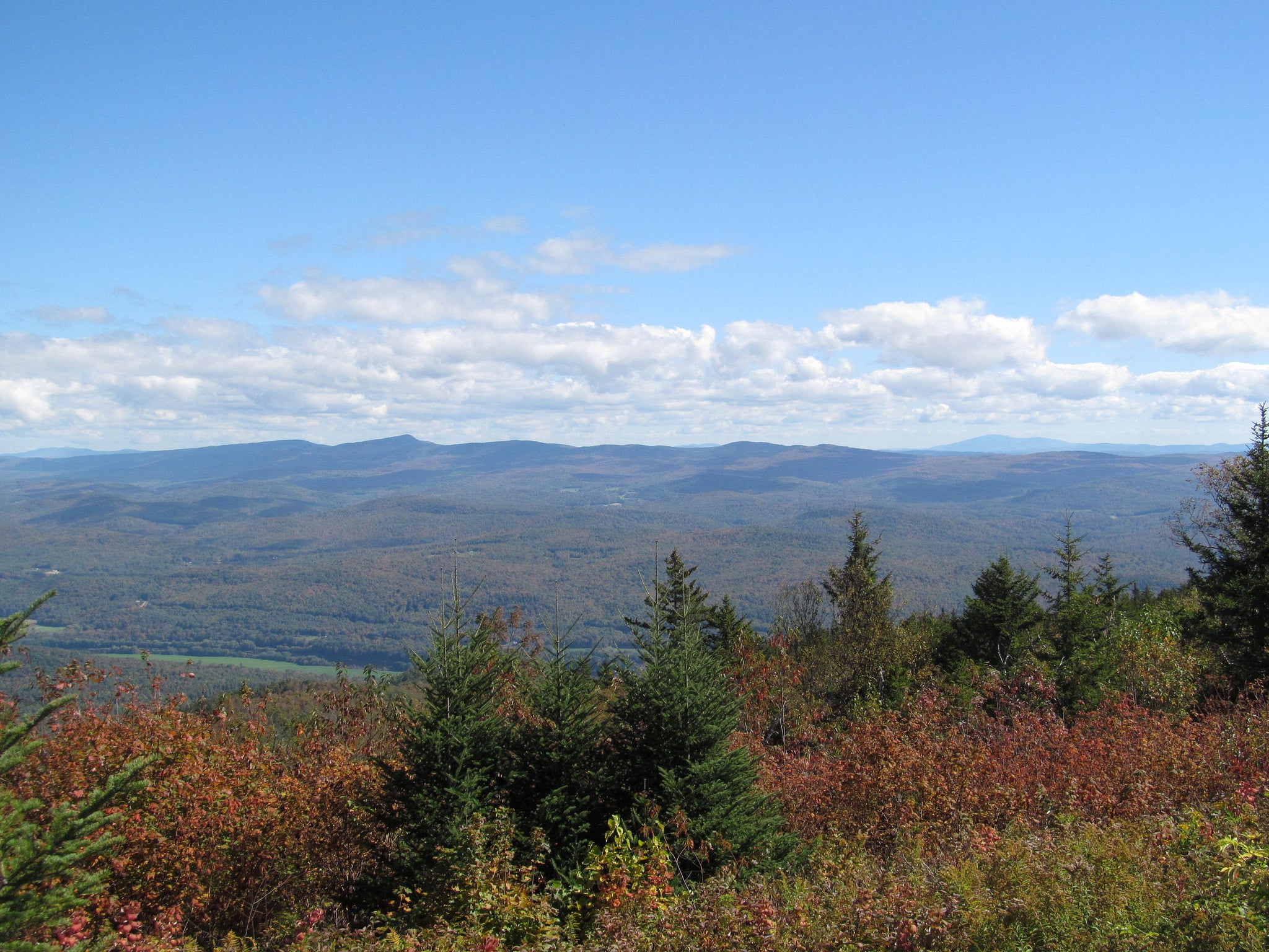
There’s green, and there’s September green. When I emerge onto the fire tower capping 1,621-foot Mt. Grace, I’m greeted by the second. Between the evergreens, clusters of chartreuse-hued hardwoods are starting their engines for the fall color show, brightening to neon levels before they turn. I’m here on the New England Trail, savoring a quiet, two-night trip before the leaf-peepers descend on the place, and this is the way to do it: I’m the only hiker on this metal aerie—reached via one of the area’s most popular dayhikes. The view of the vast forestland and remote countryside sweeps 360 degrees. I’m reluctant to descend back into the dark, leafy corridor below, but it will lead to another summit much like this and, even better, a true backcountry campsite. The New England Trail isn’t completely finished yet, but that doesn’t mean it isn’t ready for backpacking. You just have to know where—and when—to go.
Turn-by-turn From MA 78
1) Follow the New England (NET)/M-M Trail 1.5 miles south to 1,618-foot Mt. Grace, the highest peak on the NET.
2) Descend via the Old Snowshoe Trail, ducking through a hardwood forest to the state forest boundary at mile 2.7.
3) Turn west onto Northfield Road, once part of the historic 5th Massachusetts Turnpike, before returning to the woods on the NET.
4) Continue west on the NET, ascending 1,285-foot Stratton Mountain to its summit tent platforms at mile 8.
5) Follow the NET south off Stratton to the Gulf Road trailhead at mile 10.5.
Campsite
Stratton Mountain (mile 8)
Don’t miss your alarm at this northeast-facing spot. With your back to the hardwoods, soak in the view, which stretches into three states: See New Hampshire’s 3,166-foot Mt. Monadnock 50 miles north and Vermont’s 3,130-foot Mt. Ascutney 20 miles northeast, as well as Mt. Grace east across the valley. There’s a cabin on Stratton (reservation required), but the two tent platforms are relatively new and unknown, so you shouldn’t have an issue landing one (first-come, first-serve).
History
The Fifth Massachusetts Turnpike, authorized in 1799, was one of more than 60 stagecoach toll roads that operated in Massachusetts during the early 1800s. The route connected Leominster, Athol, Greenfield, and Northfield before it was decommissioned in 1833. The NET travels along a portion of the old route near mile 2.7 on this itinerary.
DO IT Shuttle car 42.6596, -72.4190; 8 miles east of Bernardston on Gulf Rd. Trailhead 42.7062, -72.3487; a 23-minute drive northeast from the shuttle car Season Year-round Permit None Custom map ($15) Contact
Distance 10.5 miles (point to point)
Time 2 days
Difficulty 1.5