Updated July 7, 2025 09:53PM
Explore the Cascadian Kingdom in North Cascades National Park, Washington
Rocky peaks, meadows, and squeaky little pikas: this hike showcases the northwest in all its glory.
'Photo by Flickr/alans1948'
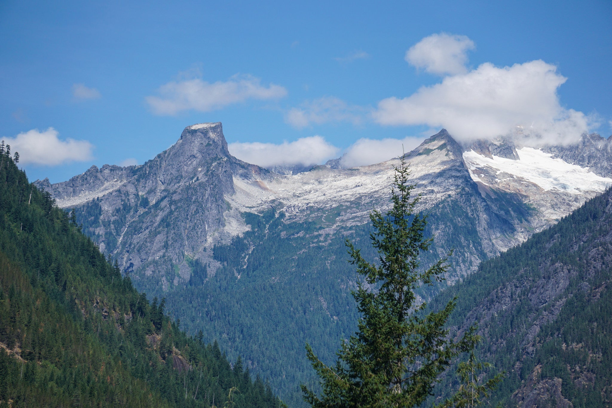
Pikas are the roosters of the alpine zone. I say this aloud, to no one, at daybreak as I unpeel my sleeping bag in the hazy lavender light to a chorus of squeaks. I roll my tent door back, revealing a picture that the national park brochures would be lucky to have: a crown of chalky spires that give way to a sea of green noble firs and gold larches. When the sun delivers on the pikas’ pronouncement, there’s nothing you can do except stop, stare, and listen.
Turn-by-turn from the Bridge Creek trailhead (in Wenatchee National Forest)
1) Head 1.8 miles south on the Pacific Crest Trail to the national park boundary.
2) Continue 1.5 miles to a Y-junction at Fireweed Camp.
3) Split east onto the McAlester Lake Trail and climb to 6,000-foot McAlester Pass at mile 8.5.
4) Follow the Rainbow Creek Trail off the pass around 6,905-foot East Peak to a social trail on hiker’s right (near mile 8.7).
5) Take the social path 1.1 miles west to a larch-framed, unnamed lake beneath Rainbow Ridge.
6) Retrace your steps.
Campsite 1
Fireweed Camp (mile 3.3)
This clearing sits at the hike’s low point near 3,600 feet—roughly 2,400 feet beneath the pass. Recharge before a tough climb at one of the two sites (reservation recommended). Get water at nearby McAlester Creek.
Campsite 2
Unnamed Lake (mile 9.8)
This campsite might ruin all others for you: Squeeze your tent between the 2-acre teardrop and Rainbow Ridge, facing the door south toward a 2,000-foot cliff that falls away to the Stehekin River Valley. Glacier-mantled McAlester Mountain and Crescent Peak dominate the horizon, while granite-and-ice pinnacles outrun the skyline.
ADVERTISEMENT
Add two summits: With some class 3 scrambling, bag Rainbow Ridge’s twin peaks: Continue west past the lake on a clearly defined ramp to 7,237-foot West Peak, about a mile away. From there, trace the ridge 2 miles back east to tag 6,905-foot East Peak before picking a path down the talus back to camp.
Season
Hiking season in North Cascades is notoriously narrow. This year’s warm spring means the snowpack should melt out by August, but check with the Marblemount Wilderness Information Center before heading out; you may need an axe and crampons near McAlester Pass. The larches turn in mid- to late September, and the snow typically returns in October.
DO IT Trailhead 48.5045, -120.7181; 53 miles east of Marblemount on WA 20 Season August to October Permits Required (free); obtain national park permit from the Marblemount Wilderness Information Center and self-issue a wilderness permit at the trailhead. Custom map ($15) Contacts ; nps.gov/noca
Distance 19.6 miles (out and back)
Time 3 days