Updated December 4, 2024 04:41AM
Vancouver, WA: Round Lake
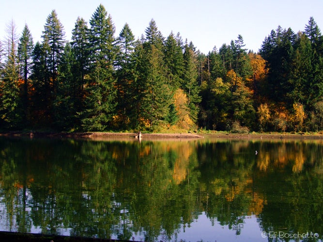
Get a quick outdoor fix without the long drive on this 3.4-mile loop that circles a small lake, visits two waterfalls, and offers dazzling spring, summer and fall colors.

One of the great things about the Portland/Vancouver area is the abundance of urban and suburban parks offering the chance of quick escape without a long drive. Lacamas Park, a mere 20 minutes from the urban center, is one such oasis.
Park in the small lot on the east side of Highway 500 across from Lacamas Park. Pass the picnic area and playground to a wide gravel trail through fir forest, the beginning of the route to Round Lake. The path soon crosses a fish screening apparatus, then traverses a concrete dam. From the dam, there are nice views across Round Lake and down the Lacamas Creek channel, pocked and gouged by ancient floods. Stick to the path along the lake to the first junction and veer right, following the creek bed. At the next junction,go right again along a fenced area with views below to Pothole Falls. Follow the fence to the end, keeping right over a mossy rock outcrop.
ADVERTISEMENT
After a half mile, the trail reaches a wide bridge over Lacamas Creek. Cross the bridge for views of Lower Falls, but do not continue to the other side. Instead, stay on the east side of the creek, then head left on an old forest road for 100 yards to a trail marked “Access Road” climbing up to the left. The trail climbs to another old forest road where you’ll turn left and meander under shady trees back toward Round Lake. If visiting in early spring, take the Lily Loop trail on the right for a pretty display of blue camas lilies; or if water runoff is high, take the short spur to the left to 50′ Woodburn Falls.
Once you return to the lake, keep to the right through a couple more trail junctions to complete the loop. A small platform along the way offers views across the water. Continue around to the north end of the lake where the trail diverts away, then ends at paved sidewalk. Turn left to the end of the block at Highway 500, then another left back the parking area and your starting point.
Mapped by Eli Boschetto Bosco Mountain Photo


