Published September 20, 2013 03:50AM
Vail, CO: Snow Pass Loop
The Eagles Nest Wilderness doesn’t attract regular Colorado crowds—unless you count the mountain goats. Explore rugged peaks, and pristine alpine lakes on this 13.3-mile route in an under-appreciated Rocky Mountain getaway.
This 13.3-mile route could be tackled in two or three days and offers add-on options for an additional challenge. Start at the Gore Trail Trailhead and follow Gore Creek heading east. Elevation increases quickly as the trail switchbacks up rocky steps and winds through open forests. At mile 4.3 turn left at a 3-way junction where the trail turns more sharply uphill for the 1.8-mile climb to Gore Lake. Look back during meadow stretches for cross-canyon views of Chief and Buffalo mountains before the trail turns west for the final approach to the lake.
On day two, head cross-country around the east ridge of Snow Peak, to Snow Creek. Near the creek’s widest point, consider a 2-hour, class III scramble detour to the top of 12,904-foot Hail Peak before continuing along the creek toward the rocky basin surrounding Snow Lake. Follow a goat-trail above the lake’s north shore and switchback to the pass for panoramic views of the Deluge and Snow lake basins. Consider the 0.5-mile out-and-back scramble to the steep, rocky summit of Snow Peak before traversing the steep hillside on into the Deluge Lake basin for the night.
If you’ve got stamina on day three, start off with another tough scramble to the summit of 13,180-foot Mt. Vahalla before packing up and following the Deluge Lake trail downhill to close the loop near the trailhead.
The scramble add-ons to this route are short on mileage, but require lots of time, route-finding and sure-footedness. The talus slopes can be loose and are not for the faint of heart.
-Mapped by Kristy Holland & MacKenzie Ryan


Trail Facts
- Distance: 21.4
Waypoints
SPL001
ADVERTISEMENT
Location: 39.6277715, -106.2749147
There is limited parking and no services at the well-marked trailhead. If the lot is full, there may be some parking available at the campground a few hundred feet up the road on the left.
SPL002
Location: 39.6285746, -106.2732167
Start this route’s loop by continuing straight, following the Gore Creek Trail, at this 3-way junction. Look for this sign on your way back to the trailhead via the Deluge Creek Trail.
SPL003
Location: 39.6293368, -106.2584562
You’ll follow the creek as you climb (you’ll even cross a few small streams), but this rocky cliff above it offers one of the best trailside views of the running water.
SPL004
Location: 39.6263894, -106.2240215
There are many small stream crossings on the Gore Creek Trail, most a have small footbridges to aid the crossing.
SPL005
Location: 39.624904, -106.2051558
ADVERTISEMENT
There is a small graveyard marking this junction with the Gore Lake Trail at mile 4.25. Turn left to follow the trail uphill. Though occasionally deadfall disguises the path, it is otherwise easy to follow.
SPL006
Location: 39.6334488, -106.2043436
As you climb, surrounding views of the Gore Range get even more beautiful. You’ll pass through meadows and round a rocky hillside as you approach Gore Lake.
SPL007
Location: 39.6409545, -106.2075269
On the east side of Gore Lake there are several established campsites. Minimize impact by camping in established sites away from the water. It’s only about 0.5 miles around the lake and it’s an excellent after-dinner excursion.
SPL008
Location: 39.6422236, -106.207744
On day two, this route heads off trail for the entire day, from Gore Lake to Deluge Lake. Begin by tracing the base of Snow Ridge northeast. Though you’ll loose some elevation here to pass below cliffs try to avoid losing ground by heading too far south.
SPL009
Location: 39.6466499, -106.2010275
ADVERTISEMENT
As you crest a small hill between rocky outcroppings, you’ll begin to hear Snow Creek. Head toward the creek and follow it uphill, northwest into the valley.
SPL010
Location: 39.6487325, -106.2013847
Near the creek’s widest point, consider dropping your pack and taking the 2-hour side trip toward the 12,904-foot Hail Peak. The scramble is loose, difficult, and slow: bring enough supplies for several hours and unexpected conditions. After the side-trip, continue following the creek uphill.
SPL011
Location: 39.6509382, -106.2101233
A small goat path leads above the rocky north shore of Snow Lake becoming steeper and less defined as it climbs toward the pass. Expect snow in early summer and wildflowers into August.
SPL012
Location: 39.6530859, -106.2178159
The pass offers amazing views of both basins. The steep, loose trail down traverses the talus slope to the northwest. If you have the time, energy and expertise, consider adding on the class III southbound scramble the summit of Snow Peak.
SPL013
Location: 39.6550089, -106.2208287
ADVERTISEMENT
About half way into the descent between the pass and Deluge Lake, the faint trail disappears. Turn downhill more directly where you’re comfortable and continue toward the base of the scree field and alpine meadows.
SPL014
Location: 39.6540028, -106.2292743
There is a small, dilapidated cabin on the edge of the basin. If a storm is imminent, it might be a good place to wait it out, but expect to see evidence of occasional animal inhabitants.
SPL015
Location: 39.6559274, -106.2283087
Look for a night-two campsite on the southeast side of Deluge Lake and consider an early-morning class III scramble up the southeast ridge of Mt. Vahalla on day three. To finish this route’s loop, follow the Deluge Lake trail downhill from the shore through meadows and across the creek a few times before hitting tree line.
SPL016
Location: 39.6364, -106.2587673
Watch your step on these two steep, loose switchbacks. There is still more than 1,500 feet of descending from this point to the trailhead, but you’ll begin to see the freeway as the trail loops east.
Trailhead
Location: 39.6277715, -106.274786
ADVERTISEMENT
The trailhead is easy to spot alongside the road. There is a map kiosk and self-registration, but no other services available here.
Beetles
Location: 39.6292147, -106.2503611
Pine trees in this area have been affected by a beetle infestation and there are many dead and dying trees. Watch for deadfall on windy days and plan to camp away from affected trees.
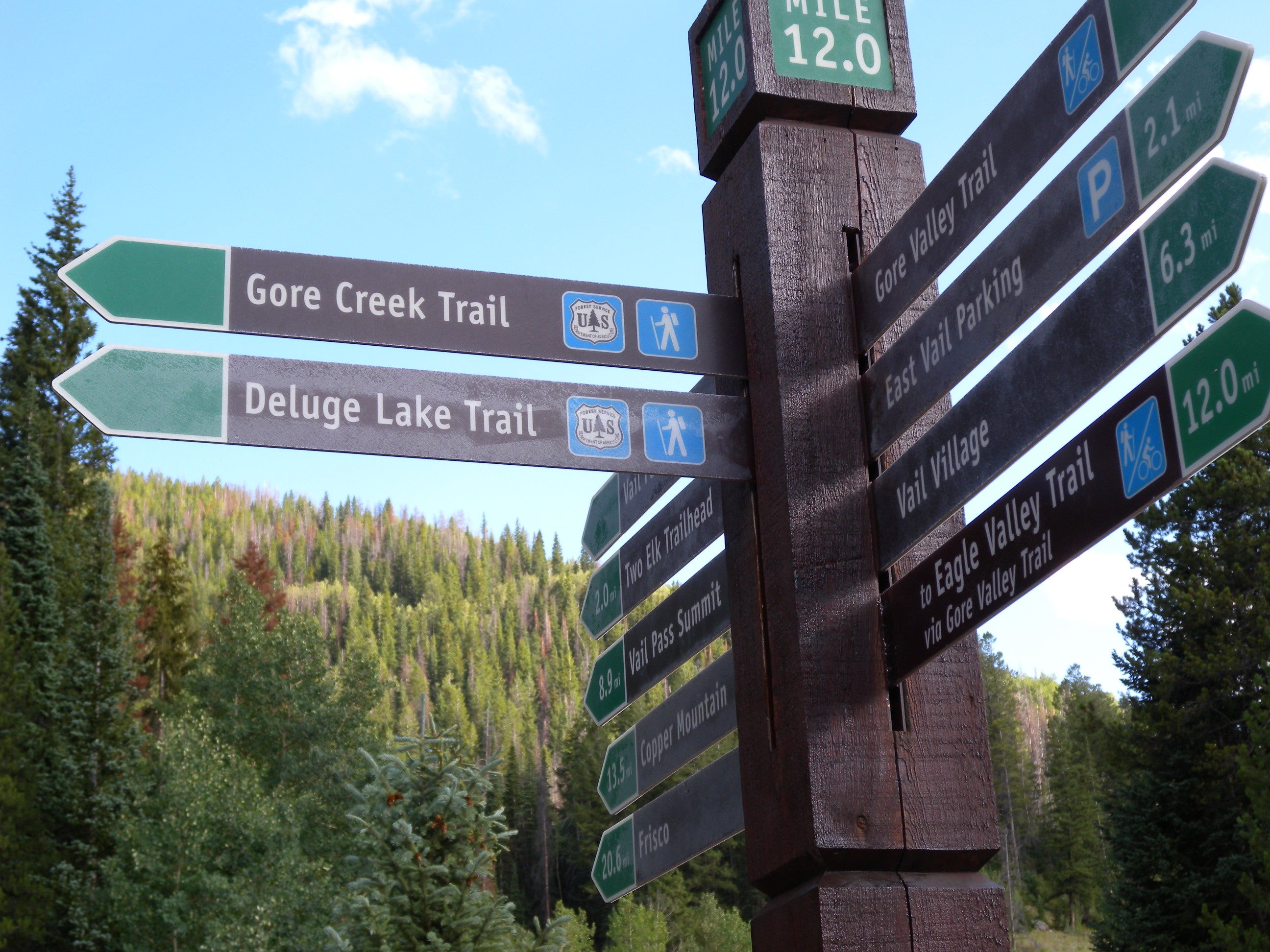
Sign
Location: 39.6248545, -106.2051424
With the exception of the cross-country section between Gore and Deluge lakes the trail junctions, like this one at mile 4.25, are well-signed.
Gore Lake
Location: 39.6410125, -106.2079931
One of the most beautiful lakes accessible via Vail, Gore Lake is flanked by rocky ridgelines.
View
Location: 39.6334645, -106.2042937
Looking past the rugged peaks in the nearest valley toward Red Peak.
Off Trail
Location: 39.6453639, -106.2053848
There are many obstacles on the first section of cross-country trail including: grass, fallen trees, elk, rocky outcroppings, and even a small marsh on the east side of the valley.
View
Location: 39.6466253, -106.2009142
ADVERTISEMENT
The southern view from meadows near the mouth of the Snow Creek valley.
Scrambling
Location: 39.6495834, -106.200242
The talus slopes of Hail Peak take longer to climb than you’d think. Allow more than 2 hours for the optional side trip if you plan to reach the summit.
Alpine
Location: 39.6479234, -106.20046
This route traverses more than 3 miles of rocky, alpine terrain above treeline.
Goats
Location: 39.6509382, -106.209619
Keep a look-out for mountain goats, like this large group grazing below Snow Lake.
Snow Peak
Location: 39.6524022, -106.2181207
The view of the rocky peak from the saddle. Though it’s less than a quarter mile to the top, allow lots of time for the steep, rugged climb.
Deluge Lake
Location: 39.6525609, -106.2179715
Looking toward Deluge Lake from the pass. The trail traverses the rocky hillside on the right side of this image.
Traverse
Location: 39.653945, -106.218996
The rocky trail on the Deluge Lake side of the pass is steep and difficult.
Trail
ADVERTISEMENT
Location: 39.6540652, -106.2293353
This view looking back toward the pass shows the difficult terrain. With a heavy pack, expect to move slowly on this difficult downhill.
Deluge Creek
Location: 39.6477134, -106.2327093
The upper stretches of the Deluge Creek Trail are more gradual than the end. You’ll pass through several meadows and cross the creek a couple of times on the way down.
Rock Fall
Location: 39.6353321, -106.263172
The trail crosses a couple of rock-fall areas, like this large one about 1.5 miles from trail end.