Updated July 8, 2025 09:42AM
3 Urban Hiking Trails for City Dwellers
Redefine “close to home” on these three trails within city limits.
'Gregory Vozzo'
New York, New York: Long Path
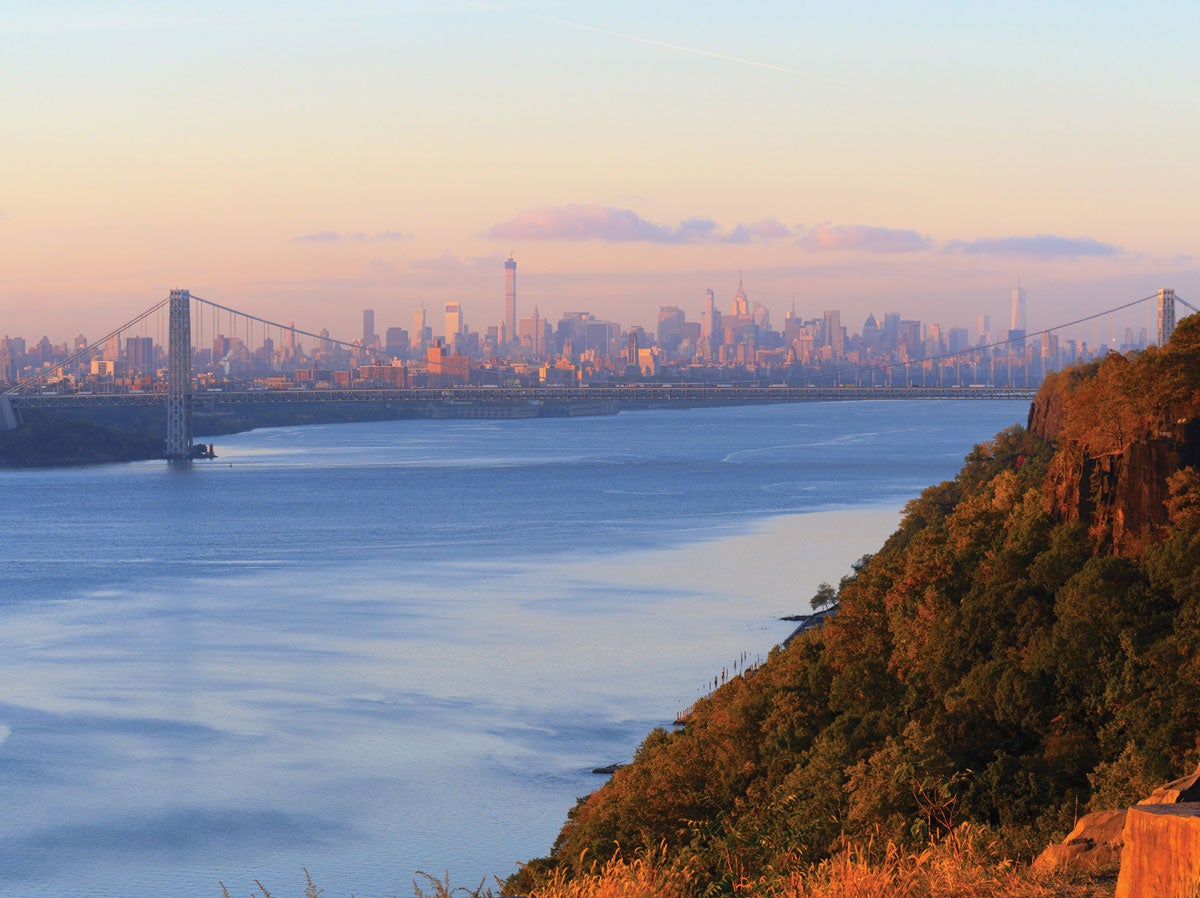
Palisades Interstate Park
You don’t need to wander far from the concrete jungle of Manhattan to find a real forest. In fact, with just an afternoon and a MetroCard you can tackle part of the 358-mile Long Path. The 3-mile piece (6 miles out and back) from the George Washington Bridge scores you an up-close look at the 400-foot-tall Palisades cliffs, as well as some perspective on the urban digs across the Hudson. From the New Jersey side of the bridge, head north on the Long Path, climbing above the Palisades to ramble 3 miles through maple-oak forest on riverside bluffs to the Rockefeller Lookout. Pinpoint Manhattan to the southeast and Yonkers to the northeast.
Public transit Take the A train to the 175th St. Station; walk 1.2 miles west, crossing the George Washington Bridge to the trailhead.
ADVERTISEMENT
Oakland, California: Mission Peak
Mission Peak Regional Preserve
The East Bay doesn’t get much trail cred, but local hikers know it should. Exhibit A: The Oakland metro area hosts the two hiker-only sections of the 375-mile (and counting) Bay Area Ridge Trail. Check one off when you climb 2,517-foot Mission Peak via the Peak Trail. Do it as a 6.6-mile out-and-back, ascending golden grasslands dotted with bright-orange California poppies (flowering in summer) to the exposed spine where you’ll be nose-to-beak with hawks floating on thermals. At the summit, savor a spin-around view over the Bay to a Who’s Who of NorCal peaks, including Mt. Hamilton, Mt. Diablo, and Mt. Tamalpais. On clear days, even spy the snowy summits of the Sierra Nevada.
ADVERTISEMENT
Public transit Take the 217 bus to the Ohlone College-Key D stop; walk .3 mile south to trailhead.
Dallas, Texas: Cattail Pond
Cedar Ridge Preserve
Think of this 4-mile loop in the Metroplex as the poor man’s safari. The preserve, which sits on the White Rock Escarpment, hosts endangered black-capped vireos, blue herons, snapping turtles, and even beavers (look for these guys and their handiwork near waterside groves). To see the park’s residents, link the Cattail Pond, Fossil Valley, and Cedar Brake Trails into a counterclockwise loop in the blessed shade of eastern red cedars. Roll along the escarpment before reaching tiny Cattail Pond near the midway point to look for waterfowl and turtles. After, circle back on the Cedar Brake Trail, where views stretch to 7,400-acre Joe Pool Lake.
Public transit Take the 574 bus to the County View @ Mountain Creek stop; walk .2 mile northwest to the trailhead.