Updated July 10, 2025 09:03AM
Hiking Mt. St. Helens, 41 Years After the Blast
Gifford Pinchot National Forest, Washington
'Terry Donnelly / Alamy Stock Photo'
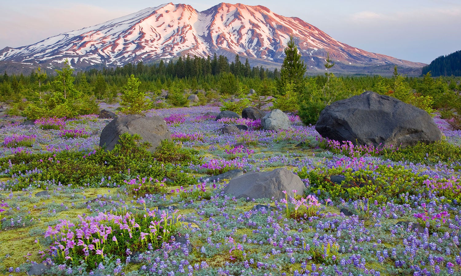
From the top of Windy Ridge, it looks as if Mt. St. Helens erupted yesterday. You can still see the steaming, gray wound on the side of the now-peakless mountain. Below, Spirit Lake is half hidden by a logjam built from the white ghosts of a long-dead forest. But the trek across the eastern slopes, which were wiped clean by the surge of rock and volcanic gas in 1980, reveals small signs of life hidden among the devastation, like smears of lichen and lupine. We leave the scorched earth behind for more signs of renewal: Knee-high pine saplings carpet the south side of the ridge, and, by the time the trail hits Smith Creek, the trees are 20 feet tall. Shiny new forest, in the blink of an eye.
Turn-by-turn from the Ape Canyon trailhead
Follow the Ape Canyon Trail (#234) 4.5 miles northwest up the flank of Mt. St. Helens.
Turn north (hiker’s right) onto the Loowit Trail (#216) and take it 1.7 miles through the Plains of Abraham to an intersection.
Stay north on the Abraham Trail (#216D) and hike 2 miles to its terminus at the Truman Trail (#207).
Take the Truman Trail north to the parking lot at the Windy Ridge Interpretive Site at mile 10.
Continue clockwise, linking the Windy Ridge (#227) and Smith Creek (#225) Trails 5 miles to a small tributary .
Stay on the Smith Creek Trail for 5.1 miles to the Muddy River.
Veer west onto the Lava Canyon Trail (#184) and go 1.5 miles through the chasm to the Lava Canyon Interpretive Site parking area at mile 22.6.
Walk .2 mile west on NF-83 to your car.
ADVERTISEMENT
Campsite 1
Plains of Abraham (mile 5.4)
Spend night one in the shadow of Mt. St. Helens. From the 1.5-mile, pancake-flat plateau, you’re guaranteed the best vantage of the sun setting behind the volcano. Also in the viewshed? Mt. Hood 60 miles south and Mt. Adams 30 miles east. Pick from any number of great sites north of scree-packed Pumice Butte. (Top off water before turning onto the Loowit Trail; springs in the blast zone aren’t reliable.)
Campsite 2
Smith Creek (mile 15)
The Smith Creek Trail descends from Windy Ridge to its namesake waterway, where a number of tributaries splinter outward. Pick one of the sites that’s tucked in the Douglas firs west of the water, closer to Mt. St. Helens.
ADVERTISEMENT
Explore a canyon
In the 1980 blast, a wave of mud and debris ripped up centuries-old forest that covered what’s now known as Lava Canyon. When the Muddy River resumed its course, it found the exposed bedrock, creating a staircase of waterfalls and pools that parallels the trail from miles 20.1 to 22.6 on this itinerary.
DO IT Trailhead 46.165429, -122.092151; 46 miles east of Woodland on NF-83 Season Mid-June through October Permit Required (free); self-issue at trailhead Custom map ($15)