Published September 19, 2013 10:16PM
Have an Adventure in the Enchantment Range—No Permit Required
Scramble a sneak route to the highest mountain in the Enchantment Range on this challenging, 11.3-mile out-and-back in the Alpine Lakes Wilderness.
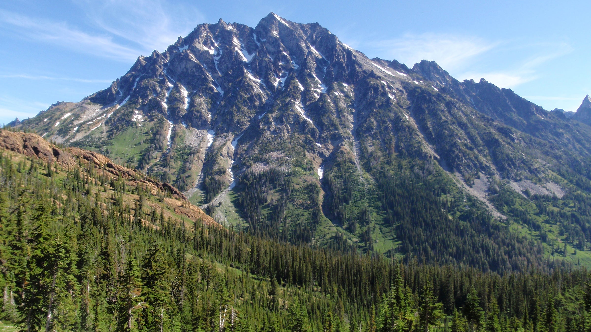
To live in Seattle is to have an embarrassment of life-list mountains within a few hours of your door. But only Mt. Stuart couples the alpine rewards of high-profile peaks like Adams and Rainier with the solitude usually found only on weeklong trips—and it’s outside the Enchantments permit zone.
This summit rises more than 5,000 feet from the surrounding terrain, testing quads and lungs alike—but you won’t need to rope up or pack crampons. Stuart is the highest mountain in the Enchantment Range, overlooking the entire Alpine Lakes Wilderness. Some speculate that it’s the largest chunk of exposed granite in the United States. Bonus: You’ll be able to see your entire summit-day climb from the hike in.
From the Esmeralda trailhead, hike the Ingalls Way Trail past several small waterfalls up switchbacks to 6,200-foot Longs Pass at mile 2.5, then descend a rocky climbers’ trail to Ingalls Creek. Cross the creek and find the Ingalls Creek Trail, which parallels the stream. Head southeast along the creek a short distance to a small meadow on the left to set up camp.
ADVERTISEMENT
Locate the faint climbers’ trail heading northeast before settling in for the night (it can be tricky to find via headlamp during your alpine start). It leads to the Cascadian Couloir climbing route. Mountain goats may mingle with you on your way up the rocky terrain in the class 3, 3,500-vertical-foot, 30-degree couloir. At the top of the chute, continue up talus to a notch east of a false summit. Pick your way across the ridge and up a slab to the summit. Pack a helmet—rockfall (usually goat-triggered) is common.
Guidebook Climbing Washington’s Mountains, by Jeff Smoot ($30, falcon.com)
Permits Required (free at trailhead register). A Northwest Forest Pass is required to park at the trailhead
Contact Okanogan-Wenatchee National Forest
-Mapped by Kevin Goodenough and Ryan Goodenough


