Updated January 28, 2025 12:15PM
A Hiker's Guide To The Eagle Creek Trail
With several dozen waterfalls, old growth forest, and mossy grottos carved right out of the wall of Columbia River Gorge, this trail is a hiker's paradise.
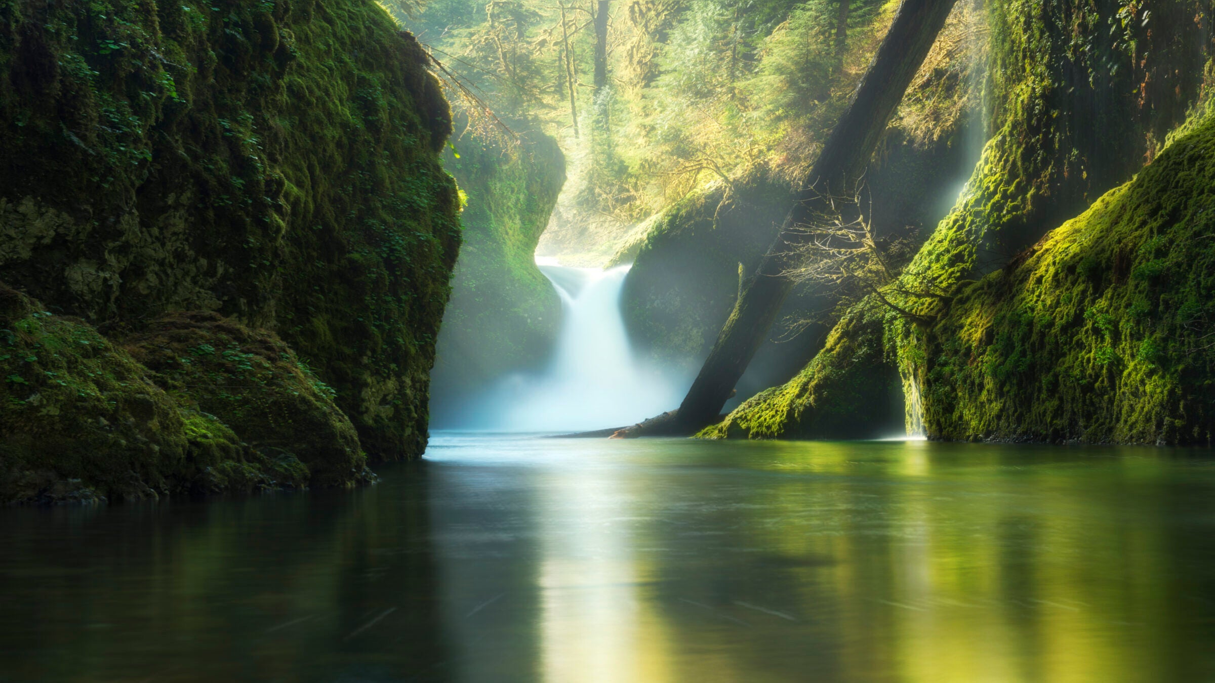
Punchbowl Falls (Photo: Chen Su/Moment via Getty Images)
The Eagle Creek Trail up Oregon’s Columbia River Gorge in is an iconic and popular hike for a reason. You can’t get this kind of landscape anywhere else. This 26.2-mile out-and-back is half thick, mossy rainforest and half vertiginous ledges blasted straight out of the gorge’s wall. The trail is one of the most visited in the region, but the experience is well worth the crowds.
Trail Facts
- Distance: 26.2 out-and-back
- Elevation Gain: 5,210 feet
- Difficulty: Challenging
The Route: Eagle Creek Trail Hike
This popular route brings you through lush greenery, along rocky ledges, and past a handful of waterfalls before reaching the trail’s terminus at Wahtum Lake.
Eagle Creek Trailhead to Tenas Camp
Start at the Eagle Creek trailhead and follow a wide, well-marked trail above Eagle Creek. Pass into a grotto festooned with maidenhair ferns, then head into the basalt cliffs of the Columbia River Gorge. This is the first real section of ledge. Cable handrails provide a handhold for less secure hikers. It’s worth noting that this section of trail can be quite narrow. Use caution when passing other visitors.
The first major waterfalls come after a second cliffside trail section. The first is 82-foot Metlako Falls on Eagle Creek at mile 1.3. The second, 100-foot Sorenson Falls, drops from the east rim of the gorge at mile 1.6.
The next big viewpoint is the Lower Punchbowl Falls overlook at mile 1.8, where a 35-foot cascade drops into a mossy “bowl” in the rock. From there head to a series of bridges, past scree slopes where pikas often chirp from the rocks, and head into another cliffside section.
ADVERTISEMENT
Tenas Camp to Wahtum Lake

Reach the first campsite, Tenas Camp, at mile 3.7, after passing 50-foot Skoonichuck Falls. From there, head to another bridge over Eagle Creek. Don’t miss the nice swimming hole with a cobbled beach to dry out on for a quick cool-off on hot days. The next set of campsites, at mile 4.6, come after a thicket of willows. Keep an eye out for tiger lilies on either side of the trail.
Another cliffside section followed by scree slopes drops you into the amphitheater of 175-foot Tunnel Falls. The trail passes through the namesake tunnel behind the cascade, where yellow arnica flowers cling to the walls. This is where most day hikers turn around. Continue another 1.5 miles to more possible tent spots at Seven and a Half Mile Camp.
Past Seven and a Half Mile Camp, the climbing begins. Head up the ridge that divides the east and west forks of Eagle Creek. The trail gains 2,300 feet of elevation over the next 5.6 miles. It tops out at Wahtum Lake, which sits in a forested cirque.
ADVERTISEMENT
Gear for Hiking the Eagle Creek Trail
The Eagle Creek Trail winds through classic Pacific Northwest rainforest, so come prepared for rain. A good rain shell—and depending on the forecast, rainpants and gaiters, too—is necessary even for dayhikes. Even in summer the temps in the gorge can be cool, so add in a good insulating layer. If you’re going overnight, make sure you have a good rain fly for your tent, and weigh the likelihood of tracking water inside against the weight and space benefits of a down sleeping bag. There’s plenty of water along the route, so pack in a good filter to save pack weight.
The Map: Eagle Creek Trail Hike
Permits
A recreation pass is required to park at the trailhead. It’s $5 per vehicle per day or $30 for an annual pass. Wilderness permits are required for entry to the Mark O. Hatfield Wilderness. The wilderness permits are free and self-issued at the boundary.