Updated April 7, 2025 05:43PM
Paddle the Sandfly Island Loop and Explore an Ocean Forest in Florida’s Ten Thousand Islands
Located off the coast of the Everglades, the Sandfly Island Loop is an intro to sea kayaking that even beginners can do.
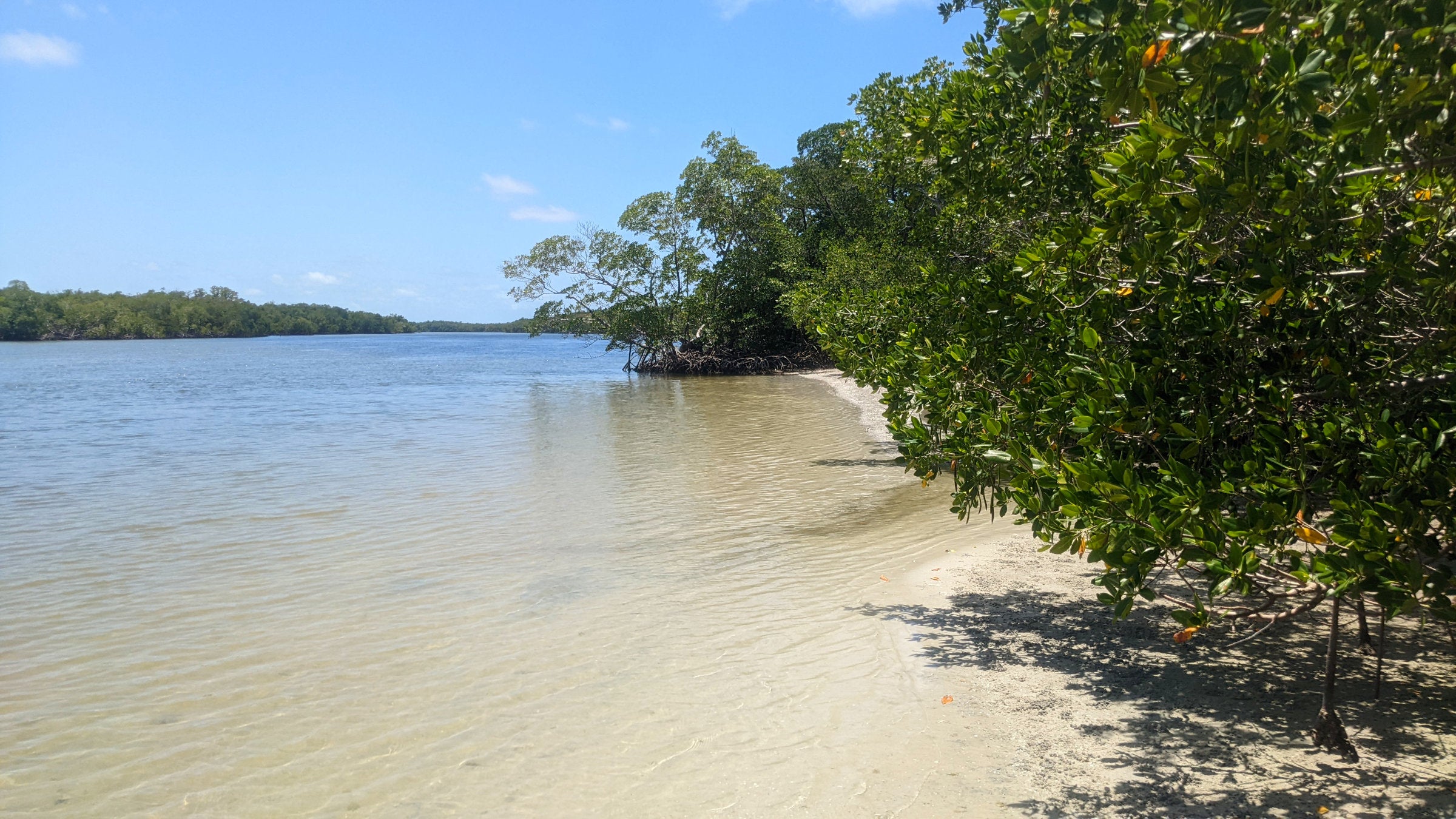
Sandfly Island (Photo: Adam Roy)
I was grabbing my rental life vest off the rack when I noticed my two friends and a National Park Service employee standing at the edge of the water, staring into the shallows. I walked down the stone-and-pavers boat ramp—past a sign asking divers and anglers to report sightings of smalltooth sawfish, a critically endangered, shark-like ray—to see what had gotten their attention.
There, just a few feet offshore, were a pair of those very same sawfish. Though juveniles, they were already big, probably four feet from the tip of their chainsaw-like noses to their tails. Oblivious to overfishing, pollutants, and climate change, they floated, fanning their fins back and forth. I don’t know if fish have a sense of humor, but it was a pretty good joke either way.
This was our welcoming committee to the Ten Thousand Islands, the strip of coastline where the dense wilderness of the Everglades meets the Gulf of Mexico. In this tangle of mangroves, tidal flats, and sandy keys, wildlife thrives: colonies of chattering seabirds, turtles, and even large predators like bobcats and Florida panthers. This morning, we’d be temporarily joining them.
The Route: Sandfly Island Loop

The plan was to paddle the Sandfly Island Loop, a 5-mile sampler that circles one of the nearest isles to the put-in at the park’s Gulf Coast Visitor Center in Everglades City. We three were the remnants of a destination bachelor party that a Covid cluster had decimated the day we were supposed to leave. If we weren’t expert paddlers, we were enthusiastic enough to make up for it.
Paddling out with the tide, we crossed the biggest stretch of open water, Chokoloskee Bay, in less than an hour. By noon, we had hauled our boats up onto Sandfly Island’s gravelly beach, sending a crowd of fiddler crabs scurrying for cover, and were setting out on the mile-long loop trail that crosses the island.
ADVERTISEMENT
The History of Sandfly Island
As wild as it looks, Sandfly Island bears the marks of hundreds of years of human habitation. The area’s earliest known Native inhabitants, the Calusa, built up the entire shoreline of the island to aid them in fishing. Centuries after Spanish colonization and American expansion decimated the tribe, the island was home to settlers. This included Charlie Boggess, who built a two-story home and farmed tomatoes on the island beginning in 1912. While the tomatoes and the house are long gone, the concrete well—drilled in 1922—still stands. It’s the only source of drinkable water in the islands.
What to Expect
We followed the packed dirt and boardwalk trail as it wended through the mangroves for about a quarter-mile before we ran into a swarm of ground-dwelling bees. After several fruitless attempts to find a way through, we decided jointly not to begin our vacation by getting stung. We headed back to the beach, shoved off, and headed deeper into the islands.
Surrounded by trees on all sides, it was easy to forget we were paddling on the ocean. For the next two hours, we slowly worked our way through a maze of mangroves, cul-de-sacs and dead ends, and deep, marked channels that we shared with motorboats. Blue herons perched on downed logs, scanning the shallows for fish to snatch. This placid corner of the ocean could have been an inland swamp, until the tide began to slowly but insistently tug us toward shore.
ADVERTISEMENT
Trail Facts & Other Logisitics
- Length: 5 miles
- Time: 2.5-4 hours. Budget more if you want to hike the Sandfly Island Trail (0.9 mile) or stop for lunch on the beach. Time your departure for an hour or two after high tide for an easy return trip.
- Rentals: Everglades Florida Adventures
Hurricane Damage
We did this trip before Hurricane Ian rocked southwest Florida in September 2022. The disaster caused more than $50 billion in damage and killed nearly 150 people in the state. Due to storm damage, the Gulf Coast Visitor Center is currently closed and should re-open in Fall 2025. While the boat launch is still open, other services are limited, and no drinking water is available onsite.
Navigation
We called the Ten Thousand Islands a maze for a reason. Finding your way through the twisting passages that separate these islets can be challenging. It’s easy to get turned around. Bring a chart, compass, and the knowledge to use both of them, or plan on navigating by GPS. (Outside+ member? We used Gaia GPS’s NOAA Nautical Charts, which members can access for free.)
Gear
Besides navigation equipment, sun protection is a must. Pack a few liters of water and a method of communicating in an emergency—a PLB or Spot device works, or an SOS-equipped iPhone 14. If you hike the Sandfly Island Trail, bring a waterproof daypack or a pack combined with a lightweight drybag.
ADVERTISEMENT
Mangroves
The trees in the Ten Thousand Islands that we call mangroves are actually three different species. There’s the red mangrove (Rhizophora mangle), black mangrove (Avicennia germinans), and white mangrove (Laguncularia racemosa). All three thrive in saline and brackish water thanks to evolutionary adaptations like roots that filter out salt. The forests provide habitat to hundreds of species of birds, fish, insects, and arachnids. They also protect coasts from erosion by stabilizing the ground on which they grow and providing a buffer against storm surges and wave action.