Published June 25, 2021 01:05PM
Explore an Alpine World of Rock and Water in this Colorado Cirque
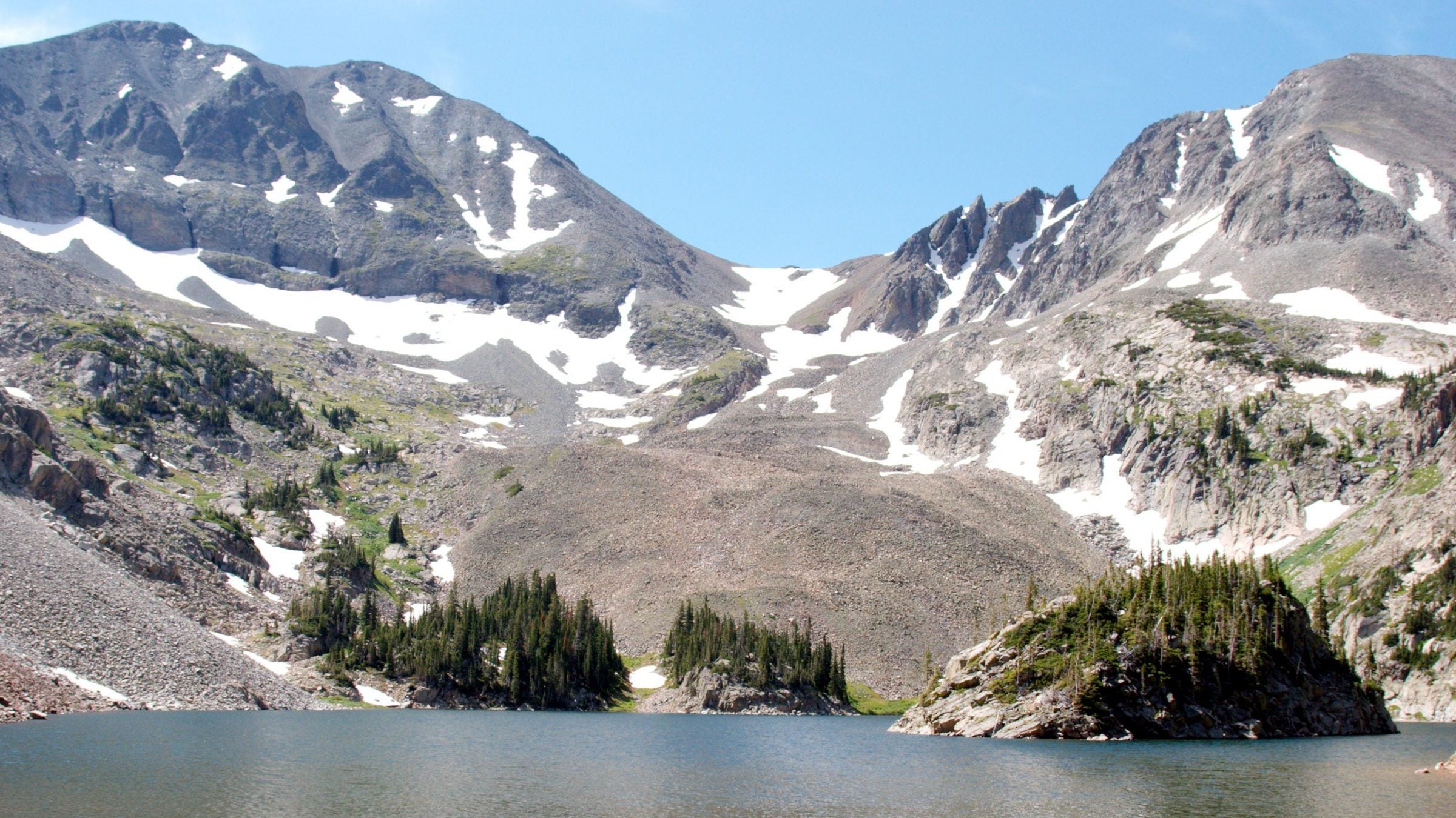
The short and steep trip to Lake Agnes delivers with craggy peaks, scree fields (home to pika), and fish-filled alpine waters.
(Photo: "IMG_2644_1" by KimonBerlin is licensed under CC BY-SA 2.0)
- Distance: 2.3 miles
- Time: 1 day
- Elevation gain: 684 feet
This short, steep trail begins near a historic cabin and skirts a marshy flatland before turning uphill through a deadfall-scattered forest. This area is the moose-watching capital of Colorado, so watch for antlers along the trail (especially in the mornings and afternoons). Switchbacks climb beside the Upper Michigan Ditch and offer unfettered glimpses of the Nokhu Crags. The sheer western faces of these 12,485-foot peaks form the dramatic backdrop for Lake Agnes. The tough hike ends right at the lakeshore, where fishermen settle into the sandy western bank for a shot at rainbow and cutthroat trout. Allow at least an hour for the easy 1-mile trip around the lake, more if you plan to stop for a picnic or a swim.
Directions
Start from the Lake Agnes trailhead. There is ample parking and a toilet, but the steep road ends above 10,000 feet and is closed through the winter. The trail begins near the old cabin on the south side of the parking lot. At the first junction turn right, following the signs for Lake Agnes. As you begin a series of tight, short switchbacks along the edge of the Upper Michigan Ditch, look left and up to catch early glimpses of the Nokhu Crags.

Go straight at the 3-way junction where the trail evens out and begins a short descent to the lakeshore. From the rocky beach at the lake’s northern edge, you can clearly see the surrounding 12,000-foot peaks and a small island on it’s western side. From here, start your circumnavigation of the lake itself. The entire east side of the lake is a scree field with a well-trodden, but rocky path just a few feet above the water line. Rocks on the path itself are fairly solid, but watch your footing above or below it where your body weight will shift loose stones.

Pick your way through a wet and grassy snowmelt drainage before rounding the lake’s southern side. To get around, either jump and scramble around sheer boulders along the lakeshore or head inland and bushwhack over a tree-covered knoll. You’ll drop down to a muddy, boulderless beach a few hundred yards away. Cross 2 small wooden bridges as the trail enters the woods to skirt a small lagoon. Look for schools of baby trout in the shallows.

A short loop trail offers an alternative way to begin your return trip. It’s only an extra few hundred feet of travel, but offers a close-up view of the Nokhu Crags steep lower slopes and a peek at the Upper Michigan Ditch. Once you rejoin the main trail, retrace your steps to the trailhead.

Mapped by Kristy Holland