Published September 20, 2013 06:00AM
Hike to an Alpine Lake in the Shadow of the Continental Divide
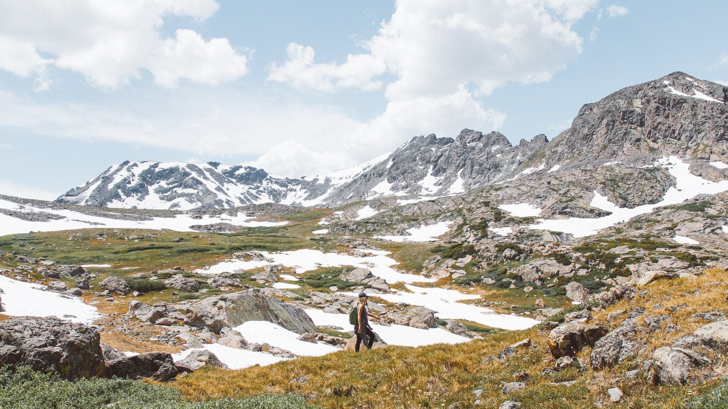
Sampling the best of the Indian Peaks Wilderness, this 5-miler traverses alpine meadows up to a sparkling lake perched below the Continental Divide.
(Photo: Photo by Holly Mandarich on Unsplash)
- Distance: 5.2 miles (round trip)
- Time: 1 day
- Elevation gain: 974 feet
- You’ll like this hike if you like: mountain lakes
If spending an afternoon watching the clouds by an alpine tarn sounds like some kind of heaven to you, you’ll love this day hike. From the Mitchell Lake trailhead in Brainard Lake Recreation Area, this route climbs steadily toward Mitchell Lake (0.8 mile from the trailhead), and then up to Blue Lake, another 1.7 miles up the trail. Several ponds and streams pepper the route, and the trail crosses two impressive bridges along the way: one 15 feet above a fast-moving stream, and one picturesque double-log bridge atop a wide, tumbling cascade.
ADVERTISEMENT
At mile 1, the elevation gain intensifies as the trail heads up a series of increasingly narrow and rugged steps. Notice the changing vegetation and twisted, wind-blown trees as you pass several unnamed ponds and approach the towering mountains above Blue Lake. With the Continental Divide peaks (Pawnee, Mt. Toll and Paiute, all above 12,900 feet) and Mt. Audobon’s talus slopes towering overhead, it’s tempting to keep you eyes on the ridgelines, but be sure to watch your footing: the rocky path is an ankle-twister and it is easy to lose track of it if any snow lingers. At Blue Lake, large, scattered rocks offer shore-side picnic seating and user-created trails along the lake’s north shore bring you to the lake’s west end waterfall and additional exploration opportunities upstream.
-Mapped and photographed by Kristy Holland and Steve Johnson
Permit Entrance fee for Brainard Lake Recreation Area Contact Indian Peaks Wilderness
Hike Photos


