Updated December 3, 2024 11:25PM
8 Lonely Backpacking Trips Where Solitude Rules
Sharing is for kindergarten. Try one of these hikes to have the wilderness all to yourself.
(Photo: Joel W. Rogers via Getty Images)

Sespe Wilderness, CA
This wilderness in the Sierra Pelona and Topatopa Mountains is home to southern California’s last undammed river, some of the hottest hot springs in the country, and a California condor sanctuary, as well as miles and miles of trails. With far fewer visitors than the more-publicized Sierra Nevada, this spot is a dream escape for backpackers looking for time alone.
Info Sespe Wilderness

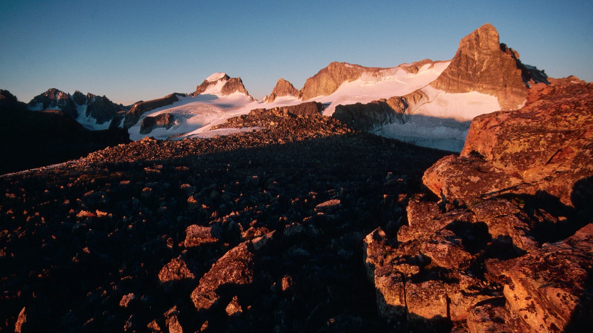
Nootka Trail, British Columbia
This little-known trail has even fewer visitors than the rest of BC’s remote coast. Running along the outer edge of Nootka Island, itself just west of Vancouver Island, the trail heads from open viewpoints to beach to thick forest, where ancient totem poles from the Muchalaht Nation are slowly returning to the earth.
Info Nootka Trail

ADVERTISEMENT
Cutler Coast, Maine
Blueberry barrens, unique maritime forest, and open heaths open onto rocky headlands on this section of Maine’s Bold Coast. Snowshoe in during the winter for the best chance of absolute solitude, or hit the trails in late summer and early fall for ripe blueberries.
Info Cutler Coast

Gore Range, CO
Despite being only 60 miles from Denver at its closest point, this range is little-known even by Colorado hikers. The range has more than 50 peaks over 12,000 feet, with sharp-edged glacial cirques dropping from their slopes to cradle alpine lakes and waterfalls—and very few visitors.
ADVERTISEMENT
Info Gore Range

Border Route Trail
This 65-mile trail follows the border between Minnesota and Ontario through the Boundary Waters Wilderness, tracing the ridgelines that rise between the lakes and rivers. The panoramic views, waterfalls, and lakeside lunch stops on this route see very few people; take a week and explore this border wilderness without a single hint of crowds.
Info Border Route Trail

Mt. Barnard, CA
Despite its proximity to the John Muir Trail, this peak is rarely climbed. At 13,990 feet Mt. Barnard requires a lot of elevation gain from any climber, but the views over the High Sierra are worth it. The route up the southwest slope is only class 1, requiring no technical gear or advanced routefinding.
Info John Muir Wilderness

ADVERTISEMENT
Diamond Peak, OR
This basaltic-andesite shield volcano’s broad, low-angle slopes stand out among the sharp stratovolcano cones of most of the Cascades range. Climb it in a day on the 12-mile South Ridge route, or make a weekend of it on one of the long routes up the western slopes.
Info Willamette National Forest

Gannett Peak, WY
Wyoming’s highest point is a serious mountaineering objective, requiring a wide variety of climbing skills and a weeklong expedition. The main approach, through Titcomb Basin, piles on the views long before you get near Gannett, as the trail winds through high mountain meadows surrounded by a sea of ragged peaks.
ADVERTISEMENT