Updated July 7, 2025 06:29PM
Beaches, Bears, and Redwoods: the Ultimate Guide to California's Lost Coast Trail
The 53-mile Lost Coast Trail heads through some of California's last pristine beaches.
(Photo: "Lost Coast Trail, The King Range National Conservation Area" by blmcalifornia is marked with CC PDM 1.0)
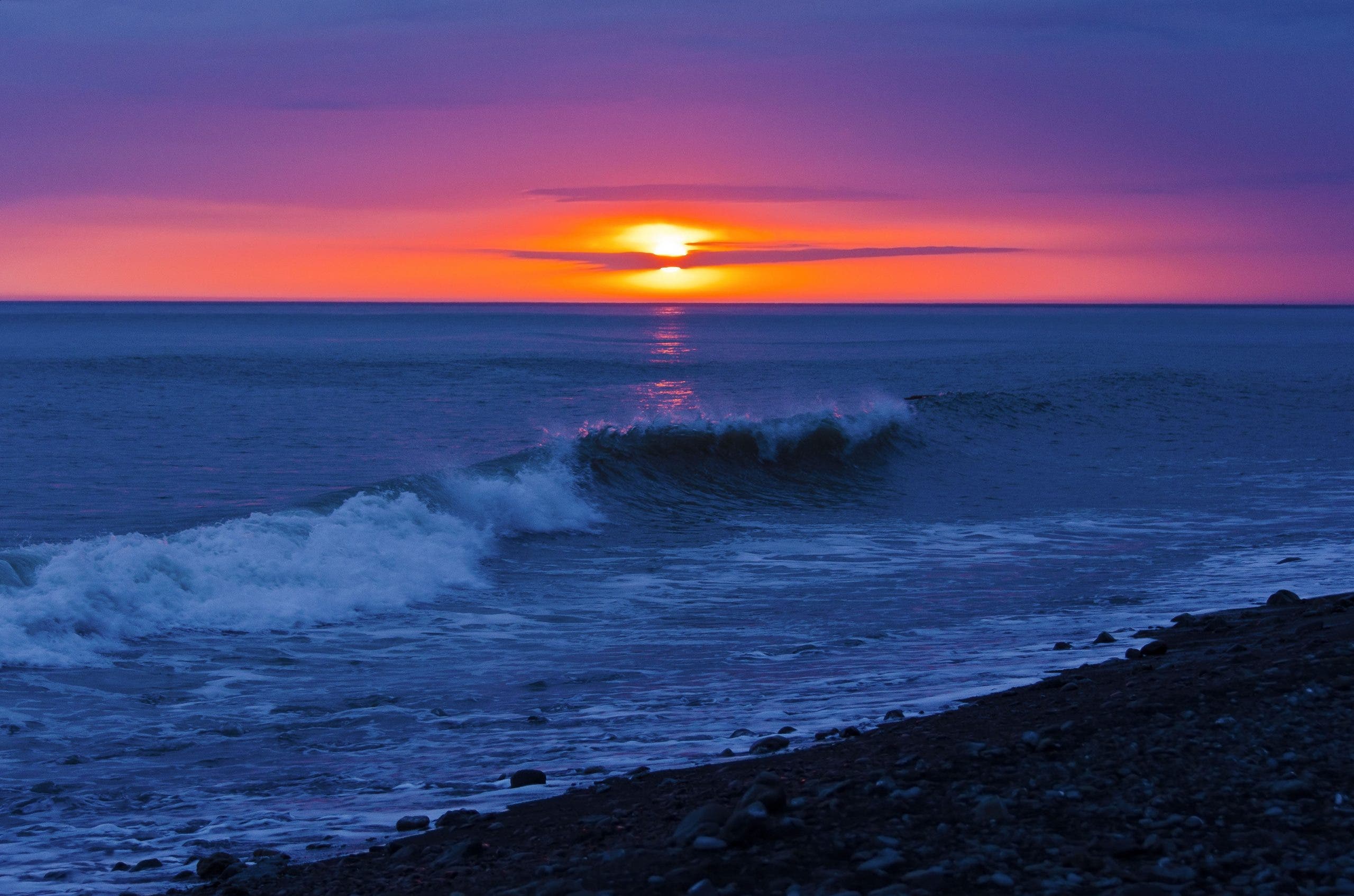
The Lost Coast Trail: Just the name conjures up visions of solitary beaches tumbling with surf, golden sunsets sinking into the Pacific to the accompaniment of gulls and sea lions, and campsites perched right at the high tide line without another hiker in sight. And luckily for every daydreaming backpacker, the reality lives up to the hype.
California’s Lost Coast Trail runs 53 miles through one of the state’s few remaining stretches of pristine shoreline, saved from development by virtue of simply being too steep for roads: The Kings Range drops right into the ocean here. The northern half of the trail traverses black sand beaches, bouldery tidelines, and steep bluffs, while the southern half veers into the lush ferns and redwoods of the Sinkyone Wilderness. Pick a half or do it all in one go with our guide to the Lost Coast Trail.
Hiking the Northern Section of the Lost Coast Trail
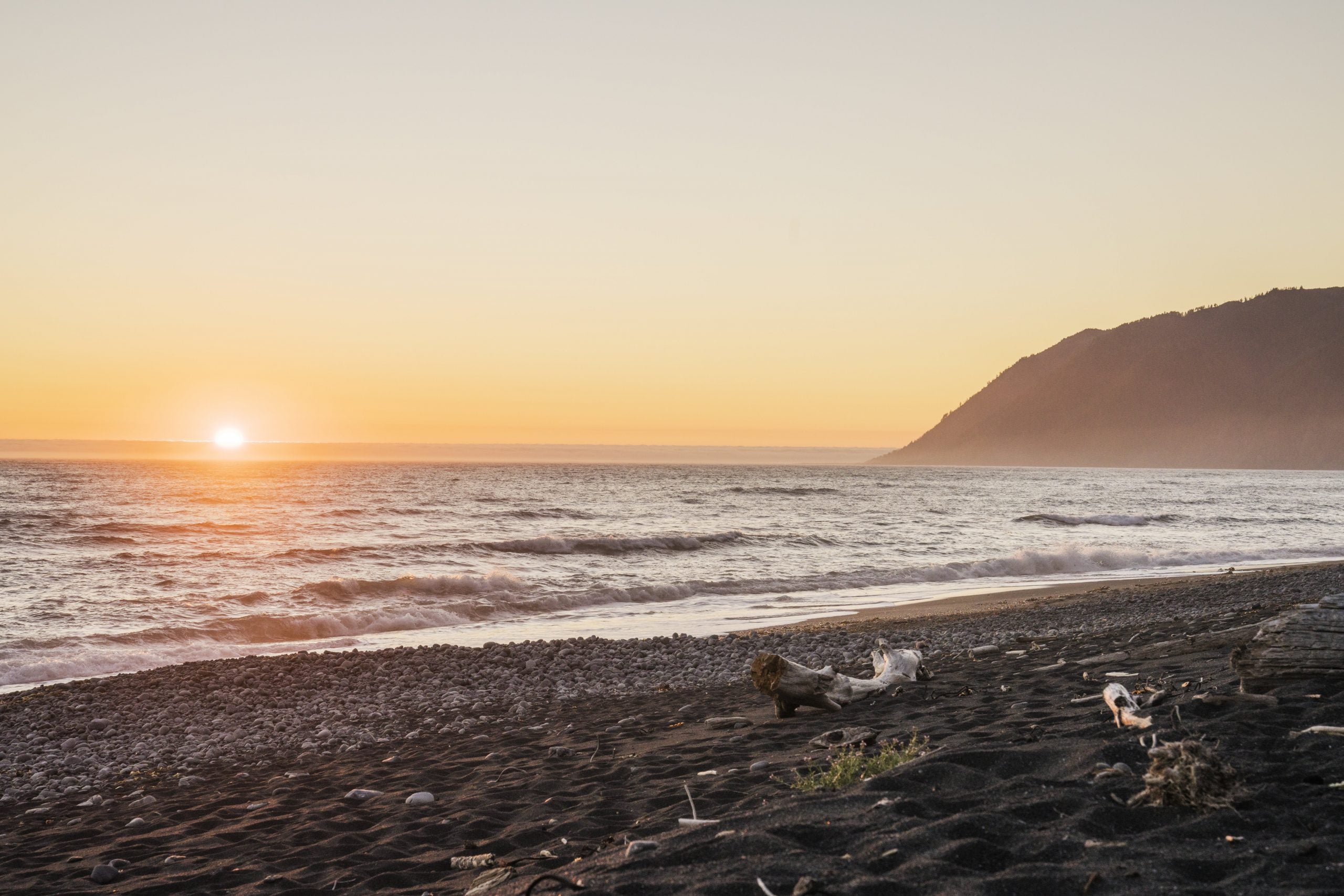
The 24.6-mile northern section of the trail sticks to the coast. Start from the trailhead at Mattole, where the Mattole River drops through a sandy beach and then into the sea. The trail winds through dune grass until mile 2.5, when the defunct but scenic Punta Gorda lighthouse comes into view. Tidepools litter this part of the trail; take a slight detour to look for anemones, hermit crabs, and barnacles. At mile 5.4 some larger wildlife waits: Sea Lion Gulch, a favorite hangout for sea lions and seals. Soon after you’ll reach a perfect first-night camp site, Cooksie Creek, at mile 6.8. Pitch your tent next to an improvised driftwood shelter just over the high tide line and fall asleep to the sound of pounding surf.
The next day, head onto a narrow strip of beach beneath sheer gray cliffs. This section of the trail is only hikeable at low tide, so make sure to consult your tide table before heading out. Watch the horizon for gray whales (migrating along the California coast between December and April) or blue whales, the world’s largest animal, on their summer migration route. The Randall Creek campsite at mile 8.8 marks the end of the low-tide-only beach walk, but pushing on to Spanish Creek at mile 9 lets you take a snack break among bright orange California poppies. For a longer day 1, you can camp here, too. After Spanish Creek, the trail meanders between beach and a coastal scrubland just inland before returning to the waterline below 2,797-foot Shubrick Peak. Pitch camp number 2 a few miles farther on at Big Flats (mile 17.1). Deer, black bears, and even bobcats frequent this meadow, so make sure your food is well stored. The next few miles of trail are again impassable at high tide, so time your departure with the ebb. The beach opens up again as you near Black Sands Beach, framed by windswept Douglas firs crowding down to the sand and gravel. If you dropped a second car at Black Sands, you’re ready to head back to civilization; otherwise, some shuttles are available back to Matthole (service providers vary year to year).
ADVERTISEMENT
Hiking the Southern Section of the Lost Coast Trail
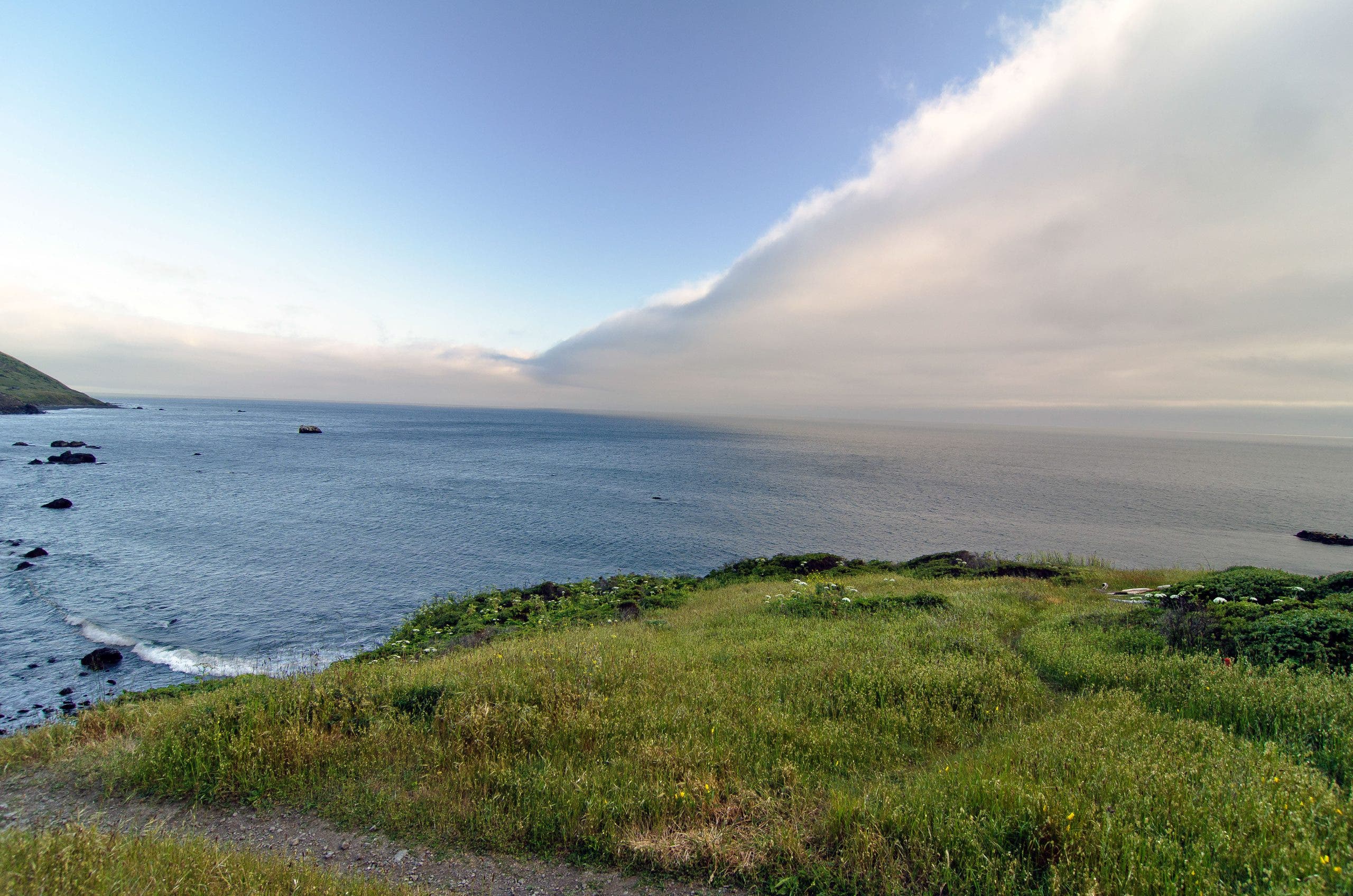
Photo: “The Lost Coast -Foggy and Sunny” by Scrubhiker (USCdyer) is licensed under CC BY 2.0
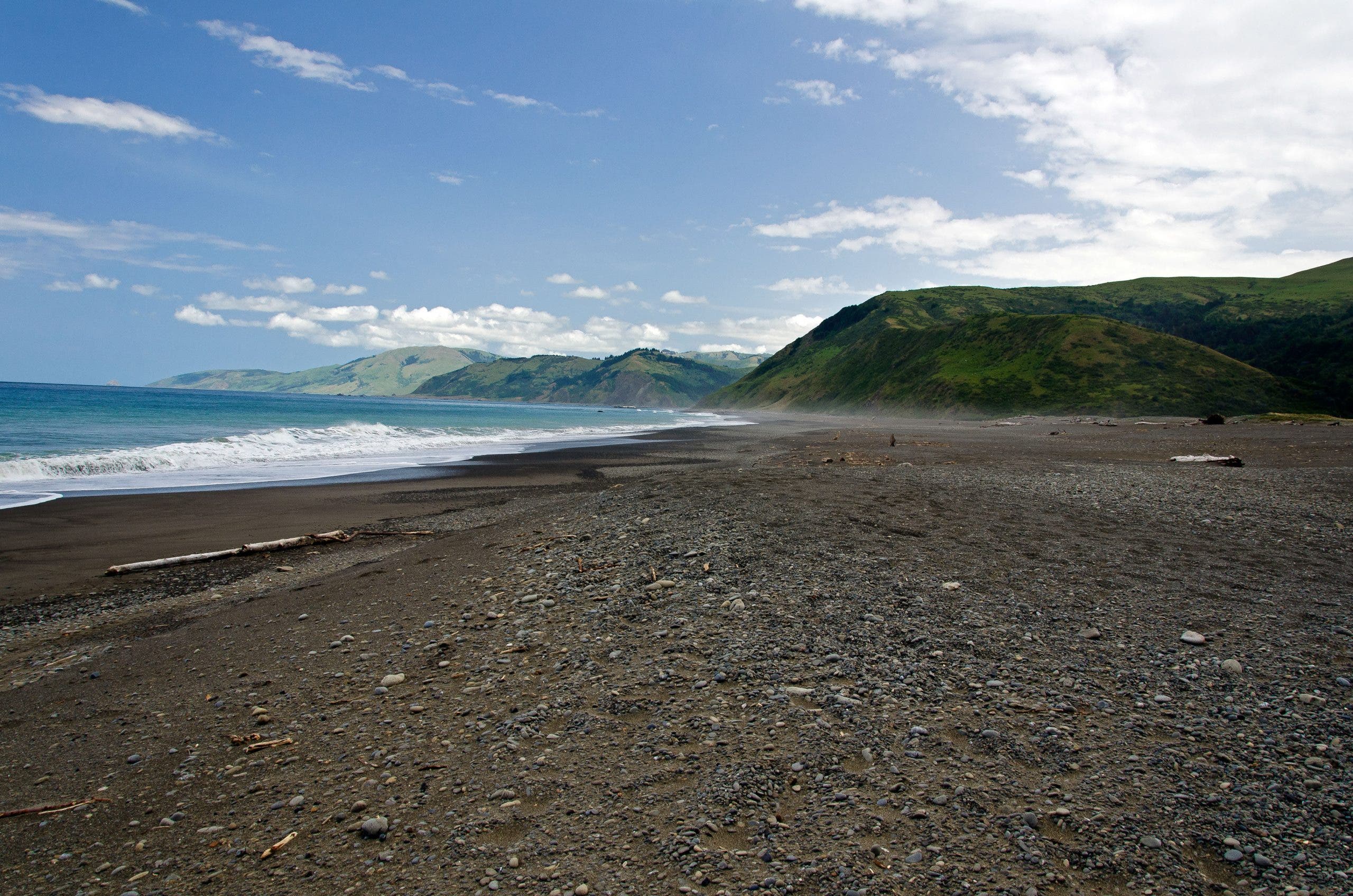
The southern half of the trail runs from Hidden Valley to Usal Beach, dipping between old-growth forest and coastal chaparral. From Black Sands Beach, take Beach Road to Shelter Cove Road to Chemise Mountain Road (there’s a narrow shoulder and a lot of fast drivers, so make sure you’re easily visible), where you can access the Hidden Valley Trailhead. Head quickly up into the Kings Range with a climb up and over 2,598-foot Chemise Mountain. Finish off the first night at one of several campgrounds near Needle Rock, around mile 9. On day 2, head up into moss-hung redwoods and firs, climbing further into the mountains with occasional glimpses of the ocean. Drop back down 7.5 miles later at Wheeler Beach, an isolated black sand cove with a scattering of scenic (though windy) campsites. The next section of the hike heads back into the woods for 3.7 miles, then drops into a grove of old-growth redwoods at Little Jackass Creek. From Little Jackass Creek, the trail grows more overgrown, and ticks are common in the underbrush (pack your DEET). Poison oak also grows across the trail in several places, so long sleeves and pants are recommended. Head up and over a couple forested ridgelines for 7.2 miles before heading back to the water at Usal Beach, where the trail ends.
ADVERTISEMENT
Hiking the Lost Coast Trail’s Tidal Zone
Several sections of the northern Lost Coast Trail can’t be hiked at high tide, and unwary hikers can be caught by the advancing waves with no way to escape. Make sure you have current tide tables for the region before heading out, and carry them with you. Start the tide-dependent sections as the tide is receding to give yourself plenty of time to get through.
Wildlife on the Lost Coast Trail
The Lost Coast is home to a whole host of critters, from ticks to peregrine falcons to black bears. Make sure you give the larger mammals their distance, especially bears and sea lions. Peregrine falcons and ravens love the rising thermals off the cliffs of the Kings Range; keep an eye out above to spot a passing raptor. Black bears frequent several of the campsites along the trail, and bear canisters are required for backpackers on the northern section. Ticks are especially common on the second half of the trail; long sleeves, long pants tucked into socks, and thorough body checks are the best way to ward them off.
Contact Lost Coast Trail Permit Required (Reservations needed for the northern section; southern section has self-issue permits at the trailhead)
ADVERTISEMENT
What to Pack for the Lost Coast Trail
Your standard backpacking kit will mostly serve you well on the Lost Coast Trail, with a couple of modifications. The big one: Make sure you’ve packed for rain, with a dependable hardshell, a pack cover, and a sleeping bag that can handle a little bit of moisture, like dry-treated down or synthetic. You may also find light gaiters beneficial, as you’ll be spending a lot of time walking through the sand.