Wrangell Plateau to Dixie Pass, Alaska

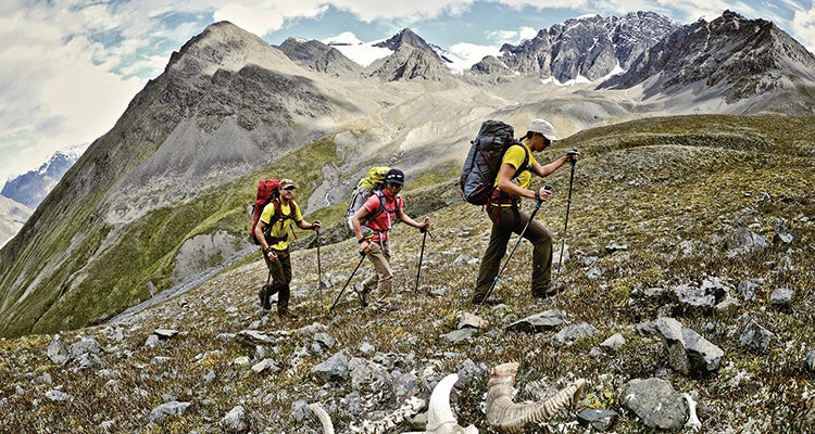
'Final Rest: Around 12,500 Dall Sheep live (and die) in Wrangell-St. Elias NP. This one met its fate near Surprise Creek Pass. (Hagephoto)'
Challenges
Mosquitoes,
bushwacking,
river crossings,
off-trail navigation,
grizzlies,
remoteness
Payoffs
True wilderness
immersion,
spectacular views of Alaska’s gnarliest
mountains
→ Even by Alaska standards, the Wrangells are big and wild. “There’s none of the hand-holding (training from rangers, buses) you find at Denali,” says photographer Matt Hage, who helped pioneer this 56-mile route from Wrangell Plateau to Dixie Pass. “It combines everything that makes Alaska tough—and amazing.” You’ll ford two large, glacial rivers (up to waist deep), bushwhack through dense brush, hike on a glacier, and navigate your own route through grizzly terrain, all to access seldom-seen panoramas of the 16,000-foot Wrangell Mountains. Complete this trek, and epics like the Sierra High Route seem simple.
DO IT Leave a car at Dixie Pass trailhead off Strelna Road and book a flight to Wrangell Plateau with Wrangell Mountain Air in McCarthy ($220/person; 907-554-4411). “Flying in and hiking out makes this trek relatively affordable, and you don’t have to depend on weather for a plane pickup,” Hage says. The six-nighter’s first big obstacle: crossing Long Glacier, which slopes to the ground (no ropes or ice axe needed, but bring microspikes). Day three, hike to Kluvesna River for boundless views of snaggly peaks, and cross the river the next morning (when flows are lower). Day five starts with the Kotsina River crossing; bushwacking up the Rock Creek Valley fills day six, which ends beneath Dixie Pass. Finally, hike over Dixie to Strelna Creek, picking up the established trail to reach your car. Info nps.gov/wrst