Published December 9, 2021 05:11PM
Winter Is Hiking Season—and These 3 Magical Trails Prove It
Make the most of the fourth season with these perfect national park hikes.
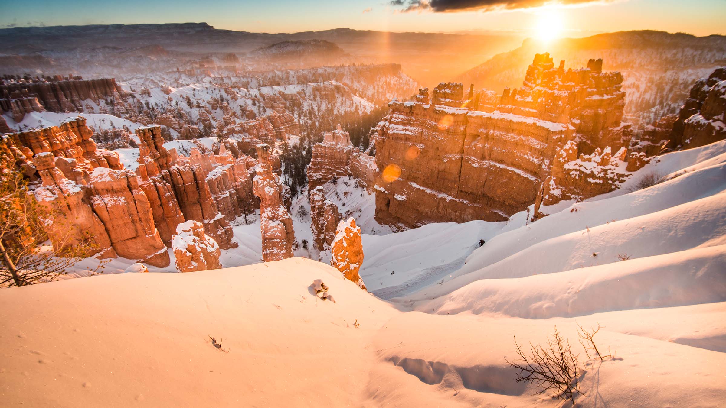
Winter in Bryce Canyon (Photo: sguophotography / Moment via Getty)
Want more like this? Become an Outside+ member today and get access to everything we publish, including the full version of this story.
When the snow starts to fall, the tourists start to retreat from the United States’ popular national parks, leaving just a trickle of visitors to enjoy them. But you know better: In winter, the national parks transform, finding a new kind of seasonal beauty. Make the most of it on these 9 fantastic hikes. —The Editors
Swamp Canyon Trail, Bryce Canyon National Park

“The contrast of red rock, white snow, and blue sky leaves hikers speechless after an 800-foot climb to the Swamp Canyon overlook,” says Janice Stock, a Bryce Canyon NP spokesperson. Although not as dramatic as other viewpoints, swamp canyon is surrounded by fins and hoodoos that hikers can explore for peace and quiet. 4.3 miles; moderate.
ADVERTISEMENT
Hike It: Swamp Canyon Trail
From the Swamp Canyon viewpoint, hike .1 mile to a T-intersection. Turn left onto the Sheep Creek Connecting Trail and follow it as it meanders through Ponderosa forests and the scars of old wildfires. At mile 1.3, the trail begins to descend, following Sheep Creek into the canyon bottom. Continue to the trail’s intersection with the Under The Rim Trail at mile 2.2, where you’ll take a right turn. At mile 3.4, continue straight onto the Swamp Canyon Connecting Trail and follow it back to where you started.
South Rim, Big Bend National Park
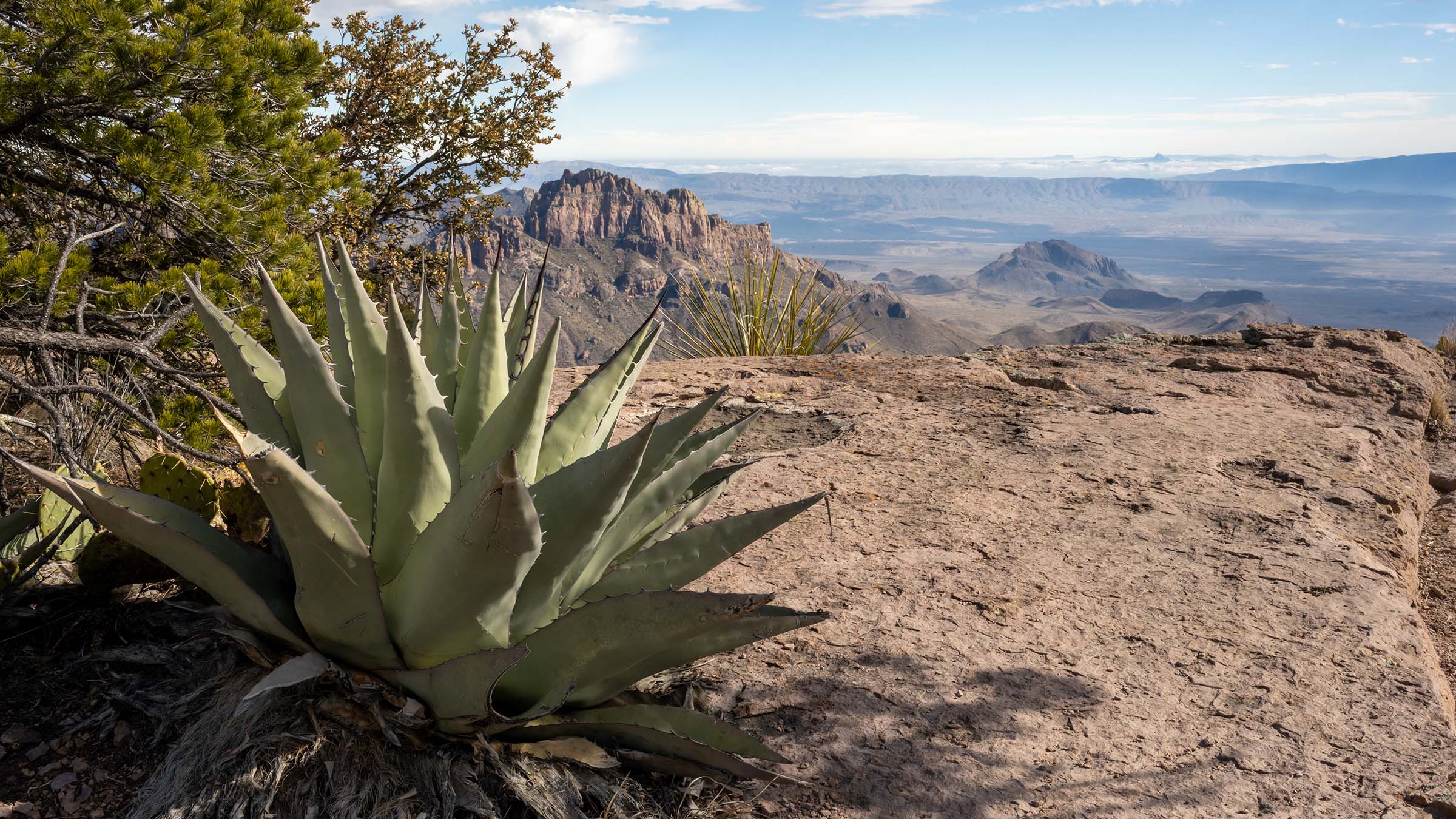
This trail can be deadly in the summer, since “temperatures run extremely high and the path lacks shade and water,” Claudia Arnberger of Big Bend National Park says. But it’s a perfectly pleasant overnight trip in the colder months. The climb spans cliffs, canyons, and plateaus over a 2,150-foot elevation gain and an incredible view of Sierra del Carmen and the Dead Horse Mountains. 12.3 miles; strenuous.
ADVERTISEMENT
Hike It: South Rim
This hike is a leg-burner, gaining and then losing nearly 4,000 feet of elevation over its 12-mile length. It also has almost limitless variations, allowing you to put together the loop of your choice. Beginning at the Window Trail Trailhead, follow the path, making two lefts in quick succession after about 250 feet. At the .3 mile mark, take the left-hand fork onto the Pinnacles Trail and follow it as it climbs towards the canyon rim, bearing left at the intersection at .8 mile. After about 3.5 miles, the trail splits; continue straight or turn right onto the side trail to bag Emory Peak—the highest point in the Chisos Mountains at 7,825 feet—with a 2.8-mile out and back.
At mile 4.6, you’ll pass Boot Spring, an unreliable water source that can vary from a miniature waterfall to a damp mark on the rock. (Play it safe and haul your own water.) Just a tenth of a mile later, hike straight at the intersection with the Juniper Canyon Trail. (Spending the night? The South Rim 4 site sits at just about the halfway point at mile 6.3.) At mile 6.5, you’ll reach a viewpoint on the canyon rim; stop and feast on views of the park’s expansive, rugged desert. Continue following the South Rim Trail to the T-intersection at mile 8, where you’ll turn left onto the Laguna Meadow Trail and begin your gentle descent. At mile 12, continue straight to the parking lot to complete the loop.
Porters Creek Trail, Great Smoky Mountains National Park
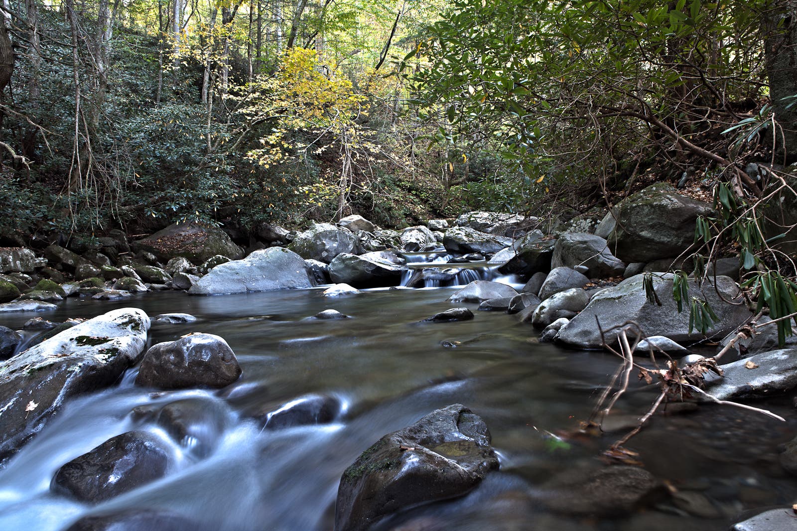
Great Smoky Mountains is the United States’ most popular national park, but go in winter and you won’t have to jockey for your spot. Reaching 2,600 feet in elevation, this trail remains fairly unaffected by road closures and winter snowstorms. Highlights include the Ownby Cemetery, an early 1900’s Smoky Mountain Hiking Club cabin and Fern Branch Falls, a beautiful 60-foot waterfall. 7.2 miles; moderate
ADVERTISEMENT
Hike It: Porters Creek Trail
Starting at the Porters Creek Trailhead, follow the eponymous rocky creek on an old gravel road as the trail gradually climbs. Keep an eye out for low stone walls, which are all the remains of the Elbert Cantrell farmstead from the early 20th century. Shortly afterward, you’ll pass Ownby Cemetery, final resting places for a dozen locals. Just before the 1 mile mark, you’ll cross a footbridge, then take a left at the fork to stay on the Porters Creek Trail, then take another left at a second fork a few dozen feet later. At 1.6 miles, cross a second bridge and continue deeper into the woods, as old-growth trees begin to take over the landscape. Catch the waterfall at the 2 mile mark. Once you’ve gotten your fill, retrace your steps to the trailhead or continue another 1.7 miles to backcountry campsite 31 (reservations and permit required).
Become an Outside+ member and read the full story today.