Updated March 8, 2024 10:52AM
The Definitive Guide to the Wonderland Trail
Get ready to trek around Washington's most iconic mountain, through some of the best scenery in the lower 48.
(Photo: Sierra Ducatt)
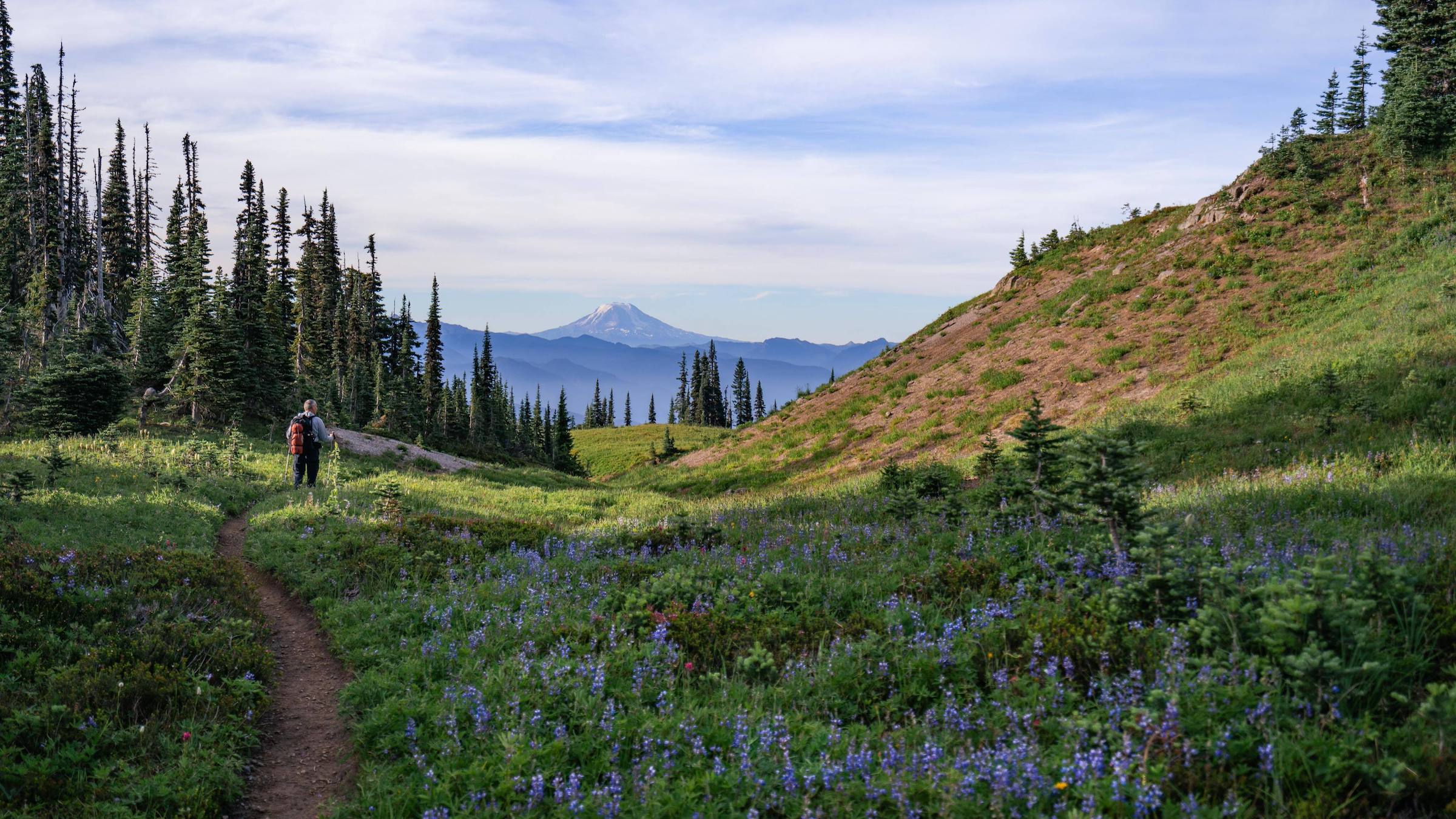
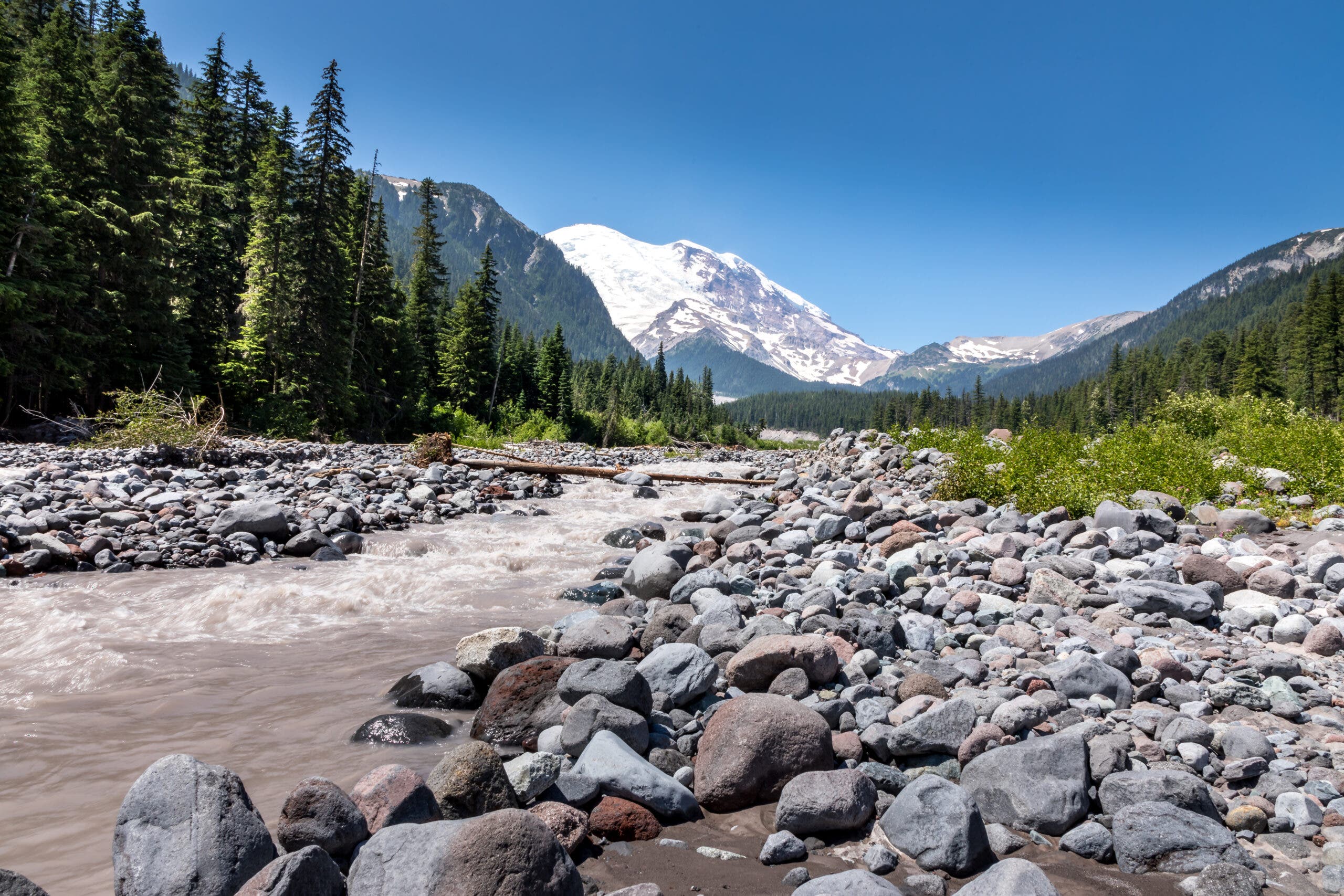
Imagine exploring both rainforests and vibrant mountain meadows within just a few miles on the same trail, all with a glacier-capped volcano rising in the background. That’s exactly what the Wonderland Trail is: a 93-mile (150 km) trek around Mt. Rainier, the most glaciated peak in the lower 48 states. Situated in the heart of Washington State, Mount Rainier National Park draws hikers ranging from local residents to out-of-state and international travelers. Whether you choose to hike the entirety of the Wonderland Trail or just wander in for a dayhike or two, a little advance planning will help you have the hike of your life on this postcard-worthy ramble.
Wonderland Loop Stats
Distance: 93-mile loop
Total Elevation: 24,939 feet
Daily Elevation Gain/Loss: 2,500-5,000 feet
Difficulty: Strenuous
Dog Friendly: No
Where is the best place to start?
There are three starting points where you can enter Mount Rainier National Park and access the Wonderland Trail. Be sure to check the park website for closures and other updates before you head out.
South Side:
- Southwest Entrance: Paradise Road starts here, and runs through Longmire and ends at Paradise. From Paradise, it meets up with Stevens Canyon Road which leads to the southeast entrance by Ohanapecosh.
North Side (access by car is more sparse here):
- Northwest Corner: Access the trail by Mowich Lake near the Carbon River entrance.
- Northeast Corner: Head to the Sunrise entrance and access the trail either by the Sunrise Visitor Center or lower down the road by White River Campground.
ADVERTISEMENT
How long will it take to complete the Wonderland Trail?
For the average backpacker, expect to hike between 7-14 days depending on how far you and your group are capable of hiking each day with a heavy overnight pack. Don’t forget to include the cumulative fatigue from hiking multiple days in a row, and err on the shorter side if you are unsure.
As a reference point, a 10-day adventure requires you to hike an average of nine miles per day whereas a two-week hike lets you cut down the mileage to about seven miles per day. This is a good baseline for how far apart you want your campsites to be. Use the Wilderness Trip Planner to help you sketch out your trip.
Quick tip: If you plan to be out longer than a week, it may be beneficial to store food midway at a food cache or have a friend meet up with you to help restock your supplies. Good places to do this are at Mowich and Sunrise.

ADVERTISEMENT
When is the best time to visit?
The most beautiful time to visit the Wonderland Trail is mid-summer when the snow has melted, the wildflowers are out, and the weather is stable and sunny. If you attempt the route before midsummer, you’ll need to be prepared for snow travel. The route’s highest point, the 6,750-foot Panhandle Gap, doesn’t melt out until late June or early July. Spring is also tricky because the snowmelt can create extreme flows that may damage bridges and trails and make them unsafe. In fall, the leaves start to change into golden hues but storms are common, and weather windows with no rain are rare.
Regardless of what time of year you hike, be sure to bring insulation and a rain shell; this is the PNW alpine—temps and weather are always variable. Stay up to date on trail and weather conditions on the park’s site.
Are permits needed to hike the Wonderland Trail?
For dayhiking, no permits are required other than the Mount Rainier National Park entrance fee or the Annual National Park Pass. If you choose to explore the Wonderland Trail on a multi-day trip, you’ll need a wilderness permit to use any of the 18 campsites next to the trail year-round. These permits are available on a lottery system, which opens each February. These permits are competitive—read more about the parameters on the permit website.
ADVERTISEMENT
How do you reserve campsites?
The best method for reserving campsites for your hike is through the lottery system, open from mid-February to early March every year. Successful applicants will have an early reservation opportunity between late February and early March. Although 1,800 applicants will be given a window to reserve, only 600 Wonderland thru-hikes are available during this early reservation period, meaning it’s still competitive even if you win the lottery. It helps to have your ideal camping itinerary ready early so you know when and where you want to stay and can make your reservations as soon as possible.
Following the lottery, the remaining campsites open for reservations in late April. Outside of that, it is possible to piece together the remaining campsites, although you may have days of uneven hiking lengths—a 2-mile day and then a 15-mile day, for example—if you cannot get your ideal campsites. There is often more availability for partial Wonderland Trail backpacking trips.
Wonderland Trail: Section by Section
This is an overview of the trail going clockwise starting at Longmire, although any other starting point and direction can work too. No matter where you are on the trail remember to follow Leave No Trace principles and stay on the proper trail to avoid damaging off-trail areas, including the wildflower meadows which are extremely fragile.
ADVERTISEMENT
Longmire to Carbon River
The westerly stretch from Longmire to Carbon River is filled with deep forest walks, glacial rivers, and colorful subalpine meadows. The trail begins by meandering through the forest and past Rampart Ridge—a worthy 1.5-mile detour for amazing views of Rainier. After a climb and short descent into the Kautz Creek Basin, you’ll reach Pyramid Creek Camp, a great place to rest before heading up another long ascent to Devil’s Dream Camp. As you continue past the field of purple lupine flowers surrounding Squaw Lake, you’ll find yourself at Indian Henry’s Hunting Grounds. This area has one of the most photogenic views of Rainier with an open subalpine meadow and old-school ranger patrol cabin.
If you can peel yourself away from the bewitching meadows, the moderate trail will take you to the famous Tahoma Creek Suspension Bridge, the longest bridge in the national park. The swinging bridge is a jaw-dropping airy crossing above the glacial melt river and not for the faint of heart. A short climb brings you up and around Emerald Ridge for a great view of Glacier Island, a mass of rock rising from the Tahoma Glacier. Enjoy another rich meadow before descending back into the forest to the South Puyallup River Camp. Just a short few minutes walk further and you’ll get a view of the unique Devil’s Pipe Organ, a conglomerate of columnar lava cliffs.
Take a break at mile 18 at the aqua-blue St Andrews Lake before heading on to Klapatche, one of the most beautiful campsites along the trail. It boasts another green-blue lake and a subalpine view of Rainier. This is a prime tent spot for the sunset alone, which lights up Rainier at dusk.
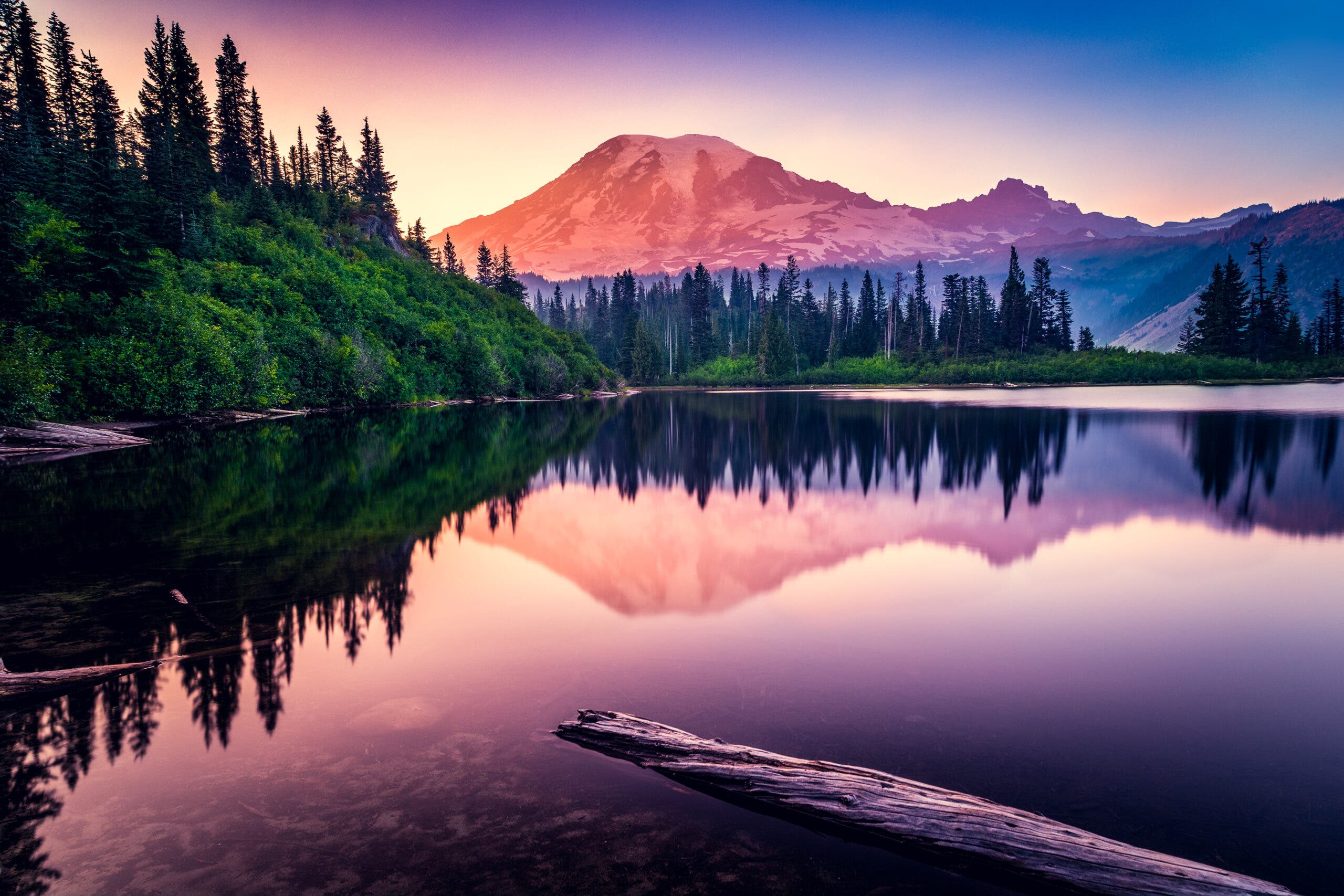
The next section through the North Puyallup River Camp makes for a great autumn hike, with blueberry bushes along the trail and the mountain ash turning a spectacular golden yellow. Continue on to the campsite at Golden Lakes. The Sunset Park Patrol Cabin is located here and if you wander a little, you can find yourself an iconic sunset lake reflection view of Rainier.
Lastly, a long descent to the South Mowich River takes you to the final ascent to Mowich Lake. Be careful crossing the river. Sometimes a log bridge will take you across and other times, you may need to pick your way through the silty rocks. (Trekking poles are a great idea here.)
ADVERTISEMENT
Mowich to Sunrise
This northerly section has a large variety of scenery. You’ll experience wide-open river beds created by the melting glaciers, fields of wildflowers, and a vast, outer space-like ambiance of monochrome ash formed by an andesitic lava flow.
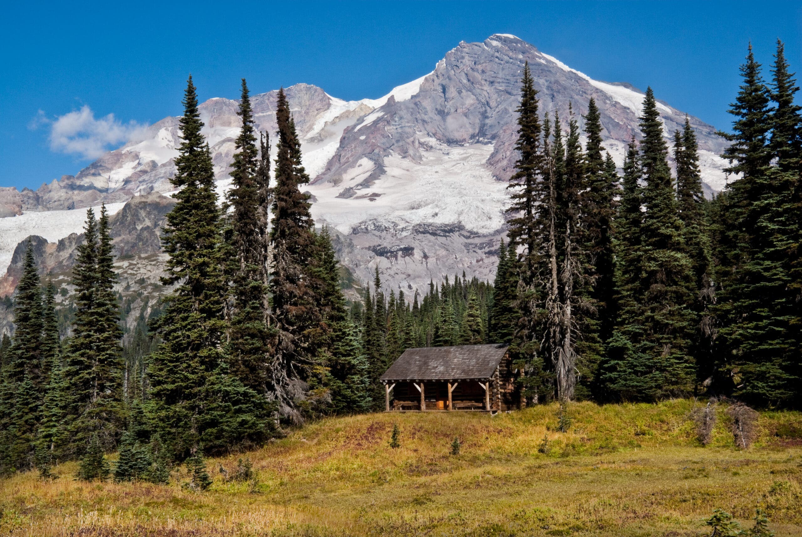
Take some time to restock with your food cache at the patrol cabin, catch up with friends over lunch by the picnic tables, or take a stroll around the many trails. Tolmie Peak Lookout has one of the best vantage points of Rainier. Eunice Lake below is teeming with wildflowers. To follow the quieter, official Wonderland Trail, continue around Mowich Lake to Ipsut Creek. Or, if you don’t mind the busier alternate route, hike through Spray Park, a wildflower paradise.
Ipsut Creek Camp is not too far from Mowich and offers a lowland experience by the Carbon River. Walking along the Carbon River, you’ll cross another incredible suspension bridge, albeit shorter than the Tahoma Creek bridge. Soon, you’ll climb out of the river bed and pop out to Mystic Lake, which hosts another campsite and ranger station. The lake is a welcome sight with Old Desolate, a lonely mountain towering 1,000 feet above the lake, making for a slight change in background. Situated between the Carbon Glacier and Winthrop Glacier, Mystic Lake is a little fertile oasis nestled amongst trees.
From the Mystic Camp, walk near the foot of the Winthrop Glacier before passing the Granite Creek Camp with more views of Rainier. You’re in for a treat as you head towards Sunrise (the northeast entrance of the park) with views that are other-worldly. The Burroughs Mountains have a moon-like quality to them, barren unlike any other section of the Wonderland Trail, but are surrounded by some of the most vibrant wildflower meadows.
Sunrise has many side trails and camps to choose from that are slightly off the main Wonderland Trail. You can watch summit climbers find their way up the Emmons Glacier or watch the sunrise from the Insta-popular Mt. Fremont Lookout. Despite the name, Sunrise is a great location for sunset in the summer because the sun sets far enough north to put on a beautiful display on both Rainier and the fields below.
ADVERTISEMENT
Sunrise to Longmire
It may be hard to leave the diverse landscapes of Sunrise, but some quieter yet still stunning sections of the Wonderland Trail are coming. Pass the White River Campground and pick up the trail as it follows Fryingpan Creek up to Summerland. Wander through a dense forest of fir, spruce, and hemlock as you climb to the Summerland Camp, where the trees become sparse again and green grass carpets the ground.
Before long, the luscious green will transition briefly into the dry moon-like landscapes at Panhandle Gap. As you crest the gap, the views will open up beyond Rainier and all the way down to Mt. Adams with rolling ridges ahead. Quiet and beautiful, this is a favorite spot for many hikers. Soak in the scenery of the Ohanapecosh glacial moraine until you reach Indian Bar. Don’t forget to take a look at the waterfall on the Ohanapecosh River before passing through.
Next, traverse along the Cowlitz Divide and enjoy a few-mile stretch of magnificent views with Rainier as the main backdrop. At the bottom of the ridge, you’ll end up at Nickel Creek and another section of forest.
Save some time to take a few pictures at Box Canyon, a narrow slot canyon tumbling with whitewater, before you cross Stevens Canyon Road to follow Stevens Creek uphill. Along with Maple Creek Camp, you’ll pass over bridges and past waterfalls, like the 125-foot Martha Falls and fan-shaped Sylvia Falls. Reflection Lakes and Louise Lake are great places to stop for lunch and though there may be more visitors in this area, the views of Rainier are hard to beat.
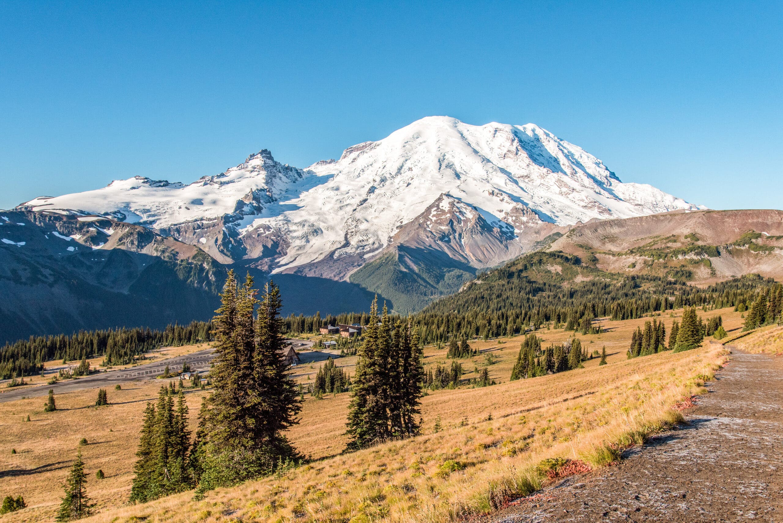
While you can take a longer detour to visit Paradise, Longmire, and the end of the Wonderland Trail, is but a few miles away. Finish it up with a nice descent along Paradise River, with the babbling water flowing alongside the trail as you pass the hustle and bustle of Cougar Rock Campground. The trail will deposit you back at Longmire, where you can kick back in one of their outdoor wicker chairs and pat yourself on the back for the successful thru-hike.