Updated July 1, 2025 05:27PM
Hike the Least-Visited National Park in the Lower 48 on Isle Royale's Greenstone Ridge Trail
See plentiful wildlife and few people on this 41-mile hike.
(Photo: Posnov / Moment Open via Getty)
Hiking any national park is an adventure, but hiking Isle Royale—the Lower 48’s least-visited park, located in the middle of Lake Superior—is on another level. Want to see it for yourself? We’re sharing this story on hiking the park’s classic Greenstone Ridge Trail for free. Members can read our full-length round-up of this and 9 other perfect ridge-hiking adventures right now. Not a member? Sign up today.
- Distance: 42 miles
- Time: 3-5 days
- Elevation gain: 4,320 feet
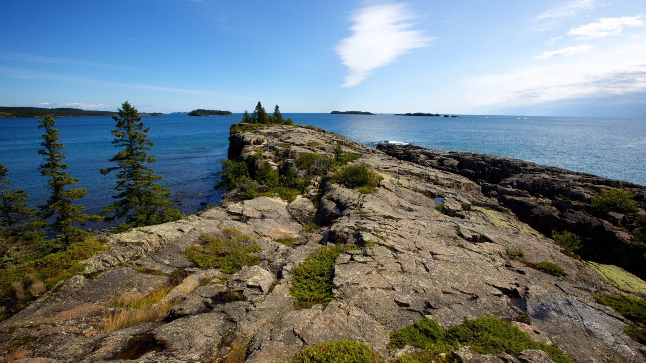
This boat-access-only weekend or weeklong point-to-point has it all: Wildlife, Great Lakes views, and solitude. And it’s understandable: Serious elevation gain, length, and the ferry ride required for access keep the crowds away. For those willing to brave the hurdles, though, Greenstone Ridge is a life-list-worthy trek. After the seven-hour ferry ride (bring a book, or maybe a pillow), most hikers start from the east end of the island, following the rocky spine of Isle Royale through thick forests and grassy meadows. Remote, little-visited lakes dot the crest, perfect for a quick dip on a hot summer day. In late summer and fall, berries line the trail, providing snacks by the handful. On the trail’s high points you can take in panoramic views of Lake Superior and the isle itself, with sightlines stretching unimpeded to the lakeshore 50 miles away.
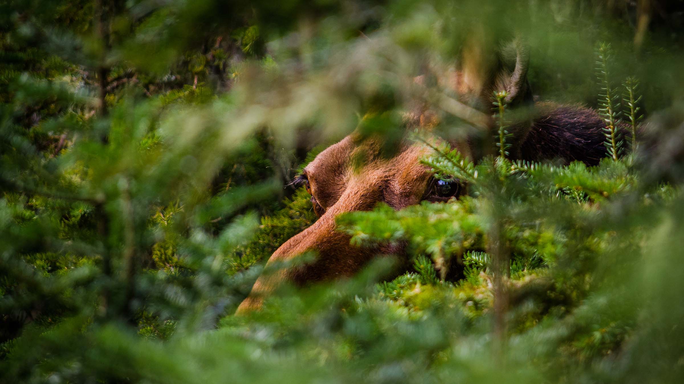
One of the best parts of the Greenstone Ridge hiking experience, though, is the wildlife. A pack of wolves roams from one end of the island to another, their eerie howls rising to greet the moon on many nights, and lucky hikers can spot moose feeding at inland lakes. With the wolves as their only predator, the moose population is mostly controlled by winter vegetation scarcity. Keep an eye out for one or more as you hike past ponds below the ridge crest.
ADVERTISEMENT
The Trail
From Rock Harbor (the ferry stops here), start your climb in boreal forest on the way up the ridge, which dips from 280 to 800 feet above the waters of Lake Superior as it crosses over six different peaks. Nine different campgrounds along the route offer an array of possible stopping points for each day, depending on how much daily mileage you want to cover. Many hikers finish a short (3 mile) day 1 at Three Mile Campground, where you can pitch your tent right on the shore of Lake Superior. Eleven miles from Three Mile Campground is Chickenbone Lake, another great camping spot. For hiking days that max out just over 10 miles, Lane Cove, Hatchet Creek, and Island Mine make good nightly stopping spots. Make sure to check the ferry schedule and time your arrival at Windigo, the western terminus, to coincide with the ferry you want to catch.
Royale Resupply
If there’s anything more chilling than showing up at the trailhead and realizing you forgot something important, it’s doing the same thing on an island wilderness. Luckily for those of us who are prone to lapses of memory at the worst time, the Rock Harbor Store (open from May 22 to September 11) carries a small variety of grocieries, freeze-dried food, camping supplies, and various sundries, as well as offering showers and laundry.
ADVERTISEMENT
What is Greenstone, Anyway?
The Greenstone Trail traverses a ridge made of basalt, erupted from a series of rifts in the Earth’s crust 1.2 billion years ago. The spineIsle Royale was forced upward by a later fault system, pushing the old volcanic rock above the deep basin of Lake Superior. The distinctive pattern of parallel ridges seen in the basalt today was further exposed by repeated glaciation between 1 million and 10,500 years ago, which also left the striation marks that hikers can now see on some rock slabs on the island. The ridge pattern continues beneath the water, then re-emerges on Michigan’s Keweenaw Peninsula.