Published August 12, 2022 04:42PM
Originally posted onOutside Online
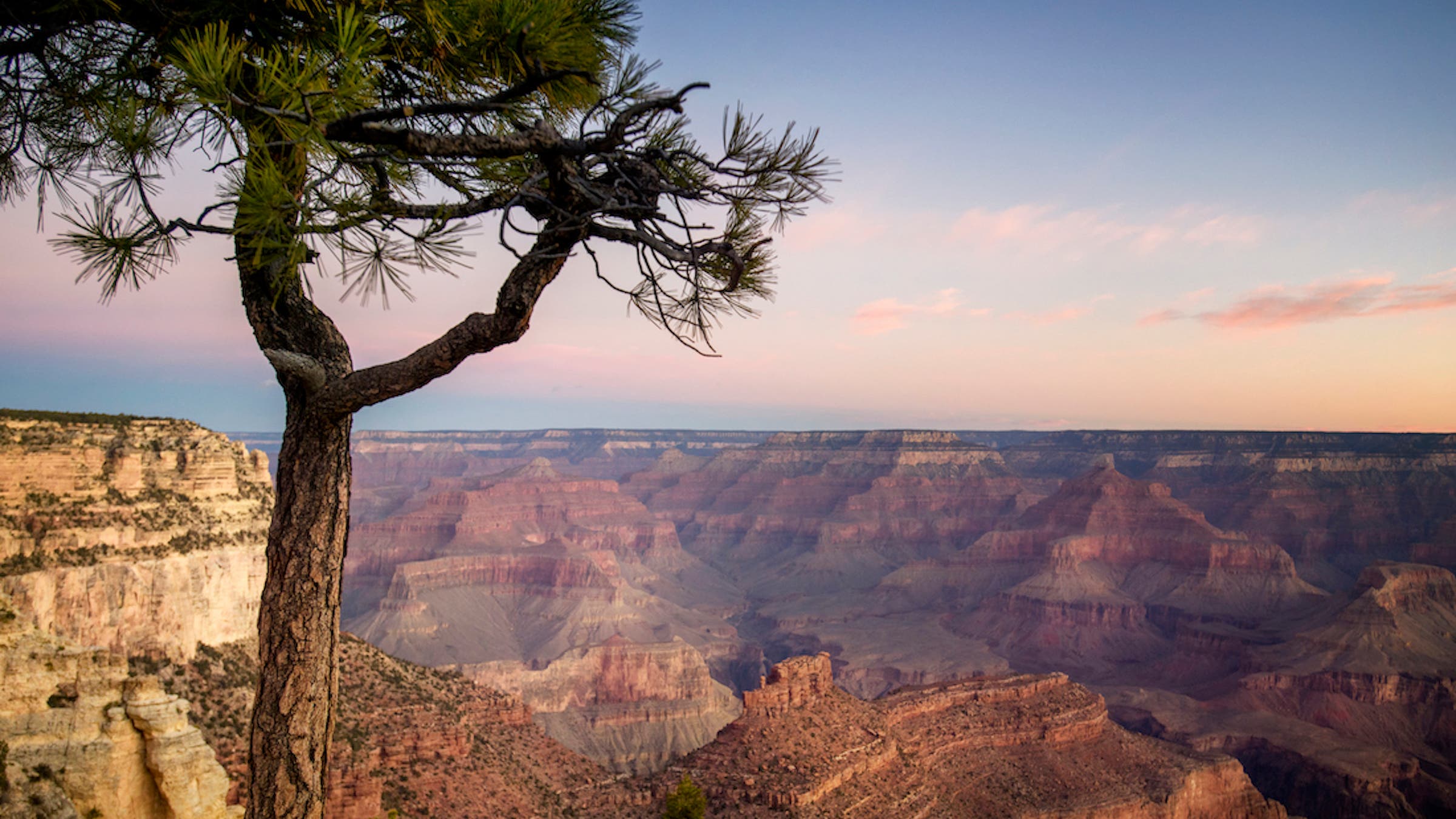
Grand Canyon Hikes: 11 Trails to Add to Your Bucket List
Want to hike without crowds? See jaw-dropping vistas without torching your quads? Check out these dayhikes and backpacks.
From our partners at Backpacker Magazine.
Getting ready for your first trip to the iconic Grand Canyon and not sure where to hike? We’ve got your back. The Big Ditch has a lifetime’s worth of trails to choose from, from mesatop vistas to riverside rambles past bright orange and red layers of geologic history. But, we’ve narrowed it down to the park’s 11 best hikes. From family dayhikes to week-long adventure treks through remote backcountry, there’s sure to be something for your next trip.
Best Dayhikes in the Grand Canyon
Best North Rim Scramble: Monument Point to Esplanade
Length: 9.7 miles
Elevation gain: 2,850 feet
Route type: Out-and-back
Difficulty: Very difficult
This wild route drops off the remote North Rim through an abundance of cactus flowers before heading into slickrock scrambling. From the juniper-lined Bill Hall Trail, clamber down an exposed traverse and then another sandstone ledge (make use of the abundant handholds) before emerging on the Esplanade, an open slickrock plateau perched between the rim and the canyon floor.
ADVERTISEMENT
Best Mountain Views in the Grand Canyon: North Kaibab Trail
Length: 8.1 miles
Elevation gain: 7,823 feet
Route type: Out-and-back
Difficulty: Difficult
Drop from the North Rim for views of the San Francisco peaks on this out-and-back. There are a couple spots on this trail to get away from the desert sun: the 20-foot-long Supai Tunnel, an impressive hole right through a protruding section of the canyon wall, and Roaring Springs, where water rushes right out of the cliffside.
Best Views from Inside the Canyon: Skeleton Point
Length: 6.6 miles
Elevation gain: 2,935 feet
Route type: Out-and-back
Difficulty: Moderate
Though it starts from the busy South Rim, this hike quickly descends to a midcanyon viewpoint where the most noise you’ll hear is from the wind and the river far below. With views down to the river and up canyons in every direction, Skeleton Point is the perfect perch to take in the size of the Grand Canyon.
ADVERTISEMENT
Best Easy Dayhike in the Grand Canyon: Widforss Trail
Length: 10 miles
Elevation gain: Less than 500 feet
Route type: Out-and-back
Difficulty: Moderate
This trail is a rare flat path in the Grand Canyon. Winding along the North Rim, the Widforss Trail takes in panoramic views of Wotan’s Throne and Zoroaster Temple, as well as the distant San Francisco peaks. Bonus: This path through evergreen and aspen forest stays nice and cool while the desert below bakes.
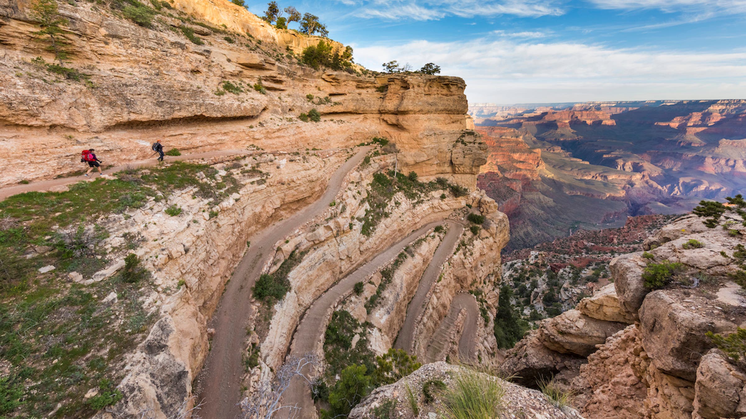
The Classic Grand Canyon Dayhike: Bright Angel Trail
Length: 18.4 miles
Elevation gain: 4,249 feet
Route type: Out-and-back
Difficulty: Moderate
The Bright Angel is a choose-your-own-adventure trail jam-packed with amazing views from start to finish. You don’t have to do the full 18.4 miles to have a spectacular hike here: You’ll pass by an orchid-dotted oasis and several petroglyph panels in just the first 5 miles. Feeling ambitious? The trail continues all the way to the canyon floor, where you can link up with the rest of the Rim to Rim trail.
ADVERTISEMENT
Best Overnight Trips in the Grand Canyon
Best Grand Canyon Overnight for Solitude: Powell Plateau
Length: 8.2 miles
Elevation gain: 1,968 feet
Route type: Out-and-back
Difficulty: Moderate
Looking to escape the crowds at the Grand Canyon? You’ll find solitude on this out-and-back to Powell Plateau, a remote, pine-forested tableland that rises a mile above the Colorado River near the canyon’s North Rim. It’s only 2.5 miles from the trailhead to the plateau, but you’ll want to spend a couple days exploring the secluded trail along the rim, where the ponderosas open to views deep into the main cabin and several narrow side chasms.
Best Overnight to the Bottom of the Grand Canyon: Yaki Point to Phantom Ranch
Length: 12.7 miles
Elevation gain: 5,916 feet
Route type: Out-and-back
Difficulty: Moderate
Lace up at the South Kaibab trailhead and immediately descend into the belly of the Grand Canyon’s South Rim. Along the way, the route passes O’Neill Butte and Skeleton Point. At the bottom, cross Black Bridge, a suspension bridge over the Colorado River, and head west toward Phantom Ranch and the mouth of Bright Angel Canyon.
ADVERTISEMENT
Best Off-Trail Overnight in the Grand Canyon: Deer Creek Loop via Cranberry Route
Length: 24.4 miles
Elevation gain: 7,805 feet
Route type: Out-and-back
Difficulty: Very difficult
Rule #1 in the Grand Canyon: Leave the trails, and you lose the crowds. Rule #2: Hiking cross-country in the Big Ditch is really, really hard. This challenging loop has significant off-trail portions, and we strongly suggest only backpackers with at least five or so years of experience, class 4 climbing skills, and solid map technique attempt it. But the payoff is a park that few hikers get to experience. With no established trails or campsites through much of the route, the chances of spotting wildlife, such as bighorn sheep, are much higher, and you can enjoy panoramic views of sandstone cliffs and the sheer drop to the Colorado River below.
Best Classic Grand Canyon Overnight Trip: Rim to Rim Trail
Length: 23.3 miles
Elevation gain: 15,692 feet
Route type: Out-and-back
Difficulty: Difficult
Whether you camp on the opposite rim and return the next day, or split the route into a two-day point-to-point with a tentsite beside the Colorado River, the R2R is a trail on many ambitious hikers’ life lists. The views from the canyon bottom to the rim will more than make up for the burning in your legs on this hefty hike.
ADVERTISEMENT
Best Multiday Overnights in the Grand Canyon
Best Point-to-Point: Grandview to South Kaibab via Tonto Trail
Length: 26.7 miles
Elevation gain: 9,744 feet
Route type: Out-and-back
Difficulty: Difficult
Descend roughly 4,000 feet in only 2.5 miles of switchbacks from Grandview Point to Horseshoe Mesa, a boomerang-shaped mesa with pocked Redwall Limestone cliffs. And that’s just day one. The next morning, trace the rim of the ever-deepening canyon to the Tonto Trail, with fantastic mid-canyon views every step of the way. Looking toward the North Rim, you can spot Wotans Throne and Vishnu Temple. On the last day, climb back to the South Rim on the South Kaibab Trail and watch the park open up around you with each switchback.
Best Grand Canyon Tour: Hermit’s Rest to Phantom Ranch
Length: 40.2 miles
Elevation gain: 14,863 feet
Route type: Out-and-back
Difficulty: Difficult
Start with the overarching canyon views at Hermit’s Rest, then drop into the canyon toward a roaring set of rapids on the Colorado River to start this route, then continue on a tour of just about everything the Grand Canyon has to offer. From the river, climb back up to the Tonto Plateau for panoramas of canyon country, then head into unexpectedly verdant oases of the Bright Angel Trail.
ADVERTISEMENT
Grand Canyon Skill: Scrambling
Some of the best terrain in the Grand Canyon requires a bit of near-vertical know-how. Start with a good pair of shoes: sturdy boots or trail runners with a sticky rubber sole. Pack the heaviest gear closet to you in your pack so the weight won’t swing you around. Always test every hold or boulder before committing to the step—much of the rock here is less than solid—and always make sure you plan your route before beginning your ascent or descent.
Hiking Safely in the Grand Canyon
There are two things Grand Canyon visitors consistently underestimate: hiking difficulty and heat. Don’t make the mistake of thinking that being in good shape automatically makes you heat-immune. Some of the most common victims are young and fit. Here’s how you can stay safe on your next trip:
- Make sure you are in good shape before planning a hard hike.
- Know your limits for elevation gain/loss, mileage.
- Prepare for trail challenges, such as scrambling and off-trail navigation.
- Aim to hike early or late in the day when the heat isn’t as oppressive, especially if you’re visiting in the summer.
- Carry 5 to 6 liters of water per day per hiker.
- Find out if there are water sources and emergency phones along your route.
- Give your itinerary to a designated person back home before you hit the trailhead.