Trail Report: Aero Lakes, Beartooth Mountains, MT


Trail: Aero Lakes, Beartooth Mountains, MT
Distance: 11.9 miles
Submission: Brent Umphlett
Difficulty: difficult
Duration: 4 days
Rating: 4/5 stars
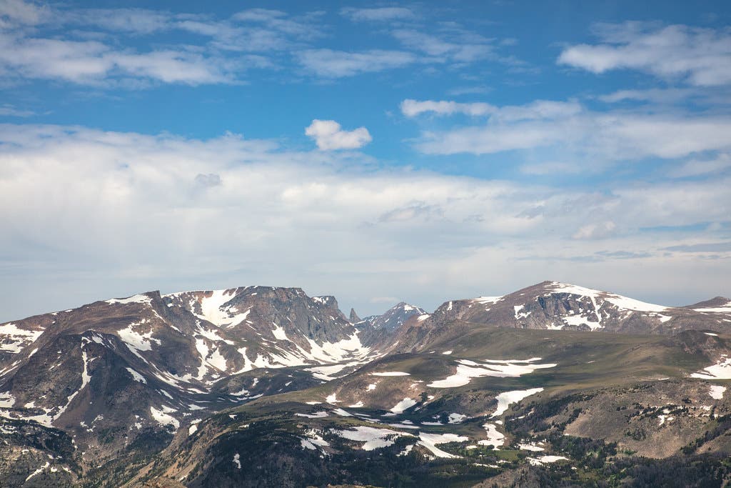
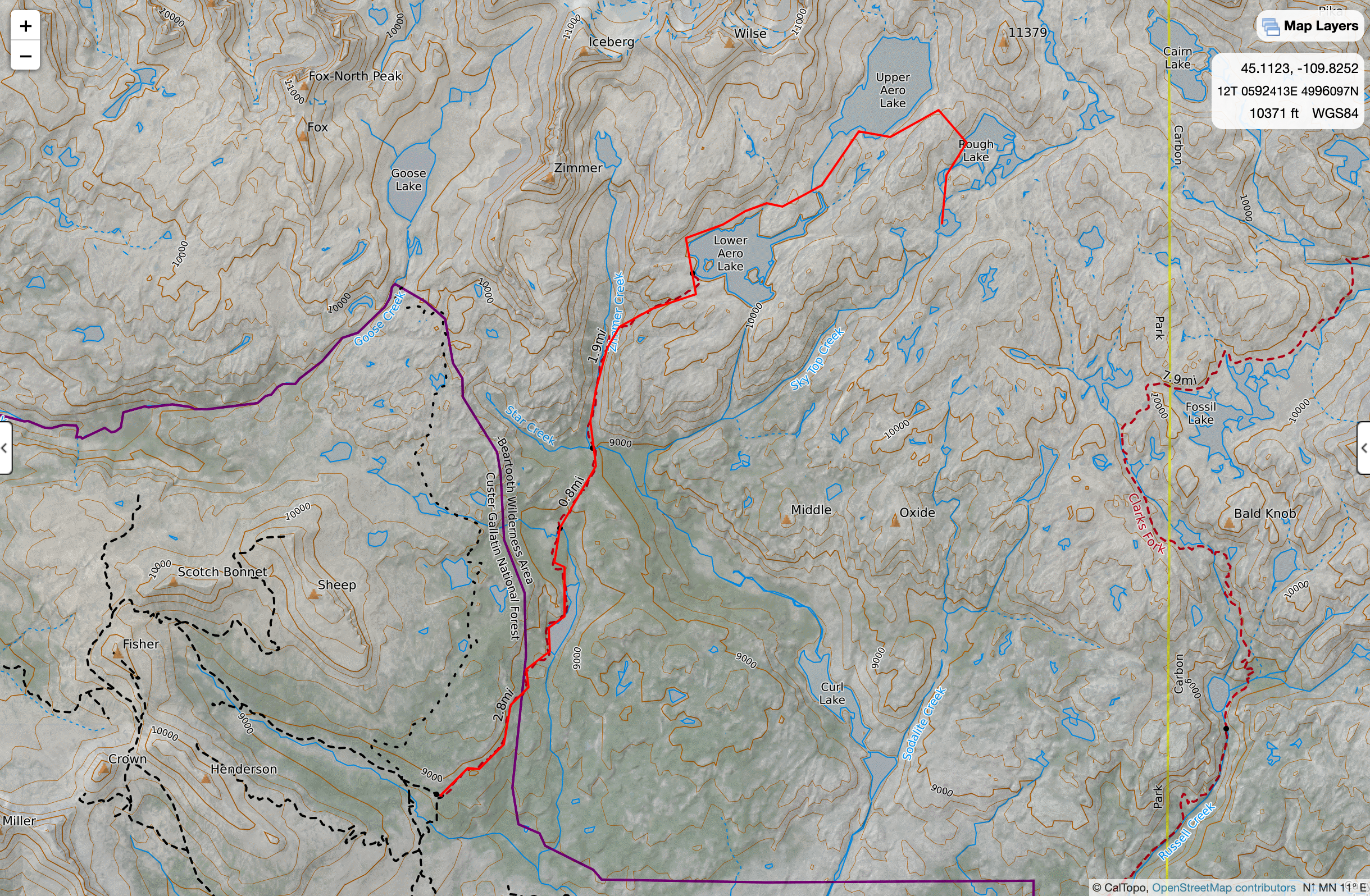
In late July 2019 my brother and I headed into Montana’s Absaroka-Beartooth Wilderness for a four-day backpacking trip. We’d been trying for the trip for two years but were stopped by persistent snow every time; last summer we decided to just go for it anyway. Starting from the upper Lady of the Lake trailhead, we encountered our first challenge where Star Creek and Zimmer Creek met. An unmarked trail junction just before a narrow alpine meadow left us scratching our heads, unsure which was the trail to Aero Lakes. After a bit of thought we went straight, following the more-developed trail. When that trail started following a creek, we consulted the map again and realized we had taken the wrong fork. Backtracking, we went left at the original junction, climbing towards the bare-rock peaks and cirques occasionally visible above the trees. At mile tk we spotted the cairn on the other side of Zimmer Creek marking the path to Aero Lakes and hopped boulders across the water. It was only a few minutes into the new trail that we realized the easy creekside hiking was over. We gained about 900 feet in a mile over loose scree and boulders, which we would realize on the way down was actually one ravine over from the actual trail (the trail still tackles the same climb, but with slightly better footing). Despite the route snafu we still reached Lower Aero Lake about 6 hours after leaving the trailhead. A point on the southern end of the lake only just fit our two-person tent, but the tight fit was well worth it for the views; Glacier Peak, Mt. Villard, and The Spires, all draped with lingering snow above the wind-ruffled gray surface of the lake. Below our tent a steep slide of bare rock and snow dropped straight to the water.
On day 2 we woke to a thin skin of ice over most of the lake. Firing up the stove for breakfast, we decided to stick to our original plan despite the cold; climbing up to Upper Aero Lake. With no obvious trail upward visible from our campsite, we circled the lake to consult with some other backpackers, eventually following the upper lake’s outlet stream past two waterfalls and into the basin of Upper Aero Lake. The lake was a bright cobalt, nestled in a dip seemingly scooped from the Beartooth’s metamorphic core rocks and framed by rock and scree sloping up to the summits of the surrounding mountains. On day three we returned to Upper Aero Lake, then scrambled over scree and snow to nearby Rough Lake, Shelter Lake, and Lone Elk Lake. Both lakes were dropped into depressions in the rock like Upper Aero Lake, though each gave us a different view of the mountains we had seen from our camp. On day four we hiked back out (following the actual trail down from Lower Aero Lake this time), more than satisfied with our days of wandering among big mountain lakes and lingering snowfields. We’d finally seen the Beartooths.
