Published December 10, 2021 04:35PM
These 7 Magnificent Mountains Are the Best Summit Hikes in America
No, they aren't Everest, but these soaring summit hikes will make you feel like you're standing on top of the world.
(Photo: Sierralara/RooM via Getty Images)
There’s no feeling in the world like standing on top of a new summit, taking in a 360-degree view of peaks and valleys you’ve never seen before. Some mountaintops are gentle and rounded, looking out over patchwork farms and fields beyond a drop of forested foothills; some are crags barely wide enough to fit one hiker, with sheer drops and glaciers at every edge. No matter the degree of topography or the geology beneath your feet, though, every one is special.
But there are some summits that are just a cut above the rest, the life-listers, the moments you tell every fellow hiker or even mildly-enthusiastic bystander about at every bar and party for decades to come. Some, you’ll need to rope up for; others you can visit with just a pair of hiking boots and a pack. In the right conditions, these seven summits are some of latter: the best mountaintop hikes in the whole country. Grab your boots, pack, and camera, and check out our guide to get climbing.
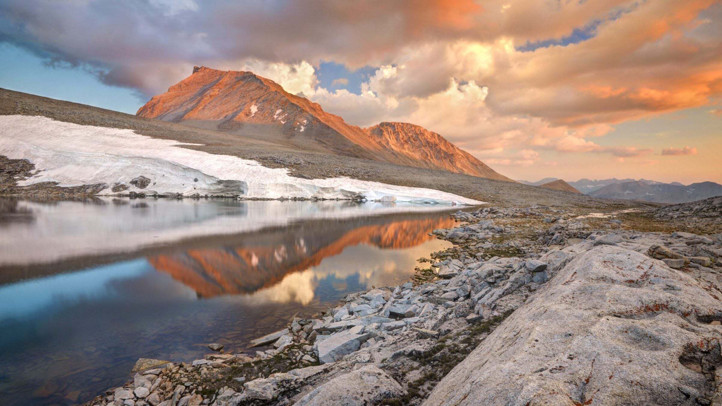
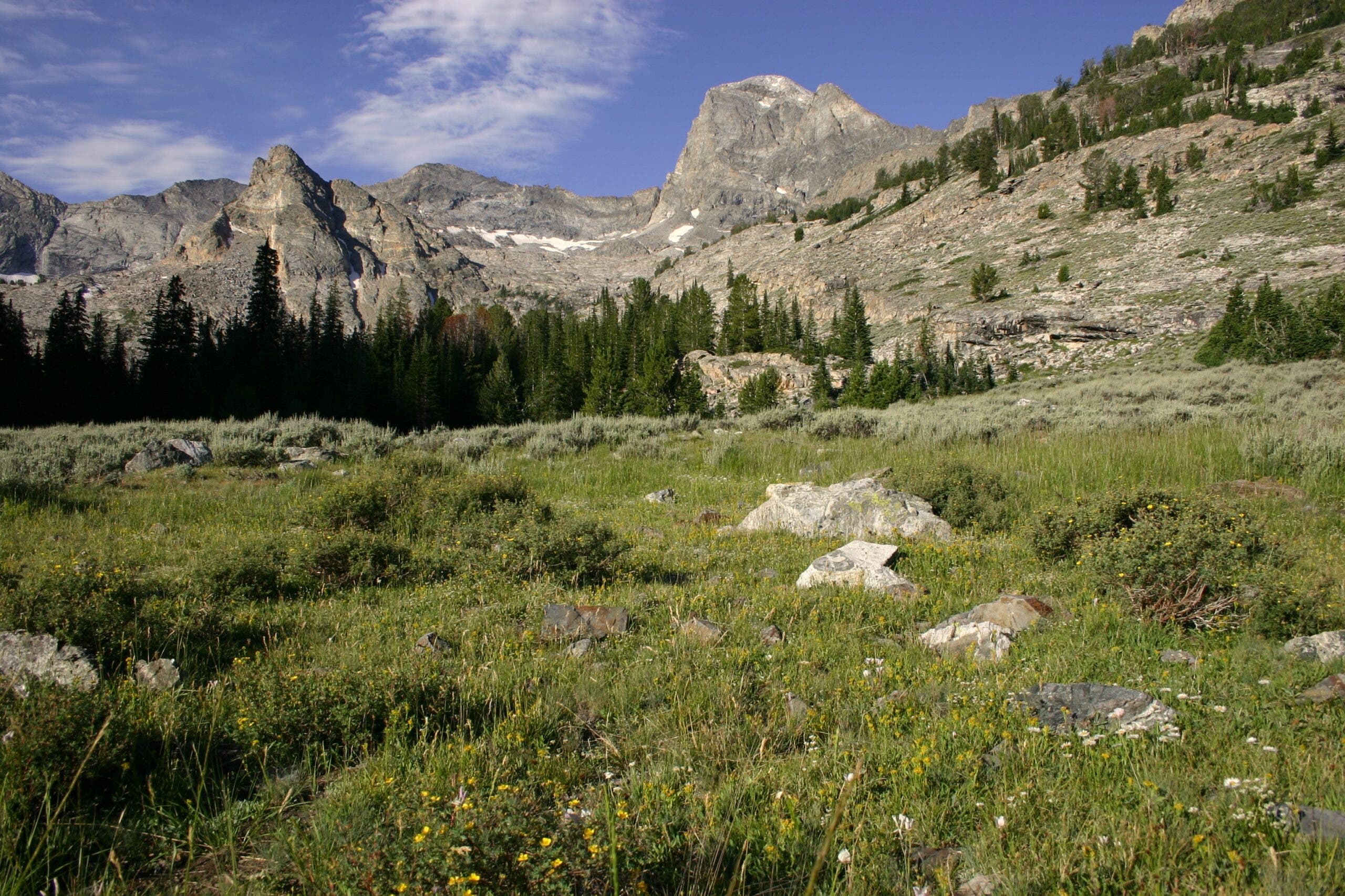
Snowmass Mountain, Colorado
“This is one of the truly classic places in Colorado,” says Gerry Roach, author of Colorado’s Fourteeners. “I love how the summit, which lies in the heart of a wilderness, isn’t visible from any road.” One of the most rugged of Colorado’s famous Fourteeners also is one of its most remote—a marvelous combination for backpackers, especially when the mountain’s east side offers stupendous scampering up a ridge that’s “always interesting but never desperate,” according to Roach.
This route is best done as a weekend trip, leaving you plenty of time to linger in the views from your camp at Snowmass Lake. Nestled among an amphitheater of 13,000-foot peaks and 12,000-foot ridges, the lake—itself at an elevation of 11,000 feet—is an excellent place to pitch camp and prepare for the day of climbing ahead. The scramble to the peak starts from the far shore, traversing snowfields and scree slopes with increasingly expansive views of the Rockies until the final climb to the summit.
ADVERTISEMENT
The Trail
Start from the Snowmass Creek Trailhead. Head south on the Snowmass Creek Trail, passing through a few cattle gates. At the first junction at mile 1.5, stay left on the Maroon-Snowmass Trail. At mile 4, take in your first good view of Snowmass Mountain up the Bear Creek drainage. At mile 6 is a sometimes-tricky crossing of a log jam through a pond. At mile 7.7, go straight at the junction to reach Snowmass Lake at mile 8. Camp near Snowmass Lake (at least 200 feet from the water), then ascend a nasty scree slope to the mountain’s large namesake snowfield, which you’ll climb to a rounded protrusion below Snowmass Mountain’s southeast ridge. Continue to the summit ridge at 13,700 feet. The most exciting part comes in the final quarter mile of climbing when you have to scramble to the summit (mile 10.3) using hand- and footholds.
Challenge factor: Moderately high. There’s some exposure along the summit ridge. Bring trekking poles (or an ice axe) to traverse the lower snowfield. Beware that the snow can turn icy in September and can freeze solid during cold spring mornings, requiring crampons and an ice axe.
ADVERTISEMENT
Humphreys Peak, Arizona
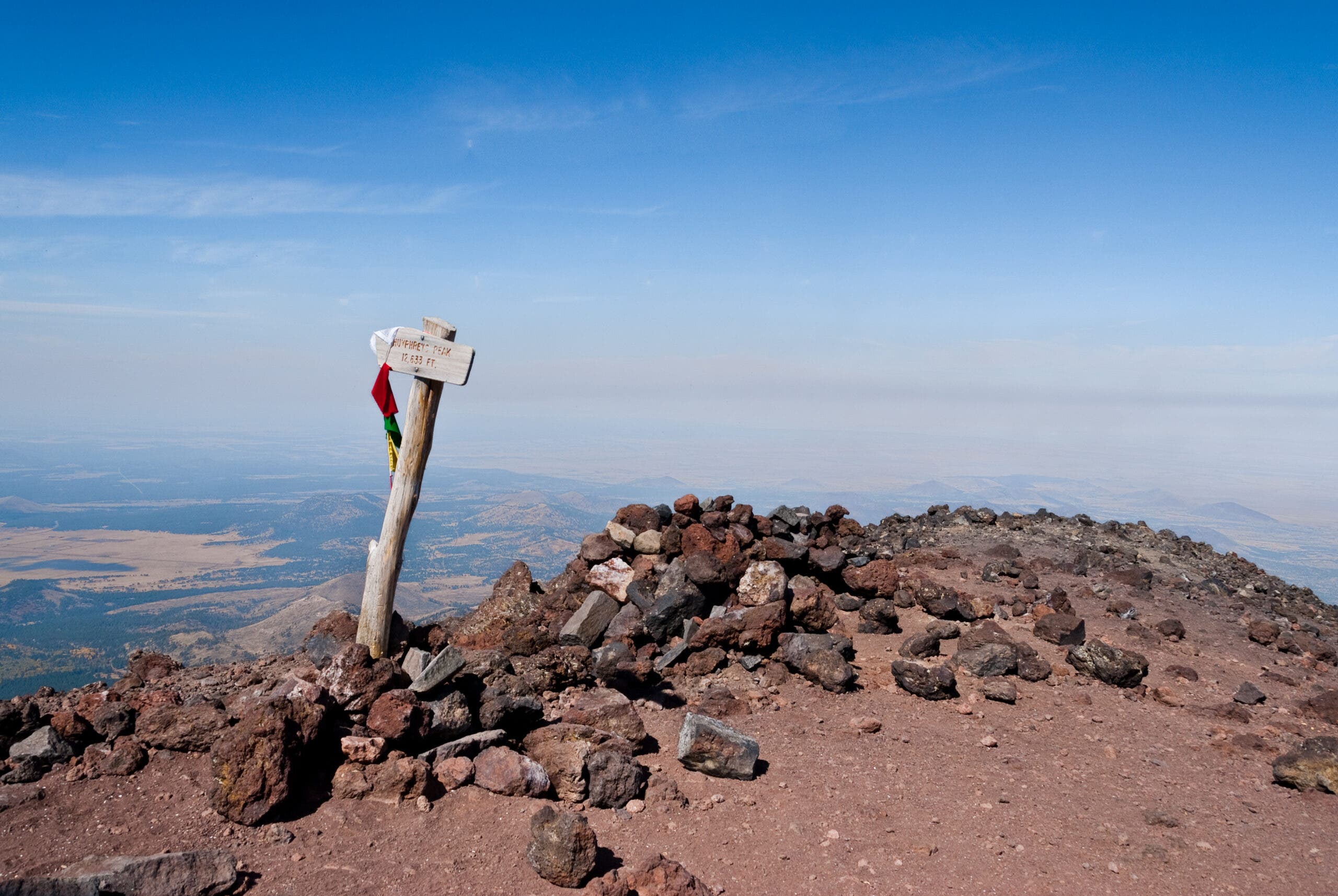
“I’ve been up this peak probably 100 times,” says Bruce Grubbs, author of Hiking Northern Arizona. “For me, the highlights are the distinct life zones you climb through on the way-the theory of life zones was coined here back in the 1880s-and the last mile you walk along the rim of the collapsed volcano. Up there you can see well beyond 100 miles. It’s like looking out the window of an airplane.” So strikingly does this highest peak in Arizona rise from the surrounding desert that the Navajo considered this one of the “pillars of the sky.” For an experienced backpacker, the ascent makes an exciting climax to a two- to three-day circuit around lower mountains and along the rim of the exquisite Interior Valley.
While the climb from desert scrub to boreal forest to tundra is rightfully a highlight of this climb, the views from the summit are nothing to sneeze at either. Beyond the surrounding peaks and Sonoran Desert, on a clear day you can catch a glimpse of the Grand Canyon in the far distance.
The Trail
Start from the Kachina Trail trailhead. Head south for half a mile, then continue straight through three consecutive intersections. Stay straight at the next intersection as well, at mile 3.1 (this also makes a good bailout trail if needed). Continue on the Kachina Trail until mile 5.8, then continue straight as the trail becomes the Weatherford Trail. At mile 9.4, start switchbacking around the slopes of Fremont Peak, emerging into Interior Valley 2 miles later. Go left at the intersection at mile 12 to head towards Agassiz Peak. At mile 14, go right to take the trail up to the summit of Humphreys Peak; after summiting, retrace your steps to the intersection, then go left. Take the Humphrey Peak Trail all the way down to it’s trailhead, then walk .4 mile back to the Kachina Trailhead and your car. Note: Unless you’re doing this route in early summer with a strong snowpack, you’ll need to carry water for the whole trip.
ADVERTISEMENT
Challenge factor: Moderately low.
The trail is steep and covered with sharp, baseball-size lava rocks. Packed snow and ice can make the trek slippery, and the wind can be fierce. Avoid the summit on midsummer afternoons when thunderstorms can rage.
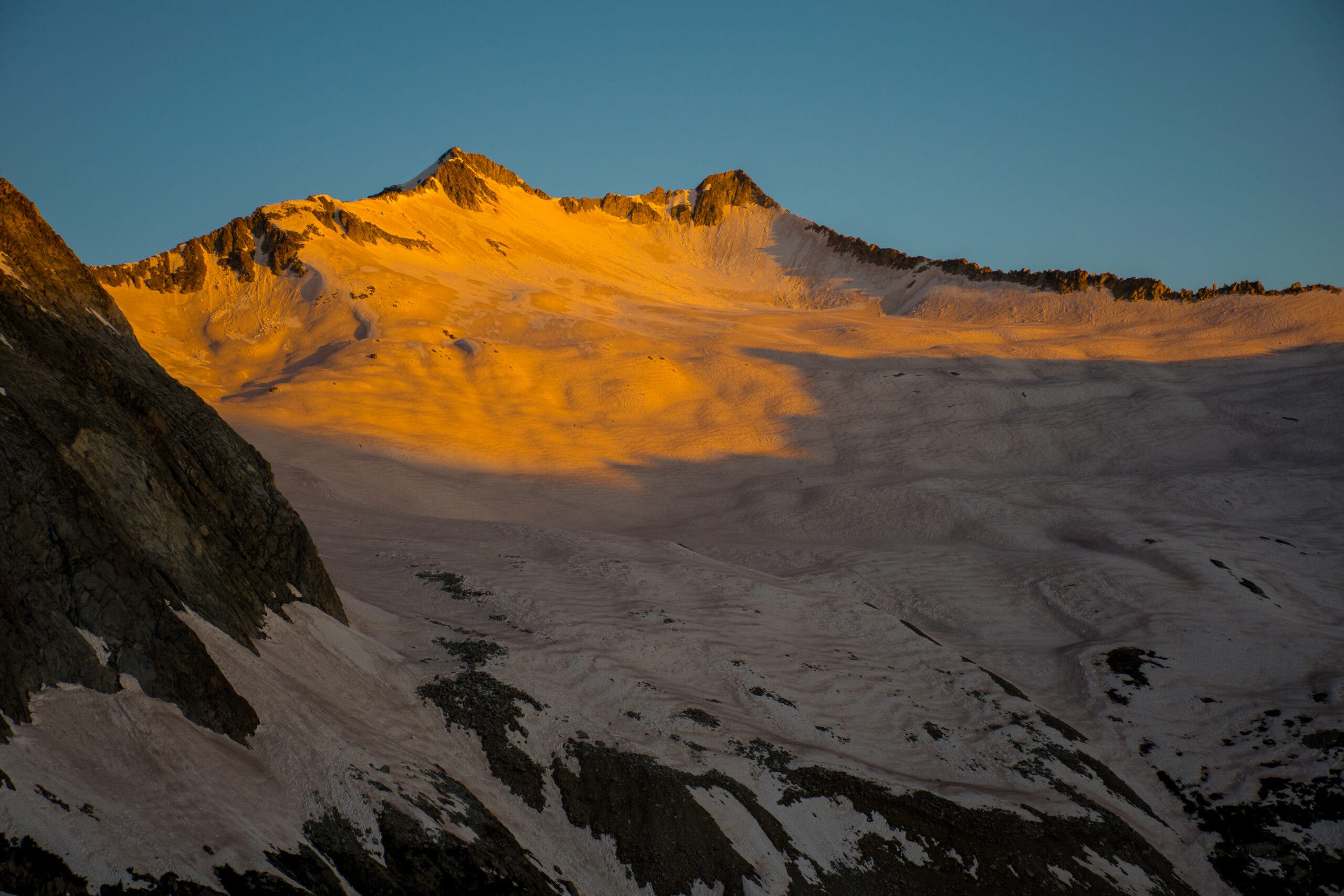
Mount Tyndall, California
“This peak is so spectacular,” says Cameron Burns, coauthor of Climbing California’s Fourteeners, “that the first ascent party thought they were climbing the highest summit in the Sierra.” Pioneering Sierra climber Clarence King, heading up the mountaineering party, made that mistake in 1864, but even modern climbers can be forgiven for thinking they’ve found the apex of the entire Sierra; .As you wend your way up Tyndall’s easy, northwest ridge, you’ll see why King thought he was on the grandest mountain in the land.
At the summit, the 2,000-foot sheer east face drops out like a trapdoor under your feet. Steady your trembling knees enough to take in the staggering views of peak after granite-walled peak for as far as the eye can see. The High Sierra stretches across every horizon, a sea of peaks with Tyndall afloat in the middle.
ADVERTISEMENT
The Trail
Start from the Shepherds Pass trailhead. Head up interspersed switchback sections all the way to Anvil Camp at mile 8.5, which offers the best campsites on the route just below Shepherds Pass. The next morning, go left at the intersection at mile 9, then continue one mile to the pass. .5 mile west of the pass is an obvious ridge; this is the Northwest Ridge Route, your pass to the summit. Follow the ridge all the way up, with a brief detour around a small rock tower on the upper slopes.
Challenge Factor: Moderate. The ridge is easy to follow, but quite exposed near the top. In bad weather, take care that you don’t wander eastward near the drop-off.
ADVERTISEMENT
Peak 11825, Idaho
“I’m amazed that this giant is unnamed,” says Tom Lopez, author of Exploring Idaho’s Mountains, “especially since it offers such a classic scramble with a super view. To me, Idaho’s unnamed peaks are diamonds in the rough.” The Pioneers are one of Idaho’s premier mountain ranges, filled with pristine lakes, uncounted and unnamed 11,000-foot peaks, and true wilderness (albeit undesignated). An excellent trail leads to the mountain’s base, but the route up the southwest ridge provides a typical Idaho mix of good solid rock and loose talus. The east side of the Pioneers, Lopez insists, is nearly unknown even to Idahoans.
That remoteness is to your benefit, though; you can bag this peak without fighting weekend crowds or the complicated permit systems that surround many more popular hiking routes. The surrounding lakes net just as much solitude, and enterprising hikers could spend a week or more exploring the surrounding area.
The Trail
Start from the Fall Creek/Surprise Valley trailhead. Stay left with the intersections with the Moose Creek Spur Trail at mile 3.3.4 and the Fall Creek Spur Trail at mile 3.7. Arrive at Surprise Lake at mile 6.6; you can camp here or drop over the pass to Betty Lake, just under two more miles down the trail. The next morning, return to the pass between the two lakes and head east up the obvious ridgeline, staying to the south of all obstacles, until the summit at mile 9.4.
ADVERTISEMENT
Challenge Factor: Moderately high. Though the east face takes an awesome plunge, the steep southwest ridge is uncomplicated hiking.
Mount Colden, New York
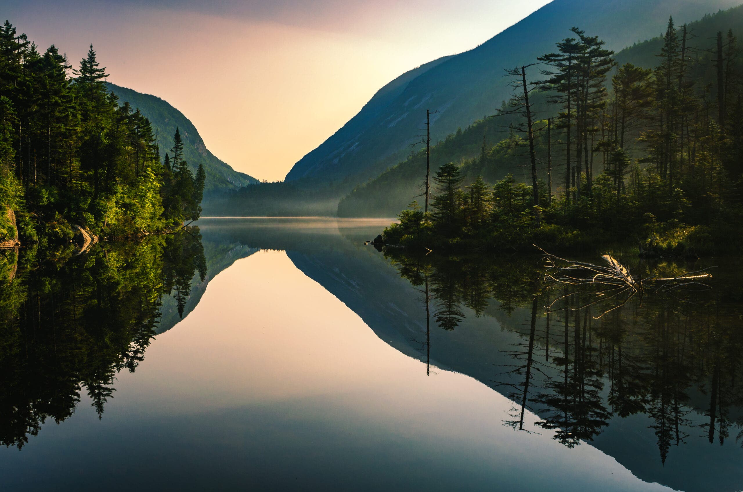
“The Trap Dike Route gives you 2,000 vertical feet of the most satisfying unroped climbing on the East Coast,” says Don Mellor, author of Climbing in the Adirondacks. The ascent begins in a deeply eroded dike, where you’ll climb up ladderlike fractured rock past a waterfall. After several hundred feet, you’ll break out onto a 30-something-degree slab of smooth granite that will eventually leave your hamstrings begging for mercy. Fortunately, the summit views of neighboring high peaks are as sweet as they come.
At 4,714 feet, Mount Colden is the 11th-highest mountain in the Adirondacks, and it has the summit views to show it. From Avalanche Lake, bordered by the cliffs far below that form the base of the mountain, to the surrounding Adirondacks High Peaks, it’s a hike you won’t ever forget.
ADVERTISEMENT
The Trail
There are two routes up Colden, but both start at the High Peaks Visitor Center near Adirondack Loj. For the shorter approach, take the trail to what remains of Lake Marcy Dam (it was destroyed by Hurricane Irene), then head up to Avalanche Camp at mile 3.4. Go left at the camp and climb to Lake Arnold, one of the highest bodies of water in the Adirondacks at just below 3,800 feet. From there the climbing really begins; turn right at Lake Arnold to start the last 1.4 miles up rock slabs to Colden’s summit. For the longer route, take the same path to Avalanche Camp, then go right. This takes you up a steep section known as “misery mile” to Avalanche Pass, where you’ll forget all about burning muscles as the forest disappears in favor of views of cliff-edged Avalanche Lake. Take a series of ladders and scrambles around the lake to the junction at mile 5.8, then go left towards Lake Colden. Past Lake Colden, go left again for the climb to the summit. The two routes can also be connected to make one long loop.
Challenge Factor: High. It is steep passing the waterfall at the bottom, and the upper slabs are easy but unnervingly smooth. Do not venture onto the slabs if they are wet or there is a chance of rain. Try this route only if you have prior experience at walking up smooth granite slabs with lots of exposure below.
ADVERTISEMENT
Mount Katahdin, Maine
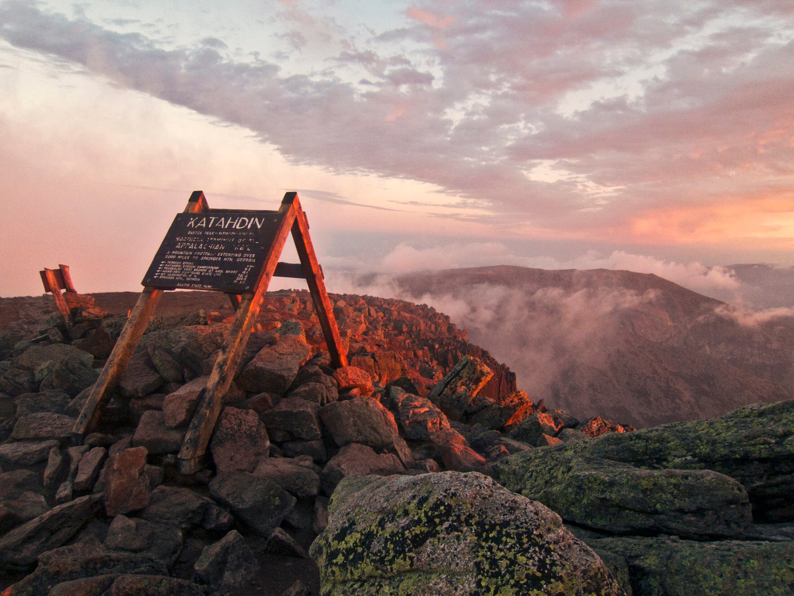
“The Knife Edge is the most spectacular feature of Katahdin,” writes Stephen Clark, author of Katahdin: A Guide to Baxter State Park & Katahdin. Along the ridge “there are only three ways to go: forward, backward, or straight down.” For this reason the bladelike arête connecting two of Katahdin’s highest summits has become the prized “trail” for the mountain’s most adventuresome hikers. The best way to reach the summit is from Chimney Pond, a campground described by Clark as the most dramatic east of the Rockies; you’ll gaze directly upward at 2,000 vertical feet of glacially carved granite. Adjust your eagle eyes to see the hikers tiptoeing across the Knife Edge.
Katahdin also has the distinction of being the northern terminus of the Appalachian Trail, as well as one of the most spectacular mountaintops in the country. You don’t have to hike a few thousand to get enjoyment out of Katahdin, though; just a day climbing up to this high point is still a life-list moment. (Be aware that the trail to the top closes for the winter; check with Baxter State Park if you’re not sure about its status.)
The Trail
Start at the Roaring Brook Trailhead. From there, 3.3 miles brings you to the lean-tos at Chimney Pond Campground, where you can stay for the night if you want to make a weekend of your Katahdin climb. From there, take Cathedral Trail to Baxter Peak, the highest point on Mt. Katahdin, which gains 2,300 feet in just 1.6 miles. Head .3 mile along the ridge to South Peak, then take the iconic Knife Edge traverse another mile to Pamola Peak. Drop 1.3 miles back to Chimney Pond, then retrace your steps to the trailhead.
ADVERTISEMENT
Challenge factor: Moderate. You’ll be stepping carefully across the Knife Edge. Make sure the weather is in your favor because this is an exposed and potentially dangerous position.
Mount St. Helens, Washington
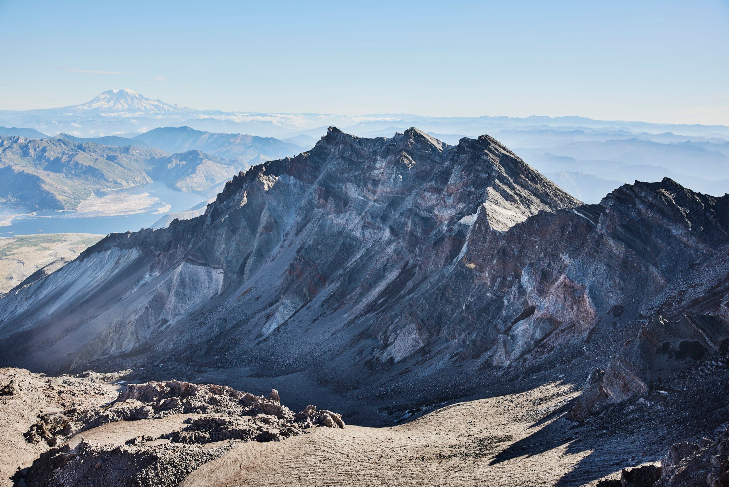
“Of all the hundreds of summits that I’ve stood on, none are more glorious than that lowly walkup, Mt. St. Helens.” So says John Harlin, author of The Climber’s Guide to North America, Vol. 1: West Coast Rock Climbs. He doesn’t climb this mountain for the steep, beautiful, view-filled hike; he climbs it to reach the top. If you’ve ever stood on this summit, it’s easy to see why: All the way up, you trudge the monotonous slope of a cinder cone. But step onto the summit and you’ve entered an exploded world of unparalleled power, a spectacular display of raw geology. Scattered across the horizon, you’ll see a speckling of snow-covered volcanoes, all patiently waiting to show what they’re made of. Mt. St. Helens is a reminder of the power of these mountains and a perfect sample of the beauty that can come from destruction, all in one.
Though the entire route heads through the incredible aftermath of St. Helens’ eruption, perhaps the most impressive piece of geology lies in the summit crater; the magma dome. This occasionally-steaming rock mound swells and shrinks with the movement of magma to the near-surface, and is one of many indicators of new eruptions monitored by volcanologists.
ADVERTISEMENT
The Trail
Start from the Redrock Pass Trailhead. Follow the trail 2.2 miles to Butte Camp Dome, which has several sites for those starting late or who want to turn the usual dayhike into a weekend excursion. From there, follow the Loowit Trail another 2.2 miles to Monitor Ridge, then follow the ridgeline to the summit.
Challenge factor: Moderate. Beware not to step onto hidden cornices overhanging the interior.