Published April 14, 2022 11:30PM
6 Trails to Make Someone Love Hiking For the Rest of Their Life
The miles are low and the rewards are sky-high on these perfect first hikes.
(Photo: Kara Hollenbeck of Rogue Musings/iStock via Getty Images)
Brush up on backpacking basics with tips, tricks, and advice from Backpacker’s experts in Hiking 101. We’ve made this members-only article free to help you get started.
When you love hiking, you want to share it with everybody—your friends, your family, the neighbor you just met yesterday. However, if they haven’t spent the time in the wilderness that you have, they may not share your enthusiasm right off the bat. (Your stories of several-thousand-foot elevation gains, blackened toenails, and bear encounters probably aren’t helping). But don’t give up: With the right introductory hike—easy enough it isn’t intimidating, but with views that will leave every new hiker planning their next wilderness trip on the drive home—you can get friends and family as hooked on hiking as you are.
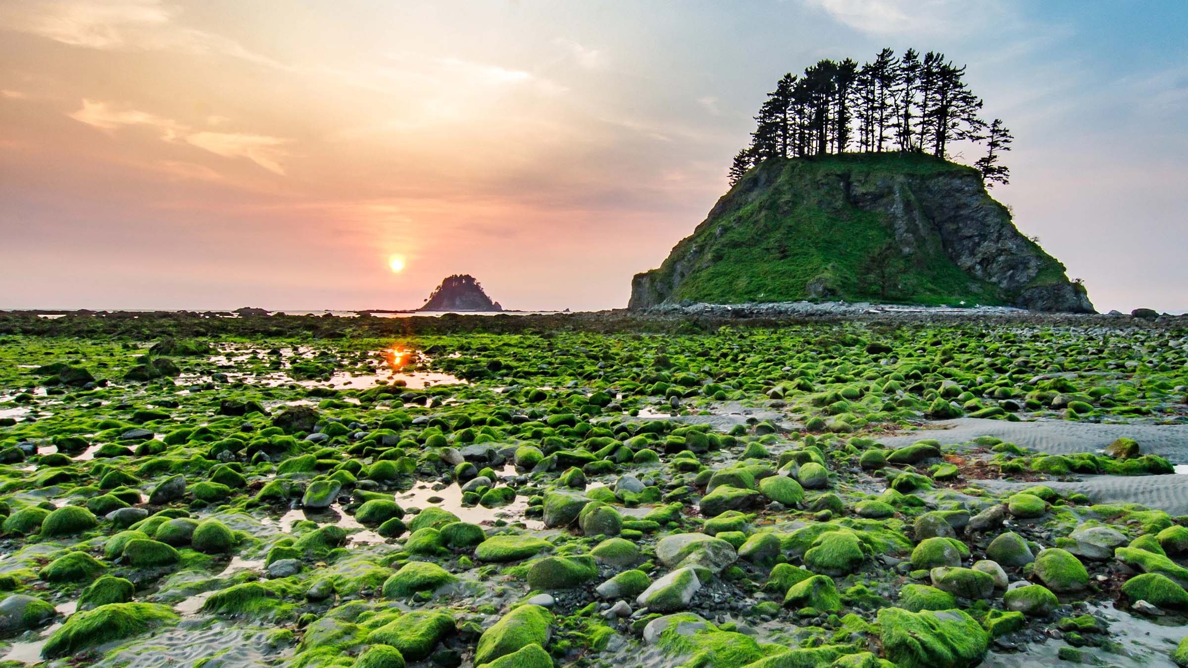
Headlands Trail, Isle au Haut, Acadia National Park, Maine
- Distance: 6 miles
- Time: 1 day
- Elevation gain: 675 feet
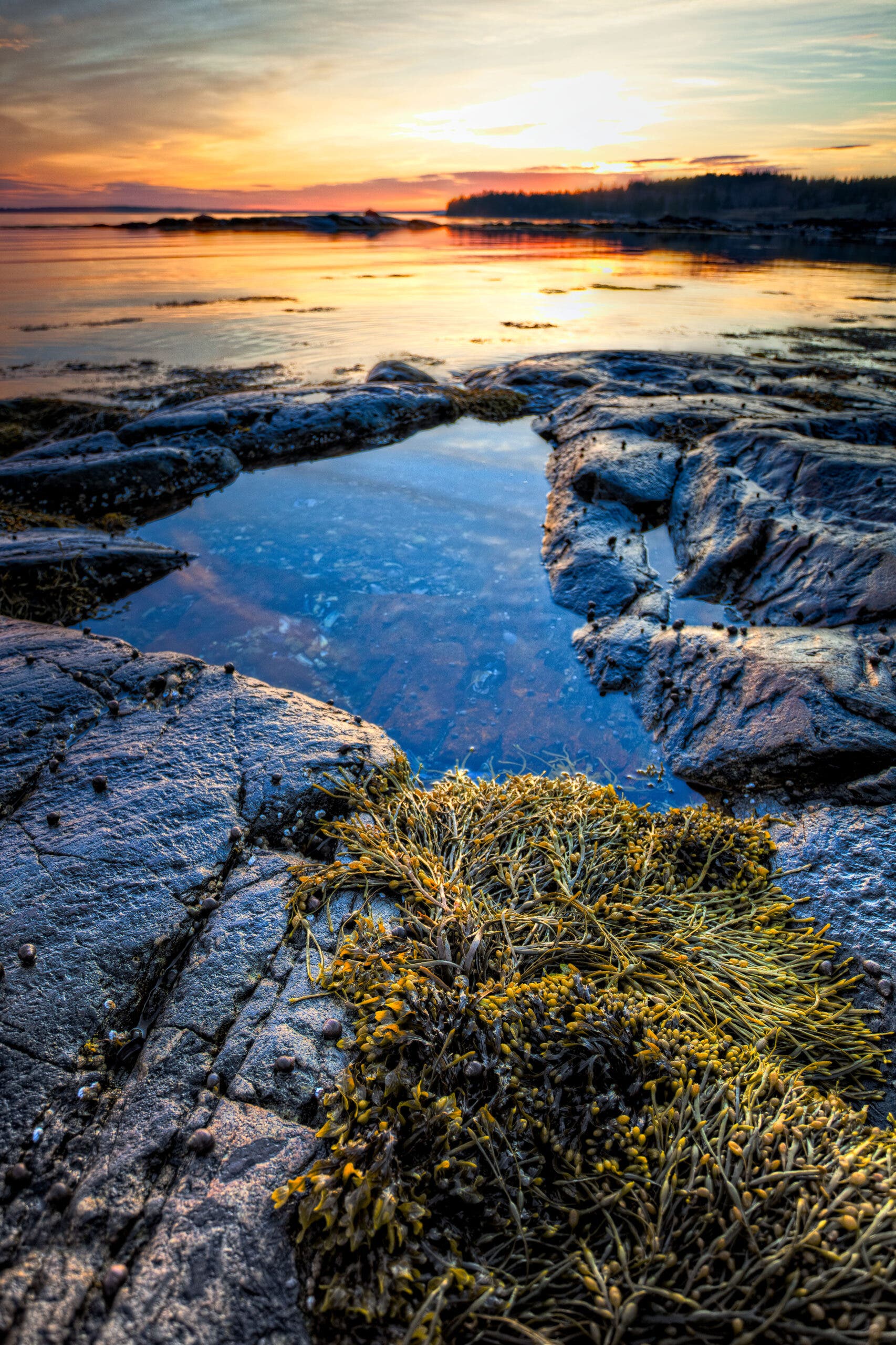
This loop might only be 4.6 miles long, but it feels like the middle of nowhere. A forest of red spruce and balsam fir springs straight from the cliffs of the coastline, swaying in the Atlantic wind; the sound of waves echoes against the cries of gannets and guillemots. Occasionally the path dips to a cobbled beach, with equally dense forests of seaweed swaying between knobby fingers of rock at low tide. Though the town of Duck Harbor (population: 73) huddles against the west edge of the island, here there is no sign of human habitation.
Winding over headlands and down to isolated cobblestone beaches, the Headlands Trail takes you around the remote southern half of Isle au Haut, 7 miles off the coast of Maine. The northern half of the island is mostly private land, but the southern 3,200 acres are part of Acadia National Park. If a day isn’t enough (and once you visit, you’ll definitely want more than a day), the Duck Harbor Campground has five sites with lean-tos and fire rings.
ADVERTISEMENT
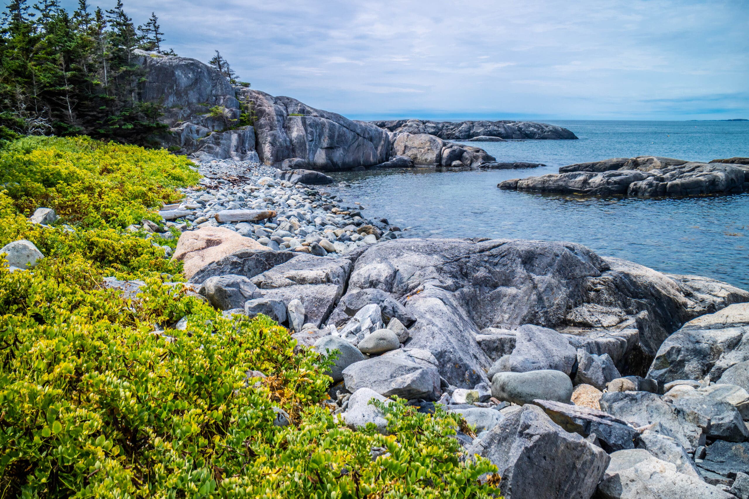
Into the Tidepools
Time your hike for low tide to explore one of the best parts of Isle au Haut: tidepools. These ephemeral ecosystems are a treasure trove of marine species that, with only a little effort, any hiker can identify. Some of the biggest inhabitants are the sea stars, anemones, and—if you’re very lucky—nudibranches, more commonly known as sea slugs. These gastropod molluscs actually start life with shells, but shed them after their larval stage; the name nudibranch actually means “naked lung”. Many of the species that live in Acadia eat the anemones also found in tidepools and incorporate the stinging cells into their own bodies for protection.
The Trail
From Duck Harbor Campground, take the Western Head Road 0.5 mile to the Western Head Trailhead. Follow blue blazes up a rocky path through spruce and fir forest. Just before mile 1, you’ll find the first views of the ocean and the first cobblestone beach, where each low tide exposes several tide pools. Head to the other end of the beach, where a cairn marks the beginning of the next section of trail. After another stretch of forest, the trail drops to beach again; look for the blue blaze on the seaside boulders to find where it continues. Continue straight at the sign for the Cliff Trail, which runs along another section of coast—this time with more sheer drops and less beaches. At mile 3, re-emerge on the Western Head Road, then turn right onto the Goat Trail. At mile 4.9, the trail meets up with the Park Road; take it straight (west) across the island, then take a left on Duck Harbor Road to return to the campground.
ADVERTISEMENT
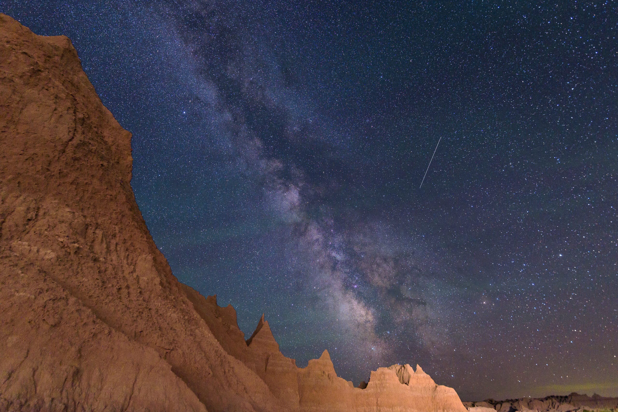
The Wall, Badlands National Park, South Dakota
- Distance: 1.2 miles
- Time: 2 days
- Elevation gain: 43 feet
If your new hiker loves stargazing, this is the trip for them. The Wall is a rock formation separating the lower south prairie and higher south prairie, eroded into the characteristic towers of the Badlands. There are few trails in the park’s north unit, but you won’t need them; the formation is visible from all along the park road, and as long as you’re half a mile away from any infrastructure, you can pitch camp anywhere.
Once the sun goes down, there’s nothing in the way of a horizon-to-horizon star show. With few nearby towns to cause light pollution and scarce hikers, your only camping companions will be the Milky Way and the moon. For an extra boost to the nocturnal show, time your visit to coincide with a meteor shower. While you’re waiting for the sun to go down, keep an eye out for the park’s herd of bison, one of the largest protected groups of the animals in the country.
Spot That Constellation
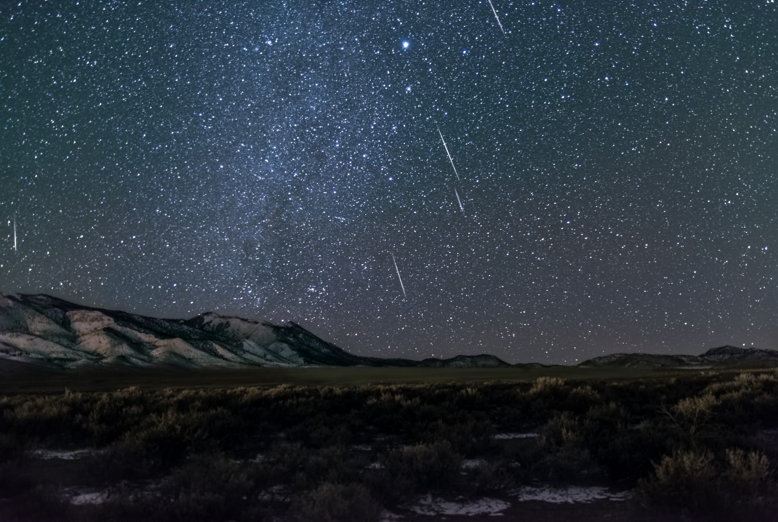
What’s visible in the night sky changes with the seasons, but during peak summer camping season, there’s a few easy-to-identify patterns in the northern hemisphere. The easiest to find is the big dipper, Ursa Major. Follow the two stars at the front of the “dipper” to find the North Star, Polaris, and the constellation Ursa Minor. Though it is almost always referred to in the singular, the North Star, Polaris, is actually a triple star system; Polaris A, the primary star, is a yellow supergiant, while the smaller Polaris B and Polaris Ab are both dwarf stars.
ADVERTISEMENT
The Trail
The north unit of Badlands National Park has few established trails. Instead, drive west along the Sage Creek Rim Road from the Pinnacles Entrance until you see a section of The Wall you like, then park and start hiking. You can camp anywhere, as long as you’re at least a half-mile from the road.
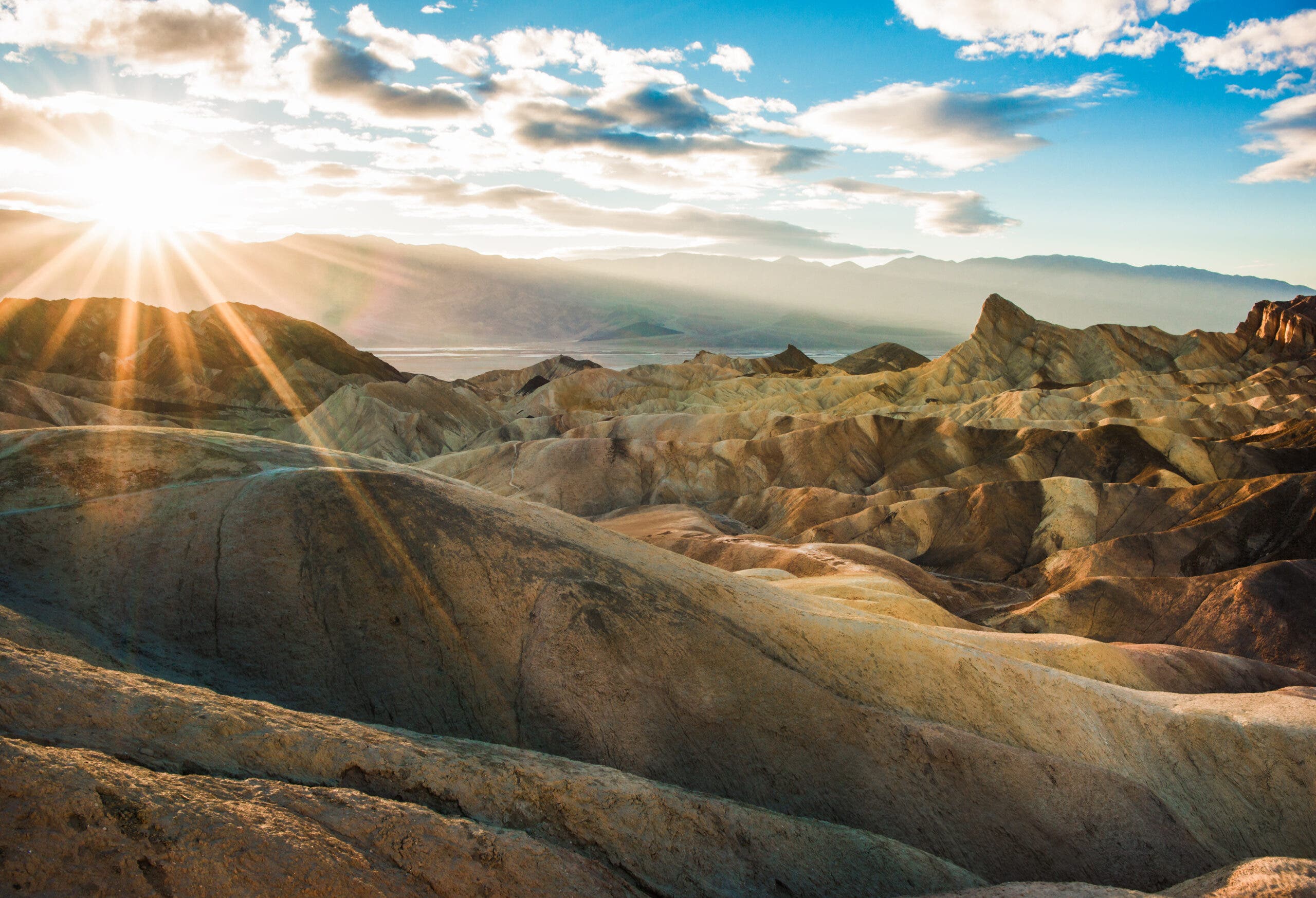
Golden Canyon-Gower Gulch Loop Trail, Death Valley National Park, CA
- Distance: 7.8 miles
- Time: 1 day
- Elevation gain: 1,624 feet
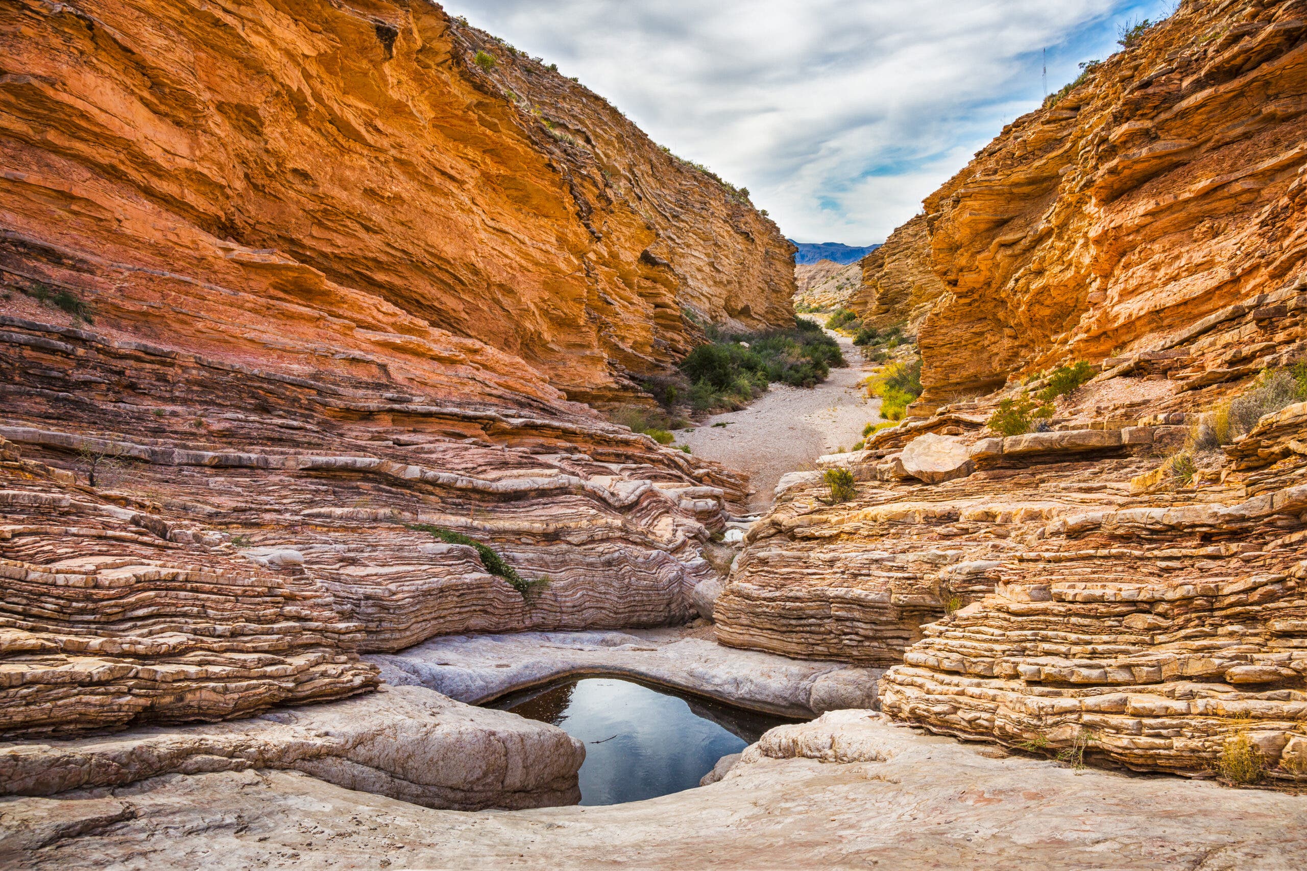
Even amid the spectacular desert of Death Valley, this labyrinth of golden stone stands out. The bright canyon walls hold the most unlikely of preserved geologic remnants, water ripples, while the apex of the hike at Zabriskie Point looks out beyond the cliffs to the salt flats of the valley floor and the Panamint Mountains beyond. Right from the trailhead the experience begins, golden walls looming large to either side of the trail; just a couple miles and a few short, easy scrambles brings you to an even more impressive amphitheater of fluted stone. The Red Cathedral is a sharp contrast in color with the hike up to the that point: The “cathedral” cliffs are deep red, their buttresses rising straight from the paler stone below.
The second half of the hike, climbing up to Zabriskie Point before descending Gower Gulch, winds through an expanding rainbow of rocks. The red-, gold-, and white-striped badlands leading up to the point are one of the most photographed places in the entire park. Catch the best light, and the best views, at sunrise or sunset, when the low-angle rays bring out even more vivid color from the bare hills.
ADVERTISEMENT
All the Colors of the Rainbow
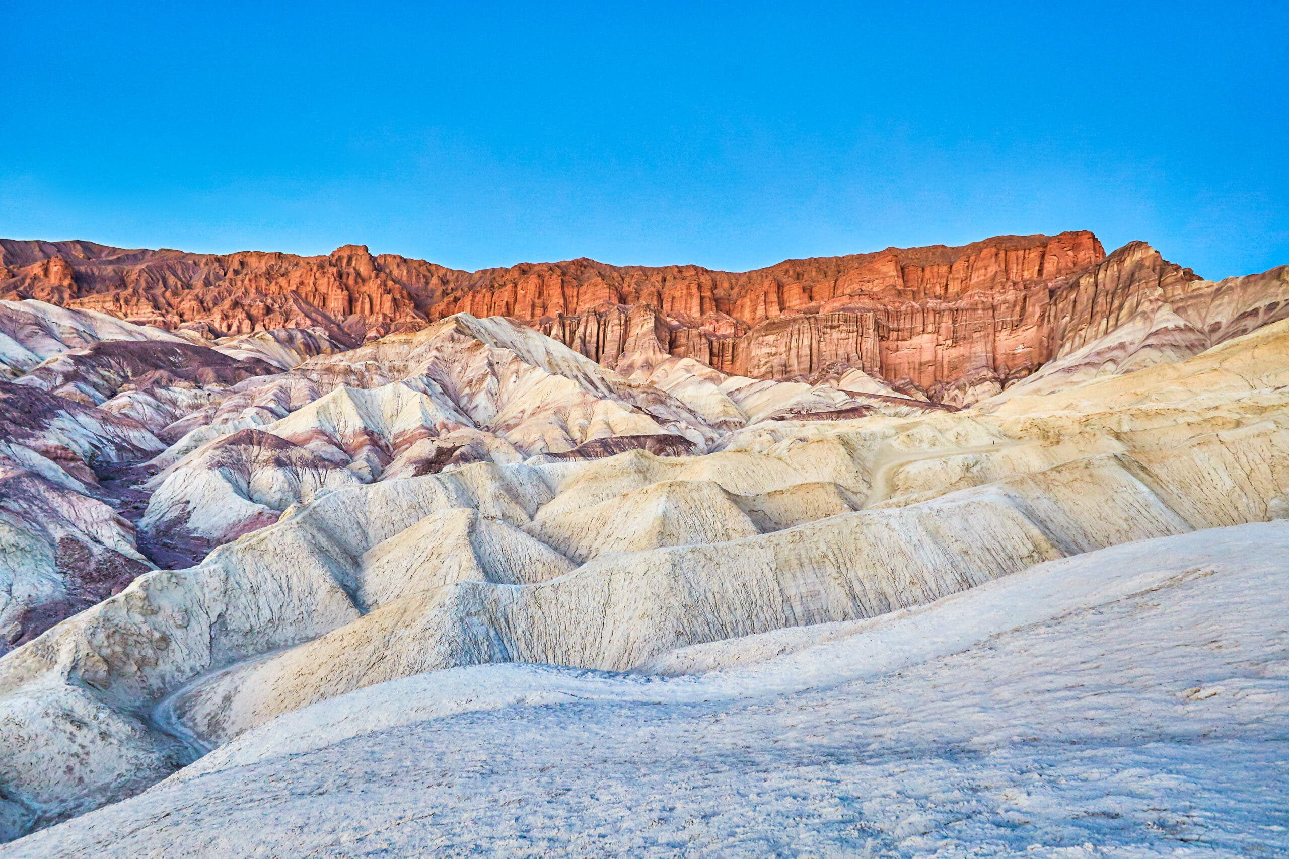
What makes the rocks of Golden Canyon and Zabriskie Point so colorful? The answer starts 5 million years ago, when Furnace Creek Paleolake, which once covered the area, dried up. The sediment left behind was a mix of saline mud, gravel eroded from the nearby highlands, and ashfall from the Black Mountain Volcanic Field. At the bottom of the lake these sediments fell into distinct layers, sorted chronologically by time of deposition and also by grain size, as larger pieces tended to sink deeper. As the lake dried, the mud, gravel, and ash solidified into conglomerates, sandstones, and mudstones, each rich in different colorful minerals—iron for the red rocks, borates for white, manganese for purple.
The Trail
Start at the Golden Canyon Parking Lot. The first stretch of trail winds between the canyon’s yellow-hued walls, looping under overhangs and over low ledges. At mile 1 take the half-mile spur trail left to Red Cathedral, a pillar-bound outcrop rising straight from the trail in bright varnished sandstone. Return to the trail and head to the first junction at mile 2.8. Go east on the Badlands loop and continue straight through the next intersection to Zabriskie Point. The point has one of the best views in the park, looking down at the sharply eroded Furnace Creek Formation badlands and across the flats to the highlands on the other side. Return down the Zabriskie Point Spur trail to the last junction and go straight, then at the next junction (mile 6.4) go left to reach Gower Gulch. About .3 mile later, reach the last junction and turn right, following the narrowing canyon back down to the parking lot.
ADVERTISEMENT
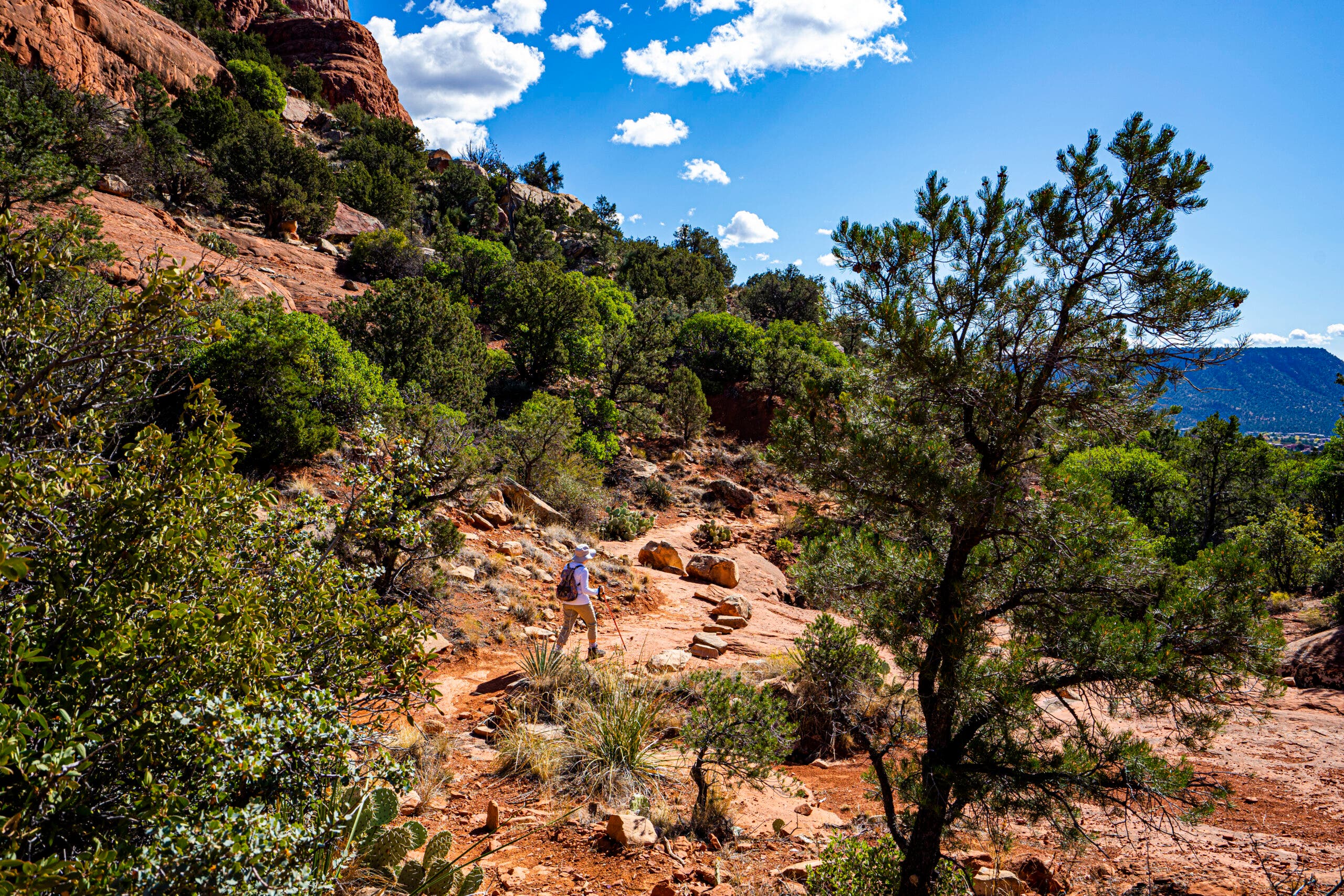
Soldier Pass Trail, Red Rock Secret Mountain Wilderness, AZ
- Distance: 4.5 miles
- Time: 1 day
- Elevation gain: 590 feet
Though this trail starts within the Sedona city limits, it soon ventures into a desert that feels worlds away. By the time you reach the series of red rock potholes known as the Seven Sacred Pools, only a mile in, any sign or thought of the city will be far behind. The climb to Brins Mesa, where views of Sedona to the south and the wild Mogollon Rim to the north, is only 4.5 miles round-trip, but those 4.5 miles will delight newbies and experienced hikers alike.
From the pools, climb into a forest of aromatic Arizona cypress, with occasional views between the trees of eerie red-rock towers in the near distance. Partway up the trail enters the Red Rock Secret Mountain Wilderness. (If that name doesn’t have you dreaming of adventure, nothing will.) The trees fall away as the path crests the mesa, opening up 360 degree views into the tangled red-orange cliffs of the Mogollon Rim and, below to the south, the city of Sedona.
What Makes a Pothole?
Also called tinajas, weathering pits, and waterpockets, these circular dips in solid rock are common throughout the desert southwest. They form mainly through two different but simultaneous processes; physical weathering, where precipitation gathers in a depression and wears away the mineral grains below, and geomicrobiologic weathering, in which bacteria that can “consume” the minerals most often found in sandstone take the grains up and incorporate them into their own skeletons. When the pools dry up, the skeletons of these organisms are carried away by the wind. Another form of geomicrobiologic weathering takes place in more established pools, where a biofilm of cyanobacteria, algae, and fungi prevents water from seeping away through the rock, keeping the eroding presence of liquid in the pool for longer periods of time.
ADVERTISEMENT
The Trail
Start from the Soldier Pass Trailhead at the end of Forest Service Road 9904. Parking is limited, so during the busy season it’s best to arrive early. Find the beginning of the path on the east side of the parking lot and head out. At mile 0.25, reach the Devil’s Kitchen sinkhole, which last had a major collapse in the 90s. A quarter mile after that the trail passes the Seven Sacred Pools, a series of potholes along the ridgeline. From there, go 1.2 miles to an intersection, where you’ll stay left on the main trail (the spur on the right leads to an arch). At mile 2 the trail emerges from the forest on top of Brins Mesa, then continues another .25 miles. Retrace your steps to return to your car.
Arabia Mountain via Mountain Top Trail, GA
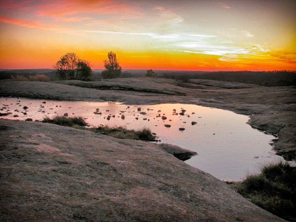
When most hikers think of Georgia, they don’t think of exposed granite summits and 360-degree views. But that’s just what awaits you at Arabia Mountain, only a few miles outside of Atlanta. There’s actually very little true trail on the Mountain Top trail; nearly the entire route follows cairns up bare granite, the kind of experience usually expected more in Yosemite and Wyoming. Dips in the rock form tiny pools and provide shelter for rare plants and wildflowers, while occasional pockets of forest break up the exposure of the open hike.
ADVERTISEMENT
At only 1.3 miles, Arabia Mountain is a perfect introduction to hiking for friends and family, or a quick pre- or post-work hike for adventurers based in Atlanta. No need to limit your exploration of the region to only one summit, though; the Arabia Mountain National Heritage Area has over 30 miles of trails.
A Tiny World
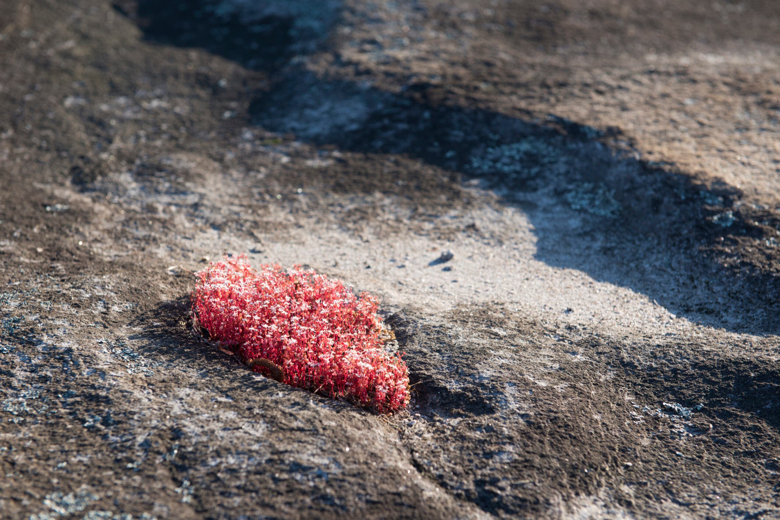
Every spring, the pools and divots in the rock of Arabia Mountain explode with life. The most colorful is the diamorpha, a rare wildflower which turns bright red in the spring before sprouting delicate white flowers at the top of each vivid stalk. It’s accompanied by other flowers, too: The less-flashy white flowers of rare granite stonecrop, bushy Atamasco lilies, orange rabbit ears. Many of the plants are endangered or only found in the Arabia Mountain Natural Heritage Area, so make sure to stay on the marked route and watch your step.
The Trail
Start from the South Parking lot in Arabia Mountain National Heritage Area. Stay straight at the intersection at mile 0.25, then at mile 0.3 go left at the Y. Follow cairns across the granite slopes of the mountain, keeping your eyes glued to divots in the rock where plant life grows, before reaching the 948-foot summit o.6 miles in, where you can bask in a 360-degree view of the surrounding forests and Arabia Lake below.