Published September 20, 2013 02:51AM
Guadalupe Mountains National Park: McKittrick Canyon
Wind through one Texas’ prettiest spot, McKittrick Canyon, on this mellow 4.8-mile out-and-back that follows a gentle stream to a 30’s-era cabin-turned-museum on the north side of Guadalupe Mountains National Park.
This pleasant hike through McKittrick Canyon–the northernmost canyon in Guadalupe Mountains National Park—is an easy escape from the dry, desert surrounds. This route begins at the interpretive center and rounds a small hillside before crossing a big, rocky wash which exposes the canyon’s geology. As you continue winding up-and-over the canyon’s bends, the trail alternates between dry and riparian landscapes. The reliable canopy of oak, Texas madrone, and big leaf maple is one of the things that makes this such a popular trail—it’s lauded as one of Texas’ most beautiful fall-color displays.
The 2.4-mile approach toward Pratt Cabin ends with a short, right-leading spur trail from a small picnic area. A sign marks the trail and you’ll likely see other hikers enjoying the wide river bend and shade nearby. Though it’s possible to begin an overnight hike from the McKittrick Canyon, the canyon itself is a day-use area. The cabin and visitors center are manned during busy times of the year (spring and fall).
ADVERTISEMENT
Though the trail cruises through a stream several times, bring plenty of water todrink and don’t plan to swim, water in this area is scarce.
-Mapped by Kristy Holland


Trail Facts
- Distance: 7.8
Waypoints
GMK001
Location: 31.977697, -104.752194
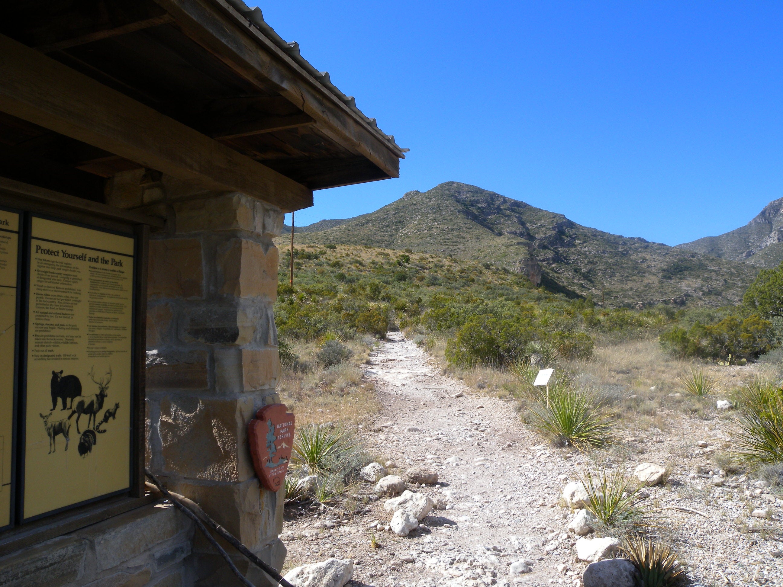
Start your hike at the canyon’s small visitors center. There are restrooms, a water fountain, a short introduction video, and a small interpretive display. Follow the trail from the center’s north side and bear left toward the map kiosk.
GMK002
Location: 31.97982, -104.755947
There are several wet and several dry crossings of the creek. You’ll dip into the first one after cruising a desert-like landscape near the trailhead. After this point, the vegetation is more riparian-deciduous trees and even spring wildflowers make this canyon stand out from the surrounding landscape.
GMK003
Location: 31.981444, -104.75745
ADVERTISEMENT
Stay straight on the main trail where a smaller trail joins in from the right just before the half-mile mark. On the return trip, remember to bear right here to return to the visitor’s center. Though the trail rises only about 200 feet during the 2.4-mile out-bound, you’ll notice short hills where the trail cuts between river bends.
GMK004
Location: 31.984729, -104.759433
Look for an old inscription on the back side of the tree trunk across the trail from this stone table.
GMK005
Location: 31.987272, -104.762242
Though the trail passes through it (on stepping stones), avoid contaminating the water by swimming, wading, or otherwise using it. Water is a scarce resource in the desert and many plants and animals depend on this reliable source.
GMK006
Location: 31.985924, -104.769359
The canopy of big tooth maple, Texas madrone, and chinkapin oak is thick and turns brilliant colors in the fall. The last few weeks of October and the first week of November are typically prime-time or fall color viewing here. After passing through this lush area, you’ll cross the river again up ahead.
GMK007
Location: 31.983282, -104.779802
ADVERTISEMENT
A final wash crossing precedes this small picnic area where you’ll see some dilapidated, rocky remains of an old fence. This route turns right here toward the cabin, but the trail continues from this point and reaches another noteworthy destination–the Grotto–within a mile.
GMK008
Location: 31.983436, -104.780624
Pratt Cabin was built in the 1930’s by the landowner, Wallace Pratt, who eventually donated more than 5,600 acres of this area to the National Park Service. The cabin itself is still open to the public and is manned by rangers and docent volunteers most days during the busy spring and fall seasons.
Trailhead
Location: 31.977751, -104.752245
Stop to check out the map kiosk as you leave the trailhead visitor center.
Wash
Location: 31.979286, -104.754961
Within the first quarter mile, the trail dips into a rocky wash. Look left for shelf-like rock formations carved by the river.
Wash
Location: 31.979632, -104.755776
Lined with stones, the well-used trail is easy to follow.
Maintenence
Location: 31.983891, -104.759102
The trail is one of the busiest in the park so it’s well maintained. Expect to see steps and other erosion-control structures, especially near the stream.
Bench
Location: 31.984783, -104.759467
ADVERTISEMENT
Signs
Location: 31.986785, -104.763114
Passing through the riparian landscape, signs warn you to avoid contaminating the water.
Stepping Stones
Location: 31.986648, -104.763646
Cross the waterway on the wide, flat stones that mark the trail. Don’t wade or swim.
Picnic
Location: 31.983281, -104.779851
This picnic area is a great resting spot just opposite of the spur trail toward Pratt Cabin.
Pratt Cabin
Location: 31.9835, -104.780613
Approaching the cabin. Built between 1931 and 1932, the stone structure that marks this route’s turn-around is still solid. It’s maintained and manned by the Park Service.
Pratt Cabin
Location: 31.983572, -104.780683