Updated March 26, 2024 06:14AM
Devil's Hall Trail
Wind into Pine Springs Canyon and squeeze through a 100-foot long hallway on one of Guadalupe’s mellowest dayhikes. In the fall, this 4-mile out-and-back features a rainbow of colors.
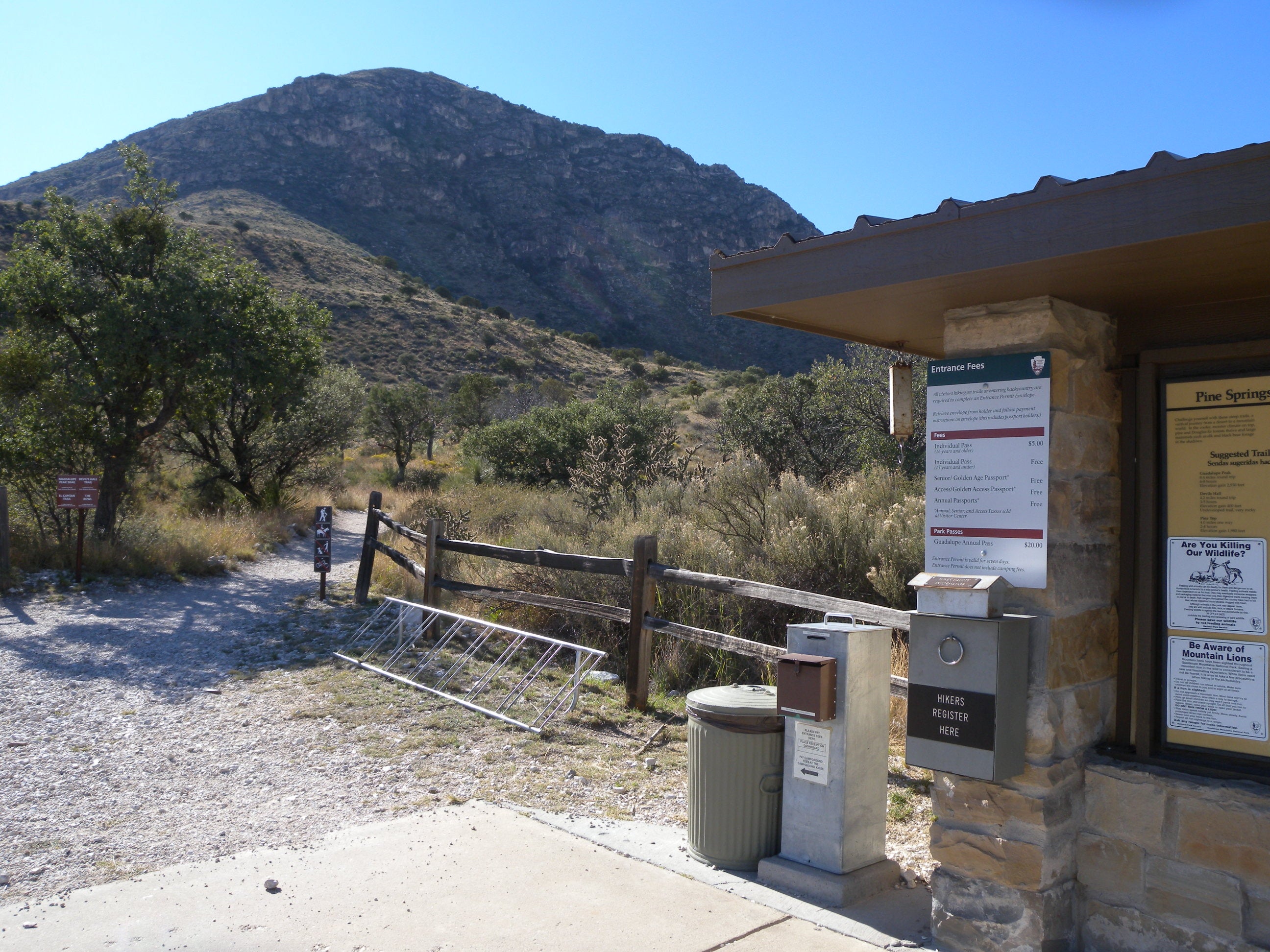
The Devil’s Hall Trail in Guadalupe Mountains National Park is one of the easiest trails that starts from the Pine Springs trailhead. Surrounded by soaring peaks on either side, this 4-miler follows a rocky, rugged wash into Pine Springs Canyon, and has just under 600 feet of climbing. The trail climbs gently through grassy savannah into the wash and scrambles over rockier terrain to the highlight of the hike, Devil’s Hall. This hallway-like slot between wave-textured 50-foot cliffs makes for a cool, shady escape from the afternoon sun. There is no backcountry water in Guadalupe Mountains National Park, so be sure to pack plenty of your own.
Trail Facts
- Distance: 4.2 miles round trip
- Elevation Gain: 548 feet
- Difficulty: Challenging
- Permits: No
The Route
Start at the Pine Springs trailhead and wind your way through the Pine Springs Canyon Wash and up a steep set of rocky stairs to the hike’s main attraction, Devil’s Hall.
-Mapped by Kristy Holland
ADVERTISEMENT
Pine Springs Trailhead to the Pine Springs Canyon Wash

Start at the Pine Springs Trailhead, which serves as a RV camping area and has both water and restrooms on its south side. Be sure to self-register at the trailhead kiosk before starting off. You’ll turn uphill and follow the Devil’s Hall Trail at the first junction just a few feet from the trailhead. The trail follows the Guadalupe Peak equestrian trail for 0.8 miles as it winds above the canyon’s wash. Look for deer, Texas madrone, yucca, and hikers on the opposite hillside’s Tejas Trail as you walk west.
Pine Spring Canyon Wash to the Hiker’s Staircase

At mile 0.8, a rugged set of downhill steps brings you into the wash. There’s a sign that marks the transition between the dirt trail and the rocky one along the wash’s base. Covered in rounded rocks of all sizes, the rugged wash winds between the canyon walls which get steeper and more exposed as you proceed. From this point, you’ll be picking your way up the rocky path.
Hiker’s Staircase to Devil’s Hall

Near mile 1.6, you’ll come to what looks like a dead-end, but it’s actually what’s known as the hiker’s staircase. You’ll have to climb about 50 feet up a series of three short staircases formed by eroding layers of sedimentary rock. Though stones sometimes flank the most direct route, you might briefly lose the trail as you climb rocky steps. Bear left at the top to get to Devil’s Hall.
ADVERTISEMENT
Devil’s Hall

The wave-textured 50-foot cliffs are about 15 feet wide and make for a cool, shady escape from the afternoon sun. The trail officially ends at a small sign on the north side of the hallway. Hikers can continue to explore the widening canyon for a few hundred feet before turning back toward the trailhead.
Additional Photos


