Updated July 1, 2025 05:23PM
Take Your Summer to the Next Level With These 7 Summit Hikes
Not every summit needs to be grueling. Get all of the glory with none of the struggle on these 7 hikes.
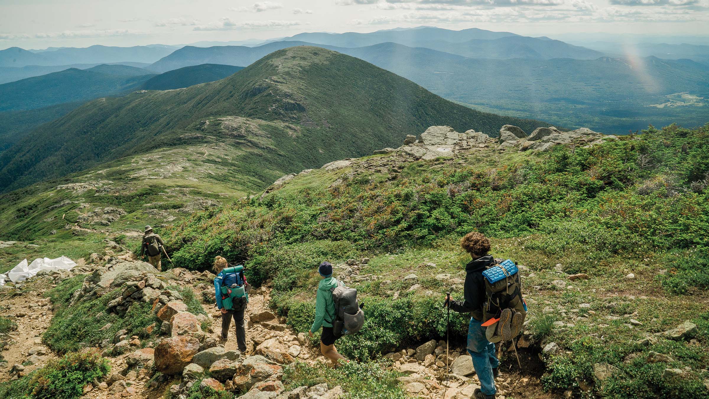
(Photo: Aaron Ibey)
You deserve an epic summer—and we want to help you have it. That’s why we’ve made this preview of our members-only story on the 14 best friendly summits in the United States free for everyone to read. Get that and more trips from our experts when you sign up for Outside+.
Overnight: Black Top Mesa, Arizona
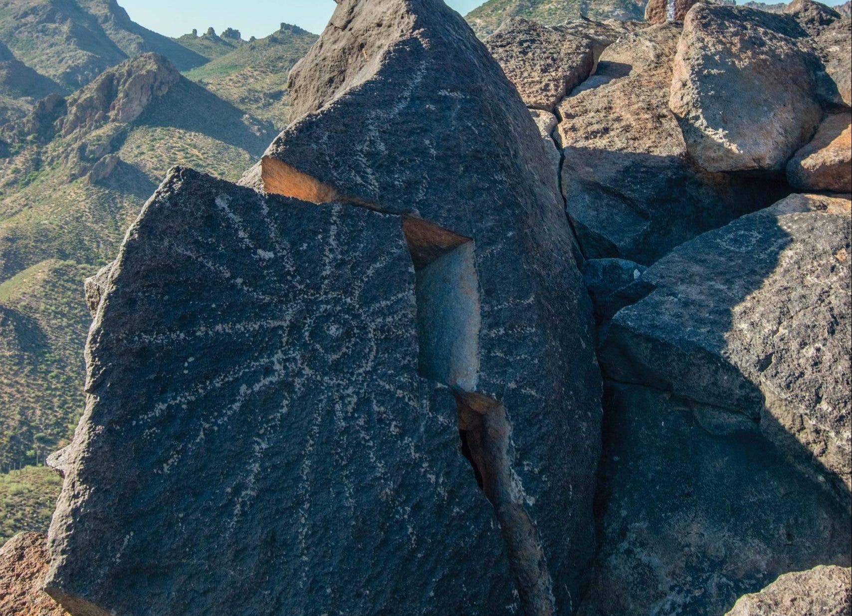
Waking up to a bird’s-eye view of the very best of the Superstitions—Weavers Needle, Battleship Mountain, Geronimo Head, and Black Mesa Mountain spread out in a semi-circle from north to south—will make the frontcountry feel farther away than it is. (The petroglyphs in the area add to the immersive feeling.) Given that, it’s easy to forget that most of the 5.7-mile hike in was a breeze through wild oats and all manner of cacti from the Dutchman trailhead, though the final gain of 1,000 feet in a mile is likely to stick in your memory. Camp in an impacted spot near the summit and rest assured that backcountry depth is more a feeling than a distance.
Trailhead 33.4801, -111.4431 Get here Follow State Route 88 to the turn for Service Road 78 and follow it to the end. Permit None
Dayhike: Blackrock Summit,Virginia
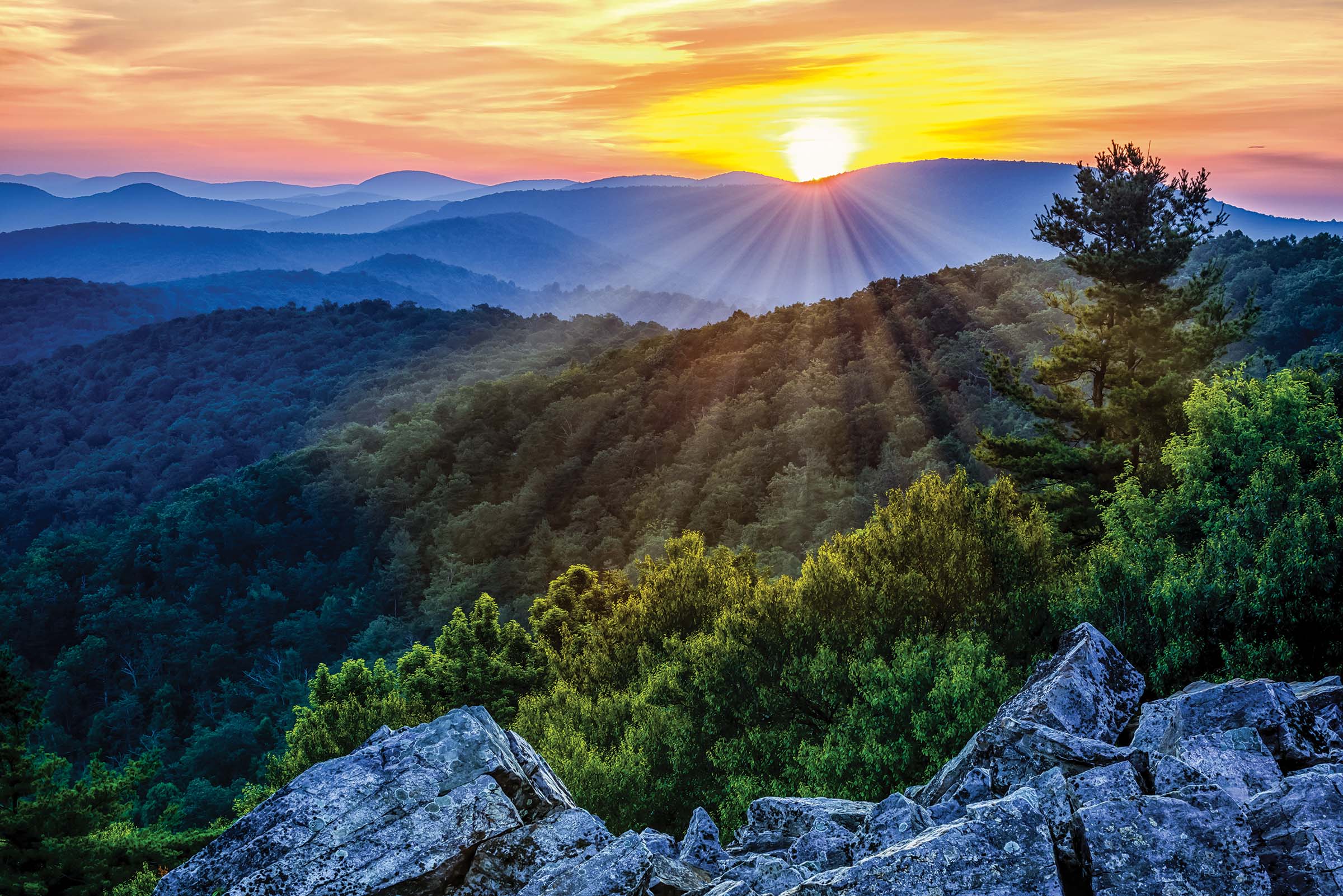
While there’s only .5 mile of hiking and 30 feet of class 2+ scrambling up mismatched boulders to reach Blackrock’s 3,160-foot summit, the views from the top of this talus slope will make you feel as if you’ve summited the Matterhorn. The vista includes a long stretch of the Shenandoah Valley flanked by the likes of Rockytop Ridge, Lewis Peak, and Massanutten Mountain. Once you’ve downclimbed (also a cinch), turn this one into a loop (maximizing your odds of spotting one of the resident black bears) by swinging around to the back of the talus slope and following the Trayfoot Mountain Trail .6 mile back to the parking lot.
Trailhead 38.2230, -78.7333 Get here Follow Skyline to the parking lot at milepost 84.8 Permit None
ADVERTISEMENT
Dayhike: North Schell Peak, Nevada
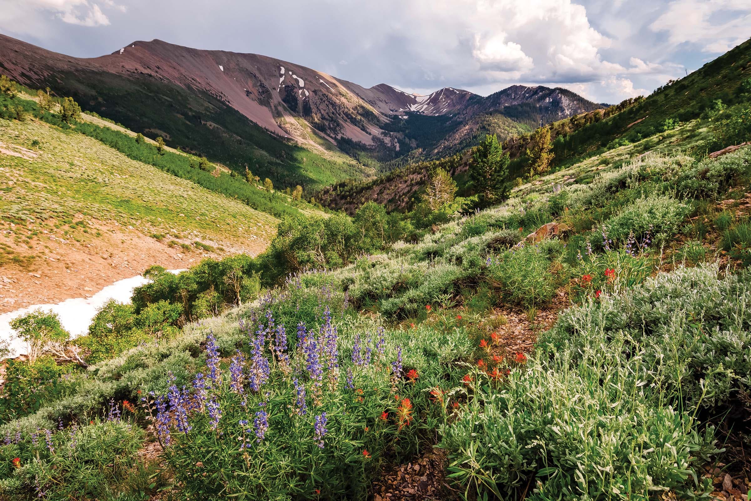
Don’t worry when the track fades. As far as off-trail navigation goes, this is as straightforward as it gets. Sure, the old roadbed climbing up through a grove of aspens and bristlecone pines at the start of this 6-mile route peters out when you get above treeline, but the basin’s miles-long views ensure that the gentle, 3,000-foot ascent along the ridgeline is easy enough to follow. From Schell’s 11,883-foot summit, experience what peakbaggers call “ultra-prominence” as you stare down the 5,403 feet to the valley below. In the distance, 13,159-foot Wheeler Peak looms, but with a measly 3,409 feet of prominence, we think you’ll agree the real bragging rights are right where you are.
Trailhead 39.4003, -114.6273 Get here From US 93 north, turn onto State Route 486 and then left onto Forest Road 425. Follow the dirt road to the campground trailhead Permit None
Dayhike: Grays Peak, Colorado
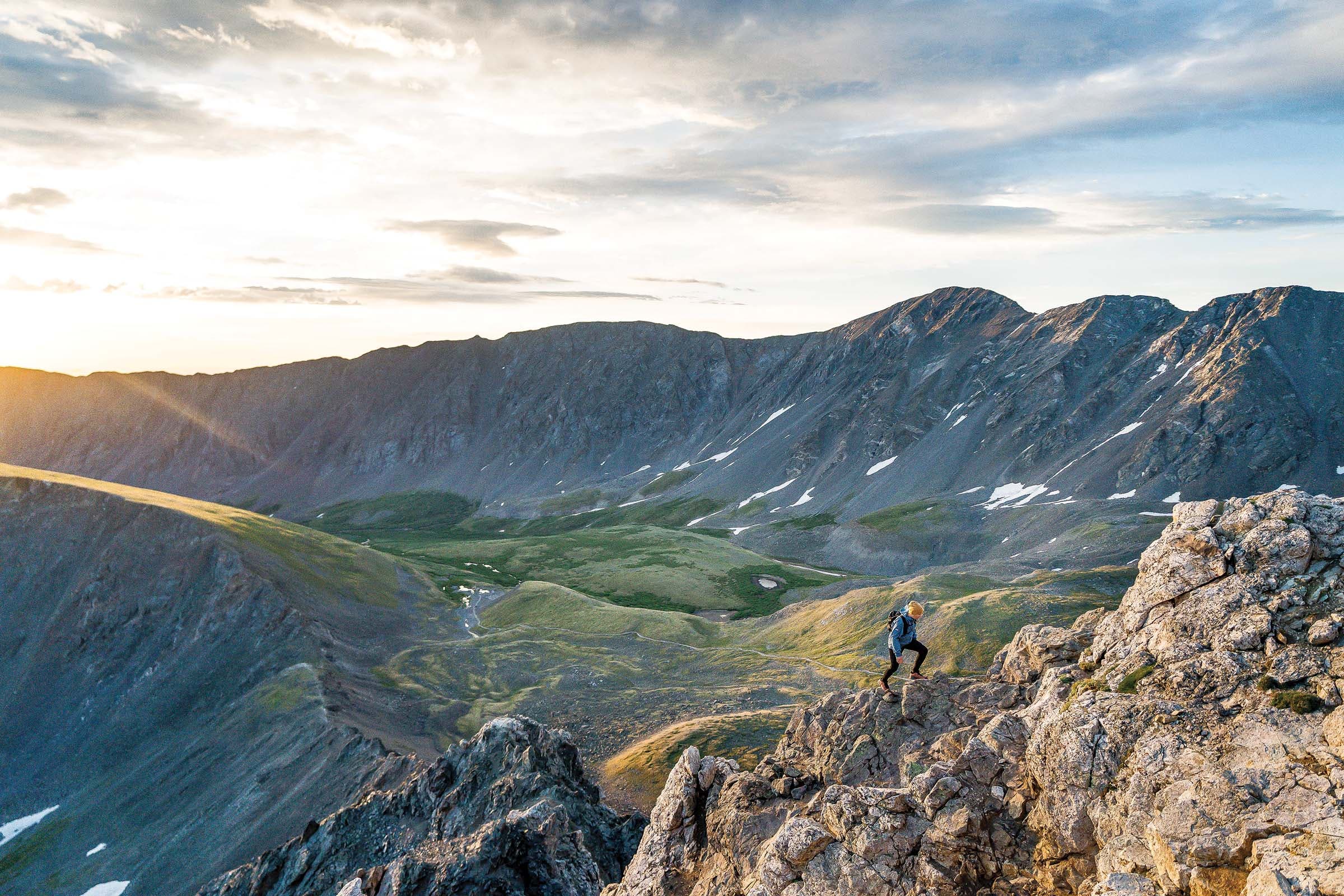
Summiting your first Colorado Fourteener is a rite of passage for any peakbagger. Kick off your list with 14,278-foot Grays Peak—though it’s the tallest point on the Continental Divide, it’s a class 1, non-technical ascent and is the easiest Fourtneer that doesn’t have an automobile road. You’ll still face a 3,000-foot climb over 2.6 miles, and you’ll share the trail with the locals—mountain goats, basking marmots, and squeaking pikas—on the final mile of scree to the summit. There, views stretch far and wide, from 14,115-foot Pikes Peak to the south to 14,258-foot Longs Peak’s summit block to the north. Make it a two-fer by adding on 14,275-foot Torreys Peak, just a half-mile away over some light class 2 climbing. Then, get to planning the rest of your list.
Trailhead 39.6590, -105.7851 Get here Take Exit 221 off of I-70 and follow Stevens Gulch Road to the trailhead Permit None
ADVERTISEMENT
Dayhike: Mt. Mitchell, North Carolina
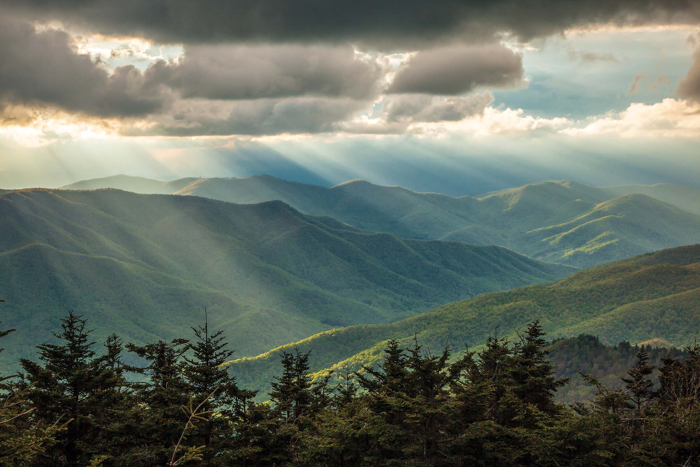
Good news: The highest peak east of the Mississippi River is also the easiest one to bag on this list. Follow an avenue of spruce along the ADA-accessible .2-mile Summit Trail to a stone ramp ending at a short turret. Just like that, you’re standing at the top of 6,684-foot Mt. Mitchell and the start of the Black Mountains. Turn in all directions to spot 6,647-foot Mt. Craig draped in Fraser firs to the north and the craggy stone summit of Mt. Hawksbill to the east. To the south is the rest of the billion-year-old Black Mountains—Mt. Gibbes and Clingmans Dome and The Pinnacle—bending around a valley. Take your time letting your gaze find that faraway glimpse of the Great Smoky Mountains to the west: After all, the short hike here means you can spend as long with the views as you like.
Trailhead 35.7664, -82.2653 Get here Follow the Blue Ridge Parkway to mile marker #355, turn left and follow NC 128 to the parking lot Permit None
Overnight: Guadalupe Peak, Texas
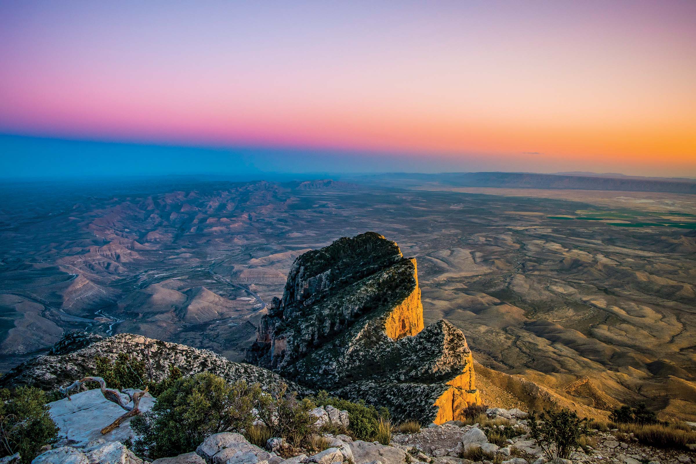
Bagging a “sky island” is easier than it sounds on this 8.4-mile overnight. As you hike up the gently graded Guadalupe Peak trail, you’ll rise from a desert of prickly pear and juniper to a forest of Douglas fir and ponderosa pine, where elk and grey fox patrol the understory. It’s about 10 degrees cooler up here, too. Spend your first night at the Guadalupe Peak campground (just three miles from the trailhead) admiring the Milky Way as it spins through the night sky amid the howls of coyotes and the call of the western screech owl. Begin your ascent of the final mile before dawn to hit the six-foot-tall pyramid that marks the summit of 8,750-foot Guadalupe Peak—the highest point in Texas—then watch peregrine falcons swoop as the sunrise lights up the desert before retracing your steps.
Trailhead 31.8966, -104.8281 Get here Drive east on US 62 from El Paso to reach the park Permit Free, five sites available, first come first served
ADVERTISEMENT
Overnight: Mt. Adams, Washington
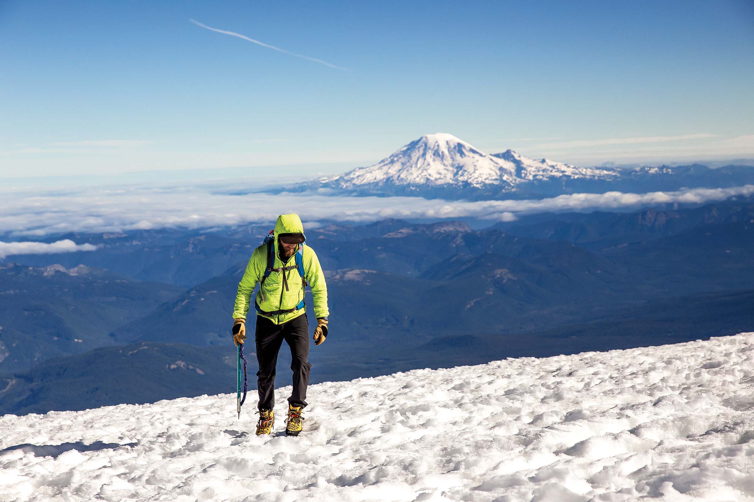
Time to add bagging a volcano to your bucket list. While the likes of 14,411-foot Mt. Rainier and 11,250-foot Mt. Hood require the full kit and caboodle to safely ascend, beginning mountaineers can tackle 12,281-foot Mt. Adams with little more than low-key traction devices and an ice axe. But you’ll still need to climb up 6,700 feet over 12 miles—that’s why we recommend pitching your tent at the so-called Lunch Counter above Crescent Glacier. Get up before dawn the next morning (before the high-altitude sun softens the snow) to finish the strenuous climb up Suksdorf Ridge to the summit. Pick out the other stars of the Cascade Range on the horizon—Rainier and Baker to the north, Mt. St. Helens to the west, Hood to the south—and know the experience you’ve gained will translate perfectly to those loftier heights in the viewshed.
Trailhead 46.1359, -121.4976 Get here Take a right on Forest Road 23 from Mt. Adams Road. Turn left on Forest Road 80, then right on Forest Road 8040 and follow until you reach the trailhead at the Cold Spring Camp area Permit $15 Cascade Volcano Pass required
Read the full story, America’s 14 Friendliest Summits, with your Outside+ membership.