Updated July 10, 2025 09:03AM
Climb to the Roof the Adirondacks
MacIntyre Range, New York
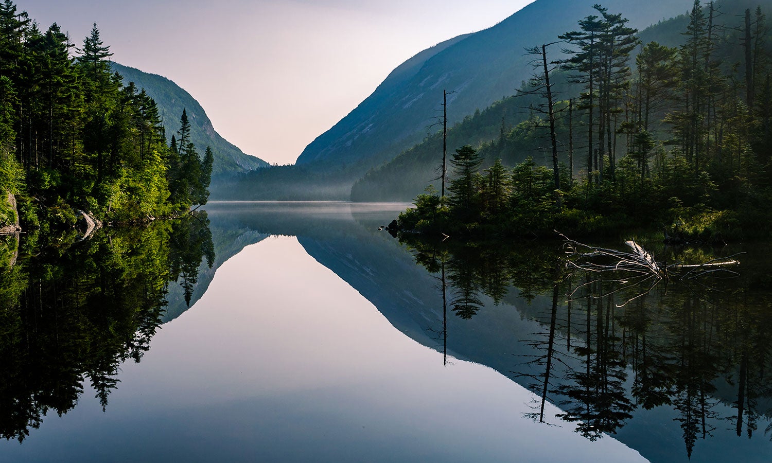
'Photo by Viktor Posnove'
The trail drops like a mine shaft below treeline on the flank of 5,114-foot Algonquin Peak. I’m at the bottom, 2,000 vertical feet down, looking up. Progress is always slow in the High Peaks of the Adirondack Mountains, but it’s especially so here. I clamber over tangled roots, choss piles, and boulders made slick by the stream that plummets along the route, sometimes reaching hand over hand as I crane my neck skyward. We summited 4,360-foot Mt. Marshall yesterday, and today we have three more peaks on the docket. Once we gain the ridgeline, they’ll unfold like a red carpet: Iroquois, Algonquin, and Wright Peaks, each rising above the gold-, copper-, and scarlet-tinted hardwoods like the points of a crown. In the ’Daks, there are no gimme peaks, but I’m on a roll.
Turn-by-turn
From the High Peaks Information Center
Take the Van Hoevenberg Trail 2.3 miles to Marcy Dam.
Continue 2.9 miles south on the Avalanche Pass Trail, which climbs to Lake Colden.
At the trail register, skirt Lake Colden’s west shore en route to the Beaver Point Lean-to , .9 mile away.
Retrace your steps to the trail register.
Veer northwest on the Algonquin Trail and take it 1.7 miles to an intersection.
Bag 4,840-foot Iroquois via a 1.4-mile out-and-back.
Continue 4 miles northeast across the MacIntyre Range, netting 5,114-foot Algonquin Peak near mile 10.4 and 4,580-foot Wright Peak near mile 11.3 (via a short spur).
Bear north on the Van Hoevenberg Trail and retrace your steps about .5 mile to Adirondack Loj.
ADVERTISEMENT
Campsite: Beaver Point Lean-to (mile 6)
The sheer rock faces above Avalanche Pass frame the view from this three-sided shelter. Occupied? A second lean-to is a short walk south, or you can follow signs 20 yards uphill from Beaver Point to campsites. (All are first-come, first-serve.)
Bear canisters
Black bears patrol the High Peaks for errant crumbs. Backpackers must store food in bear canisters (rent one at the High Peaks Information Center for $8). Be sure to cache canisters 100 feet from camp and kitchen.
Landslides
Fine-grained soil covers the Adirondacks. When rain or snowmelt overloads these thin layers, landslides result. Note the legacy of Hurricane Irene: This 2011 event uncovered bare white rock atop Mt. Colden’s Trap Dike and created the new Wright Peak slide, visible at looker’s right from Marcy Dam.
ADVERTISEMENT
Day trip
Tack on 4,360-foot Mt. Marshall via a 4-mile out-and-back from Lake Colden. Hike .4 mile southwest to Herbert Brook, where a cairn on the east bank marks the start of Marshall’s unmaintained herd path. Navigate blowdown, streams, and rockslides to the .5-mile ridgewalk.
Late bloomers
When glaciers receded 12,000 years ago, alpine tundra blanketed New York. Today, winds up to 120 mph and some 10 months of frost preserve alpine habitat above 4,000 feet. Look for white diapensia (blooming in June), yellow alpine goldenrod (August), pink Lapland rosebay (summer), and white mountain sandwort (summer) on open summits—and step only on rock.
DO IT Trailhead 44.183243, -73.963008; 8 miles south of Lake Placid on Adirondack Loj Rd. Season June through October Permit None Custom map bit.do/BPmapMacIntyreRange ($15)