Published September 20, 2013 05:11AM
Seattle, WA: Stegosaurus Butte
Go off the beaten path to witness the forging of this new trail and get your first taste of the Middle Fork Snoqualmie Recreation Area.
Sometimes you just want to have some adventure. To go places perhaps a little more wild and remote than a well-worn footpath to a scenic overlook or civilized waterfall. A trek out to Stegosaurus Butte looked to fit the bill. There we hoped to see if Manning’s vision of carving out a “family hike” up the side of this smallish granite ridge next to the Middle Fork Snoqualmie River had become a reality, or if the proposed trail had languished and faded beneath the advancing forest.
The Middle Fork Trail #1003 conveniently begins at the north end of the Middle Fork Trailhead parking lot and almost immediately spans the river via the Gateway Bridge constructed in 1993 in an effort to promote recreation in the Middle Fork area. After crossing the bridge, a sign that reads “Main Trail” directs you to the left. Head instead to the right along a less traveled but still discernable trail. Tromp along the rocky banks of the Middle Fork Snoqualmie for a few hundred yards over and around logs and boulders blocking the trail. Rounding the end of the butte, the trail curves up and away from the bank and abruptly seems to end. Simply continue forward and away from the river and quickly find the roughly hewn trail marked with bright fluorescent pink tags.
A great deal of trail construction seems to be underway, with portions of the trail defined by logs and branches, and blowdowns cleared or circumvented. While Manning’s concept is still a work in progress, between the boot-trodden outline of the path and the trail markers we never lost the trail. The bulk of the hike forgoes niceties such as switchbacks – trailblazers instead opted to cut a leg-burning bee-line straight to the top. Fortunately, the trail is short and the almost brutal ascent is over quickly, yielding great views of the massive and imposing rock face of Mt. Garfield to the north and Preacher Mountain to the far south. Rainy Creek flows through the valley to the south, beneath a prominence unofficially known as “The Pulpit”. Settle down for a snack in the grassy open areas before breaking out the hiking poles to help navigate the steep descent back down.
-Mapped by Nathan and Jeremy Barnes, hikingwithmybrother.com


Trail Facts
- Distance: 1.4
Waypoints
SB001
ADVERTISEMENT
Location: 47.5477178, -121.5370256
Middle Fork Trailhead Parking Lot.
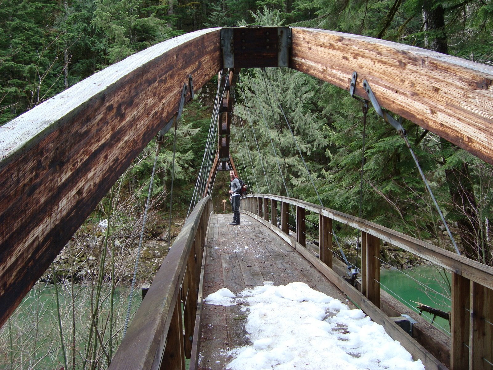
Gateway Bridge
Location: 47.5468571, -121.537317
Crossing over the Middle Fork Snoqualmie River.
SB002
Location: 47.5468463, -121.5373385
Trail junction. Take a left off the main trail, following the river downstream.
River Bank
Location: 47.5468969, -121.537486
Great spot for a picnic!
SB003
Location: 47.5467699, -121.5395826
Start of Stegosaurus Butte Trail. Head up the hillside following the pink trail markers.
Old Growth Stump
Location: 47.5451553, -121.5368021
Stump of old growth Douglas Fir. Note the still-visible foot holds cut out by loggers.
SB004
Location: 47.5448797, -121.5357538
Trail junction. Head up and to the left, following the pink tags.
View of Mt. Garfield
Location: 47.5422294, -121.5318668
The massive rock face of the 5519ft peak completely dominates the view.
Valley View
Location: 47.5421063, -121.5324998
View across the Middle Fork Snoqualmie Valley.
SB005
Location: 47.5420845, -121.5323925
End of usable trail.
SB006
Location: 47.5406985, -121.5290516
ADVERTISEMENT
Top of the butte, and overlook down granite cliffs. Must bushwhack to reach this point.
End of the line
Location: 47.5406867, -121.5288949
Ledge over granite cliffs.