Published September 20, 2013 03:30PM
Seattle, WA: Mason Lake
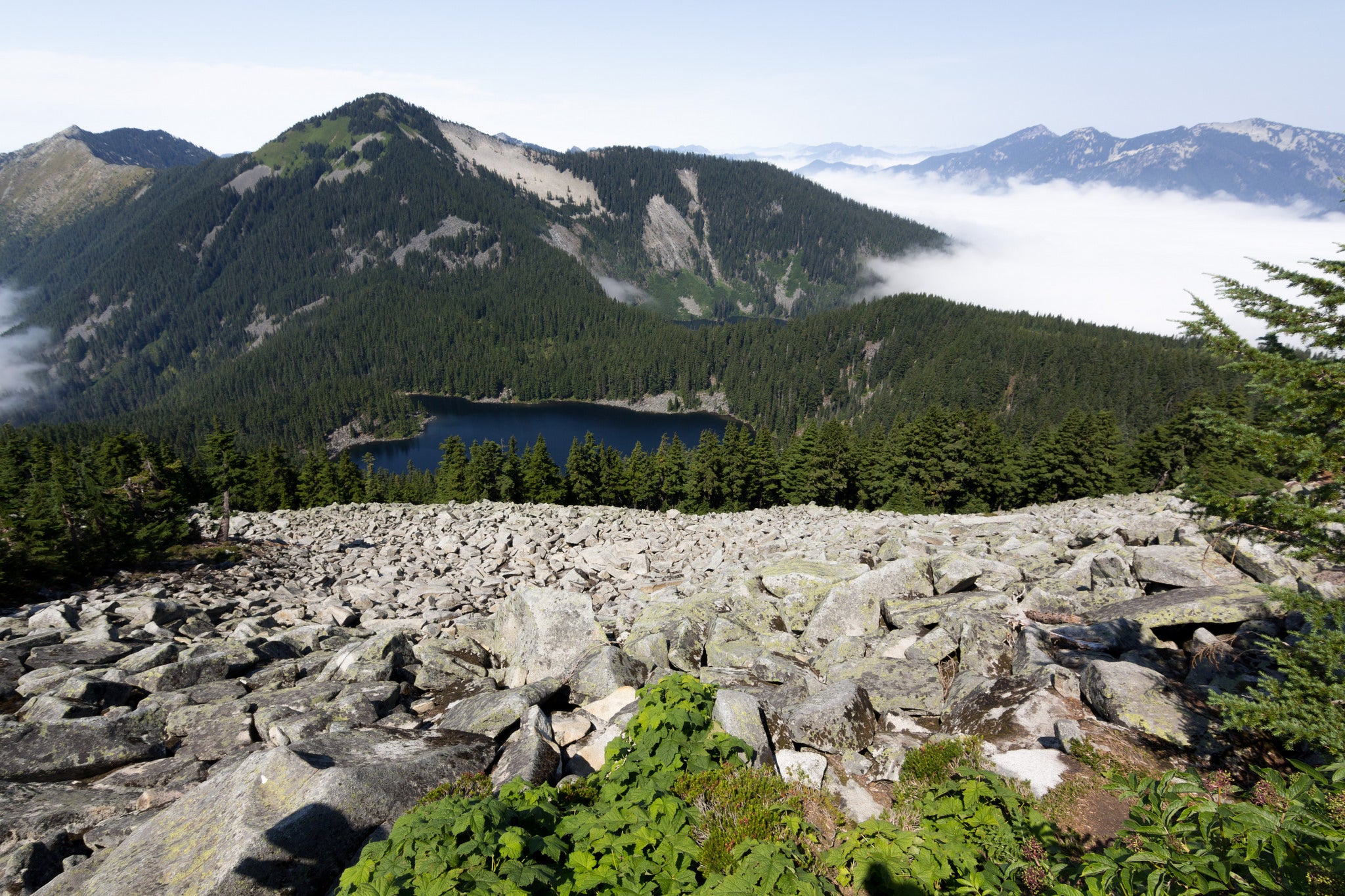
This 6.2-mile out-and-back follows the new Ira Spring Memorial Trail, which winds for 3.2 miles above Snoqualmie Valley, ending at picturesque Mason Lake.
'Nikky'
Trail Facts
- Distance: 5.2
Waypoints
MSL001
Location: 47.4242821, -121.5827026
Trail starts on abandoned road.
MSL002
Location: 47.4237975, -121.577121
Cross Mason Creek; look for small waterfalls. Continue straight bearing R @ junction with old unnamed trail.
MSL003
Location: 47.4184837, -121.5706177
Views of McClellan Butte and Mount Kent.
MSL004
Location: 47.4176331, -121.56707
L onto new Ira Spring Memorial Trail (trail leaves old roadbed).
MSL005
Location: 47.417984, -121.5626831
Cross large avalanche path.
MSL006
Location: 47.4203491, -121.5584488
Switchback skirts around huge talus slope.
MSL007
Location: 47.4186516, -121.5566635
L @ Bandera Mountain Trail.
MSL008
Location: 47.4219666, -121.557869
Cross ridgeline into Alpine Lakes Wilderness.
MSL009
Location: 47.4248009, -121.5550308
Lunch spot on Mason Lake shoreline; trail bears L toward more alpine lakes en route to Pratt Mountain and Mount Defiance ridge. Return to your car the way you came. Overnight option: Cross Mason Creek and walk 200 feet to an established campsite.