Published September 20, 2013 03:30PM
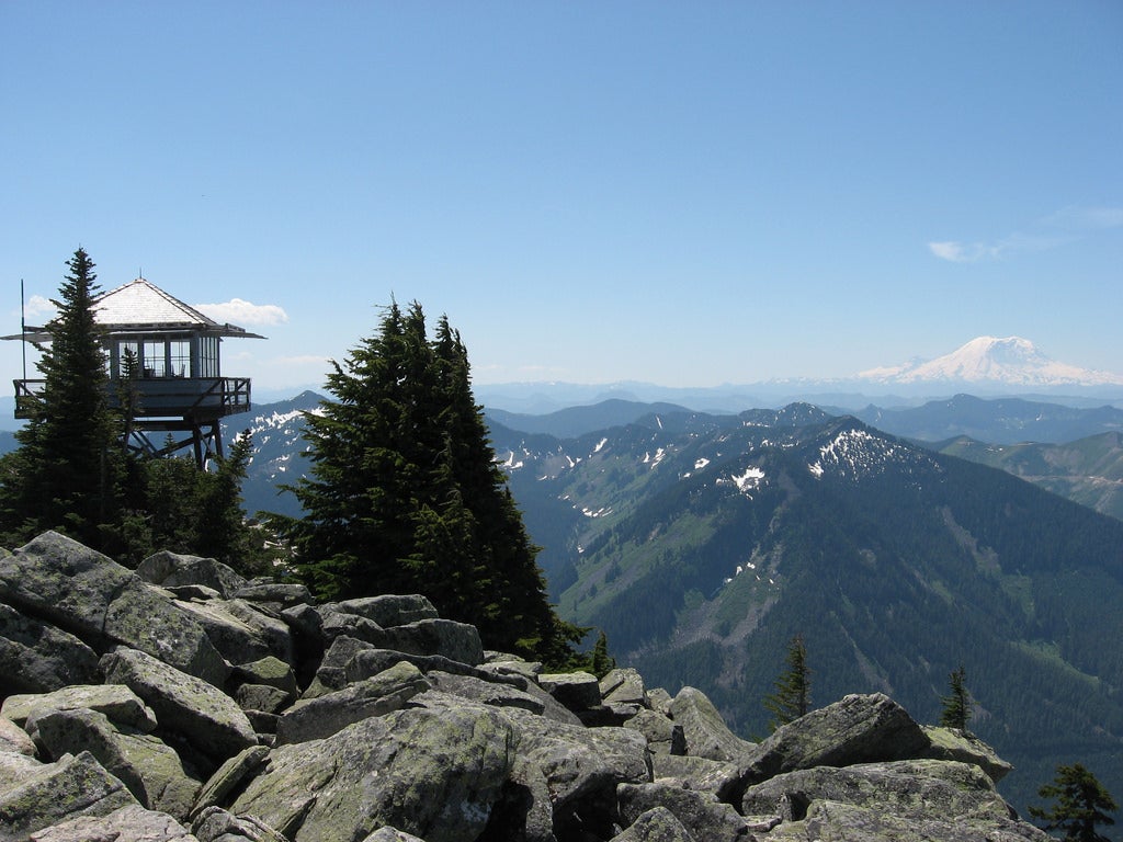
Seattle, WA: Granite Mountain Trail
A steep climb of 3,700 feet in 3.6 miles gains a firetower lookout with spectacular views of Mount Rainier, Mount Baker, and Mount Stuart.
'laffertyryan'
Trail Facts
- Distance: 6.1
Waypoints
GMT001
Location: 47.3948669433594, -121.48836517334
Trailhead for Granite Mtn. (1,944 ft.)
GMT002
Location: 47.4018096923828, -121.486534118652
Bridge over creek
GMT003
Location: 47.4047508239746, -121.487762451172
R onto Granite Peak Trail, begin to climb steadily
GMT004
Location: 47.4086685180664, -121.48120880127
Enter Alpine Lakes Wilderness, views to valley below
GMT005
Location: 47.4119415283203, -121.480476379395
Avalanche gully; snow can make this dangerous to cross in early spring
GMT006
Location: 47.4123077392578, -121.475471496582
Avalanche gully, last good shade until top
GMT007
Location: 47.4117088317871, -121.471046447754
Spectacular hillside, Mt. Rainier comes into view to S
GMT008
Location: 47.4138031005859, -121.470283508301
First view of Granite Mountain Lookout to NW
GMT009
Location: 47.4149894714356, -121.474143981934
L @ 3-way, good water to right
GMT010
Location: 47.4156951904297, -121.475196838379
Many trails at this point; best choice is to go around to E and up drainage
GMT011
Location: 47.418888092041, -121.482398986816
Granite Mtn. Lookout (5,629 ft.)