Seattle, WA: Fuller Mountain

Knowing we’d be a little short on time this week, we spent some time looking for short hikes that didn’t take us too far out on I-90. We decided on an interesting little knob just west of Mt. Si called Fuller Mountain, located in what is now called the Snoqualmie Forest, a sprawling working forest near North Bend.
Fuller Mountain sits on land that made up some of the original acreage purchased by the newly formed Weyerhaeuser Company in 1900. Over the years, as the company harvested timber and replanted it in successive waves, the 104,000 acres of timberland came to be known as the Snoqualmie Tree Farm. For decades Weyerhaeuser allowed recreational access to the Tree Farm, including hiking, biking, fishing, and hunting. In 2003 Weyerhaeuser sold all 104,000 acres to the Hancock Timber Resource Group who currently manages the property and continues the tradition of allowing recreational access to the area. A year later, in 2004, King County purchased the development rights to 90,000 acres of the Tree Farm in one of the largest public purchases of development rights in U.S. history. Thus safeguarded against future suburban growth, the name was officially changed to the Snoqualmie Forest.
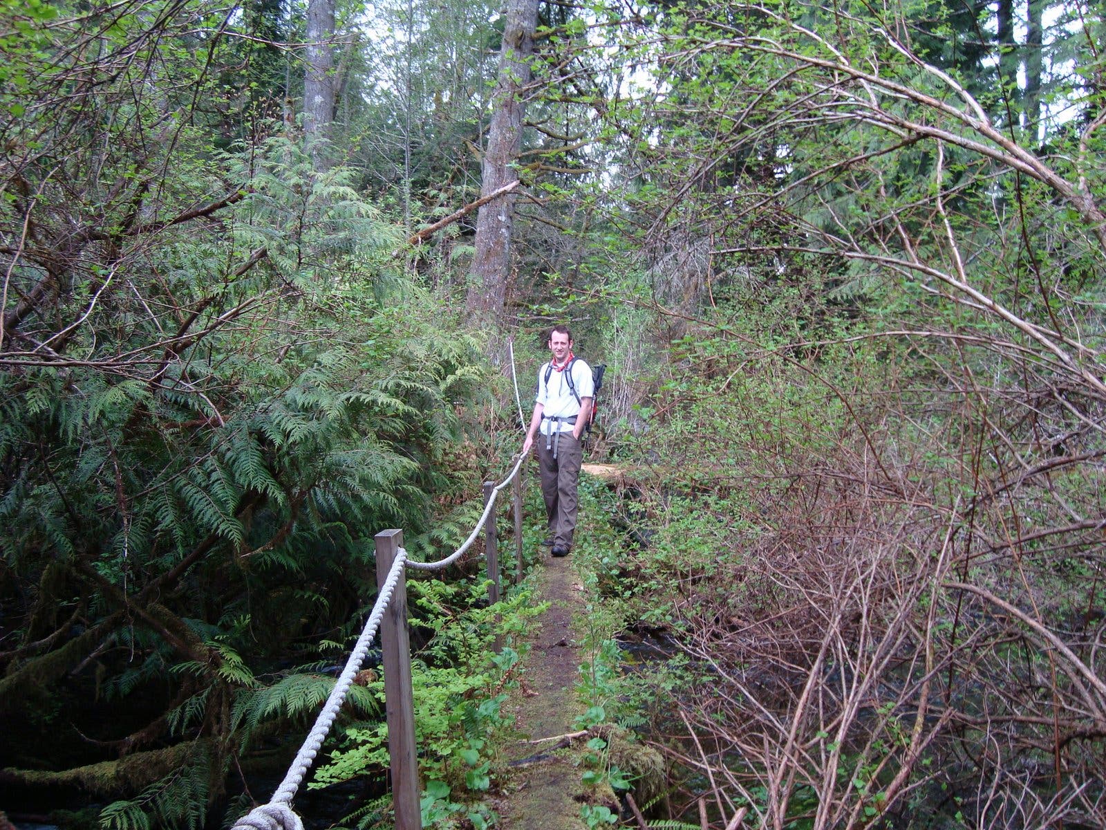
The trail begins at Spur Gate 10, narrowly winding through uniformly planted Douglas fir to Ten Creek. After crossing the creek and continuing on the trail for a few minutes, you will eventually find yourself dumped onto a logging road. At this point many hikers are understandably confused. Head to the left and follow the road for a minute or two to the first intersection with a spur road. Take this road uphill for a few hundred yards to pick the trail back up again. The small path isn’t immediately obvious so keep an eye out for it on the left.
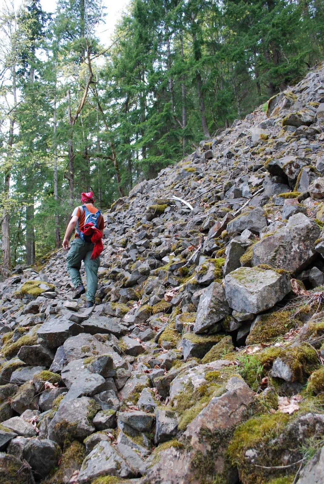
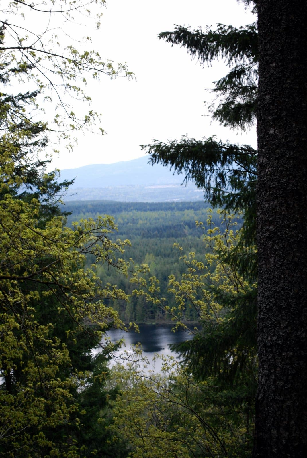
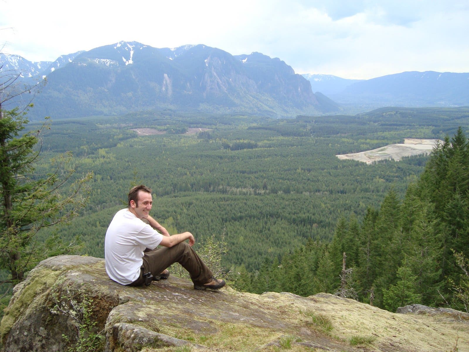
From here the trail traverses rocky fields and winds through a sparse forest of alder awash in sword fern. Through the trees you’ll catch increasingly better glimpses of Klaus Lake as you get closer to the summit. The highest point of Fuller Mountain does not have any view, so be sure to continue on to southeast to a rocky outcropping that overlooks much of the Snoqualmie Forest and gives a nice view of Mt. Si’s Moon Wall.
Expect to have this trail largely to yourself; the combination of a somewhat confusing route and being located within a working forest probably keeps hikers on more familiar trails in other locations. The quiet solitude does have a price – the lack of foot traffic means this trail is barely scratched into the side of the mountain and can be a little tough to navigate. Soil is loose and rocky and there are a few trees that need to be crawled over or around. Despite a few obstacles, Fuller Mountain was a peaceful alternative to the crowds of Tiger or Si, and the view at the top was well worth the climb.
-Mapped by Nathan and Jeremy Barnes, hikingwithmybrother.com
Trail Facts
- Distance: 2.8
- Miles from city center: 36
Waypoints
FMT001
Location: 47.57535, -121.738579
Park outside of Spur Gate 10: Do not block the gate. The small trail begins on the north side of the road and dips toward an overgrown log bridge that cruises over Ten Creek.
FM002
Location: 47.578118, -121.741819
Road Crossing. Trail continues on the other side of the road.
FM003
Location: 47.580757, -121.744859
Junction with a road. Turn left and follow the road.
FM004
Location: 47.580463, -121.746279
Y in the road. Make a sharp right up road.
FM005
Location: 47.581058, -121.746216
Make a left back onto the trail. If you reach the end of the road, you’ve gone too far.
Ten Creek Crossing
Location: 47.577394, -121.739759
Unique log bridge, is overgrown with vegetation.
Small Rock Slide
Location: 47.584168, -121.749544
Walking over one of several small rock slides on the west slope of Fuller Mountain
Klaus Lake
Location: 47.585934, -121.750102
The lake ducks in and out of view through the red alders as you progress along the trail
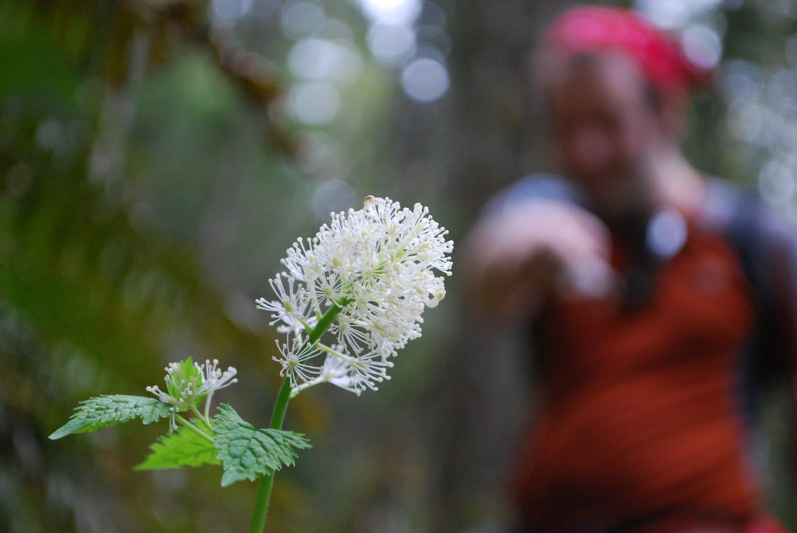
In Bloom
Location: 47.587555, -121.747355
Forest wildflower in spring bloom
FM006
Location: 47.586557, -121.744527
Trail ends on small rock outcrop, which is the summit of Fuller Mountain.
Savoring the View
Location: 47.586542, -121.744137
Taking in the view of Mt. Si, and North Bend to the South.