Heading out the door? Read this article on the new Outside+ app available now on iOS devices for members! Download the app.
This 7.4-miler starts out gently, traveling northeast through forest—you’ll follow an old road bed and trace Rock Creek for the first .8 mile. From here, the trail swings to the west and starts a steep switchback climb, passing Columbia lewisia, paintbrush, and buckwheat. Views of surrounding peaks pop in and out of view. At mile 3, the trail mellows slightly as it climbs a ridge covered with Douglas firs and lodgepole pines—pause to admire the wildflower show in the grassy, open forest. After 3.7 miles, the route crests a 5,397-foot summit, which was the former site of a fire lookout. Drop your daypack and enjoy panoramas of the Chiwawa and White River valleys to the northwest and Seven Fingered Jack to the north. Follow the same route back to the trailhead.
-Mapped by Alan Bauer, Alan Bauer Photography

Trail Facts
- Distance: 6.0
Waypoints
EST001
Location: 47.9714088439941, -120.790840148926
Leave trailhead and follow the trail marked by an old signpost; hike into the forest, heading northeast. Note: The mileage listed on the trailhead signpost is for the old trail. The new trail climbs 3.7 miles to the former lookout site.
EST002
Location: 47.9726257324219, -120.78929901123
The trail emerges right along the shores of Rock Creek; you’ll hike to the sounds of this rushing creek for almost a mile.
EST003
Location: 47.9742851257324, -120.788429260254
Stay straight @ 3-way junction; a side trail enters on the left. Ahead: Follow old, rocky road bed, and catch glimpses of Rock Creek as you hike northeast.
EST004
Location: 47.9804344177246, -120.780364990234
Turn left @ signed junction and leave old road bed. Trail switchbacks to the southwest; prepare for the steep climb ahead.
EST005
Location: 47.9806976318359, -120.785934448242
Cross a seasonal stream—this is the last place to refill water bottles. Continue climbing through forest; more switchbacks ahead.
EST006
Location: 47.9821548461914, -120.784843444824
Catch your breath on this open switchback speckled with Columbia lewisia, paintbrush, and buckwheat. In early summer, wild ginger blooms on the forest floor. Look to the southeast for views of Basalt Peak and Basalt Ridge. Steep switchback climb continues.
EST007
Location: 47.9853515625, -120.78678894043
Turn left at switchback and head west. Look for signs of the old trail, which was rebuilt (with switchbacks) to minimize erosion. Keep climbing.
EST008
Location: 47.9862365722656, -120.788032531738
Hit a switchback overlooking the Rock Creek valley below; striking views of Garland Peak are revealed to the east-southeast.
EST009
Location: 47.9867706298828, -120.790939331055
Hike north along Estes Butte’s southern ridge. The climb mellows and winds through a mix of Douglas firs, lodgepole pines, and a few mountain hemlocks. Ahead, the trail passes a few viewpoints; don’t forget to admire the wildflowers that thrive in the grassy, open forest. Scan pine trees for Clark’s nutcrackers that feed on the seed-filled cones.
EST010
Location: 47.9928016662598, -120.790870666504
The forest opens for the last ¼-mile to the lookout site. Check out views to the east of the Entiat Mountains and views west into the Chiwawa Mountains and White Mountains.
EST011
Location: 47.9950103759766, -120.793014526367
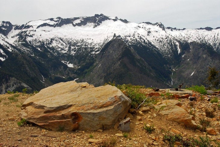
The remnants of a fire lookout—four concrete footers, old cables, and bolts—mark this 5,397-foot summit on Estes Butte’s ridge. Grab your camera and snap shots of the Chiwawa and White River valleys to the northwest. To the north, you’ll find Carne Mountain, Seven Fingered Jack, and more. Next, turn around and retrace route to the trailhead.
Chiwawa Ridge
Location: 47.9949951171875, -120.792991638184
Views of the Chiwawa Ridge from the summit.