Santa Barbara, CA: Cold Springs to Tangerine Falls

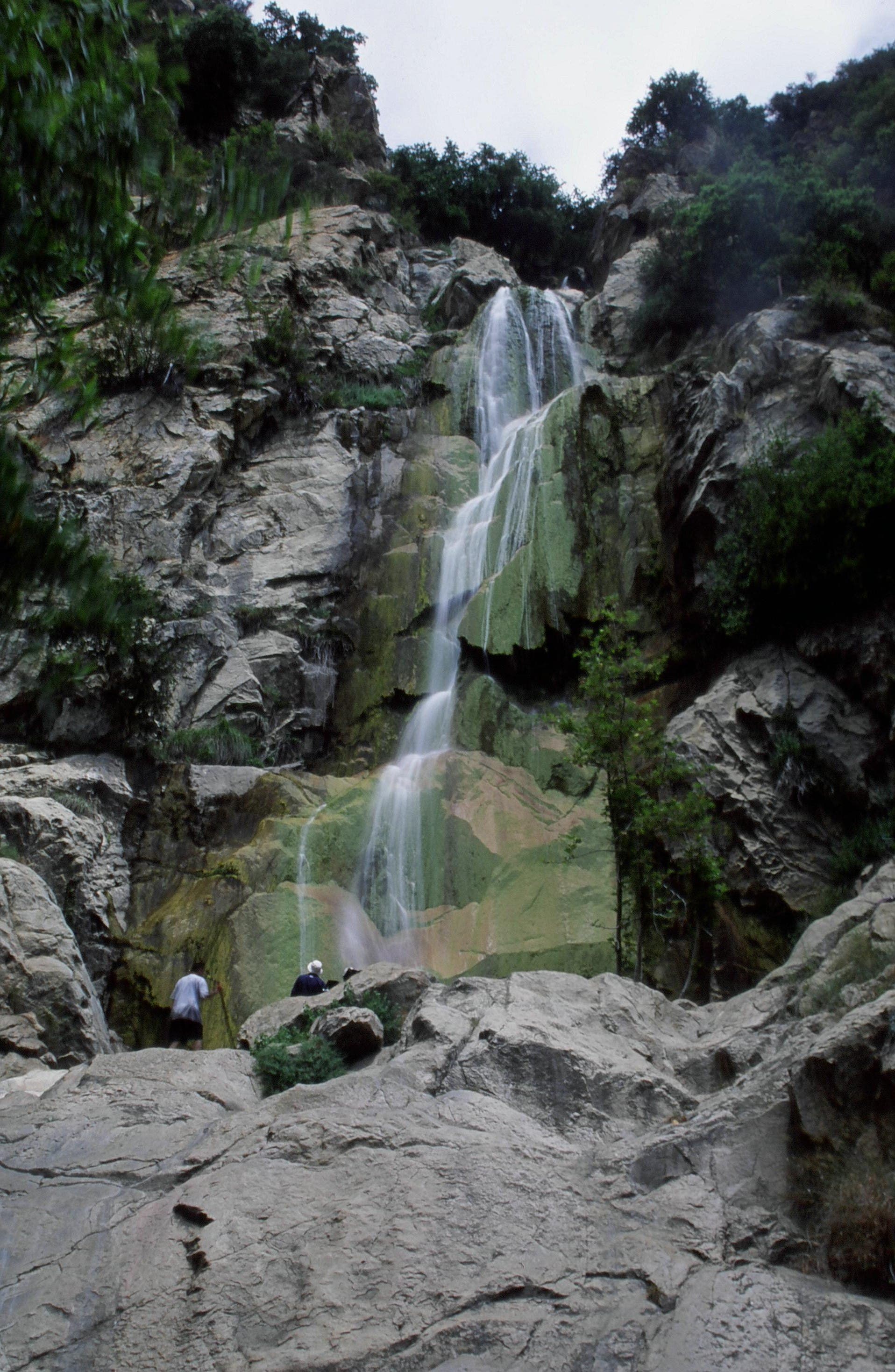
The 2.4-mile out-and-back from the West Fork of Colds Springs Creek to Tangerine Falls packs days worth of scenery into just a few hours and offers after-work hikers and trail runners a short but intense climb (1,000 feet of elevation gain in less than a mile and a half).
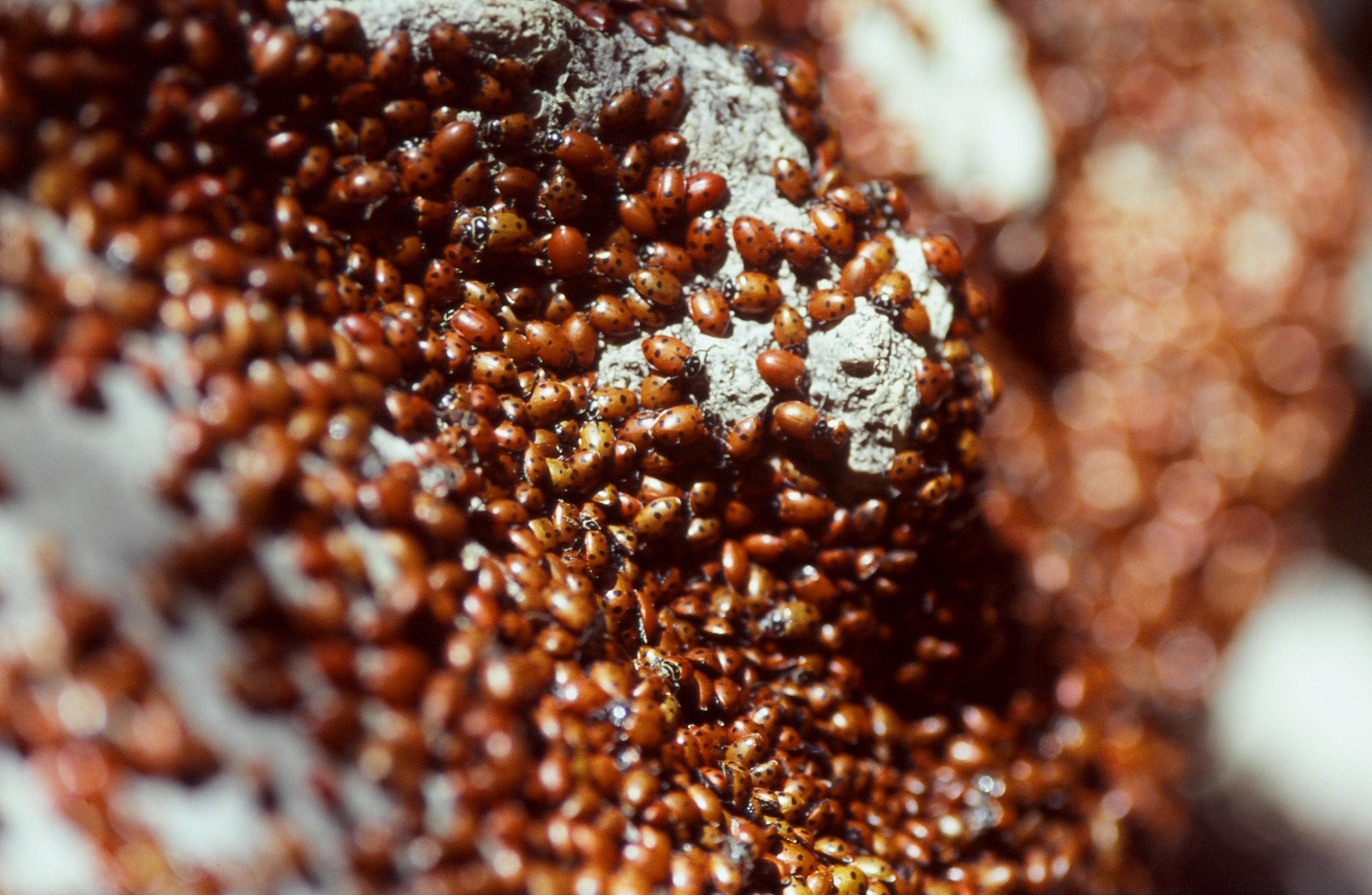
Follow the creek upstream through a canyon full of oaks and sycamores. Keep your eyes peeled for amphibians hiding along the trail. As you rock-hop over the creek, also watch for garter snakes and ladybugs in its shallow pools.
As you hike north, the canyon masks the 250-foot-high Tangerine Falls almost until you are standing right beneath it. Climb up either side of the falls for a spectacular vista of Santa Cruz Island. From there, retrace your route back to the trailhead.
-Mapped by Chuck Graham
Hike Cold Springs to Tangerine Falls
TO TRAILHEAD: Head northwest on East Mountain Drive. In 0.4 mile, turn left on Cold Springs Road. Stay left on Cold Springs after a half mile. In 0.6 mile, turn right onto CA-192/Sycamore Canyon Road. Bear left to stay on CA-192. Turn left onto CA-144/Sycamore Canyon Road. Continue for 1.1 miles, then take the first exit onto Alameda Padre Sierra. Turn left onto East Cota Street and continue for a half mile. Turn right onto North Milpas Street. North Milpas turns left and becomes East Anapamu Street. Continue straight to the trailhead.


Trail Facts
- Distance: 4.0
Waypoints
COS001
Location: 34.4559303, -119.6530344
From the Cold Springs Trailhead, hike northeast on the sandstone path through a grove of oak and sycamore trees.
COS002
Location: 34.458783, -119.6541108
Bear left at the West Fork Trail sign. Cross the creek and continue on the West Fork Trail.
COS003
Location: 34.4647802, -119.6583438
Turn right at the Santa Barbara Land Trust sign. Descend into a dry creekbed using the roots of a California Bay Tree to climb up an embankment. Proceed on the trail to the left of the creek. Look for banana slugs on the trail.
COS004
Location: 34.4657606, -119.6585545
Bear right at the fork. Follow the trail as it meanders alongside and across the creek. The final crossing puts the creek on the right side of the trail. Several shallow pools have ladybugs, canyon tree frogs and two-striped garter snakes. In the spring, look for tiger lilies. Yuccas grow in the sandstone cracks in early summer.
COS005
Location: 34.4699902, -119.6591699
Tangerine Falls cascades down a sandstone cliff for 250 feet into a shallow pool. Scramble up either side of the falls for terrific views of Santa Cruz Island. When finished marveling, retrace steps back to the Cold Springs Trailhead.
West Fork
Location: 34.4587827, -119.6540093
©Chuck Graham
Banana slug
Location: 34.465196, -119.658376
Watch for canyon tree frogs, rough-skinned newts and banana slugs on the trail. ©Chuck Graham
Ladybug Cluster
Location: 34.4664786, -119.6585155
The west fork of Cold Springs harbors many critters like these clusters of ladybugs. ©Chuck Graham
Tangerine Falls
Location: 34.4696364, -119.6593201
This is Santa Barbara County’s tallest frontcountry waterfall. ©Chuck Graham