Rocky Mountain National Park: Lost Lake

This 19.5-mile weekend retreat climbs 2,800 feet along the North Fork Big Thompson River to the cradle of Lost Lake. The initial stretch warms up the legs with a half-mile downhill before the climbing begins. The scenic trail passes buildings on a private inholdings (stay on trail), crosses footbridges in Roosevelt National Forest, and runs past homestead ruins in the Comanche Peak Wilderness before it enters Rocky Mountain National Park. Stop for the night at one of eight forest service campsites 2.3 to 3 miles from the trailhead, or continue to the National Park boundary for several widely-spaced permit-required campsites there.
The climb intensifies near mile 7 after cutting through an alpine meadow and passing the Lost Falls campground, one of four camping areas along the trail’s upper reaches. You’ll pass a spur trail to Lower Lake campsite. To continue, scramble over boulders on the climb to the mile-wide bowl between Stormy Peaks and Mount Dunraven.
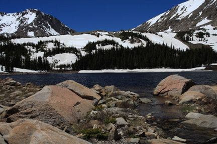
Lost Lake is guarded by 12,000-foot peaks. Pick a flat rock along the lake’s eastern shore for postcard views of the snow-caps, or continue another quarter-mile around its south side to access the chilly water from a small sandy beach.
-Mapped by Kristy Holland
Hike Lost Lake
MAP
Rocky Mountain National Park ($12, natgeomaps.com)
Order USGS topo quads at store.usgs.gov.
Order a custom map of this route using MyTopo.com
CONDITIONS
Trail Ridge Road is closed from November to April. Check conditions for the east side of the park check Estes Park, CO (80517) Weather
PERMIT
$20 for entry to Rocky Mountain National Park; (970) 586-1242, nps.gov/romo
ROCKY MOUNTAIN NATIONAL PARK INFO
Visitor Information (970) 586-1206 (daily, 8 a.m. to 4:30 p.m. Mountain Time; recorded information after hours)
Trail Ridge Road Information Recorded Message 970-586-1222 (available 24 hours a day, updated when conditions and/or road status change)
Visitor Information for the Hearing Impaired (TTY): 970-586-1319 (daily, 8 a.m. to 5 p.m. Mountain Time)
Backcountry Office (970) 586-1242
OTHER RESOURCES
GAS
Shell 860 Moraine Ave. Estes Park, CO (970) 586-7867
GEAR
Grab supplies or gear rentals (packs, bags, pads, and fishing gear) at Estes Park Mountain Shop, 2050 Big Thompson Ave., Estes Park, CO; (866) 303-6548.
GROCERIES
The Country Market National Park Village 900 Moraine Ave. Estes Park, Colorado (970) 586-2702
RESTAURANTS
Try a Mountain Mai Tai and the buffalo-and-bacon meatloaf at Peak-to-Peak American Grille, 451 South Saint Vrain Ave., Estes Park, CO; (970) 577-0577
Trail Facts
- Distance: 31.2
Waypoints
LLT001
Location: 40.475456, -105.460442
This route follows the North Fork Trail that begins on the south side of the parking area, near the toilet.
LLT002
Location: 40.472855, -105.463585
Turn right at the T-junction toward Rocky Mountain National Park.
LLT003
Location: 40.47279, -105.470001
Cross the North Fork Big Thompson River on this footbridge, the first of many along the trail.
LLT004
Location: 40.479053, -105.47113
Stick to the trail as it enters private property. For the next quarter mile, you’ll pass summer-camp facilities including a horse barn, lodge and sport field.
LLT005
Location: 40.482262, -105.474678
Turn left at T-junction following signs toward the National Park boundary and Lost Lake.
LLT006
Location: 40.484741, -105.485169
Cross another footbridge and bypass the Forest Service campsites to your right. Eight campsites are scattered along the next half-mile of trail.
LLT007
Location: 40.487663, -105.496674
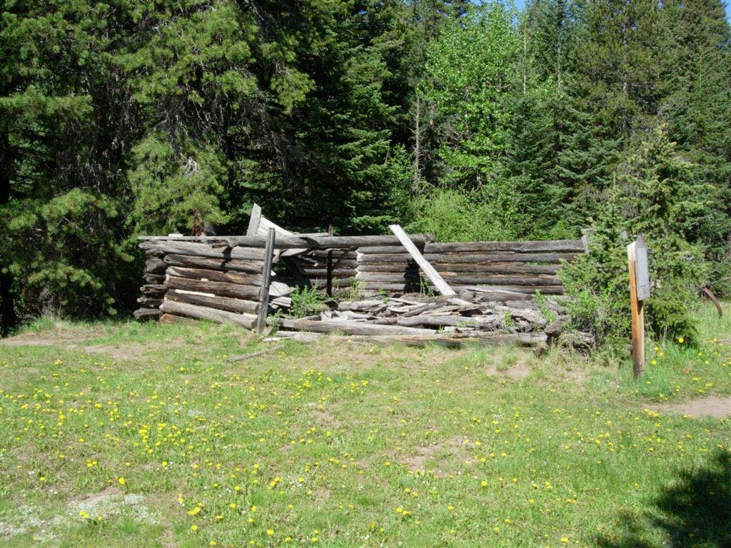
At the western end of a meadow, you’ll pass these log-cabin ruins on your left.
LLT008
Location: 40.494022, -105.508148
This section of the trail, high above the stream, is rocky with little of the lush riverbank vegetation common on other parts of the trail.
LLT009
Location: 40.497753, -105.518578
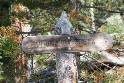
The trail to the Boundary Creek campsite, the first site inside Rocky Mountain National Park. There are at least 7 other marked sites between here and Lost Lake.
LLT010
Location: 40.497688, -105.530739
Stay to the right at the Y-junction to continue 4.4 miles to Lost Lake.
LLT011
Location: 40.497189, -105.536919
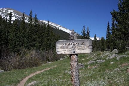
A sign marks the half-way gain in elevation from the trailhead. From here, you have to climb just 1,400 feet to Lost Lake.
LLT012
Location: 40.50032, -105.557472
Stay straight on the trail, bypassing the Lost Falls campsite. From this point, the uphill climb intensifies.
LLT013
Location: 40.505417, -105.568123
Turn left at the T-junction, 2.1 miles from the lake.
LLT014
Location: 40.505497, -105.57151
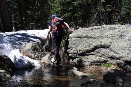
Cross the North Fork Big Thompson River, this is one of the few unbridged crossings, but several stepping-stones will keep your boots dry.
LLT015
Location: 40.507267, -105.594887
Continue left at the Y-junction toward Upper Lost Lake campground and Lost Lake.
LLT016
Location: 40.507526, -105.59938
At 10,714-feet, Lost Lake, is just below this area’s highest peaks and may take your breath away. Large rocks near its shore make great picnic spots.
Log Cabin
Location: 40.487556, -105.49633
These ruins are on the west end of an open field. Pass them on your left.
Boundary Creek Sign
Location: 40.497761, -105.518585
Boundary Creek Campsite
Location: 40.497974, -105.51831
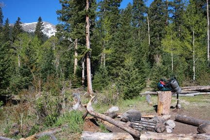
Boundary Creek’s luxe campsite can accomodate 2-3 tens and comes complete with a privy, chopping block, fire ring, and easy access to the nearby stream.
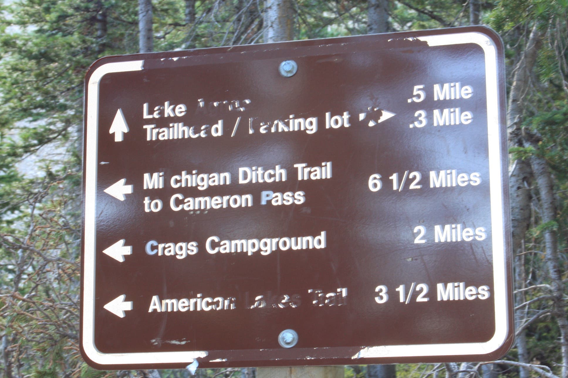
Trail Sign
Location: 40.497719, -105.530747
The whole trail is well marked and informs hikers of distances and potential destinations.
Halfway Point
Location: 40.497192, -105.536964
This sign marks Halfway campsite and point where the trail has gained half the elevation to Lost Lake.
Meadow
Location: 40.499393, -105.555191
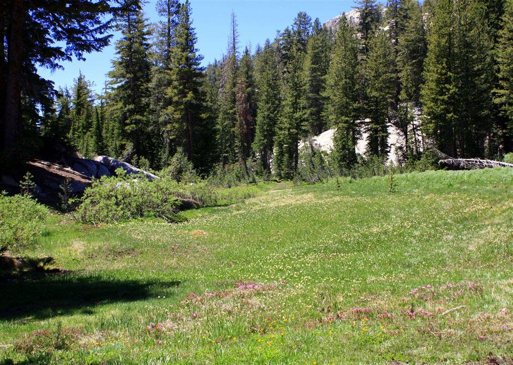
Three miles from Lost Lake, a meadow offers glimpses of Stormy Peaks to the north and Mt. Dickinson and Mt. Dunraven to the south.
Waterfall
Location: 40.504715, -105.565361
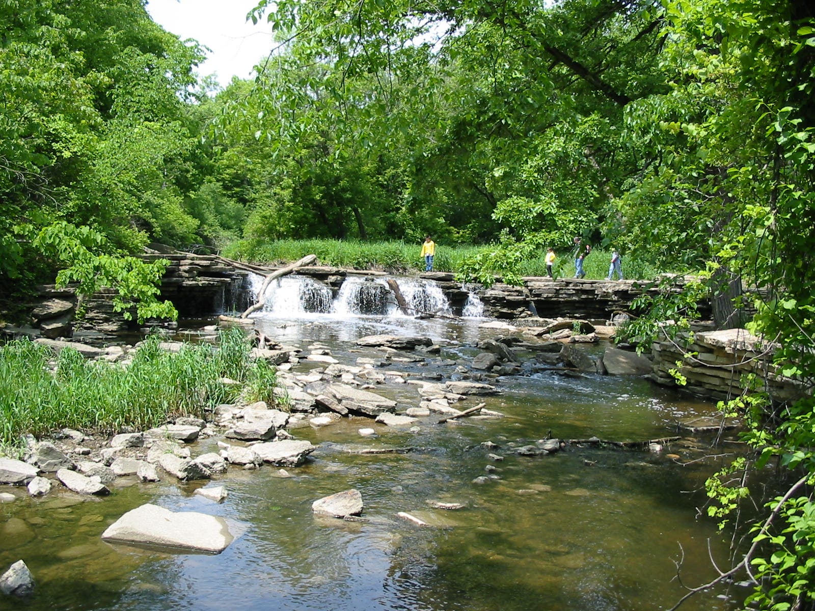
During a rain or after heavy snow-melt, this waterfall can flood the trail’s footbridge.
North Fork Crossing
Location: 40.505497, -105.571465
Stepping stones provide dry passage across the North Fork of the Big Thompson River.
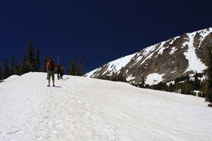
Snowy Climb
Location: 40.507572, -105.596451
This photo, taken in mid-June, shows potential snow cover on the upper reaches of the trail.
Lost Lake
Location: 40.507542, -105.599396
Large rocks on the east side of Lost Lake make great picnic spots.