Published September 20, 2013 03:17PM
Rocky Mountain National Park: Lily Lake to Estes Cone
This moderately challenging 7.2-mile hike to a photogenic summit proves that sometimes it's not how high you climb--it's where you climb.
'Lily Lake (Photo by Vern Southern)'
INFO For information on permits, current trail and camp conditions, and wilderness guidelines, go to nps.gov/romo/planyourvisit/backcountry.htm
PERMIT A wilderness permit is required for all overnight camping in the backcountry. Reservations accepted ($20 administrative fee for permits during peak season). nps.gov/romo/planyourvisit/backcntry_guide.htm
CONTACT Rocky Mountain National Park, (970) 586-1206; nps.gov/romo
-Mapped by Kris Wagner
ADVERTISEMENT
Trail Facts
- Distance: 11.6
Waypoints
ECC001
Location: 40.306419, -105.538002
Begin on wide, crushed-stone path
ECC002
Location: 40.304729, -105.540298
Veer L onto 2-track dirt road (poorly marked). In a few strides, swing R onto thin trail, following signs to Estes Cone
ECC003
Location: 40.30283, -105.541702
Veer L onto 2-track dirt road (poorly marked). In a few strides, swing R onto thin trail, following signs to Estes Cone
ECC004
Location: 40.301849, -105.5448
Stairs drop into an offshoot of Aspen Brook, deeply cut from rapid spring melt (only a trickle in midsummer)
ECC005
Location: 40.300468, -105.545601
ADVERTISEMENT
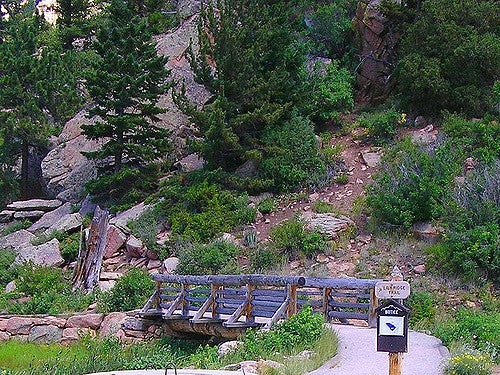
Go straight @ 4-way; immediately cross bridge. Trail begins climbing
ECC006
Location: 40.304401, -105.550102
Cross more bridges and under a few large, lifeless aspens where hawks prey on squirrels and mice in the forest duff. Eventually, pass through short hallway of tilted rocks to a brief overlook above Lily Lake
ECC007
Location: 40.301201, -105.557198
After a few switchbacks, trail eases briefly near two VW-bug-sized rocks among conifers and stacks of deadfall tinder. Intermittent views of the Twin Sisters to E
ECC008
Location: 40.294472, -105.560402
Path boomerangs around the W side of Estes Cone
ECC009
Location: 40.29187, -105.569099
Hulking, sheer Diamond Face of Longs Peak dominates W horizon. Keep hiking: Eye candy gets better!
ECC010
Location: 40.293049, -105.573799
Reach Storm Pass; turn R to begin short, steep ascent of Estes Cone
ECC011
Location: 40.294102, -105.570702
Caution: Rocky trail switchbacks @ odd places. Watch for random cairns
ECC012
Location: 40.295292, -105.567398
ADVERTISEMENT
Estes Cone (11,006 ft.): Summit serves up views of dozens of snowy peaks, including Mt. Meeker and Longs Peak