Published September 20, 2013 03:18PM
Rocky Mountain National Park: Lawn Lake Trail
A wicked flood raged through this valley 20 years ago, carving wide furrows down the Roaring River from Lawn Lake. This hike is 11.6 miles round trip.
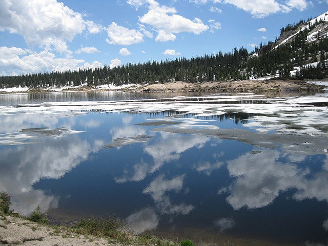
'Lawn Lake (Photo by Chad Bowman)'
Hike Lawn Lake Trail
INFO For information on permits, current trail and camp conditions, and wilderness guidelines, go to nps.gov/romo/planyourvisit/backcountry.htm
PERMIT A wilderness permit is required for all overnight camping in the backcountry. Reservations accepted ($20 administrative fee for permits during peak season). nps.gov/romo/planyourvisit/backcntry_guide.htm
CONTACT Rocky Mountain National Park, (970) 586-1206; nps.gov/romo
ADVERTISEMENT
Trail Facts
- Distance: 18.7
Waypoints
LLT001
Location: 40.407383, -105.626213
Lawn Lake trailhead; stiff climb with stunning views of Hidden Valley
LLT002
Location: 40.407745, -105.625793
Turn L @ T
LLT003
Location: 40.415199, -105.633316
Horseshoe Falls
LLT004
Location: 40.417667, -105.633469
Large mudslide on opposite side of Roaring River
LLT005
Location: 40.420017, -105.634987
R @ Y, staying E of river
LLT006
Location: 40.431149, -105.639801
Small stream joins river on L
LLT007
Location: 40.433098, -105.635796
Watch for flood scars; in 1982, a 30-foot wall of water raged down the Roaring River after an un-maintained dam broke at Lawn Lake
LLT008
Location: 40.443531, -105.625893
Continue upstream along W edge of Tileston
ADVERTISEMENT
LLT009
Location: 40.460743, -105.621239
Bear L @ Bear Canyon Trail
LLT010
Location: 40.466396, -105.628891
Lawn Lake sits in the shadow of the Mummy Range; return home. Optional: Climb 1.2 mi up to the blue waters of Crystal Lake