Published September 20, 2013 05:49AM
Rocky Mountain National Park: Bridal Veil Falls
Trace a mountain stream through knee-high grasslands and shady aspen groves to a 20-foot waterfall on this moderate 6.2-miler in Rocky Mountain National Park.
From McGraw Ranch, take the doubletrack into a pasture dotted with old-growth ponderosas. Snow-capped mountains line the right side of the valley while the sandstone crags of Lumpy Ridge form a 9,000-foot boundary to the left. After 2.5 miles, the trail climbs through a thick forest of pines and aspens, as it begins to crisscross the creek. In the next half-mile the cascades sliding between large boulders will whet your appetite for the trail’s destination.
At mile 3, Bridal Veil Falls shoots sun-kissed whitewater off a wide cliff face. While the boulders beneath the falls offer plenty of comfortable seating for spectators, for an unforgettable view of the pine-blanketed valley and the surrounding peaks, continue up the spur trail to the left of the falls and rest on top of a broad plateau. The water that feeds the falls will be flowing softly to your left. Soak it all in before backtracking to the trailhead.
ADVERTISEMENT
INFO For information on permits, current trail and camp conditions, and wilderness guidelines, go to nps.gov/romo/planyourvisit/backcountry.htm
PERMIT A wilderness permit is required for all overnight camping in the backcountry. Reservations accepted ($20 administrative fee for permits during peak season). nps.gov/romo/planyourvisit/backcntry_guide.htm
CONTACT Rocky Mountain National Park, (970) 586-1206; nps.gov/romo
-Mapped by Kristy Holland & MacKenzie Ryan


ADVERTISEMENT
Trail Facts
- Distance: 10.0
Waypoints
BVF001
Location: 40.431742, -105.50125
At the Cow Creek Trailhead, cross the bridge over a small pond and walk through McGraw Ranch. The Continental Divide Research Learning Center is here at 7,840 feet. Follow the trail to the right of the kiosk, bearing left at the McGraw Ranch barn and Cow Creek Trailhead.
BVF002
Location: 40.431468, -105.503181
Pass through an open meadow with views of the surroundings mountains. Go straight past the toilets and bear right on the doubletrack.
BVF003
Location: 40.429222, -105.512646
Climb up a short set of stairs and continue uphill for a few paces. Pass through a small aspen grove.
BVF004
Location: 40.427684, -105.520923
ADVERTISEMENT
Go straight @ the T-junction. The sign indicates it is 2 miles to Bridal Veil Falls.
BVF005
Location: 40.427165, -105.524018
Pass Rabbit Furs Campground.
BVF006
Location: 40.426927, -105.532207
Follow the trail as it heads away from the river over a gentle uphill. Cow Creek Trail slices through another open meadow, passing impressive rock formations to the right.
BVF007
Location: 40.427171, -105.534937
Bear right @ the Y-junction and continue on Cow Creek Trail.
BVF008
Location: 40.430175, -105.541235
The trail begins to climb through a forest of ponderosa pines.
BVF009
Location: 40.43158, -105.544369
Cross the split log bridge.
BVF010
Location: 40.432041, -105.54537
Cross a second footbridge and hike through a thick aspen grove. The stream will be on the right side of the trail.
BVF011
Location: 40.433691, -105.547207
Pass a small waterfall on the right of the trail.
BVF012
Location: 40.434303, -105.547945
Cross over a third footbridge.
BVF013
Location: 40.435083, -105.549187
ADVERTISEMENT
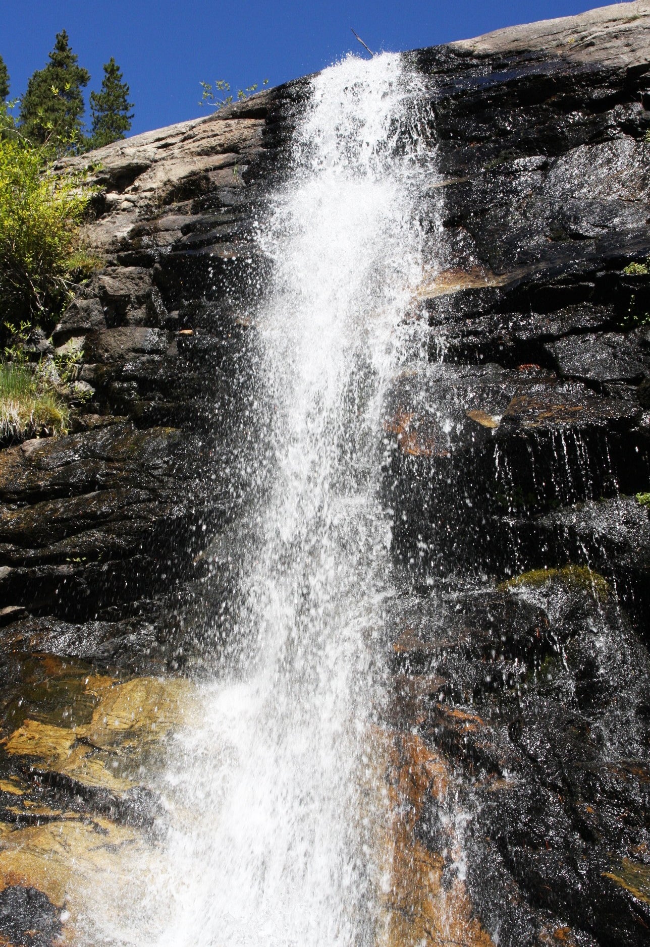
Reach Bridal Veil Falls, a thin whitewater ribbon pummeling 20 feet off a wide granite cliff. Sit and rest on a nearby boulder then walk across the creek, keeping the falls to the right. Take the spur trail to the left of Bridal Veil to access the upper falls.
BVF014
Location: 40.435852, -105.551223
Stop at the upper falls. This is a great place to sunbathe, look at the mountains, or peer into the valley below. Exercise caution on the exposed plateau. When finished, backtrack to the trailhead.
Bridal Veil Falls
Location: 40.43507, -105.549071
©MacKenzie Ryan
The barn and trailhead
Location: 40.431726, -105.50129
©MacKenzie Ryan
Cow Creek Trail
Location: 40.431285, -105.503318
©MacKenzie Ryan
Two miles to falls
Location: 40.427651, -105.52086
©MacKenzie Ryan
Looking toward Lumpy Ridge
Location: 40.427332, -105.522351
©MacKenzie Ryan
Through the meadow
Location: 40.426949, -105.525205
©MacKenzie Ryan
Crossing the first bridge
Location: 40.431539, -105.544313
©MacKenzie Ryan
Trailside cascade
Location: 40.433727, -105.547017
©MacKenzie Ryan
The second bridge
Location: 40.434336, -105.547983
©MacKenzie Ryan
Short rock scramble
Location: 40.434568, -105.548084
©MacKenzie Ryan
Rock formations near falls
Location: 40.434919, -105.548186
©MacKenzie Ryan
Side view of falls
Location: 40.435152, -105.549082
©MacKenzie Ryan
Upper falls
Location: 40.435826, -105.551228
©MacKenzie Ryan