Published September 20, 2013 03:32PM
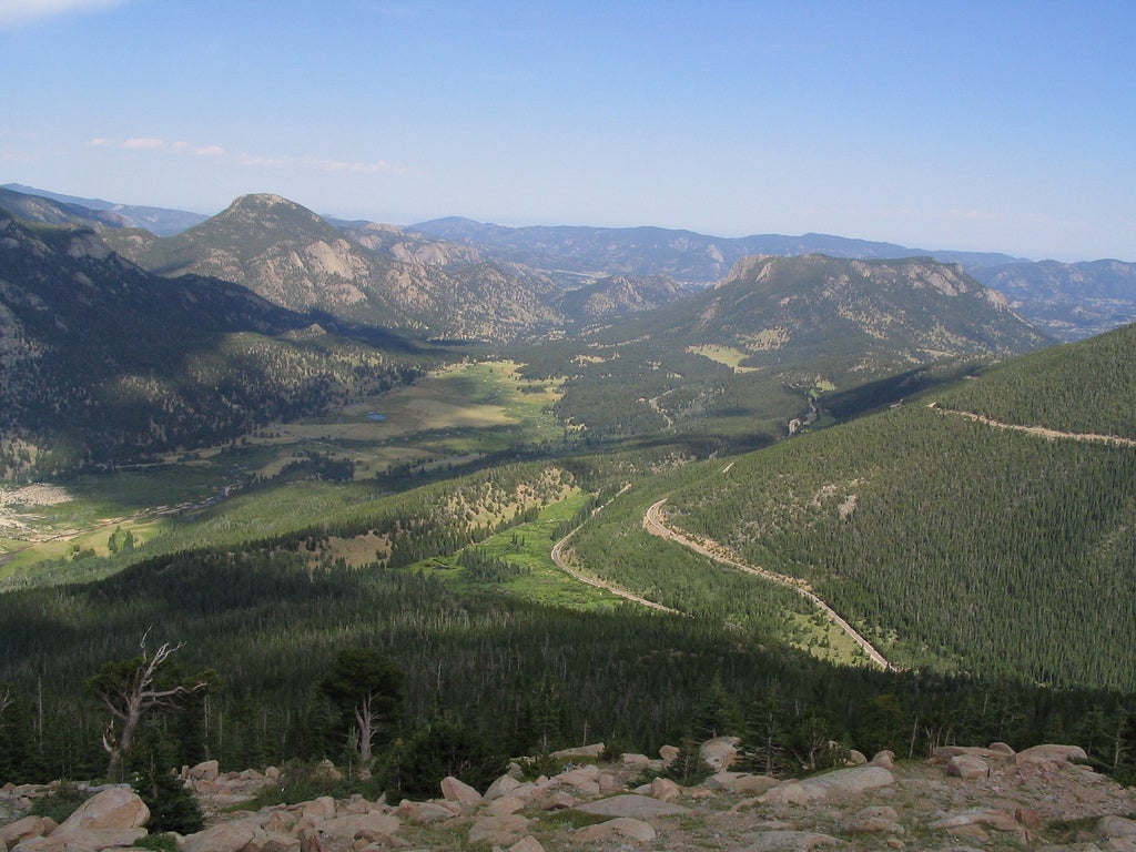
Rocky Mountain National Park: Beaver Mountain Trail
Thanks to only a little elevation gain, this 7-mile loop offers flatlanders great rewards (big views, wildlife, solitude) without much suffering. Pack plenty of water and sunscreen.
'Ken Lund'
INFO For information on permits, current trail and camp conditions, and wilderness guidelines, go to nps.gov/romo/planyourvisit/backcountry.htm
PERMIT A wilderness permit is required for all overnight camping in the backcountry. Reservations accepted ($20 administrative fee for permits during peak season). nps.gov/romo/planyourvisit/backcntry_guide.htm
CONTACT Rocky Mountain National Park, (970) 586-1206; nps.gov/romo
-Mapped by Kris Wagner
ADVERTISEMENT
Trail Facts
- Distance: 11.3
Waypoints
BMT001
Location: 40.386818, -105.6101
Deer Ridge Junction: Hike S of US 36, following signs to Bear Mtn. Trail
BMT002
Location: 40.382282, -105.608765
Huge rocky thrones sit alongside trail
BMT003
Location: 40.379452, -105.607117
Turn R; trail crosses swampy meadow then climbs a sun-baked knoll
BMT004
Location: 40.376999, -105.607986
Turn R onto Bear Mtn. Trail
BMT005
Location: 40.379482, -105.622482
Gentle climb to a snow-white aspen grove
BMT006
Location: 40.374184, -105.625664
Cross Beaver Brook; look downstream for deer foraging along the grassy banks; begin easy ascent around the E-side of Beaver Mnt.
BMT007
Location: 40.364944, -105.626465
ADVERTISEMENT
Spur Trail: Turn L to a gnarly outcrop with impressive views Moraine Park and a sea of dramatic peaks; return to trail and turn L
BMT008
Location: 40.360382, -105.631287
Turn L onto Beaver Meadows Trail; small overlook on R; path passes under the outcrop described above
BMT009
Location: 40.369202, -105.617554
Keep L @ Y
BMT010
Location: 40.373051, -105.614067
Trail exits @ Upper Beaver Meadows trailhead; head E on gravel road
BMT011
Location: 40.37265, -105.612465
Turn L back onto trail; marmots scurry in a meadow of blue-green sage brush
BMT012
Location: 40.376934, -105.608032
Turn R to end loop, then return .9 miles to trailhead