Published May 9, 2013 12:56PM
Rip & Go: Shackleford Banks, Cape Lookout National Seashore, NC
Paddle to explore beach, dunes, and maritime forest on an uninhabited barrier island.
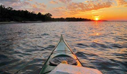
'Sun sets over Shackleford (Ted O'Callahan)'
Do itIn summer, hordes flock to the Outer Banks to enjoy pristine white-sand beaches. Get your private fix on this 16.9-mile kayaking and hiking adventure to Shackleford Banks, a 9-mile-long, string bean-shaped barrier island without designated trails, campsites, or crowds. On calm days, it’s an easy paddle (but if waters seem choppy, hire a water taxi, below right). Launch from the boaters’ ramp in Beaufort (1) and head east along Taylor Creek’s protected channel for .9 mile to the open water of Back Sound(2). Paddle southeast .6 mile to the Middle Marshes (3), a series of low grass islands barely poking out of the bay. Continue about 2 miles southeast to Shackleford Banks’ shoreline (4). To be sure to hit the highlights, continue paddling southeast for about a mile to the mouth of a shallow inlet (5). Pull boats to high ground among the cedar trees, then head directly south across the island—Shackleford’s 100-plus wild horses (likely descendents of refugees from 17th-century shipwrecks) will have left plenty of tracks to follow. Within a hundred yards, dense vegetation gives way to a large meadow (6). Set up a basecamp here, away from the muck and brush of the inner beach, then load a daypack to head for great ocean views from the island’s tip. Continue .2 mile south to a gap in the dunes, which leads to the sandy beach of the outer shore (7)(also a good place to camp if you want to paddle around). Turn left and follow the beach for 1.3 miles; look for bottlenose dolphins just beyond the crashing surf. At a low spot in the dunes with a view through to the meadow beyond (8), detour north .1 mile to a covered picnic table, a nice, sand-free rest spot surrounded by wildflowers like red-and-yellow firewheels (starting to bud in April). Back on the outer beach, continue 1.9 miles southeast along the southern beach to the end of the island (9) for a view of the black-and-white-checked, 163-foot-tall Cape Lookout Lighthouse. Also keep an eye out for nesting sea turtles (May to August) and shorebirds. Backtrack on the beach for 3.2 miles, enjoying the millions of shells that form a ribbon along the high-tide line. The shallow water averages 75°F by May and makes for great swimming, though stay alert for rip currents. Return the way you came.
BYO water: When rain puddles dry, horses dig in the sand for H20, but they are more tolerant of brackish water than we are.
Get there From Beaufort, head east on Live Oak St. Turn right on Lennoxville Rd., and go 1.4 miles to the boaters’ lot on the right. Gear up Down East Kayaks; 1604 Harkers Island Rd., Beaufort; (252) 838-1336; downeastkayaks.com (rentals from $55) Season May to August Water taxi Starting from $15; bit.ly/watertaxis Contact (252)723-2250; nps.gov/calo Permit File a paddle plan with the park.